| Previous :: Next Topic |
| Author |
Message |
Brushbuffalo
Member


Joined: 17 Sep 2015
Posts: 1887 | TRs | Pics
Location: there earlier, here now, somewhere later... Bellingham in between |
When I hiked to Muckamuck Mountain on August 30 I drove right by the best access point to Old Baldy (former lookout site). Then in looking at the map in consultation with Ray Kresek's information of sites with former lookouts, I saw that Granite Mountain (7366')was only six miles from Old Baldy (7844'), Granite also being a site of a lookout in the past. However although only about 6 miles apart as the raven flies, the summits are about 40 miles apart as the Toyota Tacoma negotiates.
These two are what some would call 'dumpster dives', a term I dislike. Any day outside is a fine day if you have fun, are challenged a bit in one way or another, and come back safely.
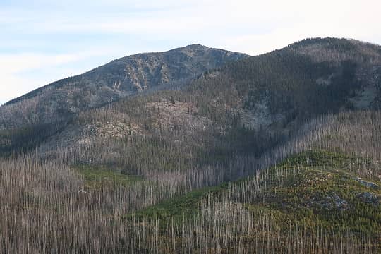 Old Baldy from FS37 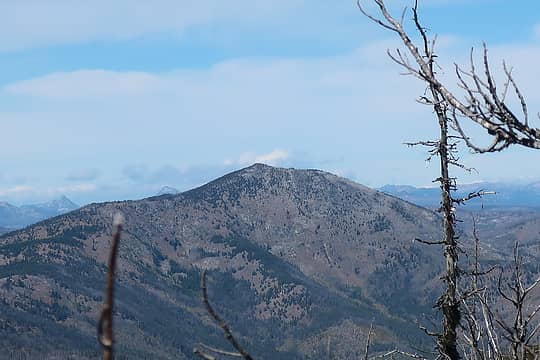 Old Baldy (why do I keep typing it as Old Badly?) from Granite Mountain 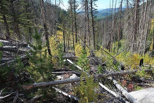 Just dive into this ( this isn't where I started but is typical of the scene) 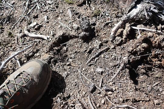 Moose or cattle track? 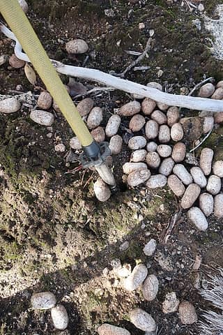 Moose! 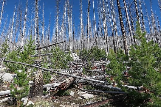 not anything like North Cascades ( west- side ) stuff, but still a little slow going 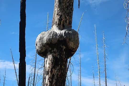 Cool burl 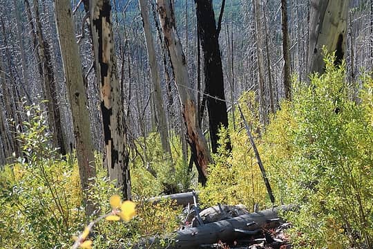 just sort of tiptoe through this stuff. It is like a slow- motion steeplechase. 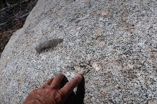 Beautiful coarse granite with large feldspar crystals and dark xenoliths, which are inclusions of other rock contained by the granite magma 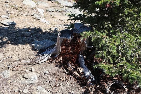 one stump 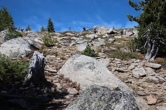 5 stumps 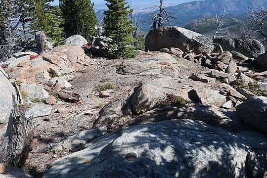 Lookout site 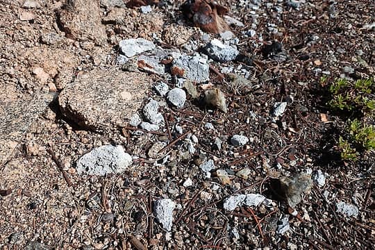 Concrete fragments 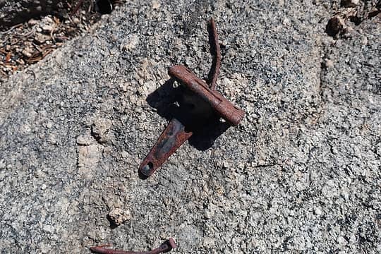 Hinge 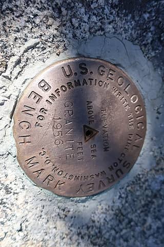 Granite Mountain benchmark, placed 2 years after the lookout was gone 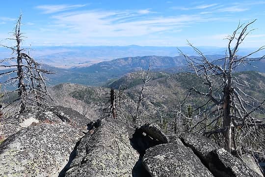 east 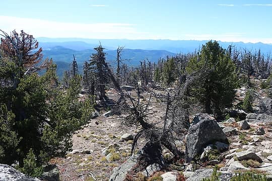 south 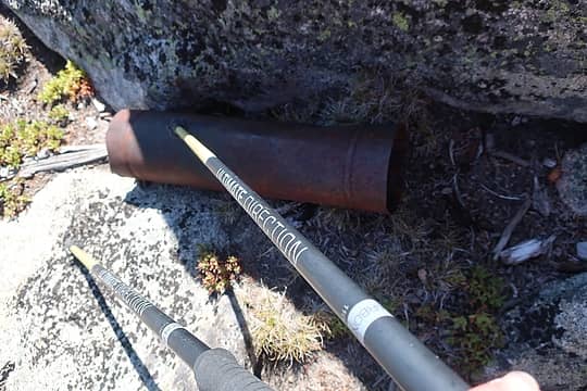 Stove pipe segment 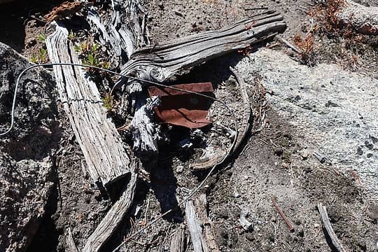 phone wire and rusty doo-dad 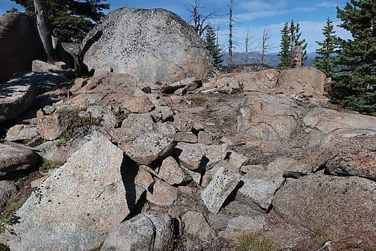 another view of lookout site 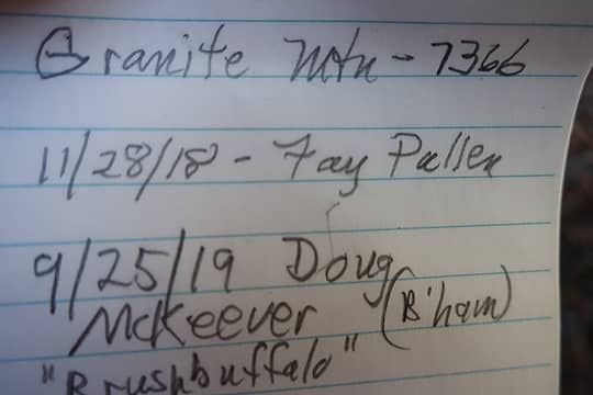 of course! 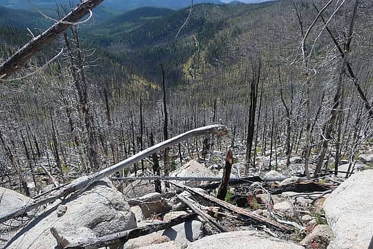 down this way...stay well left of the creek! 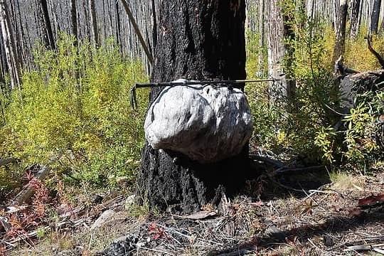 I thought this was a boulder imbedded in the trunk, but no, it's a huge burl! 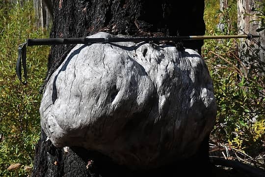 three feet across 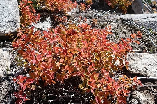 flaming shrub 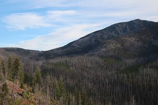 Baldy Pass on left. Old Baldy route is the skyline. 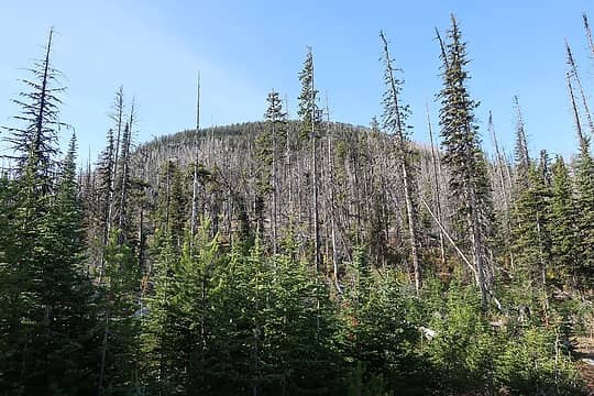 just head right up! ( photo in morning upon return) 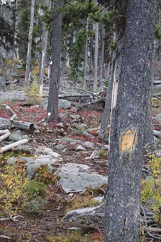 blazes and cut logs mark a path for a bit, but I followed it too far climber's left and had to backtrack. 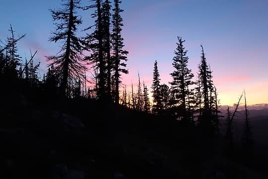 I missed a clear view of a nice sunset  It got brilliantly red in a couple of minutes.  My hastily chosen spot wasn't really out of the 50 mph wind very much, but in the morning I saw that there weren't many better spots nearby.
You ever have unrealistic but vivid dreams? Mine was that the wind was so strong that a tree would snap, impaling me and pinning me to the ground in my bag! But reason prevailed when I realized those few subalpine trees have survived many 50 mph winds, and probably the occasional 100+ gust as well. However, back home my wife asked if any of those trees up there had blown over or snapped in the past, and the answer is ' yes'.....just don't let out your weird dreams! My hastily chosen spot wasn't really out of the 50 mph wind very much, but in the morning I saw that there weren't many better spots nearby.
You ever have unrealistic but vivid dreams? Mine was that the wind was so strong that a tree would snap, impaling me and pinning me to the ground in my bag! But reason prevailed when I realized those few subalpine trees have survived many 50 mph winds, and probably the occasional 100+ gust as well. However, back home my wife asked if any of those trees up there had blown over or snapped in the past, and the answer is ' yes'.....just don't let out your weird dreams!  Although I am a certified ( certifiable?) weather geek I never did actually pull out my anemometer due to the cold and my preoccupation or laziness, but I know from experience that those winds easily exceeded 50 mph on frequent occasions that night.
After spending 11 hours in the sack, I got up at sunrise to hike the remaining 244' vertical feet to the summit. The wind had died down but it was enough below freezing for the small puddles to be frozen solid. After spending 15 minutes on top and not seeing any good bivy spots right near the site of the former lookout, I was glad I didn't push on in the dark and ferocious wind last night to a poor bivy spot in the rocks. However, it would be a good summit camp if you get there in daylight and have time to search around for a good spot.
Although I am a certified ( certifiable?) weather geek I never did actually pull out my anemometer due to the cold and my preoccupation or laziness, but I know from experience that those winds easily exceeded 50 mph on frequent occasions that night.
After spending 11 hours in the sack, I got up at sunrise to hike the remaining 244' vertical feet to the summit. The wind had died down but it was enough below freezing for the small puddles to be frozen solid. After spending 15 minutes on top and not seeing any good bivy spots right near the site of the former lookout, I was glad I didn't push on in the dark and ferocious wind last night to a poor bivy spot in the rocks. However, it would be a good summit camp if you get there in daylight and have time to search around for a good spot.
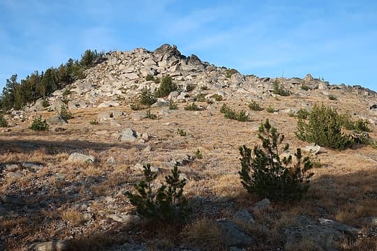 final gentle slope to summit 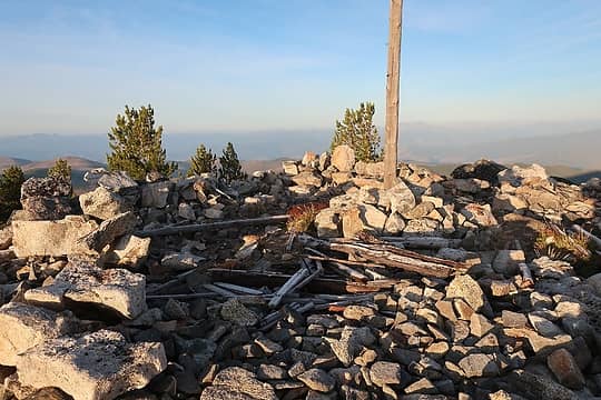 Old Baldy summit 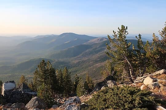 Granite Mountain, just 6 miles away 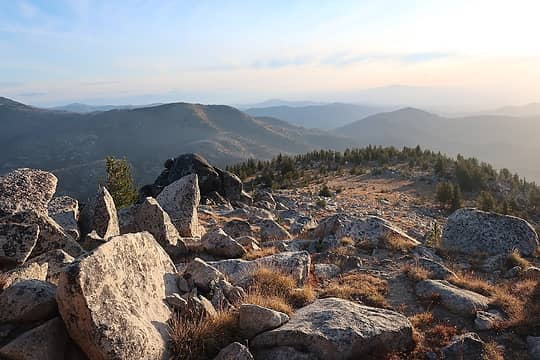 Looking back down the way I came 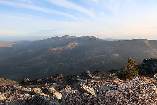 Tiffany group 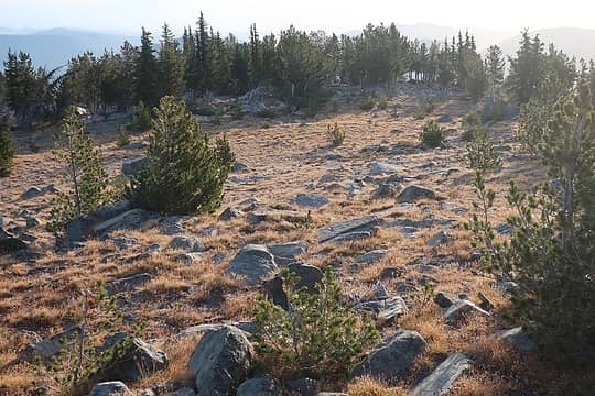 About to descend into the subalpne forest again...which clump of trees is my bivy gear in? (easy....I left some colorful objects clearly visible in the scattered clumps of trees 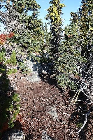 My not ideal bivy spot at 7600'. Wind came blasting through from the distance. Fun sleeping! 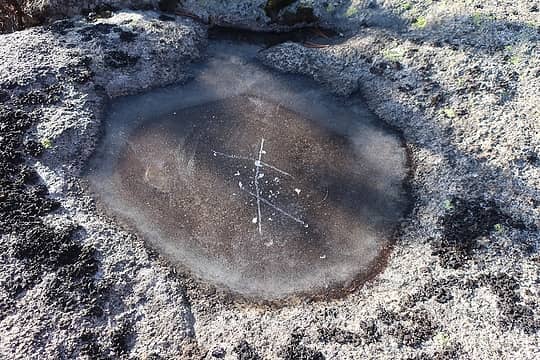 Puddle on a boulder, frozen solid 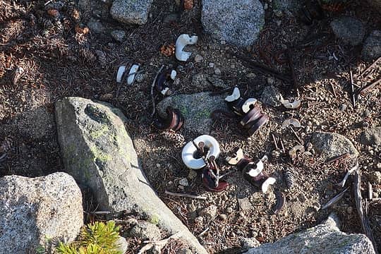 Insulators, all broken and in a pile 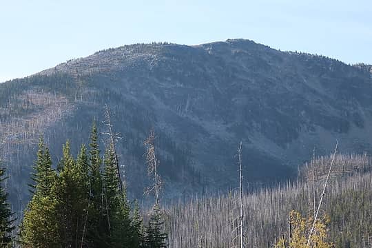 Old Baldy again. There is a mildly impressive cirque on the NW flank of O.B. 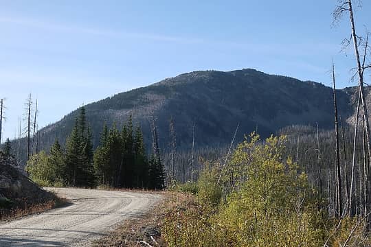 and again....never has such a blob been photographed so much in a TR! 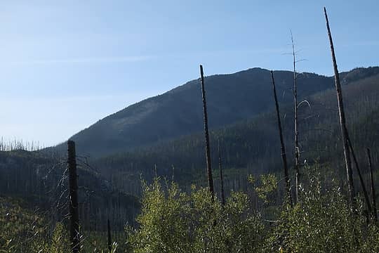 I bivied right about where the snag is pointing, left of the summit. 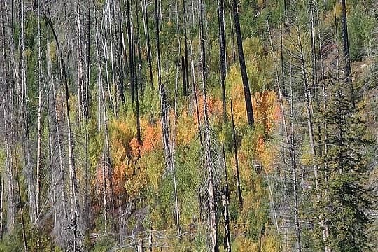 Colors are starting. Photo along FS37. 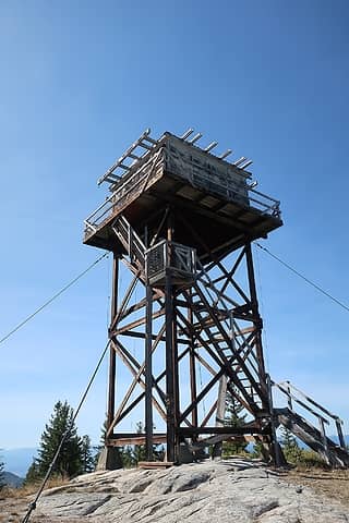 First Butte tower 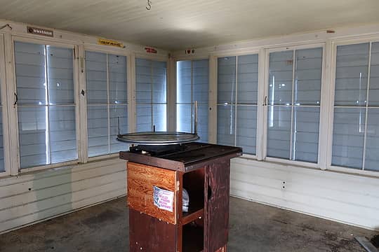 The Osborne firefinder is intact 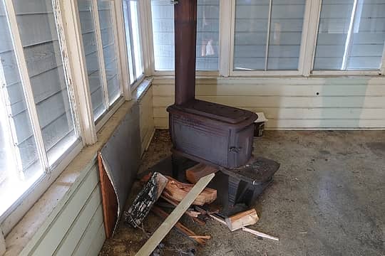 and a wood stove, but otherwise the interior was bare. 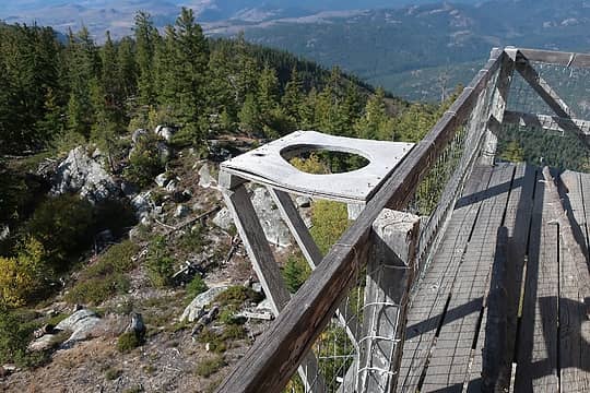 Not the potty! At least I hope not!  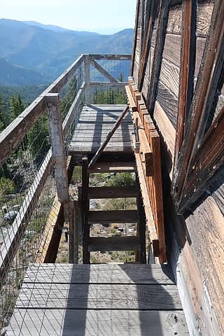 The hatchway was unlocked and untampered with, but expect to push the heavy thing up to get from the stairway to the catwalk 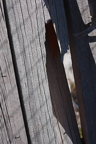 Poor picture, but the plank in shadow had a sizable chunk missing.. Would increase one's pulse if it split upon your footstep as you stroll the catwalk. 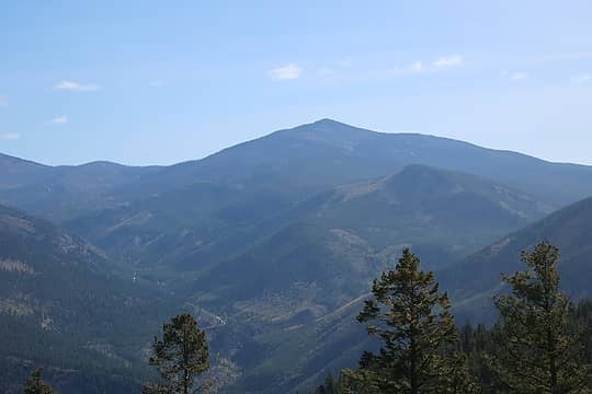 Old Badly from First Butte ( edit: whoops, there I go...Old Baldy!) 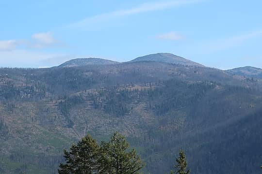 Tiffany group 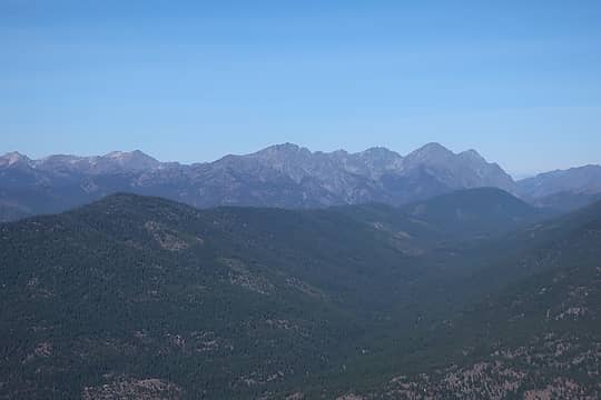 Craggies and Isabella Ridge to northwest
Passing rocks and trees like they were standing still
Passing rocks and trees like they were standing still
|
| Back to top |
  
|
|
Downhill
Member

Joined: 30 Jul 2018
Posts: 340 | TRs | Pics
Location: Leavenworth |
|
Downhill
Member
|
 Thu Sep 26, 2019 3:07 pm |
|
|
| Brushbuffalo wrote: | | Logs under brush don't show up too well on Google Earth! |
 So happy to learn that I'm not the only one.... So happy to learn that I'm not the only one....
|
| Back to top |
|
|
Downhill
Member
Joined: 30 Jul 2018
Posts: 340 | TRs | Pics
Location: Leavenworth |
|
Downhill
Member
|
Fri Sep 27, 2019 5:35 pm |
|
|
Awesome pics and TR!!!  I'm a huge sucker for lookouts - or former lookout sites! Thanks so much for this report!
I want to be stationed at a lookout. It has nothing to do with Kerouac.
I'm a huge sucker for lookouts - or former lookout sites! Thanks so much for this report!
I want to be stationed at a lookout. It has nothing to do with Kerouac.
|
| Back to top |
|
|
Brushbuffalo
Member
Joined: 17 Sep 2015
Posts: 1887 | TRs | Pics
Location: there earlier, here now, somewhere later... Bellingham in between |
Downhill, of the ones I've reported on recently you should at least hike to Muckamuck and Old Baldy, stroll to Corral Butte, and drive to First Butte, although if this storm dumps a lot of snow, easy approach may be soon ended for this year.
You would be a little more committed if you went to Granite Mountain....quite a bit more taxing, but still worth it.
There are so many more former lookout sites and a steadily reduced number of existing lookouts. Have you joined Forest Fire Lookout Association? Good organization.
Passing rocks and trees like they were standing still
Passing rocks and trees like they were standing still
|
| Back to top |
|
|
Downhill
Member
Joined: 30 Jul 2018
Posts: 340 | TRs | Pics
Location: Leavenworth |
|
Downhill
Member
|
Fri Sep 27, 2019 6:03 pm |
|
|
I have not joined but you have inspired me!
I have a queue of yet-to-do trips for this season and the weather is working against me. I still want to fish more, but after the first good freeze up high, they will likely all sleeping until next year.
|
| Back to top |
|
|
Abert
Member
Joined: 02 Sep 2010
Posts: 588 | TRs | Pics
Location: Sequim |
|
Abert
Member
|
Sat Sep 28, 2019 6:08 am |
|
|
In 2012 I went up Granite more from the west (from 4235). I don't remember it being especially bad, but I'm sure a lot more trees have fallen (and brush grown) since then. I also wondered whether I was seeing moose or cow tracks crossing the Lightning Creek bottoms. Granite photos I spent the night in the car on Starvation Mountain and took the Golden Stairway Trail up to Old Baldy the next morning. Your bivy makes me shivver just thinking about it, but maybe that's just my mindset with the apparent early onset of winter weather. Old Baldy photos
|
| Back to top |
|
|
Brushbuffalo
Member
Joined: 17 Sep 2015
Posts: 1887 | TRs | Pics
Location: there earlier, here now, somewhere later... Bellingham in between |
Abert, your route on Granite is twice as long but might be better than the way I went. By the way, great pictures and especially of the mountain bluebird.
There are moose about and cows too, but how did the horse get up there with all the fallen trees?  Then again, I'm no horseman.
I thought about hiking the Golden Stairway from Starvation summit, but I needed to be home early on my second day, and having seen how short the route was from Baldy Pass, I opted to go that way.
Sorry to cause 'cold thoughts' with my description of the wild night on OB. It wasn't too bad once I settled into my warm bag.....and zipped it up! Then again, I'm no horseman.
I thought about hiking the Golden Stairway from Starvation summit, but I needed to be home early on my second day, and having seen how short the route was from Baldy Pass, I opted to go that way.
Sorry to cause 'cold thoughts' with my description of the wild night on OB. It wasn't too bad once I settled into my warm bag.....and zipped it up!  And indeed, with the snowstorm predicted now, it just might be an early winter in the high country. We'll see.
Passing rocks and trees like they were standing still
Passing rocks and trees like they were standing still
|
| Back to top |
|
|
KarlK
Member
Joined: 18 Jun 2009
Posts: 584 | TRs | Pics
|
|
KarlK
Member
|
Sun Oct 06, 2019 8:48 pm |
|
|
Quote: See it? You have to look for it a bit. She was there on 11/28/18, a good time to avoid the worst of the brush.
Fay reminds me of one of my very favorite artists, Johnny Cash, and his version of "I've been everywhere."
Fay is an inspiration.
Nice report!
|
| Back to top |
|
|
|
|
You cannot post new topics in this forum
You cannot reply to topics in this forum
You cannot edit your posts in this forum
You cannot delete your posts in this forum
You cannot vote in polls in this forum
|
Disclosure: As an Amazon Associate NWHikers.net earns from qualifying purchases when you use our link(s). |


