| Previous :: Next Topic |
| Author |
Message |
Eric Gilbertson
Member


Joined: 04 Jul 2018
Posts: 188 | TRs | Pics
Location: Seattle |
Six Washington Top 200 Mountains car to car: Apex Mountain (8,297ft), The Pope/Chewuch (8,264ft), Wolframite Mountain (8,137ft), Bauerman Ridge (8,044ft), Arnold Peak (8,091ft), Horseshoe Mountain (7,956ft)
October 12, 2019
Eric Gilbertson
59 miles, 11,000ft gain, 3:30am Saturday to 7:20am Sunday (28 hours continuous moving, mostly breaking trail through snow)
Trailhead 3:30am
Apex 10:15am
Pope 11:45am
Wolframite 2:15pm
Bauerman Ridge 4:30pm
Arnold 10pm
Horseshoe 11:30pm
Trailhead 7:20am
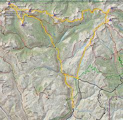 The route 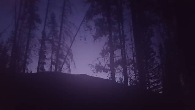 Alpenglow a few hours into the hike 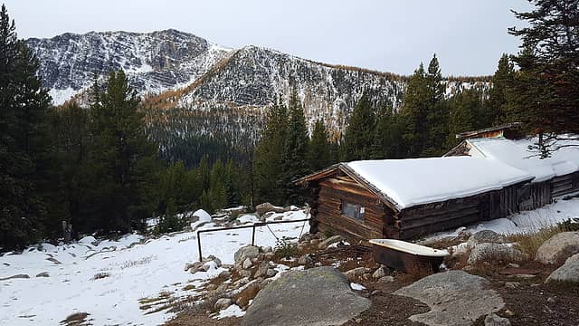 Apex seen from the surprisingly well-maintained tungsten mine buildings 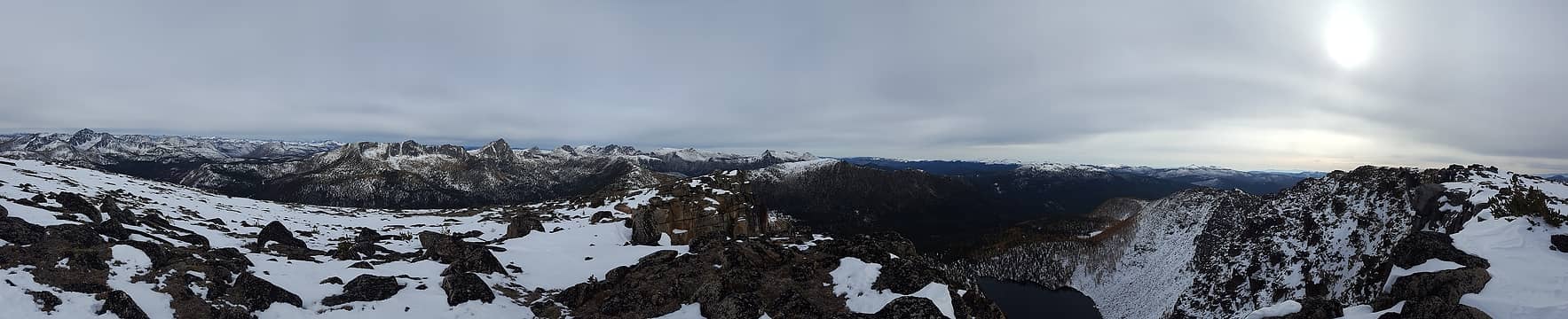 Panorama from Apex summit 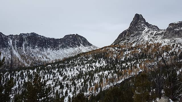 Looking across at Cathedral and Amphitheater 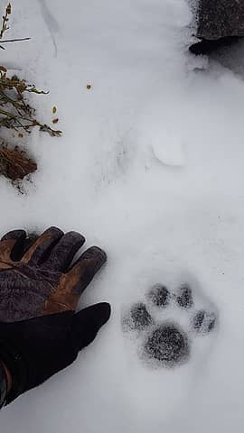 Mountain lion tracks (?) 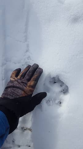 Wolf tracks (?) 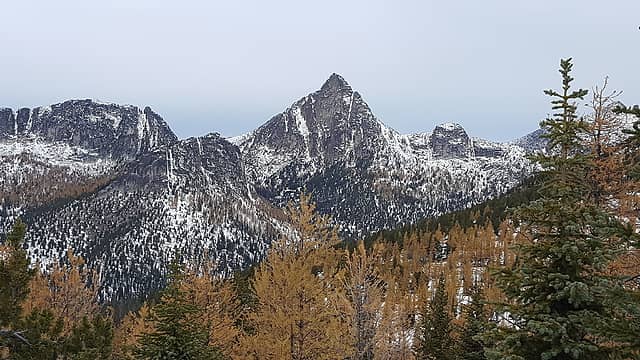 More views of Cathedral with the larches 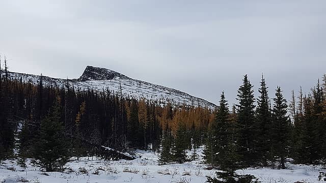 Looking back at Apex 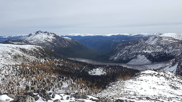 The US-Canada border clearly visible from The Pope/Chewuch 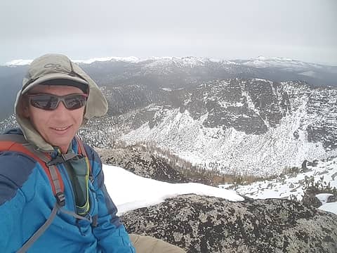 On Wolframite summit 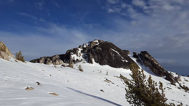 Approaching Bauerman Ridge 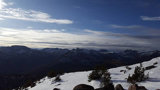 Skies clearing out to the west 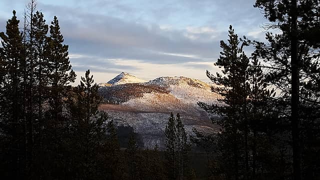 Windy Peak at sunset 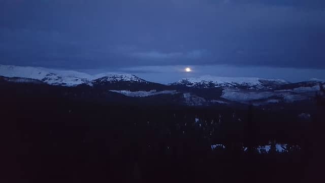 The moon rising over Arnold and Horseshoe in the distance 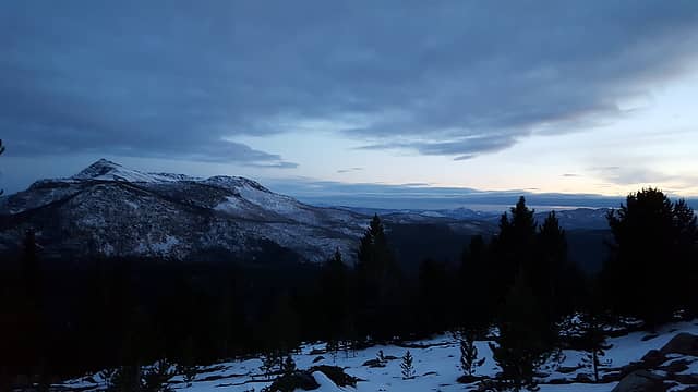 The last rays of light to the west 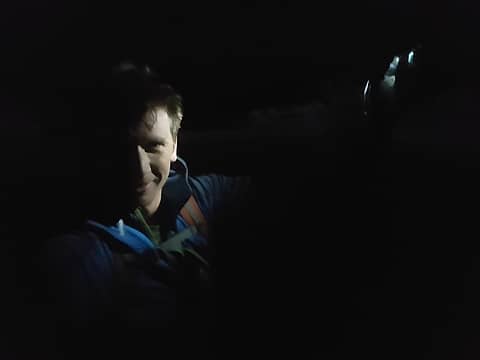 On the summit of Arnold (the last picture I took at night before the snowstorm started) 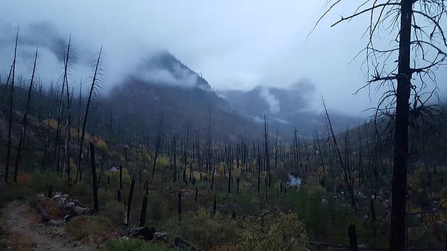 Sunrise at the Chewuch River near the trailhead 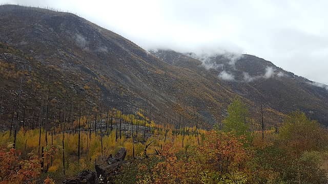 Nice fall colors at the trailhead
|
| Back to top |
  
|
|
RichP
Member

Joined: 13 Jul 2006
Posts: 5634 | TRs | Pics
Location: here |
|
RichP
Member
|
 Tue Oct 15, 2019 4:53 pm |
|
|
Dude, don't wear yourself out.  But seriously, your day trips would take me a week to do. But seriously, your day trips would take me a week to do.
|
| Back to top |
|
|
awilsondc
Member

Joined: 03 Apr 2016
Posts: 1324 | TRs | Pics
|
I love seeing your reports, Eric. It's cool to see you do things few humans are capable of. I hope you appreciate your own bad assness! haha. Keep it up man, and thanks for sharing these trips with us! 
|
| Back to top |
|
|
Gimpilator
infinity/21M

Joined: 12 Oct 2006
Posts: 1684 | TRs | Pics
Location: Edmonds, WA |
| awilsondc wrote: | | I love seeing your reports, Eric. It's cool to see you do things few humans are capable of. I hope you appreciate your own bad assness! haha. Keep it up man, and thanks for sharing these trips with us! |
What he said, yeah!
|
| Back to top |
|
|
Gimpilator
infinity/21M
Joined: 12 Oct 2006
Posts: 1684 | TRs | Pics
Location: Edmonds, WA |
Has there ever been a more extreme peakbagger? I think not.
|
| Back to top |
|
|
Matt Lemke
High on the Outdoors

Joined: 15 Jul 2010
Posts: 2052 | TRs | Pics
Location: Grand Junction |
|
Matt Lemke
High on the Outdoors
|
Wed Oct 16, 2019 4:59 pm |
|
|
|
| Back to top |
|
|
Brushbuffalo
Member

Joined: 17 Sep 2015
Posts: 1887 | TRs | Pics
Location: there earlier, here now, somewhere later... Bellingham in between |
Yet another of the astounding endurance feats ( feets!😁) of Eric.
| Eric Gilbertson wrote: | | they were mountain lion and wolf tracks. |
I think the cat tracks could be lynx. They are relatively common in the Pasayten. Although about the same size as cougar tracks, lynx have a fuzzy outline due to their furry feet, just like in your picture.
| Eric Gilbertson wrote: | | Its worth noting that I was wearing trail runners and micro spikes through all the postholing and, other than my feet being wet, I had no problems. I think I managed to make this work because I never stopped moving for more than about 5-10 minute food breaks on the whole trip, so never let my feet cool off enough to be a problem. |
I agree that movement in flexible shoes can keep one's feet warm, even in snow. Although I have never done a peak bagging adventure as ambitious as what you do regularly, I have completed two different hundred mile runs in winter in Alaska in sub-zero ( F) temps, wearing running shoes, oversized to accommodate thick socks. My dry feet never got cold. In other runs in above-freezing conditions but when running in ice water filling the trail, my feet have been freezing, the difference being dry vs. wet feet. However, I also have a theory that wet feet in Gore-tex shoes can be similar to a body in a wetsuit, the flexing of the feet warming the water and resulting in reasonable comfort as long as I keep moving.
Wouldn't want to have an unplanned bivy, however.
I have also had very uncomfortably cold feet in downhill ski boots with dry but unflexing feet.
So obviously the ideal is both dry and flexing feet.
Passing rocks and trees like they were standing still
Passing rocks and trees like they were standing still
|
| Back to top |
|
|
Blowdown
Sawin' Logs ...

Joined: 24 Aug 2011
Posts: 375 | TRs | Pics
Location: On the Summit |
|
Blowdown
Sawin' Logs ...
|
Wed Oct 16, 2019 7:05 pm |
|
|
59 Miles ... including postholing?
You, sir, are an animal!
Well done! 
|
| Back to top |
|
|
Bootpathguy
Member
Joined: 18 Jun 2015
Posts: 1790 | TRs | Pics
Location: United States |
| Eric Gilbertson wrote: | Mountain lion tracks (?) Wolf tracks (?) |
I love that stuff!!!
This type of thing was my inspiration & motivation for setting up game / trail cameras.
When I see wildlife tracks, it's never, for me "see it & forget it". I imagine what the animal looked like. Why was it here? When was it here? Am I being watched right now? Can it kill me? Was / is it hunting? Just passing through? Male or female?
I always enjoy being reminded that I'm not alone. I always enjoy seeing proof of what I assume is in the surrounding forest.
After a 20 minute turnaround, to find a bobcat had paralled my boot tracks. After a 45 minute turnaround, to find a bear walked in my boot path. Missed a bear at my trail camera by 4 minutes.
I absolutely love the outdoors!
Experience is what'cha get, when you get what'cha don't want
Experience is what'cha get, when you get what'cha don't want
|
| Back to top |
|
|
HitTheTrail
Member

Joined: 30 Oct 2007
Posts: 5455 | TRs | Pics
Location: 509 |
Epic feat for sure. But a lot like what the Warren Miller ski movies became. When it is something you know you could not possibly do yourself (or wouldn't try) it becomes harder to relate or appreciate.
|
| Back to top |
|
|
wildcat
Member
Joined: 28 Nov 2017
Posts: 38 | TRs | Pics
Location: Seattle |
|
wildcat
Member
|
Thu Oct 17, 2019 10:39 am |
|
|
Great job man! Mega caloric effort! Keep it going, be safe!
|
| Back to top |
|
|
markweth
Member

Joined: 08 Feb 2017
Posts: 155 | TRs | Pics
Location: Montana |
|
markweth
Member
|
Thu Oct 17, 2019 11:11 am |
|
|
Wow. What an impressive feat. I did a backpacking trip in that area last year but didn't go up any summits (which I regret, looking back). Thanks for sharing the TR and pictures!
|
| Back to top |
|
|
Brushbuffalo
Member
Joined: 17 Sep 2015
Posts: 1887 | TRs | Pics
Location: there earlier, here now, somewhere later... Bellingham in between |
Eric's achievements can be compared to those of climber/ ultrarunner Jared Campbell.
Keep it up and some may have glimmers of Killian Jornet in mind.
Oh wait, I just did.
That is some exalted company indeed.
Passing rocks and trees like they were standing still
Passing rocks and trees like they were standing still
|
| Back to top |
|
|
GaliWalker
Have camera will use

Joined: 10 Dec 2007
Posts: 4929 | TRs | Pics
Location: Pittsburgh |
|
GaliWalker
Have camera will use
|
Thu Oct 17, 2019 1:39 pm |
|
|
 That has to be the most impressive hiking trip report written on NWHikers.
|
| Back to top |
|
|
pcg
Member
Joined: 09 Jun 2012
Posts: 334 | TRs | Pics
|
|
pcg
Member
|
Thu Oct 17, 2019 4:54 pm |
|
|
My first response was... Why did you do this?
Wow, what a trek!
But for me, the answer to make it all worthwhile would be finding the lynx and wolf tracks. I believe that is a left front lynx track and not cougar, because of the tell-tale ice cream cone outline that comes from the furry foot. Note how the wolf track shows the toe pads right to the edge of the snow print. That's because he doesn't have a furry foot. Neither do cougars, but lynx do. I've found tracks of both in the Pasayten, but have yet to see either.
| Eric Gilbertson wrote: | | other than my feet being wet, I had no problems |
You're an animal!
Thanks for sharing. What a great adventure!
|
| Back to top |
|
|
|
|
You cannot post new topics in this forum
You cannot reply to topics in this forum
You cannot edit your posts in this forum
You cannot delete your posts in this forum
You cannot vote in polls in this forum
|
Disclosure: As an Amazon Associate NWHikers.net earns from qualifying purchases when you use our link(s). |


