Forum Index > Trip Reports > napeequa+cleator+rally cap+liberty cap 8-31 - 9-2-2019
 Reply to topic
Previous :: Next Topic
Author Message
b00
Member
Member


Joined: 29 Sep 2003
Posts: 1144 | TRs | Pics
b00
Member
PostSat Oct 19, 2019 5:12 pm 
napeequa+cleator+rally cap+liberty cap 8-31 - 9-2-2019
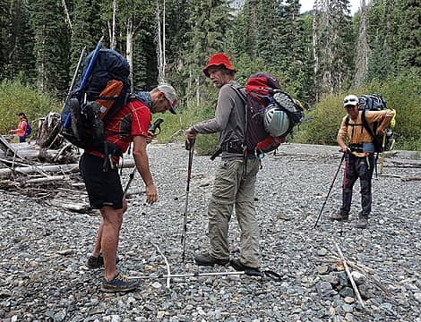
quick and dirty route info: follow nice trail to little giant pass(including a trivial ford of the chiwawa), continue on trail down to napeequa and continue on trail nw past louis creek to where the outlet from high pass empties into the napeequa. follow trail across outlet, trail disappears, but is easily found if you look, and head uphill/upstream on nice trail toward high pass. excellent large camp spot at 5500'. take trail or where the trail is missing, the route that feels correct up to high pass. nice camps(no water at camps, but water nearby). work terrain sw and then w up to ~7300 and then do a generally slightly rising traverse ssw to reach the upper sandy basin e of napeequa ~7600', ascend w to ~8000 and then traverse climber's left(sse) on ledges and ramps to just below summit and then a slightly climber's right rising traverse the last ~50' to summit block(class 2/3). cleator: follow easy west ridge on trail to summit(class 1). rally cap: head up easy se ridge on trail to summit(class 1). liberty cap: head up path on easy s face to summit. water: at chiwawa, short of little giant pass, all along the napeequa, from 5500' camp to almost high pass, on the way to napeequa from high pass, buck creek pass, lower on buck creek
our sherpa, t, carrying the big load
chill labor day weekend trip with a great team! the ford of the chiwawa and the trail up to little giant pass were as i remembered it, nice. i'd read numerous reports about the route from little giant pass down to the napeequa as being treacherous. to my surprise it was just a trail and not that difficult of one at that. (when i was asked later about that section, i replied: "it is a trail!" t felt some inexperienced people would have trouble with it and someone could be sandbagged by my response). the trail along the napeequa was muddy in sections, but easy, peasy. the crossing on the trail of louis creek was also easy. the napeequa river valley is awesome. crazy beautiful. the forecast for the day had rain hitting glacier peak, only a few miles from us and for our area to be dry. sure wish it was less cloudy, as the photos of that area would have done it more justice. unfortunately the clouds were not just for show and a torrent unleashed on us :<( we hid out with our rain gear on for 20 minutes while it was dumping, but all of us got soaked :<( fortunately the rain stopped and we continued on to the outlet stream coming from high pass, where it meets the napeequa. the trail disappeared and we commenced looking for it. there were a couple of spots that looked like people went, but before long, t found the correct trail, which again was a lot easier and far more pronounced than i expected. i was under the mistaken impression from t/r's that this area could possibly be brushy, but i soon realized it would only be brushy if one did not follow the trail and the trail was very nice! soon we were up to 5500' where there was a beautiful spot to camp on a grassy sort of knoll. but it was wet from the rain, so t wanted to go further. a few minutes from the knoll, along the creek, t found us a very usable camp spot. sunday morning brought welcome sun that we enjoyed after sleeping in and then doing an easy stroll from the 5500' camp up to high pass. what a beautiful route. along the way we ran into a few friendly groups doing a reverse of our route, including one guy who brought along a little kids snowboard(we would later see what must of have been his tracks just below cleator). everyone seemed to be enjoying their trips. t again found us a camp spot and this one was awesome. we took our time putting up our tents and leaving things out to dry in the sun and then we began heading over to napeequa. it had been a while since i had been up napeequa and i had forgotten how beautiful of a scramble and summit it was. the terrain getting to it was so friendly and i particularly loved the beach-like sand in the basin below summit block. the view from the top was even better than i remembered and i was so happy that the weather smiled on us. you could feel the joy we all felt in the sun on the summit. since camp was so close and we had so much time, we just took our time getting back to camp and then enjoyed a great dinner. while eating a couple of guys came through and chatted with us. since we had the best camp spot, i think they were considering camping on top of us(fortunately they did not). monday we again got a lazy start and broke camp at 9:30am. in a short time along the trail, we dropped our packs and headed up to the summit of cleator, where we met a really nice couple jon and stacia, who we had people we knew in common and who we really had a great time chatting with. after a good deal of time, we continued back to the packs, hiked another short distance, dropped our packs and went up rally cap. both of those summits were excellent and we were all smiles, while again leapfrogging jon and stacia. we carried over liberty cap. not sure which part was the true summit, so went to all the high points and also over to a wonderful vantage point carla had been to previously. on the way down, we again ran into jon and stacia. they joined us as we all visited while we descended the trail to buck creek pass. our plan was for me, after getting to the trailhead, to either walk the road 3.6mi back to the car or hitch a ride(and then return to pick everyone up). i wanted to ask jon and stacia to give me a ride, but i would have needed to boogie ahead with them as they were going faster and the others in our group wanted us to stay together, so i did not ask. at buck creek pass, we parted with them and our group went over to get water. someone had let their dog sh## very close to the stream where everyone in the area gets their water and did not clean the sh## up :<( unfortunately one of our party accidentally sat down there, so we waited a while they cleaned their clothes. to paraphrase mark twain, i love dogs, their owners not so much. at buck creek pass, i could see the energy of our party had was decreased. the others thought we were only a mile or two from the t/h, when i said i thought it would more than 10 miles, the others thought i was wrong. we continued down the trail. at about 5 miles from the car, i started to get a little worried about whether i would be able to find a ride for the road or whether i would have to walk it. at that point the others realized we really were a ways away from the t/h and let me boogie ahead, so i could get the car and bring it back for them. i put my feet into overdrive, but definitely started to tire. i just kept pushing as i figured if i got to the t/h early enough i could find a ride. i was running low on water and food, but did not want to stop. i finally reached the t/h and although it was labor day, no one was around. i figured ok, i'll hurry and walk the road to the junction with the phelps creek road, which would give me double the chance of finding a ride. out of water and food, i waited for a minute but there was no sign anyone was coming. i was pretty tired and thought about hiding my overnight pack, but then i figured, what if someone came along? what would be the odds of them stopping for me if i did not have a pack and look like a hiker. i just kept walking. if no one was driving the road, i needed to walk fast to the car, so we could all get home at a reasonable time. i got a second wind, then really tired again. i just kept moving, pushing. i finally saw my car and about 100' from my car, i heard a vehicle approaching on the road. they stopped. the driver offered me a ride, as my friends had talked with him at the t/h, but of course i thanked him and declined, as my car was like 30' away. nice guy. we had been hoping to hit the 59er for milkshakes on the way home, but it was so late, they were closed. we all got home late, i got home about 1am, yet we were all quite pleased with our wonderful, beautiful and fulfilling labor day weekend loop trip. being with people one likes always adds to enjoyment :>)
day one - 12.08mi 5473' gain 9:45 car to above napeequa camp (including 0:20 waiting out the rain storm) day two - 5.43mi 2721' gain (including 1.92mi 1416' gain moving camp ) 1:56 above napeequa camp to high pass camp 0:58 set up camp and take a break 2:28 high pass camp to napeequa summit 0:28 summit break 2:07 napeequa summit to camp(including 0:12 stopping to gather camp water) day three 19.93mi 2038' gain (including 3.58mi road walk to get car at little giant t/h) 10:40 high pass camp to car (including side-trips to: 0:21 up cleator, 0:09 up rally cap, 0:14 up liberty cap, 1:22 walking road to get car ) total 37.44mi 10,232' gain equipment: creek crossing shoes

Back to top Reply to topic Reply with quote Send private message
chiwakum
not credible


Joined: 29 Jun 2009
Posts: 980 | TRs | Pics
Location: Ballard
chiwakum
not credible
PostSat Oct 19, 2019 10:18 pm 
Great trip report. I think was on your tail and caught up to you when you headed up Cleator. I hiked to High Pass the same weekend in/out via LGP. Long day hiking out from High Pass. Maybe I'll get around to writing a TR.

Back to top Reply to topic Reply with quote Send private message
   All times are GMT - 8 Hours
 Reply to topic
Forum Index > Trip Reports > napeequa+cleator+rally cap+liberty cap 8-31 - 9-2-2019
  Happy Birthday Crazyforthetrail, Exposed!
Jump to:   
Search this topic:

You cannot post new topics in this forum
You cannot reply to topics in this forum
You cannot edit your posts in this forum
You cannot delete your posts in this forum
You cannot vote in polls in this forum