| Previous :: Next Topic |
| Author |
Message |
RichP
Member


Joined: 13 Jul 2006
Posts: 5634 | TRs | Pics
Location: here |
|
RichP
Member
|
 Thu Nov 07, 2019 11:48 am |
|
|
11-6-2019: After visiting the Douglas County highpoint on Badger Mtn, I crossed The Columbia and headed up Squilchuck Rd toward Mission Peak. A 2-mile road numbered 330 goes up from the 5868' level off of Liberty-Beehive Rd (9721) at the 7.1 mile point and takes you to the top. This was used by the lookout but is now a trail.
A little ice had me walk the last 1/4 mile to the 330 turnoff. Great views from the top. I scrambled out to a couple other points before retracing my steps.
Windless and warm on the summit.
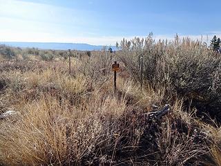 The Douglas County highpoint, Badger Mountain, 4254.' 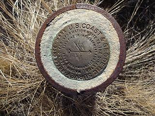 BM on Badger. 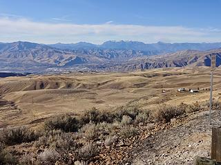 View from Badger Mtn Rd. 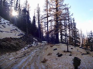 Walking the last 1/4 to the trailhead mile up Rd 9712 (Beehive) due to some ice. 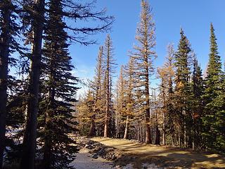 Large tamaracks at the trailhead for Mission Peak, 5868.' 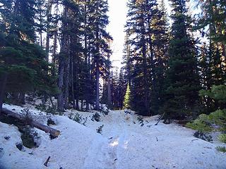 Rd 330 is now a trail but is used by quads. It's a short two miles and 1000' of vertical to reach the summit of Mission Peak. 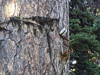 Insulator from the lookout days. 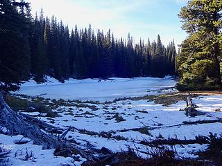 Thea Lake at 6320.' 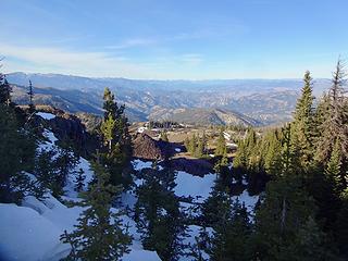 View from the road on the way up. 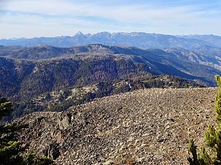 Enchantments. 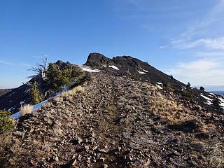 The road goes a bit further. Summit now in view. 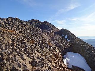 Almost to the summit. A trail leads through the basalt. 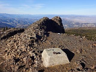 Footing from the lookout on the summit, 6876.' 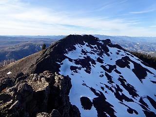 The summit from a lesser point to the south. 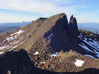 Looking back to the highpoint from the south. I scrambled out along the ridge to check things out. 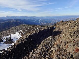 On the short trail to the lookout and summit. 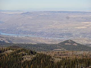 Wenatchee and Badger Mtn across the Columbia River. 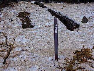 The spur that goes up to the top of Mission Peak. This was the road used to reach the lookout.
|
| Back to top |
  
|
|
BlameTheDogz
Member

Joined: 03 Jan 2013
Posts: 293 | TRs | Pics
Location: Ballard |
11/5: Mt. Si Haystack with Loki dog. He summited no prob and easily found a good route down. Good boy! And, we saw a goat on the ridge!
11/6: Trappers is still an easyish go! A bit of snow before the junction and then some intermittent snow and not too worrisome snow on the boot path, but put on spikes for a brief little descent and then kept them on until the summit. Note: morning lighting is likely ideal this time of year. I was on the summit and the ridge near sunset and the lakes no longer had any light. Still beautiful!
Cheers!
striving to stand like mountain yet flow like water, and make the dogs happy
striving to stand like mountain yet flow like water, and make the dogs happy
|
| Back to top |
|
|
Ravenridge22
Member

Joined: 21 Jun 2017
Posts: 56 | TRs | Pics
Location: Terra Incognita |
I stopped at Madison Falls at the Elwha entrance to Olympic National Park for some quick pictures Wednesday.
|
| Back to top |
|
|
RichP
Member
Joined: 13 Jul 2006
Posts: 5634 | TRs | Pics
Location: here |
|
RichP
Member
|
Thu Nov 14, 2019 9:08 am |
|
|
Blue Mtns, Nov 13, 2019
I was going to do a little canyon hiking in Asotin Ck but decided to keep driving up past Cloverland to the top of The Blues. Surprisingly, the road was snow-free well above 6000.'
I hit the Asotin County HP, Ray Ridge 6180,' walking the last bit from Misery Spring CG and then drove over to the nearby Diamond Peak Rd for the Mt Misery TH and Diamond Peak, Garfield County highpoint.
At the 3 mile-mark of this 5 mile spur I decided to walk the rest to the TH. It was mostly dry past where the road runs along the north side of Mt Misery.
The short hike up to Diamond Peak is pleasant and the trail was well packed by hunter and horse traffic. At the top of the ridge turn left up to the top at 6379.'
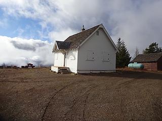 Wenatchee Guard Station in The Blue Mountains serves as a nightly rental. 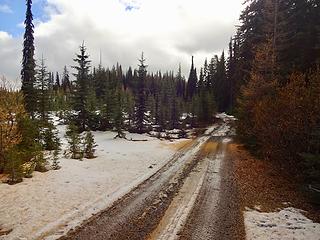 Spur road out to Ray Ridge. 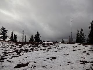 Ray Ridge and its repeater. 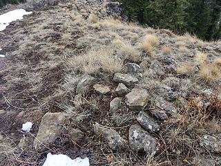 The highest piece of ground in Asotin County, Ray Ridge, 6180.' 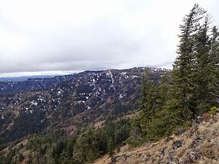 Toward Diamond Peak from Ray Ridge. 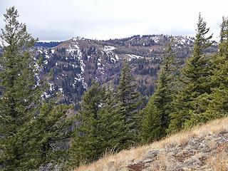 Toward Diamond Peak from Ray Ridge. 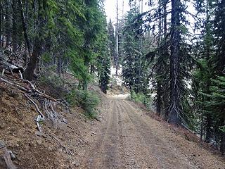 I walked the last two miles up Diamond Peak Rd to the trailhead due to some ice but much of the road was like this. 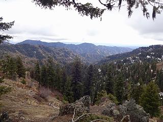 Saddle Butte. 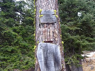 Mt Misery Trailhead, 5900.' 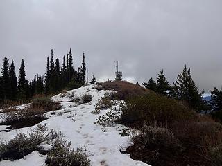 Diamond Peak summit. 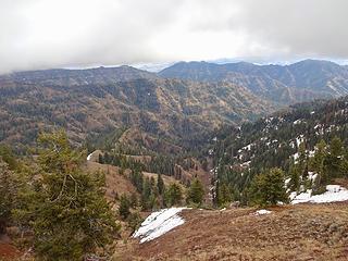 View from Diamond Peak. 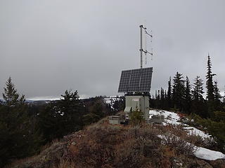 Repeater on Diamond Peak. 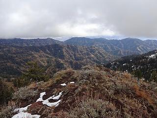 Southeast from Diamond Peak, 6379.' 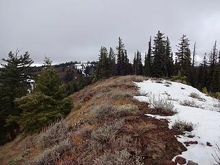 On Diamond Peak. 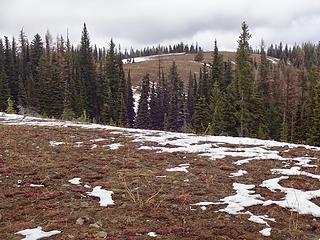 One of the contenders for Garfield County, West Diamond Peak. I tagged it just to be safe. 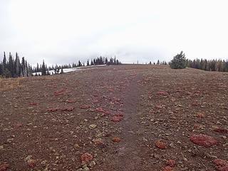 At 6250' below Diamond Peak. 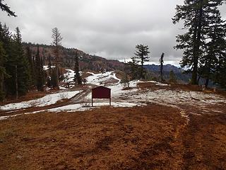 Mt Misery Trailhead at 5900.' 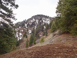 Diamond Peak. 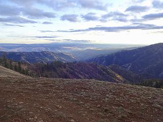 View south from Rd 43 on the way out.
|
| Back to top |
|
|
glenoid
Member
Joined: 30 Oct 2012
Posts: 307 | TRs | Pics
|
|
glenoid
Member
|
Thu Nov 14, 2019 5:35 pm |
|
|
Nice conditions for you! Should be a couple feet of snow there at this time. A Mount Misery to Oregon Butte, down to the Wenaha then back up to Misery or Diamond d Peak is a interesting loop. Thanks for posting!
|
| Back to top |
|
|
mosey
Member

Joined: 18 Dec 2018
Posts: 163 | TRs | Pics
|
|
mosey
Member
|
Thu Nov 21, 2019 12:26 am |
|
|
Had a lil jaunt to check out the low cloud system from above after an interesting sunset yesterday.
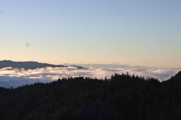 Convergence zone over Seattle and the Sound. Olympics in the background with Rattlesnake in front, DH's Balcony in foreground. 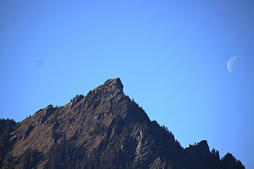 McClellan Butte with the moon 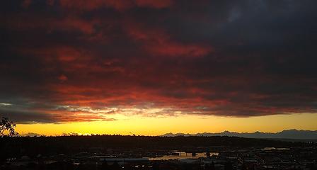 Bonus sunset from Monday
|
| Back to top |
|
|
Nancyann
Member

Joined: 28 Jul 2013
Posts: 2319 | TRs | Pics
Location: Sultan Basin |
|
Nancyann
Member
|
Fri Nov 22, 2019 12:12 am |
|
|
Nice pics, mosey!
The finest day imaginable in late November I was very fortunate to hike up to West Cady Ridge.
Thanks to the Forest Service for finally fixing the road, now how about the thousand potholes on the Beckler River Road?
It was close to freezing at the trailhead and every root, log and wooden plank on the lower part of the trail was covered in slippery ice. The trail itself was in very fine condition, thanks to Backcountry Horsemen who have kept it maintained during the several years it was closed.  Further up the trail it was warm and sunny, but when snow began to appear at about 4800 feet, there were some treacherous freeze/thaw sections which required Microspikes. At the ridge crest the trail was very icy in many places.
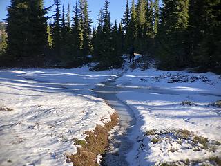 West Cady Ridge 11/21/19 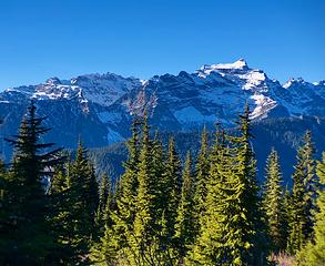 Monte Cristo and Keyes Peak from West Cady Ridge 11/21/19 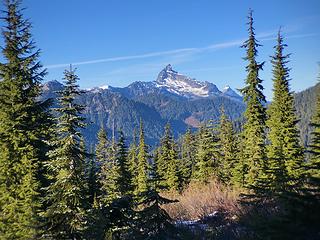 Sloan Peak from West Cady Ridge 11/21/19 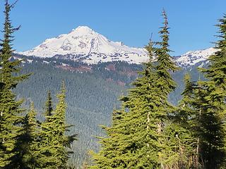 Glacier Peak from West Cady Ridge 11/21/19 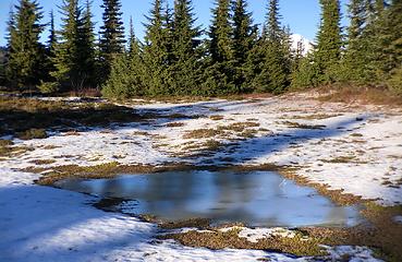 Tarn on West Cady Ridge 11/21/19 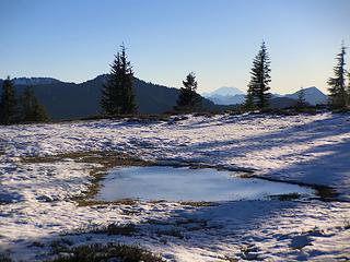 Tarn on West Cady Ridge 11/21/19 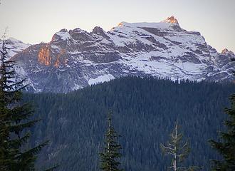 Sunset view from West Cady Ridge 11/21/19
|
| Back to top |
|
|
Sky Hiker
Member
Joined: 03 Feb 2007
Posts: 1469 | TRs | Pics
Location: outside |
Very nice. The problem with the potholes and dashboards is that people drive too fast making it even worse. The ranger district grades that road every year sometimes a couple times a year. There is only so much they can do with funding and personnel availiable. What's the other option close the road and have people drive up the north fork when it's finished. I drove that road alot and know to just take my time.
|
| Back to top |
|
|
RichP
Member
Joined: 13 Jul 2006
Posts: 5634 | TRs | Pics
Location: here |
|
RichP
Member
|
Fri Nov 22, 2019 8:51 pm |
|
|
A couple of hikes in a couple of days:
11-21, Mica Peak near Spokane. Came up the Belmont Rd access into the Mica Peak Conservation Area. Some new trails being built by WTA mix in with old roads.
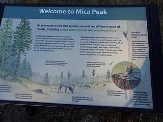 Mica Peak Conservation Area. 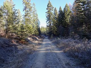 Many roads criss cross the area. 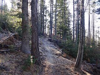 A good trail higher up. 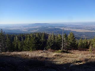 Spokane Valley. 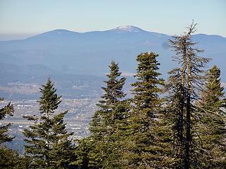 Mt Spokane is very dry. 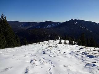 Marks Butte and Freezeout Ridge. 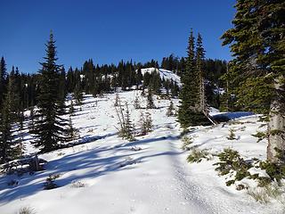 The summit is beyond the trees ahead. 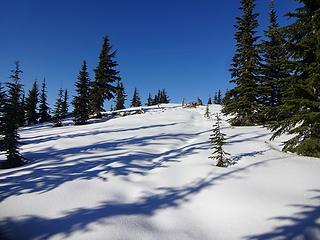 Final bit. 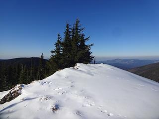 Grandmother Mtn summit, 6369.' 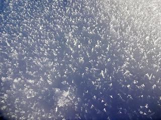 Hoarfrost crystals. 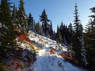 Heading back up to Freezeout Ridge. It's an almost 400' climb up from the 5620' saddle and trail low point. 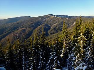 Grandmother Mountain from the Rd 301 on the walk back to the car.
|
| Back to top |
|
|
Jake Robinson
Member
Joined: 02 Aug 2016
Posts: 521 | TRs | Pics
|
Attempted Big Snow Mountain today. Middle Fork Road snow free until the Dingford gate. Snow line around 2000'. Getting up to Lower Hardscrabble Lake was miserable, snowy bushwhacking and sketchy slippery snow covered talus. Many broken poles and bruised knees. Bailed a little before the lower lake. It took us 2.5 hours to cover the last mile before we turned around.
|
| Back to top |
|
|
Sky Hiker
Member
Joined: 03 Feb 2007
Posts: 1469 | TRs | Pics
Location: outside |
|
| Back to top |
|
|
Nancyann
Member
Joined: 28 Jul 2013
Posts: 2319 | TRs | Pics
Location: Sultan Basin |
|
Nancyann
Member
|
Sat Nov 30, 2019 9:59 pm |
|
|
Had a super fun Thanksgiving Day hiking up to Lake Valhalla. Arrived at the lake viewpoint about 1:30, the same time as a couple with two dogs, no one else there on a bright sunny day. The trail had just recently been broken, so there was very little ice to walk on, but the most amazing icicles were hanging from the trees!
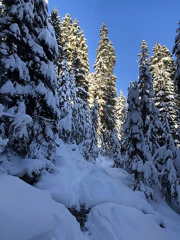 Valhalla 11/28/19 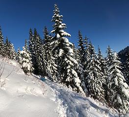 Valhalla 11/28/19 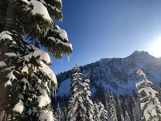 Valhalla 11/28/19 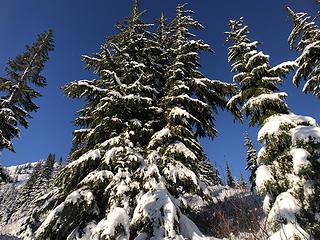 Valhalla 11/28/19 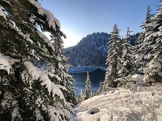 Valhalla 11/28/19 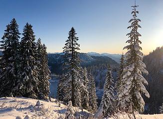 Valhalla 11/28/19 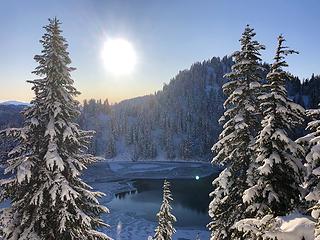 Valhalla 11/28/19  Valhalla 11/28/19 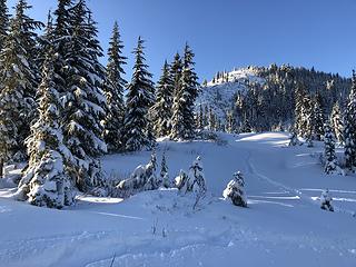 Valhalla 11/28/19 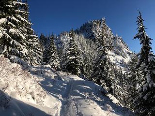 Valhalla 11/28/19 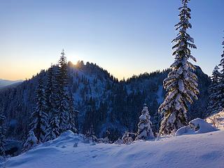 Valhalla 11/28/19 
|
| Back to top |
|
|
Kat
Turtle Hiker
Joined: 05 Oct 2003
Posts: 2560 | TRs | Pics
|
|
Kat
Turtle Hiker
|
Sun Dec 01, 2019 8:46 am |
|
|
| Quote: | | I had been planning on getting home in time to throw a turkey in the oven, (even made a pie the night before) but due to the lure of the snow, sun and blue skies, that went out the window. Instead we had a special Thanksgiving dinner of chili, hot dogs and some high-end ramen I borrowed from my backpacking stash. But we topped it off with homemade pumpkin pie, and everyone was happy |
 Spoken like a true hiker! Spoken like a true hiker!
|
| Back to top |
|
|
yukon222
Member

Joined: 12 Mar 2007
Posts: 1893 | TRs | Pics
|
|
yukon222
Member
|
Tue Dec 03, 2019 12:34 pm |
|
|
Quick hike into Snow Lake last Friday morning. Not much snow at the parking lot, maybe 5" or so. Only about 10" at the actual lake.
|
| Back to top |
|
|
Sky Hiker
Member
Joined: 03 Feb 2007
Posts: 1469 | TRs | Pics
Location: outside |
Thanks for that trip report I always wanted to go up there and check that out. Hopefully the light is good so I can get a good selfie!!
|
| Back to top |
|
|
|
|


