lanzscape
Member


Joined: 28 Mar 2007
Posts: 90 | TRs | Pics
Location: youngstown, ohio |
This is part two of our trip to Ca. to section hike the JMT. In part one, I covered trip logistics and planning, several days of travel and day hikes to get acclimated, and the first 4 and one-half days on the backpack, which consisted of nights camped at Lake Ediza, Thousand island Lake, and Lower Davis Lake in the Ansel Adams Wilderness, and in Yosemite NP's Lyle Canyon.
Midway on day 5 of the backpack (8/31), we reached our car and food re-supply at the Wilderness center in Yosemite's Tuolumne Meadows area. At this point, we exchanged some clothes, dumped some trash, and packed food for two days. We then drove about a mile down the Tioga Road to the Visitor Center for obligatory (but excellent) burgers for lunch. After lunch, we drove about another mile west on Tioga road, and parked at the Cathedral Lakes trailhead (8570'). We rejoined the JMT and hiked about 3.5 miles (gaining 860' before dropping 150') to Lower Cathedral Lake, where we found another beautiful and solitary place to camp near the lake. I spent the rest of the evening exploring and taking photos (including my only "selfie" of the trip) as the sun went down. The photos included a backpacker I came upon meditating on a rock in a stream below Cathedral Mountain. No wonder it's called "Cathedral" mountain.
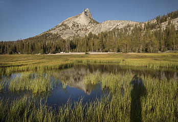 "selfie" at Lower Cathedral Lake 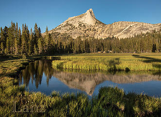 Cathedral Mountain reflection 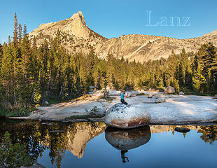 Cathedral meditation 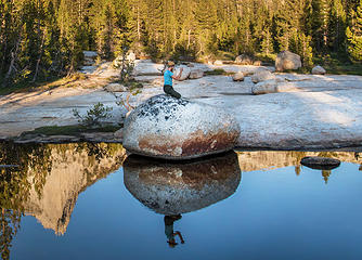 Meditating in an outdoor cathedral 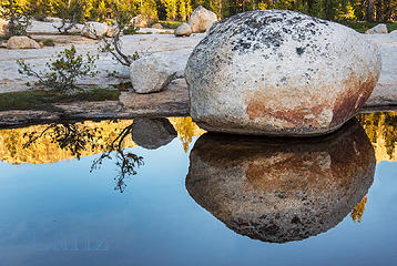 Shapes at sunset 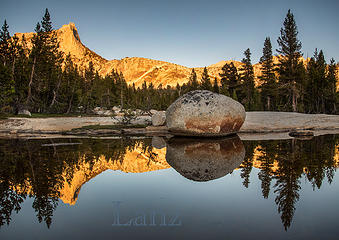 Cathedral sunset 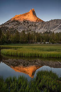 Last light on Cathedral Mountain 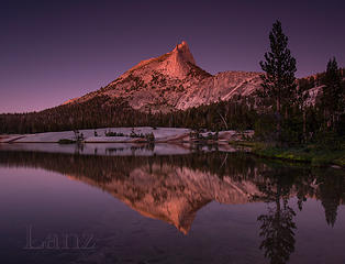 Cathedral Mountain reflected in Lower Cathedral Lake (post-sunset) 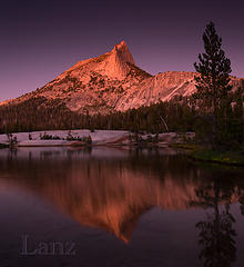 Evening at Lower Cathedral Lake 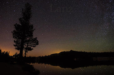 Evening sky at Lower Cathedral Lake (looking west) 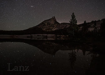 Later evening at Lower Cathedral Lake with lights of climbers on Cathedral Mtn. 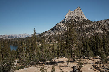 Looking back south down JMT from Cathedral Pass 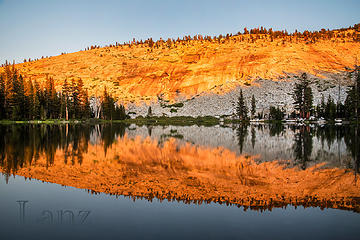 Sunset light reflection from camp at Sunrise Lake 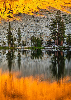 Reflections at sunset at Sunrise Lake 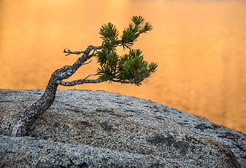 Small pine growing from rock at Sunrise Lake (at sunset) 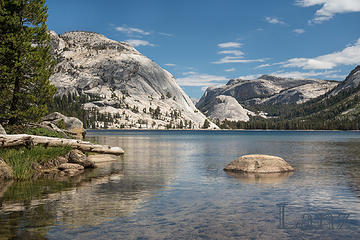 Beautiful Tenya Lake (YNP) 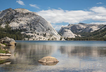 Tenaya Lake, YNP 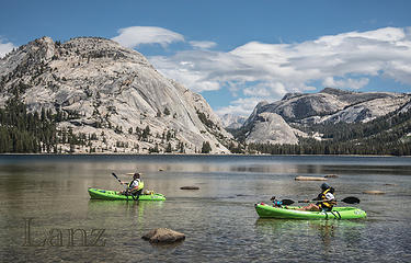 Kayakers on Tenaya Lake 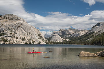 Kayaker on Tenaya Lake 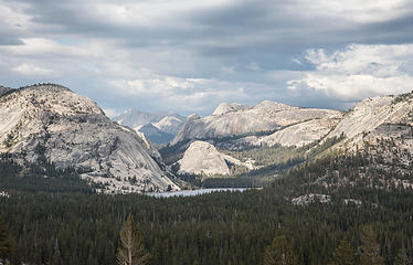 Tenaya Lake from Olmstead Point (YNP) 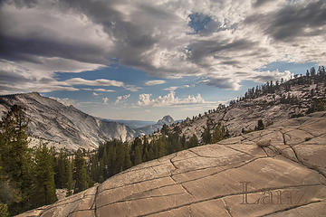 Yosemite Valley as seen from Olmstead Point 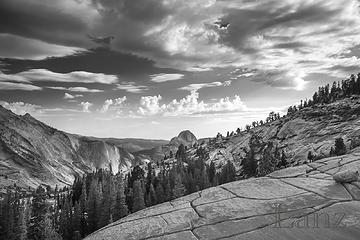 Olmstead Point in monochrome 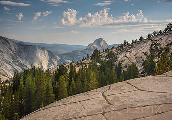 Yosemite Valley from Olmstead Point 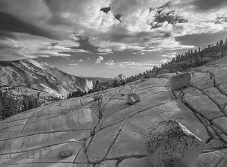 Olmstead Point rocks in monochrome 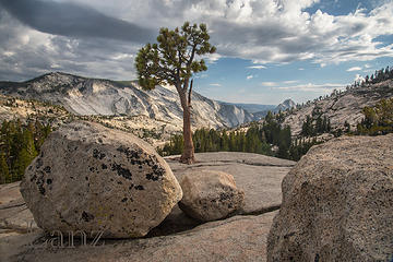 Olmstead Point rocks in color 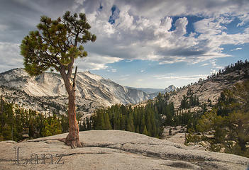 Olmstead Point, YNP 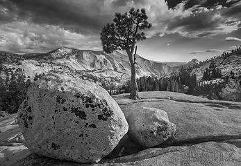 Olmstead Point rocks and tree 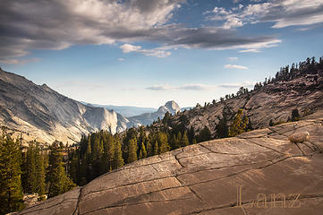 Olmstead Point in late afternoon light 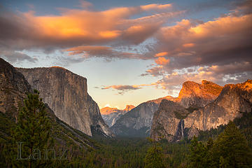 Yosemite Valley at sunset 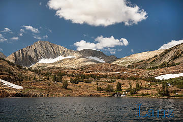 Saddlebag Lake loop 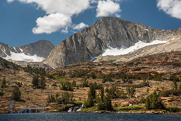 Saddlebag Lake loop (Hoover Wilderness) 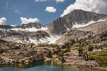 Saddlebag Lake loop (Hoover Wilderness) 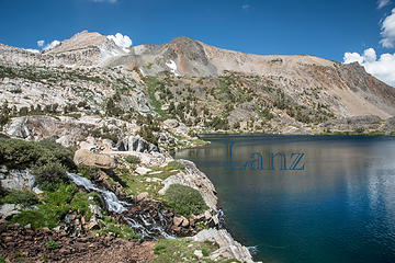 Fly fisherman 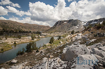 Saddlebag Lake loop (Hoover Wilderness) 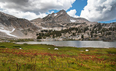 Wildflowers in Hoover Wilderness along Saddlebag Lake loop 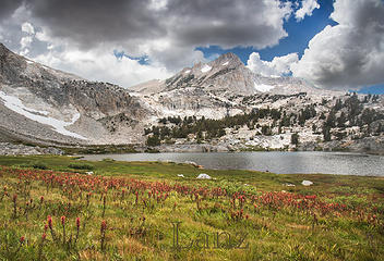 Stormclouds threatening and thundering 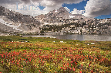 One final shot of the wildflower extravaganza in Hoover Wilderness
|


 Cloudsrest is a very worthwhile destination. Great view down into the valley and a different perspective of Half Dome and El Cap than most of the photos you see. Next time maybe.
  I've camped at Saddlebag Lake but didn't hike up there, that's something for me to do next time.