| Previous :: Next Topic |
| Author |
Message |
Eric Gilbertson
Member


Joined: 04 Jul 2018
Posts: 188 | TRs | Pics
Location: Seattle |
Glacier Peak (10,520ft)
Eric Gilbertson (solo)
March 20-22, 2020
48 miles, 11,000ft gain
Last weekend Id attempted Glacier Peak via the standard North Fork Sauk route with Ryan and Westy. Wed parked about 6 miles from the north fork sauk trailhead at a road washout and skied in all the way up to near White Peak Saturday morning, but had to retreat when we encountered unstable windslab that was unavoidable on our route.
I remember looking down to our intended route in the valley on the north side of the White Peak Red Peak ridge that we werent able to get to. If we could just get to that valley somehow, I thought, the terrain from there to the summit is mellow enough there is no avy danger.
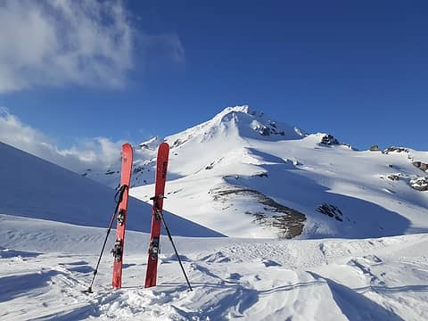 Returning from the summit, near Glacier Gap 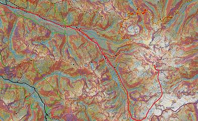 The route 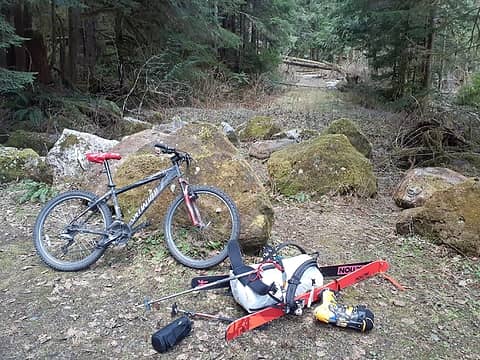 The start of decommissioned FS road 23. Tough driving up this one anymore. 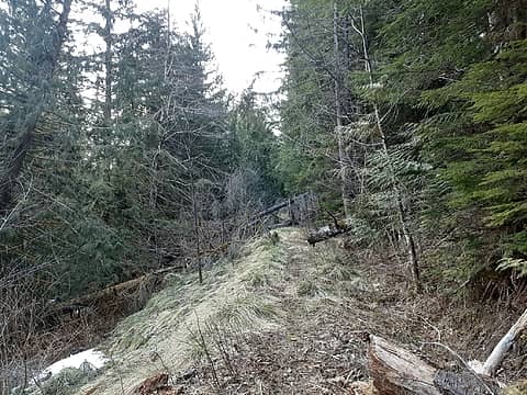 Typical "road" conditions. 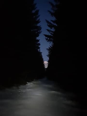 A brief view of Glacier Peak up the road 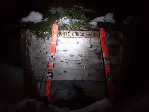 At the trailhead 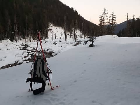 Hiking up White Chuck River 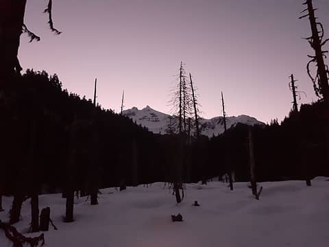 At Kennedy Hot Springs (I couldn't find the springs) 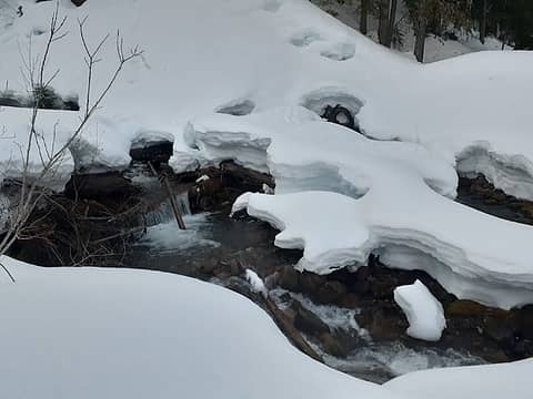 A tricky creek crossing I had to jump 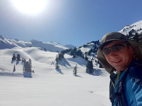 At the edge of treeline 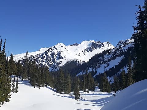 Breaking out above treeline 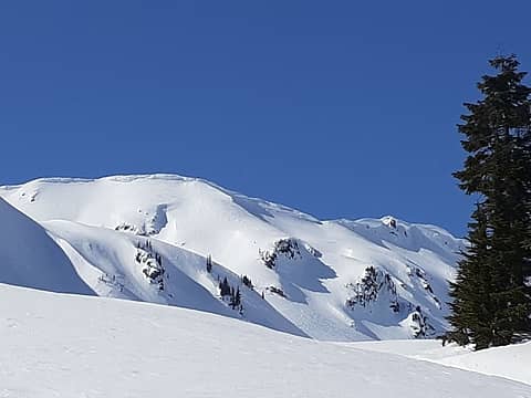 My attempted descent line from March 14 on the ridge near White Peak (you can kind of still see the ski tracks) 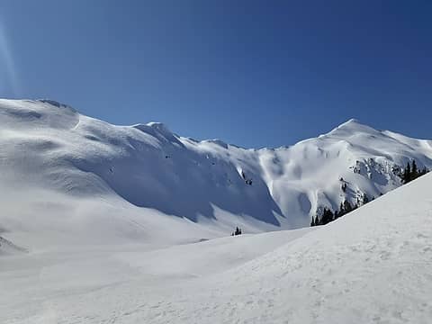 Looking back towards White Peak 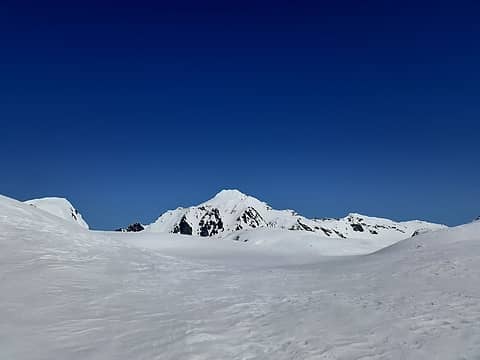 First views of Glacier Peak 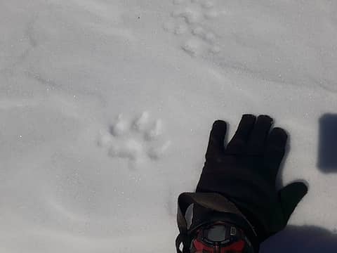 Wolverine tracks? 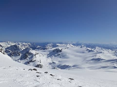 Looking back from the south ridge 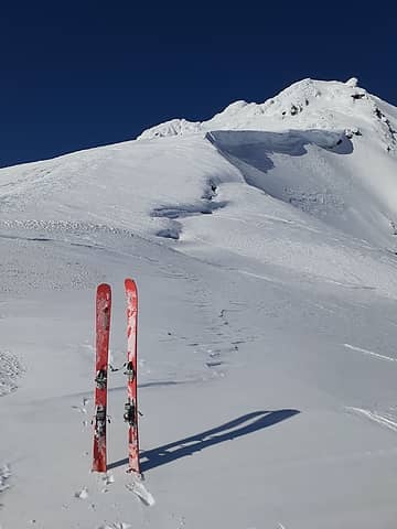 Ditching the skis at the rime ice 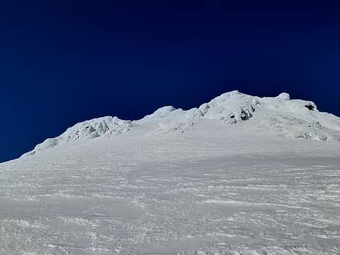 The final climb to the summit 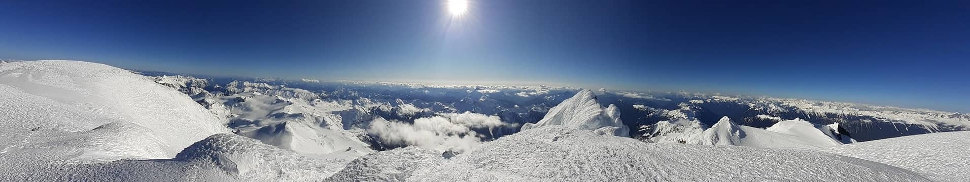 Summit panorama 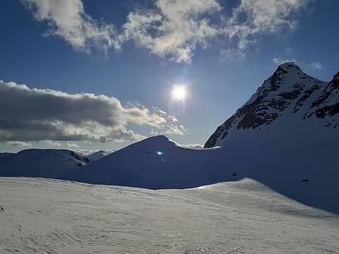 Skiing back down 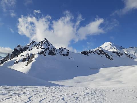 Skiing down 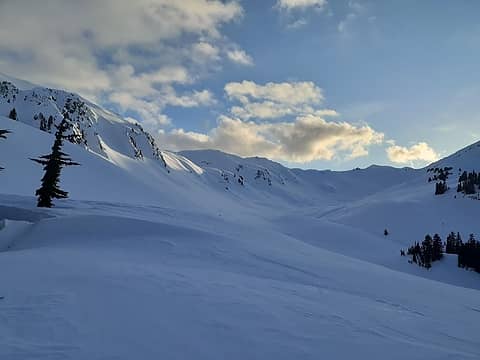 More fun skiing at sunset above treeline
|
| Back to top |
  
|
|
williswall
poser

Joined: 30 Sep 2007
Posts: 1967 | TRs | Pics
Location: Redmond |
Wow, that's one impressive undertaking! Congrats for knocking this off solo in grand style.
|
| Back to top |
|
|
Bootpathguy
Member
Joined: 18 Jun 2015
Posts: 1790 | TRs | Pics
Location: United States |
| Eric Gilbertson wrote: | Wolverine tracks? |
Yes. 5 toes and a bean shaped pad. Very cool!
Thanks for sharing
Experience is what'cha get, when you get what'cha don't want
Experience is what'cha get, when you get what'cha don't want
|
| Back to top |
|
|
I'm Pysht
Member
Joined: 11 Jul 2007
Posts: 517 | TRs | Pics
Location: Pacific NW |
| Eric Gilbertson wrote: | | I was woken up at 4:30am by a mouse chewing on my food sack that I was using as a pillow. |
I initially read that as "moose", and was going to call BS on your entire report. 
|
| Back to top |
|
|
timberghost
Member
Joined: 06 Dec 2011
Posts: 1330 | TRs | Pics
|
I had a moose licking my food sack too
|
| Back to top |
|
|
archerbrown
are we there yet
Joined: 22 Jan 2009
Posts: 42 | TRs | Pics
Location: Seattle |
Nice story and a long tough trip. Discontinuous is my new favorite word.......aka patchy, sporadic, intermittent, on and off and interrupted. 
|
| Back to top |
|
|
Backpacker Joe
Blind Hiker

Joined: 16 Dec 2001
Posts: 23956 | TRs | Pics
Location: Cle Elum |
Awesome trip. Strong work to me sure. 
"If destruction be our lot we must ourselves be its author and finisher. As a nation of freemen we must live through all time or die by suicide."
Abraham Lincoln
"If destruction be our lot we must ourselves be its author and finisher. As a nation of freemen we must live through all time or die by suicide."
Abraham Lincoln
|
| Back to top |
|
|
Kim Brown
Member
Joined: 13 Jul 2009
Posts: 6899 | TRs | Pics
|
| Eric Gilbertson wrote: | | It was 10:45pm by then and I downclimbed back to the river edge, then threw out my bivy sack next to the river and went to bed. |
I dont know why, but of all in your report (enjoyable, by the way) this ^^ chills me to the bone. Not because it was probably a bit nippy temperature-wise, but Ive seen what the river can do, and the thought of being wrapped up in a bivy while its doing it scares the bejeezus out of me. The river's kicked at Kennedy during the pulsing floods that inundated that area back in 1973, and the kick that caused the devastation in 2003. I know this wouldnt happen in winter, but fear is often unreasonable, and I would not do well in a bivy by that river.
The road has been undriveable to the trail head since 2003; Im surprised the sign is still there. I thought it was removed along with the toilet and picnic table.
Funny what you quoted about the Sitkum route being non-trivial. It was the (summer) route before the floods. So easy, that even I could do it (but in summer). But yeah, I understand avalanches wiped out Boulder Basin base camp since 2003.
So youre either the worlds happiest man; or the one most full of angst and misery. Someone doing a trip like this (its epic, to someone like me) could be either, seems like.
"..living on the east side of the Sierra world be ideal - except for harsher winters and the chance of apocalyptic fires burning the whole area."
Bosterson, NWHiker's marketing expert
"..living on the east side of the Sierra world be ideal - except for harsher winters and the chance of apocalyptic fires burning the whole area."
Bosterson, NWHiker's marketing expert
|
| Back to top |
|
|
rstoddard24
BBQWingz
Joined: 30 Dec 2016
Posts: 74 | TRs | Pics
|
Awesome! Glad you got your revenge, and so quickly after too. Good to know that way works 
|
| Back to top |
|
|
Stefan
Member

Joined: 17 Dec 2001
Posts: 5091 | TRs | Pics
|
|
Stefan
Member
|
 Mon Mar 23, 2020 11:34 am |
|
|
|
| Back to top |
|
|
Brushbuffalo
Member

Joined: 17 Sep 2015
Posts: 1887 | TRs | Pics
Location: there earlier, here now, somewhere later... Bellingham in between |
Good job to figure out an alternate route that seems safer.
I had no idea that the old 'short' standard route via the White Chuck River was still doable. I am guessing that yours is a route that will never become popular again. Incidentally, the Kennedy hot spring was washed out in the big 2003 flood. OK by me, as it was small, stinky, and likely contaminated by E. coli. The campground and 2- story ranger cabin were also destroyed by that massive flood.
And also incidentally, the Sitkum Glacier was generally quite mellow, but you were wise not to venture down into unfamiliar ground in gathering clouds late in the day, solo.
When I first saw your post title, I thought "Well, [url=https://fastestknowntime.proboards.com/thread/52/glacier-peak-wa ]there goes this[/url]!"
Passing rocks and trees like they were standing still
Passing rocks and trees like they were standing still
|
| Back to top |
|
|
Kim Brown
Member
Joined: 13 Jul 2009
Posts: 6899 | TRs | Pics
|
| Brushbuffalo wrote: | | I had no idea that the old 'short' standard route via the White Chuck River was still doable. |
It bet when all the avy debris is under snow, it is. I would like to check out Boulder Basin some day, but a trip report on this site several years ago indicated the bootpath from the PCT wasn't even findable (doesn't mean it isn't), and that Boulder Basin is destroyed (doesn't mean it is).
"..living on the east side of the Sierra world be ideal - except for harsher winters and the chance of apocalyptic fires burning the whole area."
Bosterson, NWHiker's marketing expert
"..living on the east side of the Sierra world be ideal - except for harsher winters and the chance of apocalyptic fires burning the whole area."
Bosterson, NWHiker's marketing expert
|
| Back to top |
|
|
reststep
Member
Joined: 17 Dec 2001
Posts: 4757 | TRs | Pics
|
|
reststep
Member
|
Mon Mar 23, 2020 1:45 pm |
|
|
"The mountains are calling and I must go." - John Muir
|
| Back to top |
|
|
Brushbuffalo
Member
Joined: 17 Sep 2015
Posts: 1887 | TRs | Pics
Location: there earlier, here now, somewhere later... Bellingham in between |
Brushbuffalo= Doug
That time (7:54 c2c) is soft, but since the route is gone for all fast attempts, it remains. Personally, I am long past trying to do anything fast. ( note my slogan).
Sean O'Rourke's time via the new route is much stouter.
Passing rocks and trees like they were standing still
Passing rocks and trees like they were standing still
|
| Back to top |
|
|
rstoddard24
BBQWingz
Joined: 30 Dec 2016
Posts: 74 | TRs | Pics
|
|
| Back to top |
|
|
|
|
You cannot post new topics in this forum
You cannot reply to topics in this forum
You cannot edit your posts in this forum
You cannot delete your posts in this forum
You cannot vote in polls in this forum
|
Disclosure: As an Amazon Associate NWHikers.net earns from qualifying purchases when you use our link(s). |


