| Previous :: Next Topic |
| Author |
Message |
Matt
Tea, Earl Grey, Hot


Joined: 30 Jan 2007
Posts: 4307 | TRs | Pics
Location: Shoreline |
|
Matt
Tea, Earl Grey, Hot
|
 Mon May 25, 2020 9:04 am |
|
|
Dates: February 14-18, 2020
Destination: Coquihalla Pass summits Zoa, Zupjok, Llama, Alpaca, Flatiron
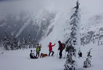
People: Carla, Suzanne, Barry, Barb, Elle, Matt
Dogs: Cooper, Isabel
This trip was inspired by trip reports that Steph Abegg posted last year of snowshoe trips around Coquihalla Pass in British Columbia. We rented an Airbnb house in Hope so that we could do multiple day trips at the pass and then relax together in the evenings. Our itinerary ended up looking like this:
Day Destination Weather Dinner Movie
Friday Drive up Pesto pasta Sideways
Saturday Zoa Mostly cloudy Chicken fajitas Minority Report
Sunday Flatiron attempt Cloudy & windy Shrimp stir fry Into the Wild
Monday Zupjok, Llama, Alpaca Party sunny Broccoli casserole Apollo 13
Tuesday Flatiron Sunny Leftovers Forgetting Sarah Marshall
Wednesday Drive home
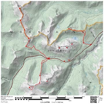 Coquihalla GPS track 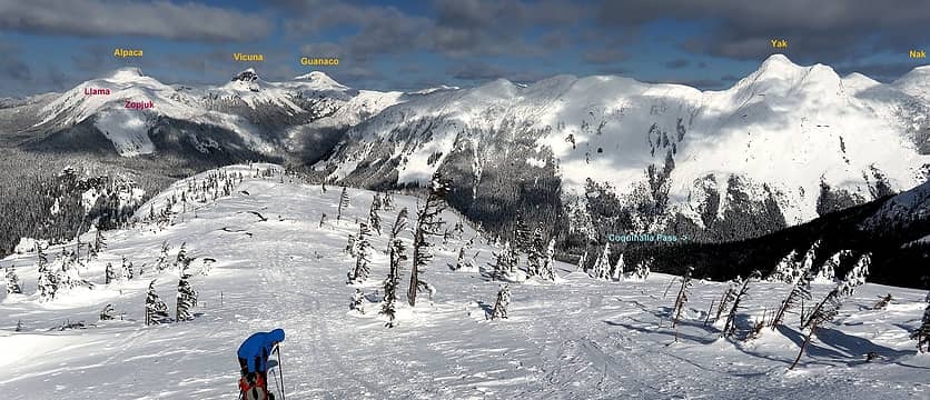 Coquihalla Pass peaks, viewed en route to Flatiron 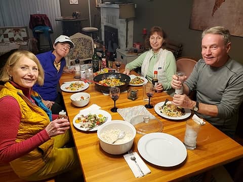 one of our dinners 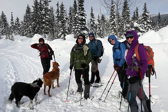 Gathered on the Falls Lake road. 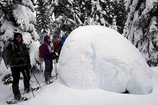 Hiking up the trail 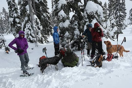 A somewhat snowy lunch break 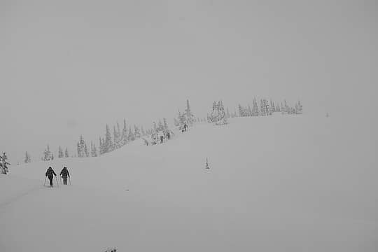 Approaching the false summit 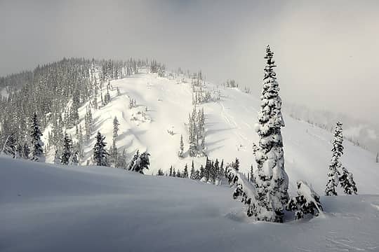 Brief sunlight looking across to the true summit 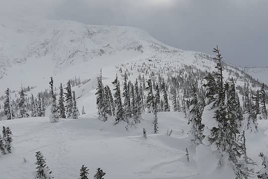 Windblown crest of Point 5860, as shown by the cornices and asymmetrical trees. 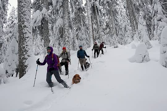 Jogging downhill through the powdery forest 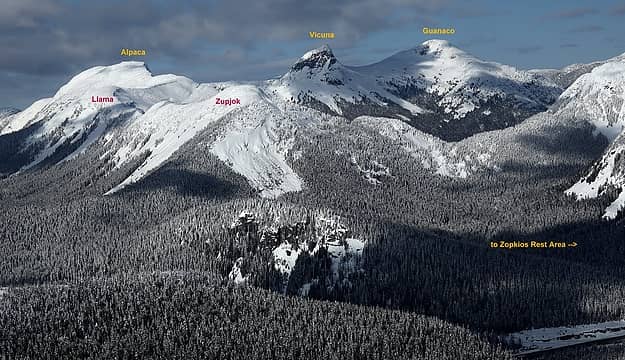 the ruminant peaks, photographed from Flatiron 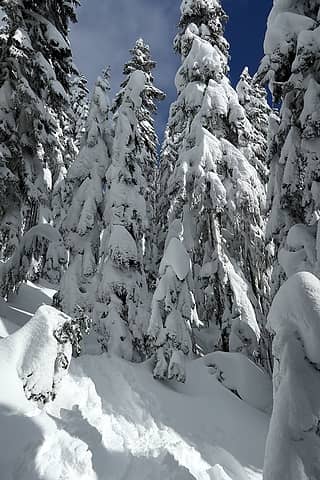 hiking up the snowy forest 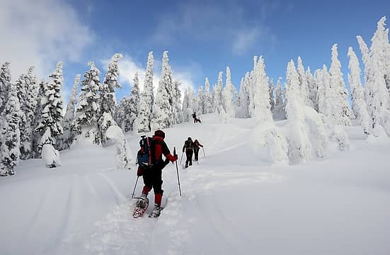 hey, there' s even me at the back of the line 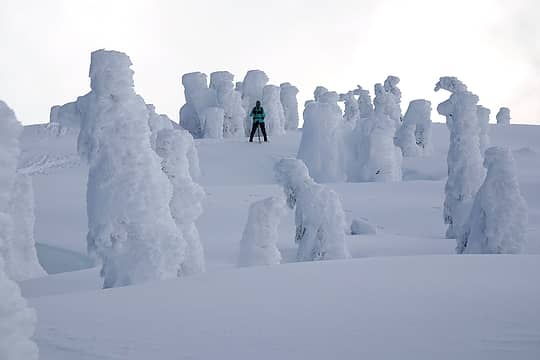 Barb in the rime Stonehenge 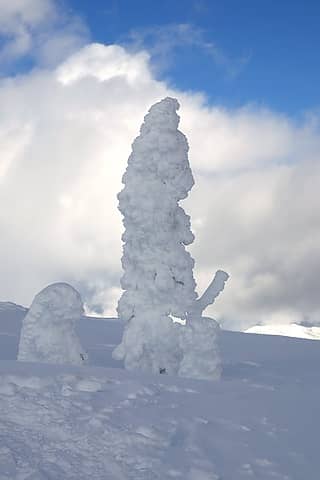 this tree seems particularly excited 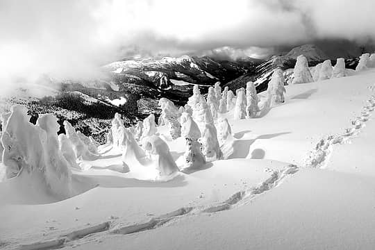 Footprints on the crest 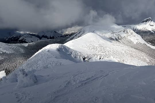 The ridge ahead 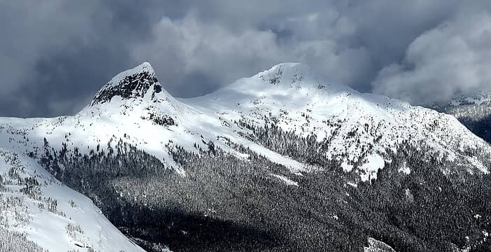 Vicuna and Guanaco 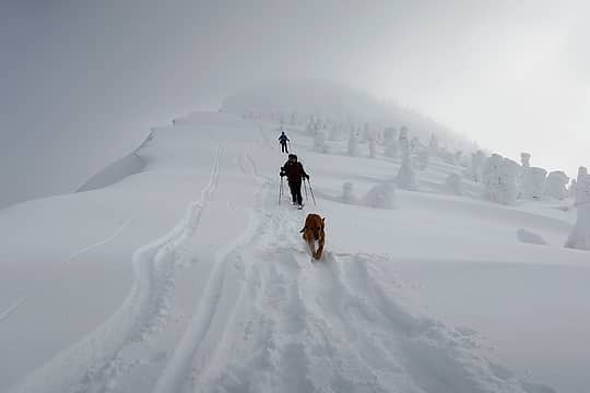 Descending from Zupjok 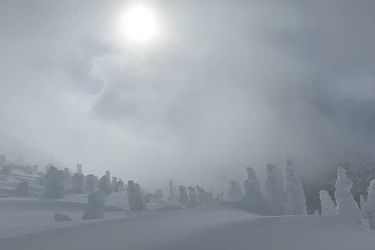 thickening clouds above the rime sentinels 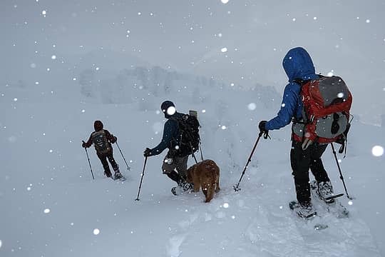 companions turning back 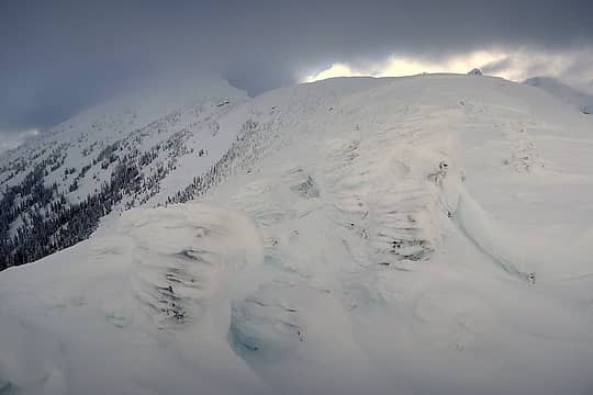 First view of Alpaca, which had been hidden in clouds all day till now 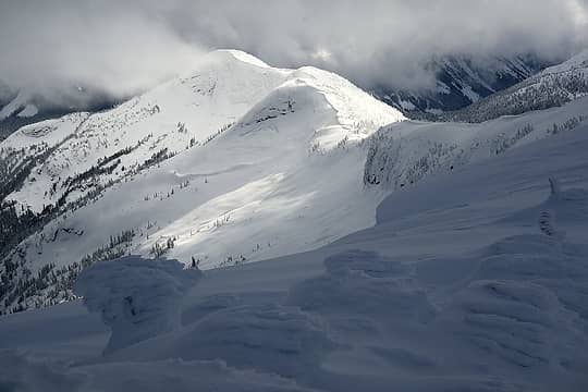 The ridge back to Zupjok (Llama is out of frame to the right) 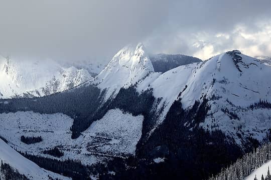 Gemse catches some light 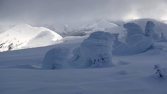 Zupjok at left, Llama at right, maybe Iago in middle distance 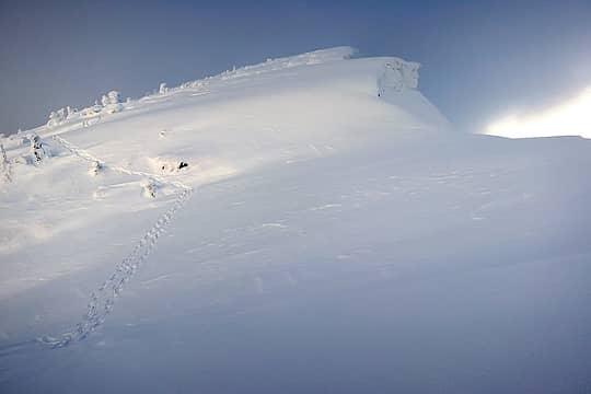 Sunny view of the final slope up Alpaca 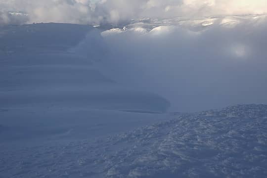 Cloudy view off the big summit cornices 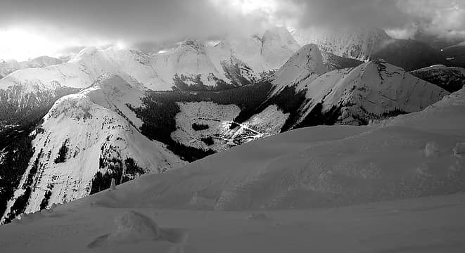 View westward to Steinbok, Chamois, Anderson River, etc 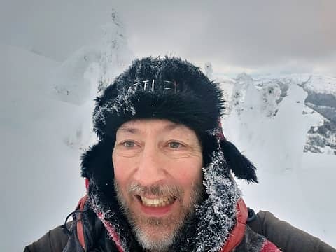 Frosty self-portrait  Dancing rime trees 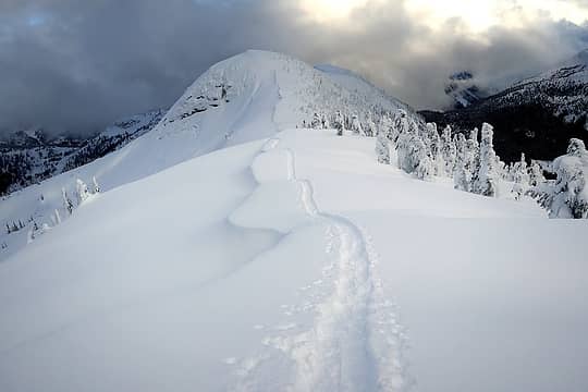 Tracks back to Point 5840 and Zupjok 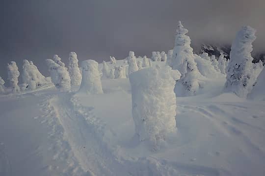 Faint light on the rime sentinels of Zupjok 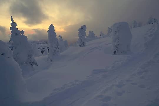 Last color descending off Zupjok 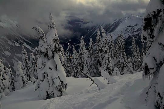 Lights on the highway far below. 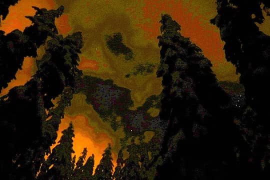 Impressionist image of the hike back to the rest area. 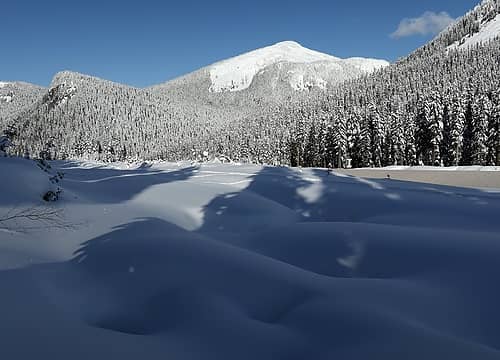 Hiking alongside the highway. On the opposite side is our hike through the forest to Zopjuk and ascent up the ridge that runs down on the left. 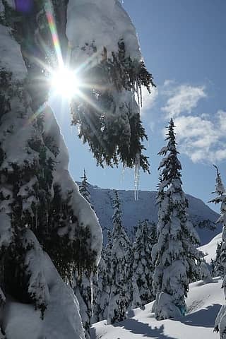 Icicles sparkling in the sun as snow melts on the trees 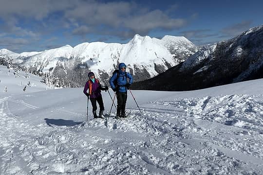 Hiking up the ridge towad Flatiron, with Yak and Nak behind 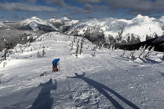 Higher up the ridge 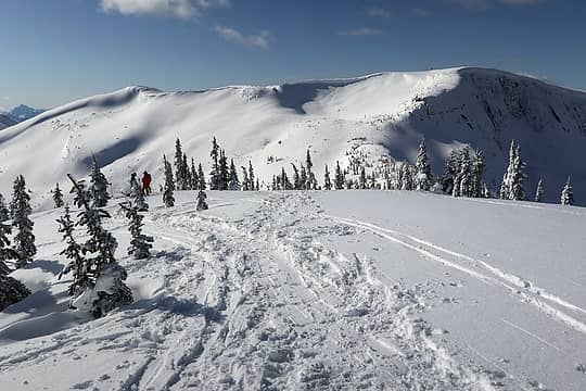 Preparing to drop down and cross to The Flatiron 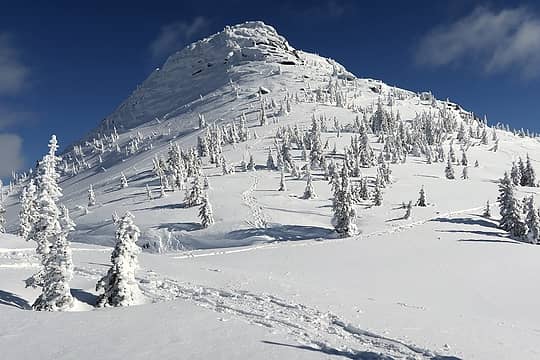 Needle Peak above us 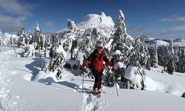 Me along the way 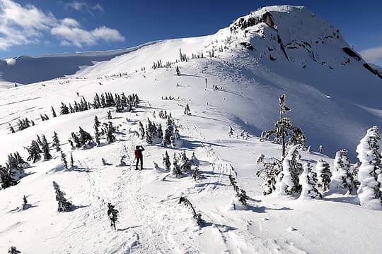 Barb taking photos and Carla switchbacking out ahead 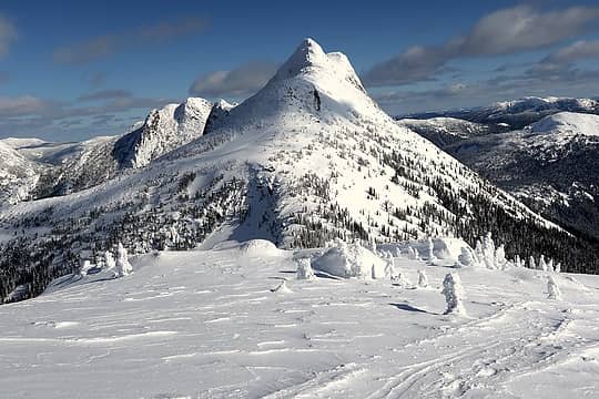 Needle dominating the view 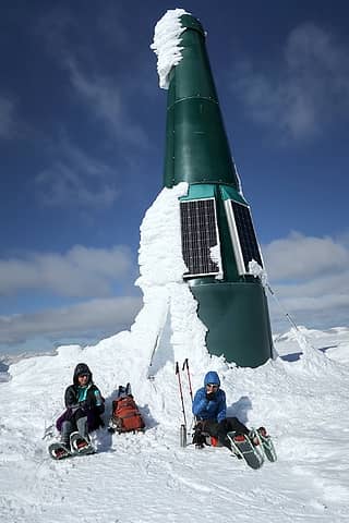 Lunch break at The Flatiron summit repeater 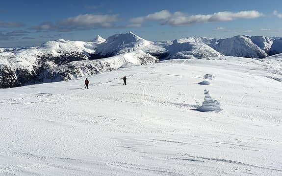 Trekking out across the expanse of The Flatiron 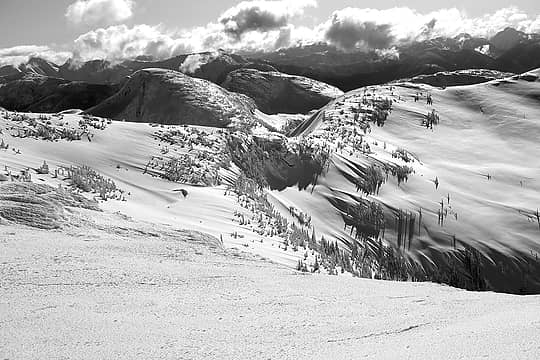 wind-carved snow terrain 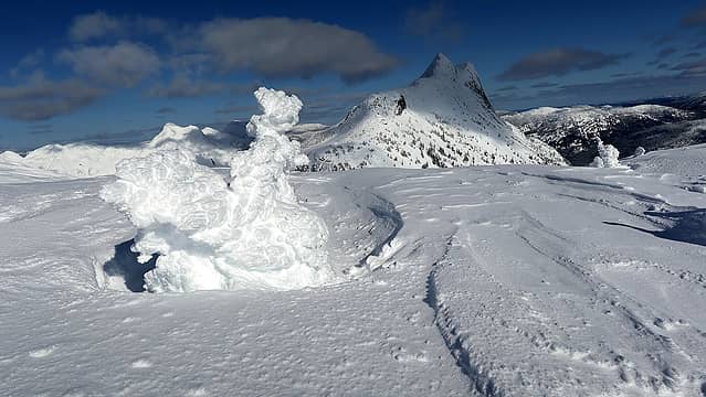 Rime Sculpture 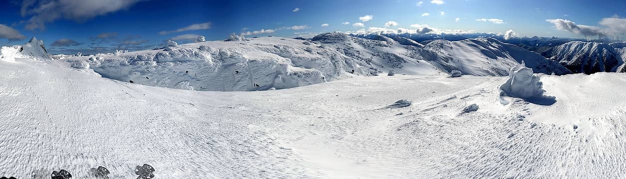 wider view of the area 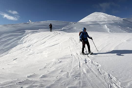 Descending from the flatiron 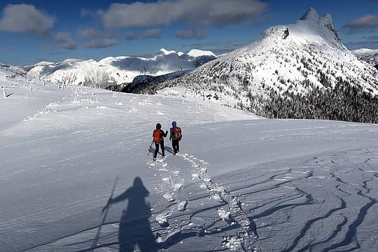 Hiking back toward the saddle 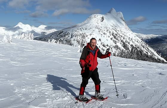 Me too 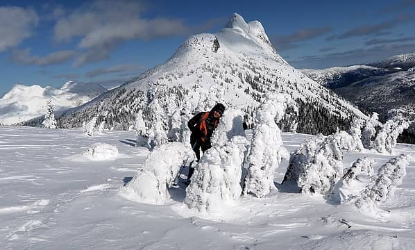 Barb hiding in a rime grove 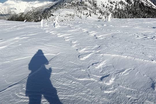 Wind-etched ghosts of previous snowshoe tracks
As beacons mountains burned at evening. J.R.R. Tolkien
As beacons mountains burned at evening. J.R.R. Tolkien
|
| Back to top |
  
|
|
BarbE
Member

Joined: 28 Jul 2006
Posts: 1153 | TRs | Pics
|
|
BarbE
Member
|
Mon May 25, 2020 1:10 pm |
|
|
Thanks Matt for planing the itinerary to this amazing place.
Especially enjoyed your pictures of Alpaca and the stunning scenery beyond.
Great food, scenery and company!
A few of my shots.
 Heading up to Zoa 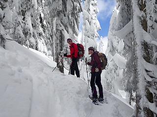 Steep ascent towards Zupjok 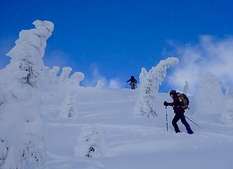 Nearing Zupjok 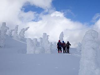 Matt, Carla & Suzanne admiring snow sculptures 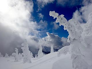 Zupjok summit 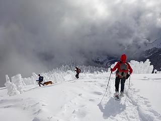 Leaving with highway below 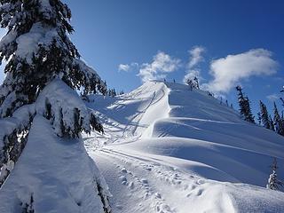 Ridge toward Flatiron 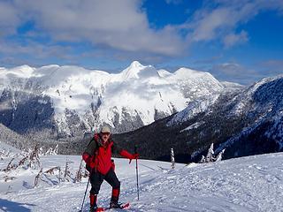 Matt nearing ridge below Needle Peak 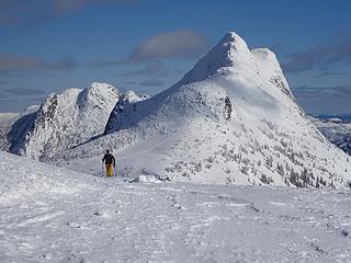 Skier arrives on Flatiron 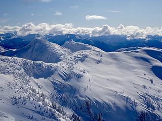 Flatiron summit views 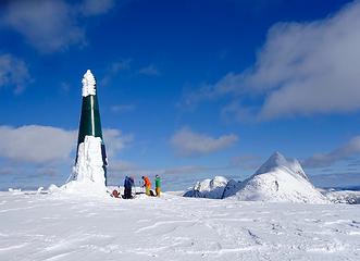 Flatiron summit repeater 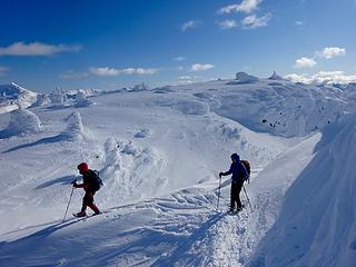 Snow formations wonderland 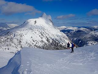 Dropping off Flatiron 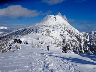 Back up to the saddle below The Needle 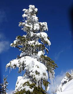 Tree decoration 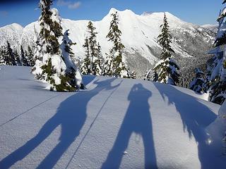 Last look at Yak & Nak before dropping down to the highway
|
| Back to top |
|
|
Jonny V
Member

Joined: 20 Jul 2009
Posts: 63 | TRs | Pics
Location: Lake Stevens |
|
Jonny V
Member
|
Mon May 25, 2020 2:26 pm |
|
|
Amazing photos, especially the snow ghosts. Really nice light! Great report. Always wanted to climb some of those.
There's time to conceive in
and time to expire
though the time twixt the two
tells the tale that transpires - "Time Waits For No One", Ambrosia
There's time to conceive in
and time to expire
though the time twixt the two
tells the tale that transpires - "Time Waits For No One", Ambrosia
|
| Back to top |
|
|
Nancyann
Member

Joined: 28 Jul 2013
Posts: 2319 | TRs | Pics
Location: Sultan Basin |
|
Nancyann
Member
|
Mon May 25, 2020 4:06 pm |
|
|
What a delightful trip report to read through! Enjoying life to the fullest spending quality time with good friends in a spectacular setting. It doesnt get much better than that!
|
| Back to top |
|
|
carlb328
Member
Joined: 28 May 2007
Posts: 327 | TRs | Pics
Location: Yakima, WA |
|
carlb328
Member
|
Tue May 26, 2020 5:50 am |
|
|
I think that's really a big bottle of Heineken with solar panels added for a disguise.
|
| Back to top |
|
|
|
|
You cannot post new topics in this forum
You cannot reply to topics in this forum
You cannot edit your posts in this forum
You cannot delete your posts in this forum
You cannot vote in polls in this forum
|
Disclosure: As an Amazon Associate NWHikers.net earns from qualifying purchases when you use our link(s). |


