pipedream
Member


Joined: 14 Oct 2012
Posts: 228 | TRs | Pics
Location: Formerly Seattle |
There's nothing particularly challenging about Kendall Peak, it's just a medium-length walk in the woods with a short climber's trail to its summit. But for some reason I've never bothered to hit it on the way to or from the Katwalk. It's like I always have some other destination in mind. Not this time. I've been ticking-off peaks & high points I can see from my deck in Hyak. Kendall was on that list but I had to do some research to ascertain that it was, in fact, the highest point I was looking at (also on that list are Huckleberry, Chikamin, Alta, Rampart, Margaret and the paraglider launch - of those, only Alta, Chikamin & Huckleberry remain yet-to-be-summited).
I left my car at the PCT-North TH right at 4pm (where the bathrooms are still locked, the garbage bins are overflowing and fees are currently not required). Took the old Crest/Commonwealth trail through the basin, stopping at the uppermost waterfall for a quick snack and contemplation (at that point I was considering just doing a loop back via the PCT but decided I could make it at least to the top of the slide path before turning back). Made my way up to the PCT and recalled some old wisdom somewhere on the 'net mentioning that you could save significant distance but not too much time by 'shwacking up the creek that runs thru the slide path. Decided to give it a go and once I had scrambled up the small cascade above the PCT I realized there was no turning back.
Made my way up the drainage finding rather easy travel as the brush has yet to grow above knee-high. The route steepened and I decided to hug the treeline on the edge of the slide path so I could maintain a visual sight of my objective. Finally reached the talus field and pushed up to the PCT. I'd guess I saved about 1.5 miles of trail but it did take me a little over an hour so it's not much of a shortcut as it took me the same amount of time on the return via the PCT proper. Finished the last two switchbacks and easily found the climber's path to the summit. Some places on the 'net designate the ascent from the PCT as a Class 2 scramble... IMO, not really. There was never a time I needed to use my hands to get up anything. Good boots and trekking poles got the job done rather easily. Once on top, a little over 3 hours from the time I left my car I snapped some pictures, enjoyed a refreshing tallboy, finished up my snacks and signed my name in the register (which was recently replaced in August 2019).
Tightened my boots, rotated my water bottles to balance out weight in my pack and stepped-off the summit at 7:30pm, wondering when the darkness would finally catch-up with me. Made it back to the junction with the Commonwealth Basin trail at 9 after doing some serious two-stepping it on the ridge where the trail was good. Swapped my sunnies for my regular glasses, tossed-on my headlamp and decided I'd rather walk the wide, relatively smooth PCT back to the TH, because even though it's longer, I didn't trust my headlamp batteries and I knew that the trail I came up would be way more difficult if they didn't last. After making the last mini-ascent along the PCT, I hustled down the long switchbacks, occasionally almost-jogging in my boots, and only needed my light for the last 15-20 mins. Made it back to the car exactly at 10pm, 6 hours after I departed with probably a total of 30min of stoppage. ~3 hours up, ~2.5 hours back, 10 mi RT according to my GPS and 2800' of total elevation gain. Not bad for a random Wednesday 
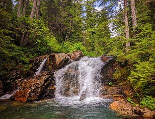 Waterfall in Commonwealth Basin 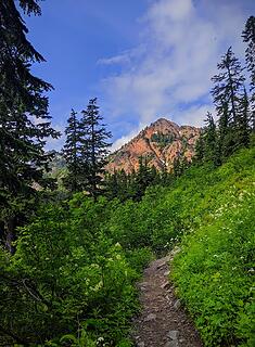 Red Mountain in the evening light 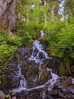 Cascade at the start of the 'shwack 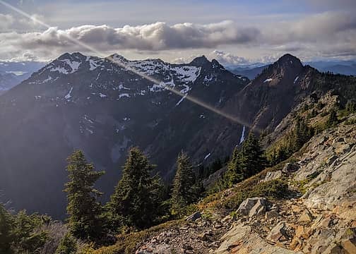 Snoqualmie, Lundin & Red 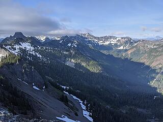 Thompson, Overcoat, Chikamin & Stuart (in the distance) 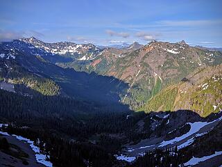 Gold Creek Valley 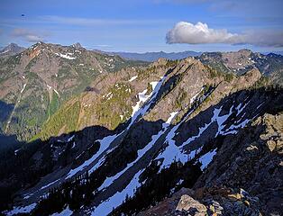 Adventure Zone still has some lines down it 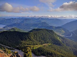 Hey, I can see my deck! 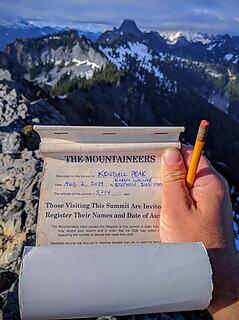 Summit Register 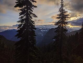 Sunset 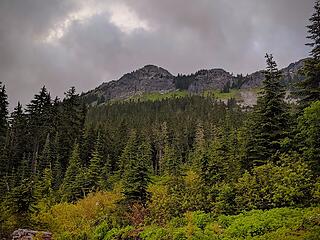 Yep, it's that
|


