Matt Lemke
High on the Outdoors


Joined: 15 Jul 2010
Posts: 2052 | TRs | Pics
Location: Grand Junction |
|
Matt Lemke
High on the Outdoors
|
 Sun Aug 09, 2020 6:23 pm |
|
|
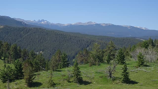
Over the course of the past month or so (July 11th through August 3rd to be exact), I completed the Wyoming 13ers, which took a pretty big effort to climb 31 of the 35 total peaks on that list in such a short period of time. With my month vacation I took in the summer of 2020, due to Covid all my big international climbing trips had to be postponed to at least the next year, therefore I had to stay in the US for the summer. I had been milling the Wyoming 13ers for many years, but never put them high on the priority and for over 5 years had deferred the project in favor of bigger and better things. However, given the circumstances, 2020 seemed like an excellent year to finally finish these peaks off. I had completed 4 of the 35 Wyoming 13ers many years ago (Downs Mountain, Point 13,062, Grand Teton and Cloud Peak), and back in May, Eric Gilbertson who was also looking for something to do in the summer this year due to his international trips also having to be postponed, sent me an email and asked if I wanted to join him for a full Wyoming 13er slam. Since I had already been thinking about doing just that, the trip was spearheaded! He spent most of June and the first half of July in Colorado climbing all the Centennial peaks in a new FKT of 32ish days, so we agreed on a start date of July 21st to hike into the Wind Rivers. My vacation began on July 11th, so I drove up to Wyoming that morning and would take the 9 days before our scheduled start date for the Wind Rivers to climb the remaining 3 peaks I hadn't yet done outside of the core Wind River Range. These three peaks included Black Tooth, Wind River Peak, and Francs Peak, and this is the first of 5 trip reports I will write that depicts our big adventure in Wyoming.
First, I'll start with a little bit more background and historical information about the Wyoming 13ers. Before this year, only two people had publicly reported completing them (although I have no doubt others have quietly completed them, as I have heard stories of old timers climbing every visible peak in both the Winds and throughout the state back in the day). There are 35 peaks on this list using the 300 foot prominence cutoff rule (see the list here) and all but 5 of them are in the core northern Wind River Range. The remaining 5 peaks are scattered around the state, one of which is in the southern Wind River Range (making a total of 31 peaks in the Winds), one is in the Absaroka Mountains just southwest of Cody (Francs Peak), one is in the Tetons (Grand Teton), and the last two are in the Bighorn Range (Cloud Peak and Black Tooth Mountain), which is another fault block mountain range further east close to the city of Sheridan. Fun fact: the Bighorn Range has some of the best kept alpine climbing secrets in all of the lower 48, but you didn't hear that from me! As of this writing, there are now 5 reported finishers of the 35 Wyoming 13ers, as there was another young climber who coincidentelly was also climbing them this summer (who we actually ran into out there...pretty cool). The current list of finishers is described in the table below.
Rank Name Final 13er Finishing Date Notes
T1 Teresa Gergen Black Tooth Mountain August 7, 2015 Finished first together
T1 Sarah Meiser Black Tooth Mountain August 7, 2015 Finished first together
3 Matt Lemke Bow Mountain August 3, 2020 First male finisher
4 Eli Boardman Francs Peak August 6, 2020 First to complete in one summer season
5 Eric Gilbertson Grand Teton August 7, 2020 Holds the FKT for the WY 13ers at 16 days and 17 hours
So withour further ado, below is the trip report for my climb of Black Tooth Mountain. See the following links for trip reports for the 4 WY 13ers I completed years ago:
Downs Mountain and Point 13,062 - August 2011
Grand Teton - August 2012
Cloud Peak - September 2015
Since I did not (and never will) care about FKTs, I did not repeat these 4 peaks on this trip to enable Eric to be able to achieve the FKT for all 35 of them without any competition between us.
Driving up from Denver, I stopped in Buffalo Wyoming for a quick rest, meal, and grocery store before driving up the Red Grade Road enroute to the Bighorn Reservoir Trailhead. From the tiny town of Bighorn, the Red Grade Road (FS 26) ascends very steeply up the east slopes of the Bighorn Range and eventually meets up with Highway 14 south of Burgess Junction. This well graded gravel road is passable to just about any car. I turned south onto FS 293 towards Park Reservior, and continued on this easy road. There were numerous people out fishing, camping and just enjoying the sunshine on this incredibly hot weekend (it was over 100 degrees in Buffalo, and my car actually almost overheated going up the Red Grade Road!). I drove around Park Reservior and near the south end of the lake, I veered left onto FS 289 which headed up to the Bighorn Reservoir, where the driveable road ended. This spur was passable for my 2WD stationwagon, but low riders would probably bottom out. I parked near the small dam on the north end of the reservoir, grabbed my pack and started walking up the ATV road along the left (east) side of the reservior shortly before 2pm. ATVs with a 50 inch width or less can actually continue along this "road" all the way to Cross Creek Reservoir. However at a point roughly halfway between the Bighorn and Cross Creek Reservoirs, there is a sign pointing left for the official start of the Solitude Trail, it's very important you turn left here, and if you stay on the ATV track along the east side of Bighorn Reservoir you can't miss it!
The Solitude Trail is actually in great condition and ascends gently in a SE direction slowly advancing into the alpine environment. The USGS topo maps indicate a trail junction at 10280 feet, however this junction doesn't really exist. The trail continues by turning east and crossing a small saddle immediately south of Point 10370, then gradually descends into the upper East Fork Little Goose Creek basin. The trail doesn't follow exactly where the map says it is, and its lowest point where it crosses the creek is actually only at 10,000 feet so the drop isn't too bad, there is also reliable water here to refill on hot days like I had. After the creek, the trail ascends again to a 10360 foot broad saddle and enters Highland Park. This massive meadowland is a spectacle to behold and is often filled with Elk and Moose, and during my walk across I indeed saw a couple moose. The only other people I saw on this climb I also passed by who were camped near a small grove of trees along the trail. They had just returned from some fishing at Highland Lake, which the trail continues to after descending 400 feet below the southwest corner of Highland Park. This is a quaint lake surrounded by thin pine forests, and offers quiet solitude. From here, it helps to know where to go, as you now have to get to Princess Falls, which is due south of Highland Lake and across Kearny Creek draining the Sawtooth Lakes.
The easiest way to get there is to hike the main trail to the outlet stream of Highland Lake and cross it. Immediately after crossing it, the main trail will take a sharp turn to the left and continue down and east towards the Kearny Lake Reservoir (which is not correctly shown on the USGS map). You don't want to go this way for Black Tooth. Right when the trail turns sharply left after crossing the outlet stream, look to the right, and spot a decent trail that takes off in a southward direction (this trail is also not on the map). Follow this trail as it weaves it's way through some unecessary ups and downs. It will seem like it's not going the right way at first, but then takes a turn due south and descended 150 feet or so, and traverses just above and west on the flat swampy area marked on the USGS quad with an elevation of 9570. Shortly after that this trail crosses the smaller northern tributary of Kearny Creek, then reaches Kearny Creek itself at a large beautiful meadow. Great camping can be had here, but it's worth continuing up Princess Falls and camping at any one of the first 4 Sawtooth Lakes, plus, I still had plenty of daylight left. An extra note: For those who have an ATV with a width of 50 inches or less, you can also reach this point by driving your ATV all the way to Kearny Lake Reservoir and walking the trail up to Highland Lake from there, making the overall approach exponentially shorter.
I found a way to cross Kearny Creek without having to take my shoes off by building a log bridge, and followed the boot path as it ascended up the steeper slopes to the right (west) side of Princess Falls. There is a 50 foot cliff band that must be negociated at the 9800 foot level, but cairns lead to a class 3 route up through slightly further right. Once atop this cliff band, the trail becomes harder to follow through scrub brush and denser trees. There is also a wet swamp that you'll have to walk around by cutting further right and to the west to get around it with dry feet. Shortly past this you will reach the west side of the first of 10 Sawtooth Lakes. The best route follows the west side of these lakes, which are all spectacular in their own ways. I camped between the 3rd and the 4th lake on a nice sheltered grassy depression at 10,250 feet elevation just moments away from the stream. It was a peaceful and calm night.
 First distant views of Black Tooth from Red Grade Road 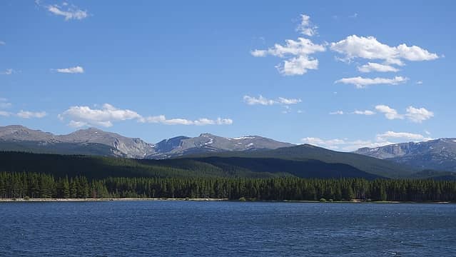 Bighorn Reservoir 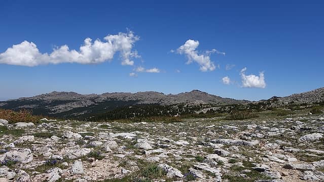 Hiking on Solitude Trail 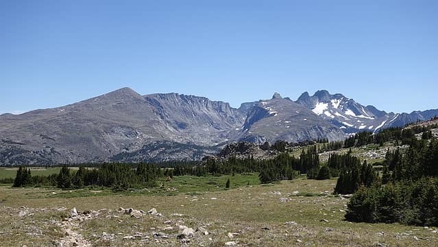 Black Tooth from Highland Park 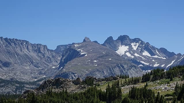 Black Tooth and the Sawtooth Lakes Basin below 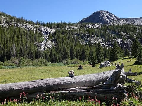 Meadow just before crossing Kearny Creek with Princess Falls 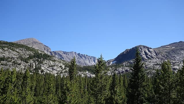 Looking up from the base of Princess Falls 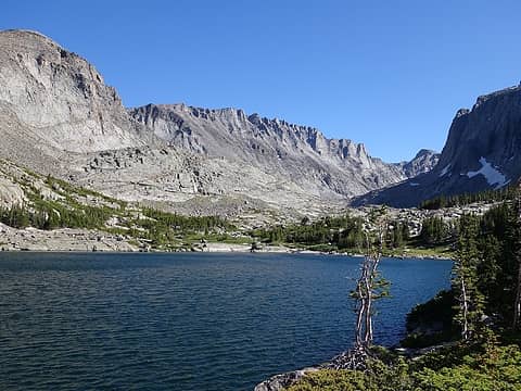 Arriving at the Sawtooth Lakes 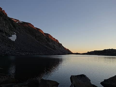 Twilight on the 4th Sawtooth Lake 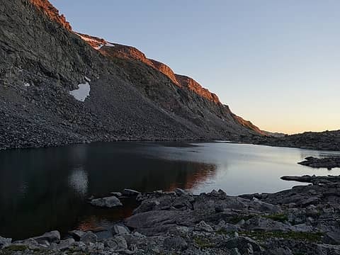 First rays of sun 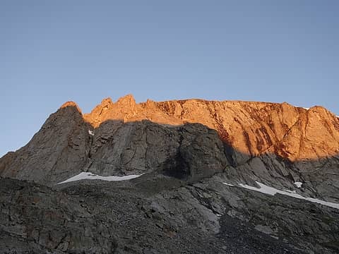 Sunrise on the steep cliffs above the 5th and 6th Sawtooth Lakes 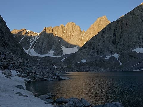 Woosley (at right) coming into view from the 9th lake 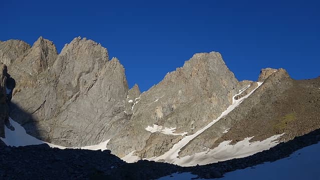 The east ramp is the obvious rightward ascending line between the black scree and the thin couloir; Woosley just to the left 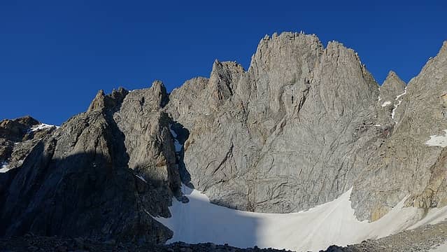 Looking up Woosley from the base of the ramp 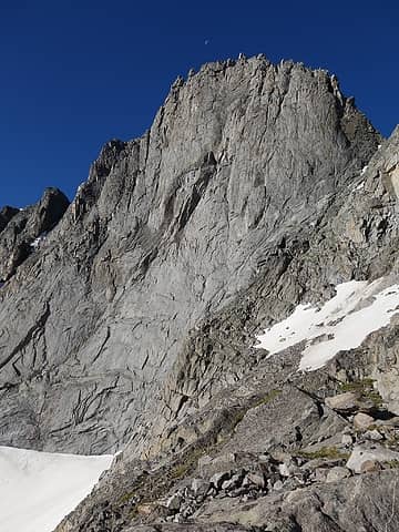 Woosley from somewhere on the ramp 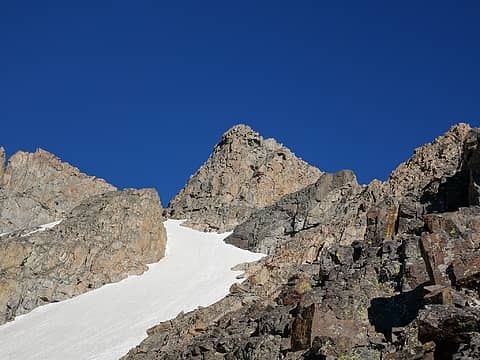 The lower east summit of Black Tooth 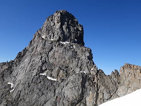 Notice the circling ledge on the left side of Woosley that I was studying 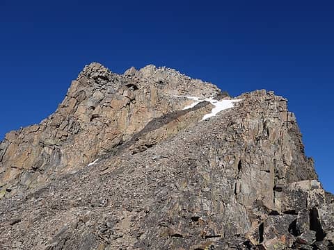 Black Tooth from above the class 4 crux 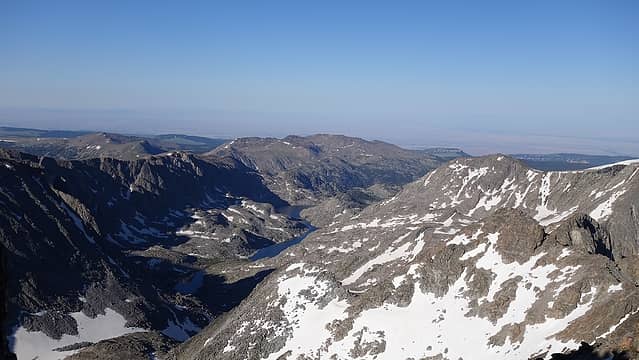 View down Wilderness Basin from the summit 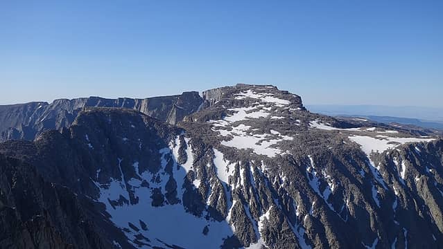 North side of Cloud Peak from the summit 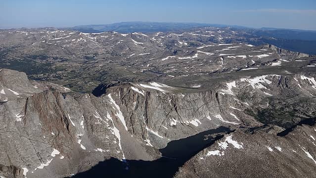 Loomis Lake from the summit 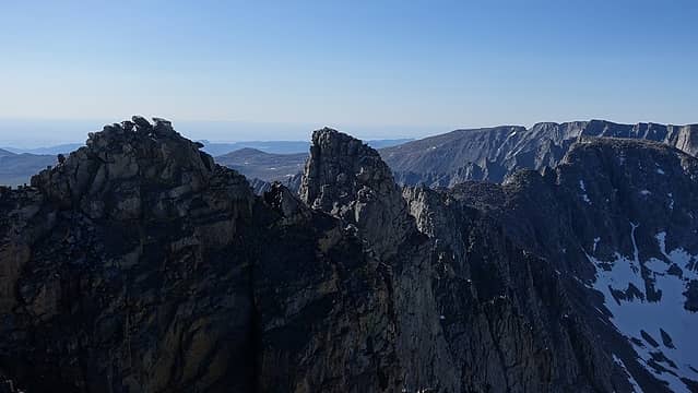 Woosley 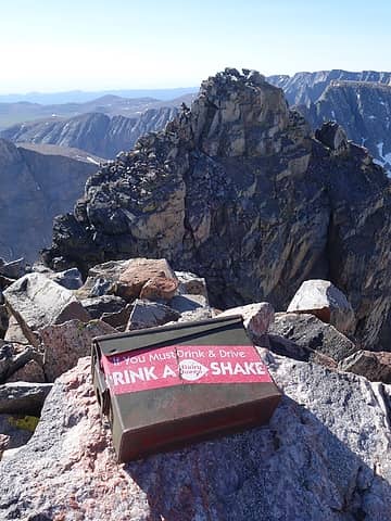 Summit Register 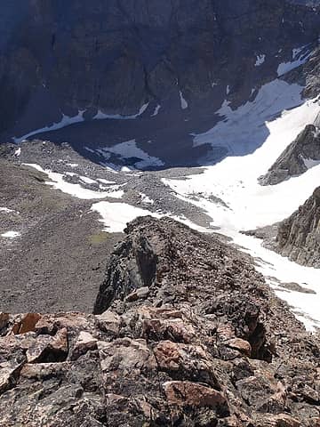 Looking down the upper part of the ramp 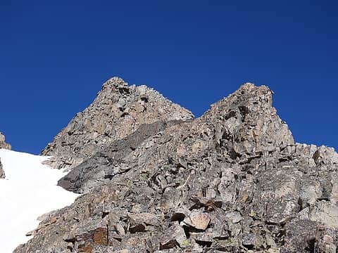 View of the steeper crux section of the route 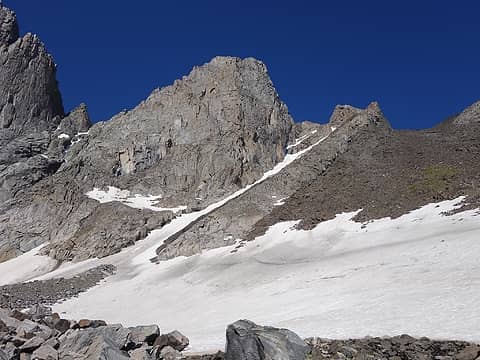 Black Tooth, Woosley and the east ramp 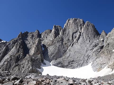 This peak to the left of Woosley is the Innominate, which has a 5.10d summit rock 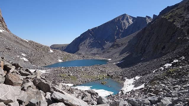 Descending to the upper Sawtooth Lakes 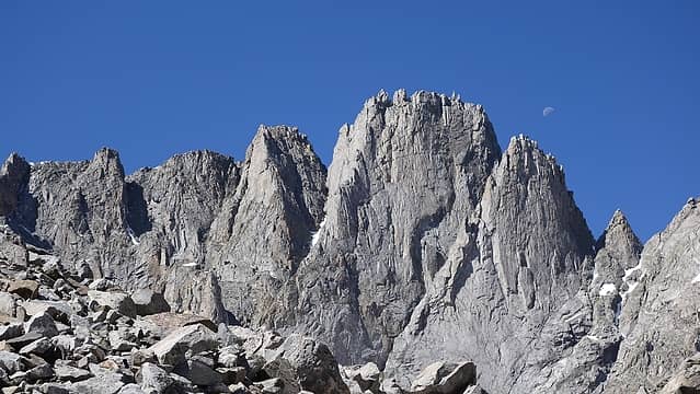 The Innominate 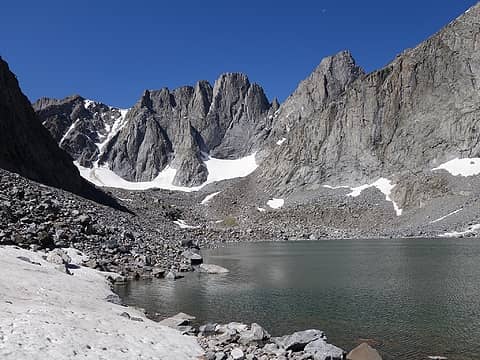 Looking back from the 9th lake 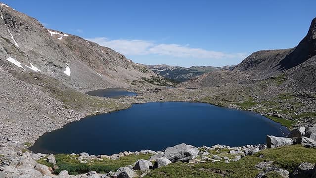 View of the 6th lake
|


