| Previous :: Next Topic |
| Author |
Message |
BeardoMcGrath
Member

Joined: 16 Jan 2018
Posts: 143 | TRs | Pics
Location: Snohomish |
For various reasons, COVID and otherwise, I really hadnt made it out for any overnight hikes yet this summer in WA, and with August moving right along that was a problem that needed solving. Due to the pandemic I was looking for an area likely infrequently traveled, and after the pleasant time I had had along Lost Creek Ridge two years ago, I wanted to give the Meadow Mountain area a try. The forecast was mixed, with a chance of showers transitioning to partly sunny on Saturday, with sunny skies on Sunday.
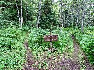
I got a relaxed start from the Meadow Mountain TH just after 10 AM, with overcast skies and a light drizzle. There were only two other cars parked there. The trail/old road up to the Crystal Lake jct is easy, and well brushed. A large tree had fallen recently heading down into the Crystal Creek valley but had been cleverly cut to allow dirt bikes or 4-Wheelers to go by.
To keep things interesting, I had decided ahead of time to climb up to Crystal Lake, and then follow the old trail over the pass to Meadow Lake and rejoin the Meadow Mountain Trail farther along. From the jct with the Meadow Mountain Trail, the old road/trail heading towards Crystal Lake is quite brushy, which was a real bummer considering the wet weather and continued drizzle/light rain. It wasnt long before I was soaked.
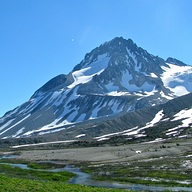
 Meadow/Crystal jct 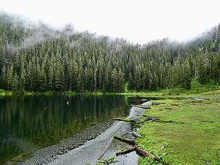 Crystal Lake 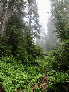 Standard condition going from Crystal to Meadow Lake 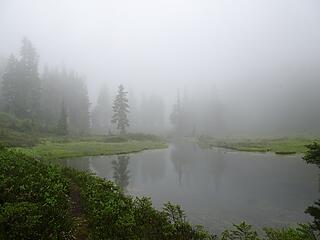 Tarn near Meadow Lake 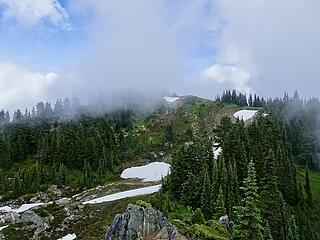 Approaching "the knoll" 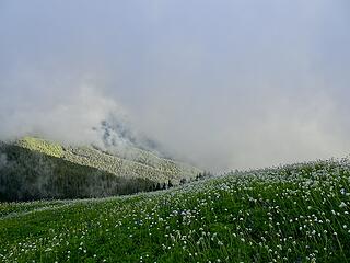 Evening "views" 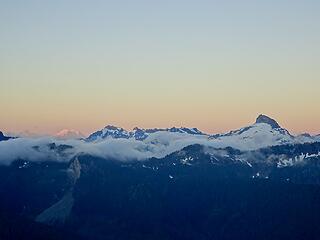 Rainier, Monte Cristo Range, Sloan 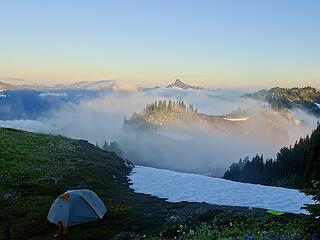 Clouds roll over the ridge 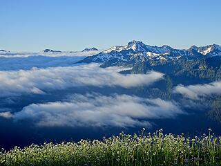 Black 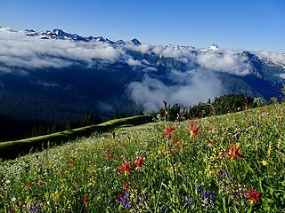 Descending to the trail 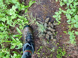 Some friend is nearby 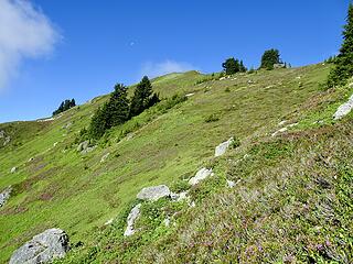 Climbing to Point 6421 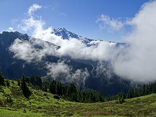 Clouds rising 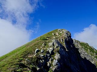 Viewpoint. There was a small area for one tent or a bivy sack here. 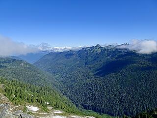 Lime Creek valley 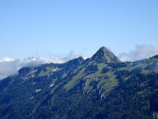 Lime 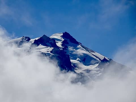 Glacier summit 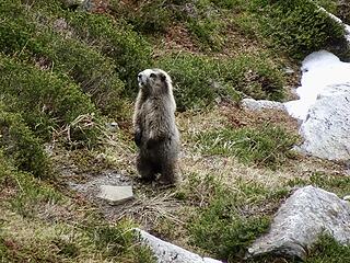 Friend 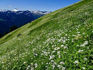 Huge wildflower field below camp 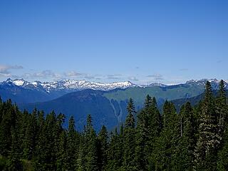 Snowking, Green Mountain 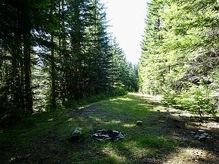 End of the old Meadow Mtn Road 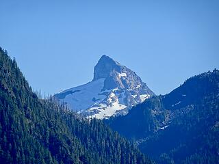 Peekaboo Sloan
 MistyMountainHop MistyMountainHop
MistyMountainHop |
| Back to top |
  
|
|
Chief Joseph
Member

Joined: 10 Nov 2007
Posts: 7697 | TRs | Pics
Location: Verlot-Priest Lake |
Great report and photos! I might actually attempt this trip someday, especially now that I have the necessary beta...well hopefully, I get lost easily!
Go placidly amid the noise and waste, and remember what comfort there may be in owning a piece thereof.
Go placidly amid the noise and waste, and remember what comfort there may be in owning a piece thereof.
|
| Back to top |
|
|
Damian
Member

Joined: 18 Dec 2001
Posts: 3260 | TRs | Pics
|
|
Damian
Member
|
 Wed Aug 12, 2020 5:49 pm |
|
|
Excellent report. Great work. 👍🏿
|
| Back to top |
|
|
Sculpin
Member

Joined: 23 Apr 2015
Posts: 1382 | TRs | Pics
|
|
Sculpin
Member
|
Thu Aug 13, 2020 9:34 am |
|
|
| BeardoMcGrath wrote: | | the old trail up and over to Meadow Lake was pretty straightforward |
I was so happy when I stumbled upon this trail! I had convinced my wife that it wouldn't be too bad bushwhacking between the lakes, but I knew there was a chance it could be an ordeal.
When we got to Meadow Lake, there was a Boy Scout troop there. The scoutmaster was loudly holding forth about something when we walked up. He turned around and saw us coming around the lake, his eyes got as big as saucers, and he said "where did YOU come from???"
Between every two pines is a doorway to the new world. - John Muir
Between every two pines is a doorway to the new world. - John Muir
|
| Back to top |
|
|
Get Out and Go
Member

Joined: 13 Nov 2004
Posts: 2127 | TRs | Pics
Location: Leavenworth |
"These are the places you will find me hiding'...These are the places I will always go."
(Down in the Valley by The Head and The Heart)
"Sometimes you're happy. Sometimes you cry.
Half of me is ocean. Half of me is sky."
(Thanks, Tom Petty)
|
| Back to top |
|
|
|
|
You cannot post new topics in this forum
You cannot reply to topics in this forum
You cannot edit your posts in this forum
You cannot delete your posts in this forum
You cannot vote in polls in this forum
|
Disclosure: As an Amazon Associate NWHikers.net earns from qualifying purchases when you use our link(s). |


 I know what brush-soaked is from the Little Wenatchee. Seems worthwhile to drive over from the eastside for a different perspective on Glacier Peak.