Forum Index > Trip Reports > Monument Peak, 09/16-17/2020
 Reply to topic
Previous :: Next Topic
Author Message
Alden Ryno
Member
Member


Joined: 04 Jun 2019
Posts: 150 | TRs | Pics
Location: Issaquah, WA
Alden Ryno
Member
PostSat Sep 26, 2020 7:01 pm 
Monument Peak 31 miles, 12,000' gain. Slate Pass TH
Synopsis: Slate Pass, Lake Ferguson Trail, "Feralcat" Pass, parallel SF Eureka Creek, ascend primary south gully of Monument, repeat in with reverse with a sleep nearly bisecting it. Beta: Fletcher's TR With work canceled on Wednesday due to adverse air quality in the Tri-Cities, I left home at 6pm for Winthrop, where I arrived at 1030pm. I parked and got a few meager hours of sleep until 3am when I left for Harts/Slate Pass. I arrived at the trailhead at 0500 and felt like turds. I took another 45 minute nap, then got ready, entirely unsure if I'd even hike a mile... Due to the smoke and overall malaise. I half-heartedly embarked from Slate Pass at 0615 on Wednesday in a smokey haze. It looked bad, however, the smell was hardly discernable; a few stars were visible above in the wee hours of the morning.
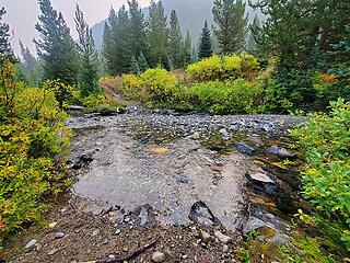
MF Pasayten crossing
In 75 minutes I was crossing the Middle Fork of the Pasayten River, which I had forded in knee-high water in June during my "Shellrock Slam" trip. This time, I hopped on two rocks and was across. Another 15 minutes and I turned onto the Lake Ferguson spur; finally, some elevation gain instead of loss! I followed the nice trail up and wondered when to diverge. Fletcher had noted gaining about 1,200' of elevation when they cut away, and that's about right. The trail crosses the creek and that's when one should probably head up. I went farther, thinking it might be good to stay in trail... Meh, take off at the water crossing. Taking off from the creek affords open terrain to the boulders on the south side of the basin.
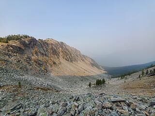
West side of Feralcat Pass (Lake Ferg/MF Pasayten side)
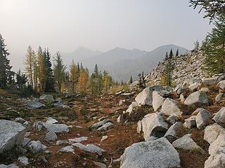
I found cairns in the boulders and it developed into defunct trail all the way to the pass! I'm not sure if Fletcher et al had this, but it is there. The trail follows the minimum of the valley for a bit then skirts along the northern flank of the valley and cuts horizontally to the pass. I think that this isn't Wildcat Pass, so I jestingly deemed it "Feralcat Pass," directly south of Lake Ferguson.
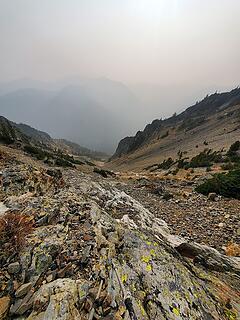
Smidge below the pass on the eastern side
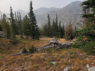
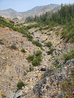
I took a snack break then, at 7.5 miles in, the off trail travel began. There are more cairns, but they seem to direct one down the creek/minimum of the valley. I'd advise against this and as annoying as it may be, make a hard traverse northeasterly around the shoulder of the mountain (Wildcat?) until one of the multiple open gully swaths down to near the south fork of Eureka Creek. I'm not sure if I took the same gully as Fletcher's gaggle, but they seem similar. It was about 1200' down from where my traverse ended to the end of area devoid of trees.
General terrain and brush during the traverse
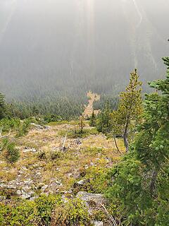
one of a few naked (treeless) gullies
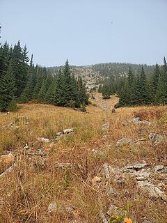
from below
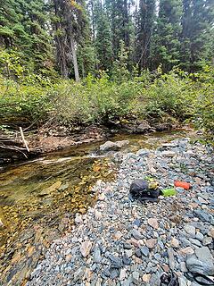
from below
Nearer the creek I found more cairns... Every so often I'd encounter "trail," which was denoted by a bit less brush and downed trees that were cut. I found more of this on the way out than the way in. Route finding here isn't terrible, though some competency would certainly help (not going too high/low in elevation). Too high brings steeper sidehilling while going lower seemed to have more dense brush and trees, as one may anticipate.
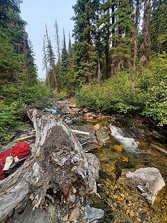
Eureka Creek crossing
more of Eureka creek
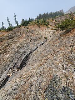
Another few hours and I reached Eureka Creek! It was 1230pm and about 3 miles from where I began to parallel the SF Eureka (~12.5 miles total). I scouted for that night's bivy site as I neared the creek and I noticed one particular spot that was very mossy, flat, and on the edge of the SF Eureka Creek. I made up my day/summit pack (a packable pack) and headed up. The creek was very easy to cross, rock hopping just once. The primary South gully of Monument practically begins at the creek. Only a few hundred feet of traversing with minimal elevation gain brought me to rock outflows which I was able to follow all the way up.
water in the gully
water in the gully
agua
agua
Looking up, up, up you can see bit of flowing water (dark portions of rock in the center gully)
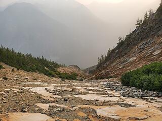
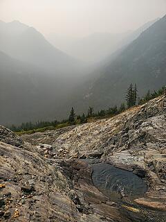
Of significance, there was flowing water from ~4,800' until ~5,600' in the gully. It appears to be from an aquifer as it spurts from rock/brush and builds to a significant flow at the lower end (multiple protrusion sites, I'm no hydrologist...). The water ceased on the surface once on downsloping slabs with marble scree around 6,000' that lasted for nearly 1,000 vertical feet. It became a screefest in the gully, so I opted climber's right (left is cliffy) and ascended small protruding ledges, still covered in scree.
Slippery Slab, viewed from above
I'd call them "obvious ledges" merely for the fact that they're obviously better than ascended nonsense scree.
not-quite-scree-ledges
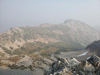
Eventually I gained the ridge at 8,000' along with a view of Lake and the more northern Pasayten Core (Lago Group) peaks. View is used in a generous manner... They were barely visible and I could make out the shape merely because they were the biggest things around.
"view" of Lake from where I gained the ridge
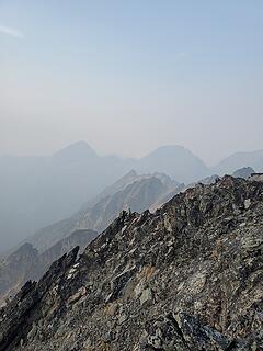
I followed the ridge to the summit without any true scrambling in my opinion; a hand for stability here and there. I gandered at and pondered the feasibility of traversing from Monument to Blackcap. While trivial for me since I don't plan to do them all again, it may be beneficial for oncomers. I recollect that Fred N. may have done something of the sort? Don't quote me on that.
Osceola and Carru
Osceola and Carru
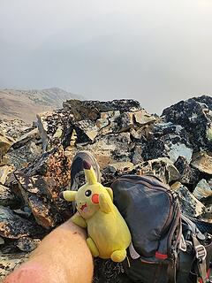
gotta have my pal :clown:
gotta have my pal clown.gif
I tagged the summit at 415pm, 10 hours from the car, which I figure is about how long it'd take from Lake based off of my experience there earlier this year. Again, trivial. However, both of these peaks (and all the Pasayten Bulgers) are a pain in the rumpus. Sans Robinson; it's lovely. I had no cell service on the summit. A semi-surprise to me since I had it on all the other Pasayten Protrusions, including Lost and Ptarmigan. The heavy smoke must be enough particulate matter to attenuate the signal from cell towers. I also had spotty reception from Chelan to Winthrop, likely the same reason, when I normally have service for about 80% of that drive. I left around 5pm and descended in the center of the gully that I avoided on the way up; scree/rock ski FTW.
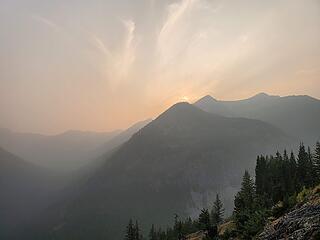
Smoke density seemed to lessen as I descended; beautiful iridescence filled the sky
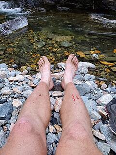
I reach the creek crossing and my pack at 645pm and made it to that awesome campsite at 715pm. It was about 10 minute walk from the creek confluence. The remaining 20 minutes was given to a leisurely transition and leg dip in the creek before meandering to camp.
FEETS (OnlyFans, huehuehue)
I took my annual "nekkid hike" pictures, finally. angel.gif They usually coincide with the summer solstice (World Hike Naked Day, obviously) but I procrastinated hard this year and got them for the vernal equinox. (I also got a slap on the wrist for posting one of those nudey playing cards earlier this year, so that's a deterrent as well; y'all should be thankful!).
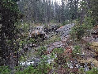
South Fork Eureka at camp
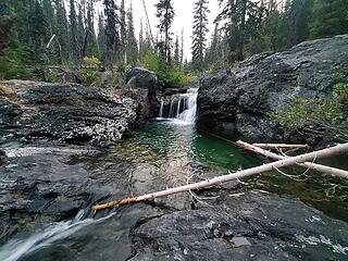
waterfall at camp
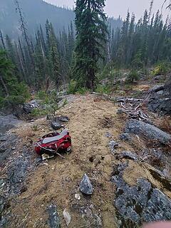
waterfall at camp
where I slept
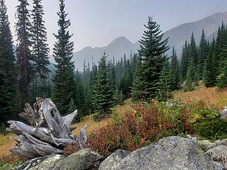
where I slept
I left camp at 7 am the next morning and practically retraced my steps (doing the higher traverse around Wildcat this time) and was back to the car at 215pm.
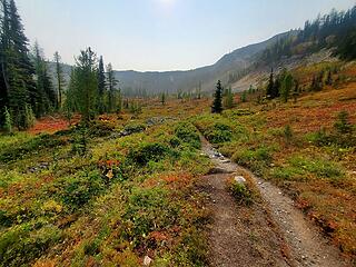
Autumn amongst us
Autumn amongst us
I could cry I love autumn so much
Colors were a changin'! Some larches had turned for the year while the majority were holding out for another week or two (right around this is being published, whoops). On the cusp of 90... 89/100

Back to top Reply to topic Reply with quote Send private message
Cyclopath
Faster than light


Joined: 20 Mar 2012
Posts: 7725 | TRs | Pics
Location: Seattle
Cyclopath
Faster than light
PostSat Sep 26, 2020 10:27 pm 
You made the smoke look beautiful in a few of those, your opening shot could be in the calendar. Sounds like it was an adventure! Such a beautiful part of Washington. Are the larches starting to go off at Feral Cat?

Back to top Reply to topic Reply with quote Send private message
Alden Ryno
Member
Member


Joined: 04 Jun 2019
Posts: 150 | TRs | Pics
Location: Issaquah, WA
Alden Ryno
Member
PostSat Sep 26, 2020 11:13 pm 
They are! I'd estimate ~20-25% were in the midst of turning while I was there. Few seemed to be fully turned (not "popping" too greatly in color).

Back to top Reply to topic Reply with quote Send private message
   All times are GMT - 8 Hours
 Reply to topic
Forum Index > Trip Reports > Monument Peak, 09/16-17/2020
  Happy Birthday Crazyforthetrail, Exposed!
Jump to:   
Search this topic:

You cannot post new topics in this forum
You cannot reply to topics in this forum
You cannot edit your posts in this forum
You cannot delete your posts in this forum
You cannot vote in polls in this forum