| Previous :: Next Topic |
| Author |
Message |
Alden Ryno
Member

Joined: 04 Jun 2019
Posts: 150 | TRs | Pics
Location: Issaquah, WA |
52 miles, 12,400' gain.
Mileage is greater by 1-2 miles than RT from Thunder Creek TH to Logan summit and back.
Notable mile markers (per my GPS):
Tricouni Camp: 8 miles.
Junction Camp: 10.5 miles.
Skagit Queen Camp: 13.5 miles.
Thunder Basin Stock Camp (crossing): 17.5 miles.
Park Creek Pass turnoff: 20 miles.
Camp below Freemont Glacier: 21.5 miles.
Logan Summit: 23 miles.
Logan has been looming over my conscious since abandoning it last Fourth of July weekend when I tackles Goode and Storm King. I knew that I'd regret it, but I just didn't want to commit an extra day (even though I was permitted to do so). Then I began toying with the idea of coupling two of my orphans; Logan and Cosho. However, as this year, the viability of the Douglas Glacier and Banded Glacier routes waned. Add in the fact that I bagged Cosho in August during a 21 hour sopping wet and I was out of any options of than the Freemont Glacier route, which I really abhorred the idea of simply for the ridiculously long approach.
Perfect weather and rearranged plans for the weekend left me with two days for a shot at Logan. Being this late in the season, the Freemont route was the only truly viable (solo) option. As much as I had wanted to try the Douglas route and a little, my least favorite option became the one I was to do.
I arrived to the Colonial Creek Campground at 0415 Friday with a nearly full parking lot! I was on the move a few minutes before 0500 knowing it was gonna be a heck of a day with my plan.
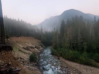 McAllister Camp river bend at 0700 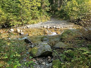 Thunder Creek crossing on the way in 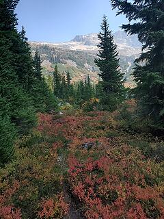 Autumn colors at Thunder Basin Hiker Camp 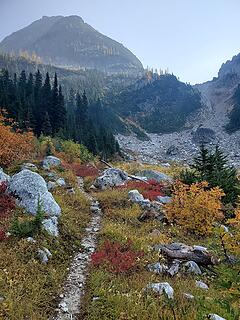 Inove with fall 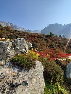 I can't not show off fall colors 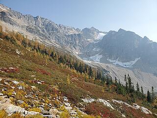 Looking back at the first third of the traverse 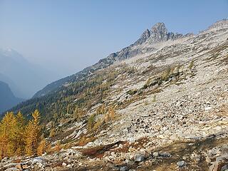 Looking ahead to the second half of the traverse 
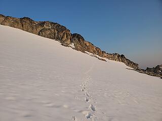 After realizing I had done derped 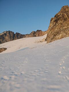 Scoping where I should have gone 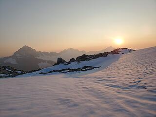 Not mad at this! 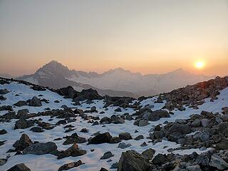 Only fresh snow not in the glacier 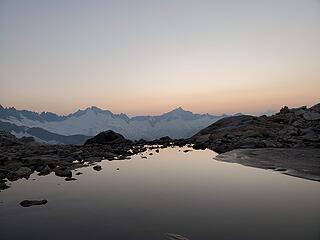 South to Forbidden 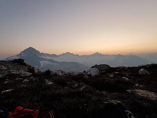 Sunset at camp 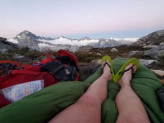 dawn light 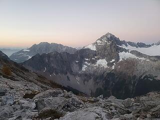 ...Buckner....oooWeee 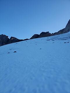 went through roughly middle of the image, trending left around a 60 degree angle from perpendicular 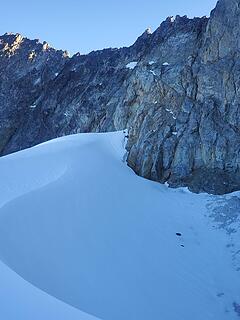 snow abutting rock, thankfully 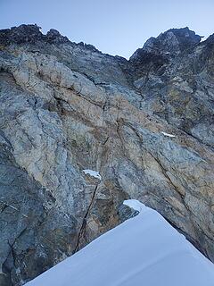 rock scramble/climb up 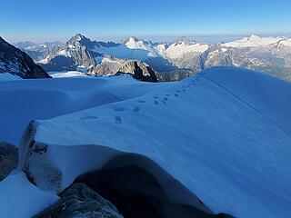 thank you for the step, nature 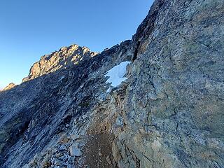 nice, obvious ledge to the ridge 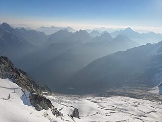 haze 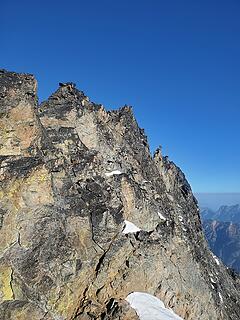 En route to summit/false summit 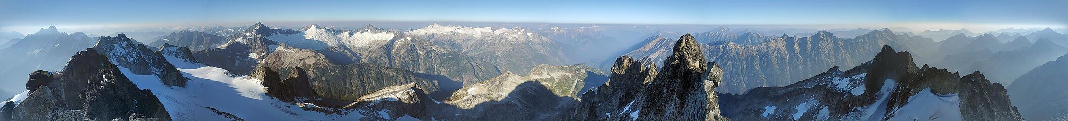 Summit Panorama, stitched by Google 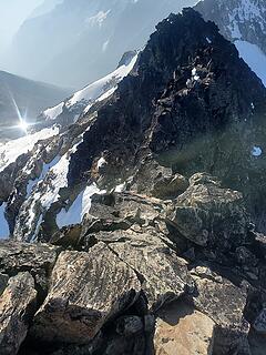 Looking back and down to the final summit scramble 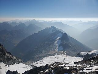 Douglas Glacier looked rough 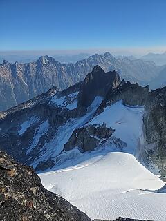 Top of Banded Glacier 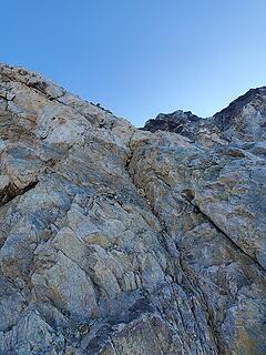 Closer look at initial climb off of snow 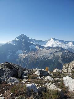 Views from camp 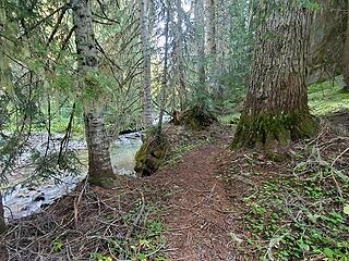 What the "earlier" Creek crossing looks like on the way in 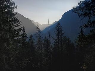 sun getting low on day 2 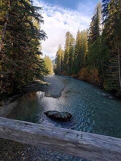 Last bridge before the end!  pretty
|
| Back to top |
  
|
|
Fletcher
Member

Joined: 29 Jul 2009
Posts: 1870 | TRs | Pics
Location: kirkland |
|
Fletcher
Member
|
 Tue Oct 06, 2020 8:11 am |
|
|
|
| Back to top |
|
|
Stefan
Member

Joined: 17 Dec 2001
Posts: 5091 | TRs | Pics
|
|
Stefan
Member
|
Tue Oct 06, 2020 12:18 pm |
|
|
You are badass. You put me to shame!
I did 34 miles this weekend....and I was tired! 52 for you. Holy canneloni.
|
| Back to top |
|
|
~*CutebutChossy69*~
bluebagprincess

Joined: 08 Jul 2019
Posts: 58 | TRs | Pics
Location: Seattle |
| Alden Ryno wrote: | | so at least I wasn't surprised to be getting wet ass pants. |
wet ass plants=wet ass pants
| Alden Ryno wrote: | | The Hogsback went right up to the rock and a lil bitty tongue overlapped the rock for maybe a foot; nature is perfect. |
Sometimes a lil bit of tongue is all it takes  Thanks for yet another fantastic TR! The wap references really set this one apart tho
  Congrats on #90 dude, it has been inspiring to watch you crush the Bulger list so quickly! Congrats on #90 dude, it has been inspiring to watch you crush the Bulger list so quickly!
Choss is a girl's best friend
Choss is a girl's best friend
|
| Back to top |
|
|
MangyMarmot
Member

Joined: 06 Apr 2012
Posts: 474 | TRs | Pics
|
Cool trip, man. Congrats. That's a big one.
|
| Back to top |
|
|
awilsondc
Member

Joined: 03 Apr 2016
Posts: 1324 | TRs | Pics
|
Great trip Alden! That summit panorama is absolutely incredible viewed full screen. Another strong effort! Good stuff as usual. 
|
| Back to top |
|
|
|
|
You cannot post new topics in this forum
You cannot reply to topics in this forum
You cannot edit your posts in this forum
You cannot delete your posts in this forum
You cannot vote in polls in this forum
|
Disclosure: As an Amazon Associate NWHikers.net earns from qualifying purchases when you use our link(s). |


