| Previous :: Next Topic |
| Author |
Message |
geyer
Member


Joined: 23 May 2017
Posts: 463 | TRs | Pics
Location: Seattle |
|
geyer
Member
|
 Tue Oct 06, 2020 5:42 pm |
|
|
Dates: October 1-4, 2020
Distance: 55.4 miles
Accum. Elevation Gain: 18.1k'
Peaks: Rolo, Osceola, Dot, Ptarmigan
Lakes: Fred, Doris, unexpected Monument Creek source lake under Lago (aka Bluebz Lake), Dot Lakes, Buckskin Lake, Silver Lake
Total Humans Seen: 24 (including two elusive Gilbertsons in their natural habitat)
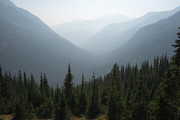
In a year where nearly everything got cancelled and postponed, it was nice for one thing that's been on the calendar since the Monday morning after 2019's larch trip to actually pull through. But man, was this rough. The smoke did its very best to shut us down the first two days...
Day 1: Slate Pass to Doris Lake + Rolo
Distance: 16.1 miles
Elevation Gain: 4200'
Elevation Loss: 4100'
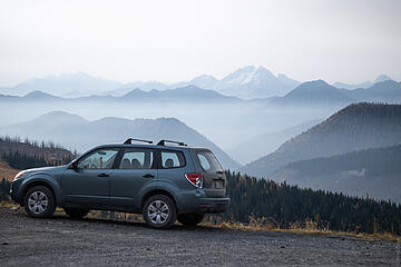
After a 5am Seattle departure, we got to the trailhead at about 9:30am with outstanding views of Silver Star and the valley below. Eve and Surafel decided which footwear they would don for the next four days; Surafel chose his Mutants (  ); Eve decided to wear the boots she got and subsequently didn't use again from 5 years ago in hopes of suddenly changing her original opinion of them. (Bold strategy Cotton! Let's see if it pays off for her.) A light haze from the California wildfire smoke gave the view a majestic feel but it didn't seem too worrisome because it looked to be staying away from us in the valleys to the south. But then we did the 20' climb to the pass and realized how wrong we were.
smoke. everywhere. ); Eve decided to wear the boots she got and subsequently didn't use again from 5 years ago in hopes of suddenly changing her original opinion of them. (Bold strategy Cotton! Let's see if it pays off for her.) A light haze from the California wildfire smoke gave the view a majestic feel but it didn't seem too worrisome because it looked to be staying away from us in the valleys to the south. But then we did the 20' climb to the pass and realized how wrong we were.
smoke. everywhere.
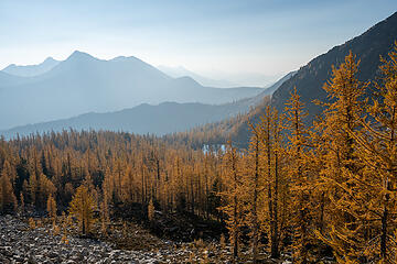
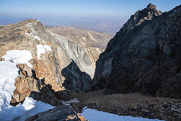
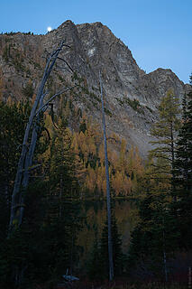
 subaru ad 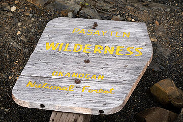 downed sign 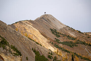 Slate peak lookout 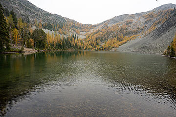 Fred Lake 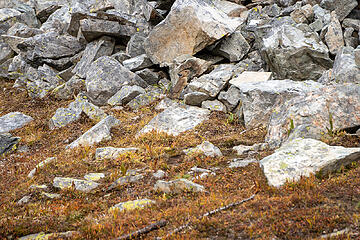 Pika! 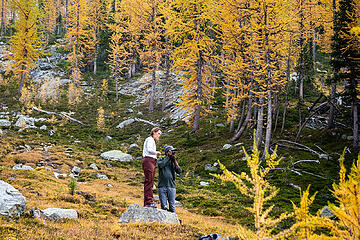 Surafel's photography 101 class 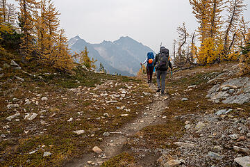 crossing the pass 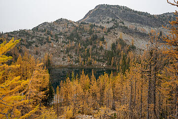 Doris Lake  Chili! 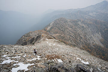 Going up to Rolo 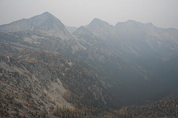 ew 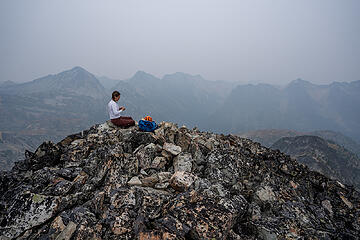 smokey summit views 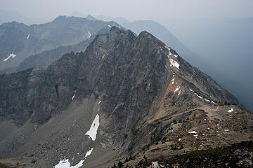 traverse from wildcat 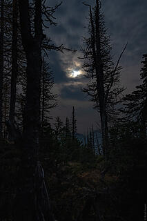 spooky full moon views 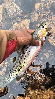 Courtesy of Surafel 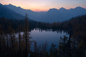 Doris 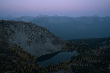 Fred & the full moon 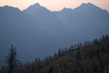 blackcap/monument 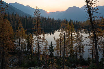 sunrise 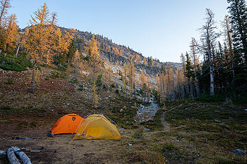 tent views 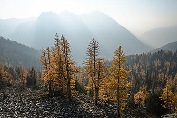 going up Osceola 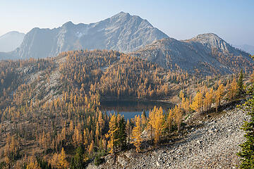 looking back at Doris 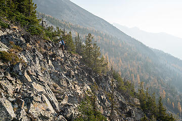 this is definitely good for the lungs... 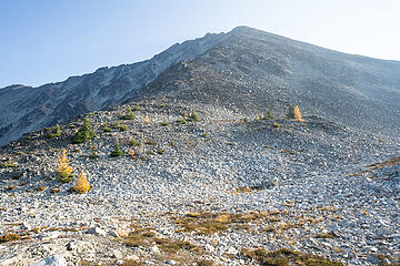 route up Osceola 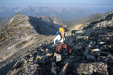 somehow all smiles 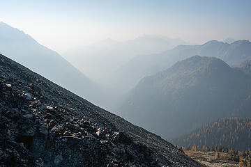 valley holding all the smoke 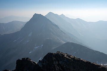 Carru/Lago 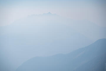 Name that Peak? lol 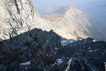 Oscy Couloir 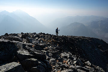 heading down  The trail had a neat view of Blackcap but things got really interesting once we were in the basin below the peak, with its source pond, golden grasses, yellow larches, and wild smoky lighting. The further up we went, the denser the larches became. Soon enough, we entered a golden palace, emanating larchy grandeur.
 valley smoke 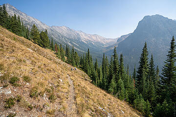 smoke clearing a bit 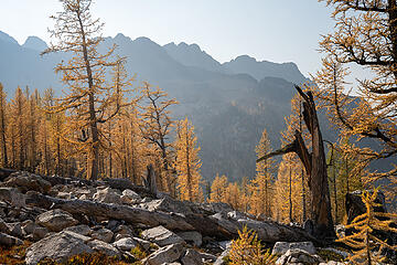 Getting up Shellrock Pass 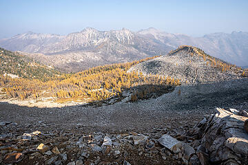 east view from Shellrock 
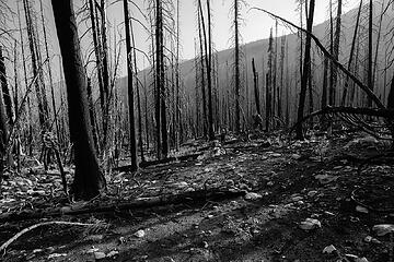 Burn zone 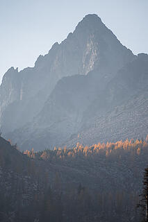 Lago east ridge 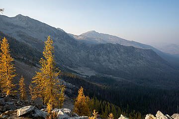 The route to Dot Lakes 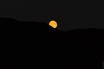 "BRAD GET YOUR CAMERA OUT" 
 Heading up to Dot Mountain  Ptarmigan 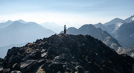 Dot  The traveling here was easy and kind of relaxing, but kept going on forever and ever and ever. The Tatoosh Buttes trail was not made for quick climber access. The traveling here was easy and kind of relaxing, but kept going on forever and ever and ever. The Tatoosh Buttes trail was not made for quick climber access.
 Ptarmigan Couloirs & gullies 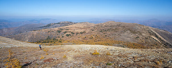 Tatoosh Buttes & Tamarack Ridge 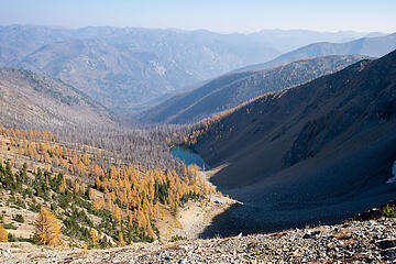 lake under Ptarmigan 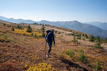 colors 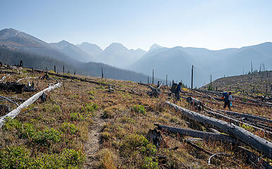 more burn 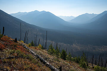 lots of burn  ).
The climb up to Buckskin Ridge was uneventful and mostly in the trees, but we caught the tail-end of sunset from a break and made it to camp by headlamp for the second night in a row. Buckskin Lake already had its two best campsites taken, so we had to camp 50' above the lake, which may have been the hardest 50' of the day. Getting water from that high is a royal pain in the ass. We decided not to set up tents and just cowboy camp since we were lazy and the nights had been warm. Finally, a good decision.
Day 4: Buckskin Lake to Slate Pass
Distance: 13.0 miles
Elevation Gain:4100'
Elevation Loss: 3700'
On the final day, we got up for sunrise and packed our bags. Surafel got a little more fishing in and we were off to the races to greet our car at Slate Pass. I mistakenly believed that it was only 10 miles and thought the trail would be much more of a contouring traverse than it actually was, so day 4 wasn't as much of a cake walk as I was hoping. Especially not the part right before Silver Pass where you contour at 6600' for miles and suddenly drop 500' straight down to the valley below! I kid you not, that was the hardest part of the entire trip right there. My knees were killing me. I'm not sure if that trail ever went through a planning phase or if they were just like "f### it, we already built the traversing trail this far, might as well keep it and drop straight to valley floor." ).
The climb up to Buckskin Ridge was uneventful and mostly in the trees, but we caught the tail-end of sunset from a break and made it to camp by headlamp for the second night in a row. Buckskin Lake already had its two best campsites taken, so we had to camp 50' above the lake, which may have been the hardest 50' of the day. Getting water from that high is a royal pain in the ass. We decided not to set up tents and just cowboy camp since we were lazy and the nights had been warm. Finally, a good decision.
Day 4: Buckskin Lake to Slate Pass
Distance: 13.0 miles
Elevation Gain:4100'
Elevation Loss: 3700'
On the final day, we got up for sunrise and packed our bags. Surafel got a little more fishing in and we were off to the races to greet our car at Slate Pass. I mistakenly believed that it was only 10 miles and thought the trail would be much more of a contouring traverse than it actually was, so day 4 wasn't as much of a cake walk as I was hoping. Especially not the part right before Silver Pass where you contour at 6600' for miles and suddenly drop 500' straight down to the valley below! I kid you not, that was the hardest part of the entire trip right there. My knees were killing me. I'm not sure if that trail ever went through a planning phase or if they were just like "f### it, we already built the traversing trail this far, might as well keep it and drop straight to valley floor."
 Buckskin Lake mornin 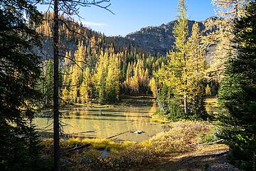 Buckskin Ridge meandering 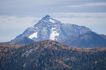 Jack, king of the Pasayten
|
| Back to top |
  
|
|
Alden Ryno
Member
Joined: 04 Jun 2019
Posts: 150 | TRs | Pics
Location: Issaquah, WA |
Woooow, Brad! What a perfect time (smoke aside  ) to be deep in the Pasayten for all those days. Stunning images. ) to be deep in the Pasayten for all those days. Stunning images.
|
| Back to top |
|
|
raising3hikers
Member

Joined: 21 Sep 2007
Posts: 2344 | TRs | Pics
Location: Edmonds, Wa |
Great effort on your trip and in your report! It was fun to read it and see the pretty pictures
|
| Back to top |
|
|
awilsondc
Member

Joined: 03 Apr 2016
Posts: 1324 | TRs | Pics
|
Great report! That's weird about your illness, I'm glad it was short lived. Great freakin' set of photos! I loved the spooky full moon photo and the larch with red carpet shots. I really need to get out into some of that prime larch country, maybe soon!
|
| Back to top |
|
|
John_B
Member
Joined: 15 Nov 2014
Posts: 50 | TRs | Pics
|
|
John_B
Member
|
Tue Oct 06, 2020 8:44 pm |
|
|
Great looking photos! The smoke looked to be a bummer but they still turned out great! One little addendum. The photo of the fish that Surafel is holding is a west slope Cutthroat trout. They are so bring you'd think they are a rainbow but the lack of spotting on the front belly and the red belly are both indicative of cutthroat.
|
| Back to top |
|
|
Nancyann
Member
Joined: 28 Jul 2013
Posts: 2318 | TRs | Pics
Location: Sultan Basin |
|
Nancyann
Member
|
Wed Oct 07, 2020 8:34 am |
|
|
Fun trip report to read as always, and so many cool pictures!
When we did our loop trip last summer, on day two, I had to haul my heavy pack up that insane sheep run to Buckskin Ridge in the hot sun. That was when the reality of unmaintained trail, dangerous for stock travel set in.  We got lucky with the smoke clearing Thursday night in the Chiwaukums, but we could see that it was still bad off to the northeast where you guys were.
|
| Back to top |
|
|
Fletcher
Member

Joined: 29 Jul 2009
Posts: 1870 | TRs | Pics
Location: kirkland |
|
Fletcher
Member
|
Wed Oct 07, 2020 1:49 pm |
|
|
The elusive Dot! Im very jealous. Excellent photography as well.
|
| Back to top |
|
|
RichP
Member

Joined: 13 Jul 2006
Posts: 5634 | TRs | Pics
Location: here |
|
RichP
Member
|
Wed Oct 07, 2020 5:23 pm |
|
|
Some nice, remote areas in that one.
|
| Back to top |
|
|
Popcorn
Member
Joined: 20 Aug 2008
Posts: 151 | TRs | Pics
Location: Another Place |
|
Popcorn
Member
|
Thu Oct 08, 2020 4:07 pm |
|
|
Wow! How many photos can your camera hold? A huge-capacity SD card? Mountain photography sure has changed since the days of carrying a dozen 36-exposure rolls of Kodachrome II slide film, a big Nikon F2 SLR, and three heavy Nikkor lenses on a ten-day backpacking trip. You guys are amazing!
|
| Back to top |
|
|
geyer
Member
Joined: 23 May 2017
Posts: 463 | TRs | Pics
Location: Seattle |
|
geyer
Member
|
Thu Oct 08, 2020 5:33 pm |
|
|
| Nancyann wrote: | | Fun trip report to read as always, and so many cool pictures!
When we did our loop trip last summer, on day two, I had to haul my heavy pack up that insane sheep run to Buckskin Ridge in the hot sun. That was when the reality of unmaintained trail, dangerous for stock travel set in.
We got lucky with the smoke clearing Thursday night in the Chiwaukums, but we could see that it was still bad off to the northeast where you guys were. |
Nancyann - I kept thinking of you out there every time we came across logs that had been cut seemingly in the middle of nowhere. The trails were in pretty great shape for how far they can all be from roads! Appreciate the work you and so many others have put into keeping this area accessible!
| Popcorn wrote: | | Wow! How many photos can your camera hold? A huge-capacity SD card? Mountain photography sure has changed since the days of carrying a dozen 36-exposure rolls of Kodachrome II slide film, a big Nikon F2 SLR, and three heavy Nikkor lenses on a ten-day backpacking trip. You guys are amazing! |
Yes digital photography is a whole different ballgame with modern SD cards. Those things can hold thousands of photos and you don't even have to remember whether you've filled it up before you leave for your trip because you can just delete old photos on your camera from anywhere. I think mine is 128 GB. It definitely takes away some of the artistry to take the perfect photo in one shot with film. But on the other hand guys like me can just take a lot of photos and filter out the bad ones to appear as if they're talented 
|
| Back to top |
|
|
GaliWalker
Have camera will use

Joined: 10 Dec 2007
Posts: 4929 | TRs | Pics
Location: Pittsburgh |
|
GaliWalker
Have camera will use
|
Fri Oct 09, 2020 11:00 am |
|
|
Spectacular photos, and an enjoyable read too!
|
| Back to top |
|
|
Popcorn
Member
Joined: 20 Aug 2008
Posts: 151 | TRs | Pics
Location: Another Place |
|
Popcorn
Member
|
Fri Oct 09, 2020 8:34 pm |
|
|
128 GB SD card, and real-time e-mailing of jpegs. nwhikers.net has revolutionized "trail guides." Really amazing stuff on this website!
|
| Back to top |
|
|
D. Inscho
Not bored yet...

Joined: 28 Feb 2010
Posts: 973 | TRs | Pics
Location: Bellingham,WA |
|
D. Inscho
Not bored yet...
|
Thu Oct 22, 2020 7:57 pm |
|
|
Well narrated and painstakingly documented trip; something warm and cozy you can snuggle up with through the winter.
I'm familiar with much of the country you travelled but by different routes; and as you noted, the Pasayten seems to proffer a healthy dose of uncertainty with regard to map-routes and distances.
Beautiful, all of it, and difficult. Thanks.
http://david-inscho.smugmug.com/
The key to a successful trip is to do the planning during work hours. -- John Muir
My most memorable hikes can be classified as 'Shortcuts that Backfired'. --Ed Abbey
http://david-inscho.smugmug.com/
The key to a successful trip is to do the planning during work hours. -- John Muir
My most memorable hikes can be classified as 'Shortcuts that Backfired'. --Ed Abbey
|
| Back to top |
|
|
pcg
Member
Joined: 09 Jun 2012
Posts: 334 | TRs | Pics
|
|
pcg
Member
|
Thu Oct 22, 2020 8:27 pm |
|
|
|
| Back to top |
|
|
MangyMarmot
Member

Joined: 06 Apr 2012
Posts: 474 | TRs | Pics
|
Nice trip. Cool photos. What a great area.
|
| Back to top |
|
|
|
|
You cannot post new topics in this forum
You cannot reply to topics in this forum
You cannot edit your posts in this forum
You cannot delete your posts in this forum
You cannot vote in polls in this forum
|
Disclosure: As an Amazon Associate NWHikers.net earns from qualifying purchases when you use our link(s). |


