| Previous :: Next Topic |
| Author |
Message |
Matt
Tea, Earl Grey, Hot


Joined: 30 Jan 2007
Posts: 4307 | TRs | Pics
Location: Shoreline |
|
Matt
Tea, Earl Grey, Hot
|
 Fri Oct 16, 2020 1:09 am |
|
|
Dates: October 1-4, 2020
Party: Matt & Carla, plus Suzanne & Barry at Star Lake
Itinerary:
1) Hike Eagle Creek trail to Eagle Pass. Side trip to Duckhead Mtn.
2) Side trip over Battle Mtn to Sun Mtn. Hike Chelan Crest trail to Star Lake.
3) Side trip to Baldy. Side trip to Scaffold.
4) Hike trails to Tuckaway Lake and Oval Pass, then down Oval Creek to Eagle Creek.
This trip combined an assortment of goals
1)Visit the golden larches The Chelan Sawtooths have more larches than anywhere else.
2) Meet up with friends Suzanne and Barry were staying four nights at Star Lake.
3) Visit some new places Some uncommon peaks (Duckhead, Sun, Scaffold) and some new lakes (Oval 6936 & 7138, Tuckaway, West Oval)
4) Hike through beauty we started out in smoke haze, but the golden larches and red meadows were both at peak color, for some amazing hikes through beautiful basins, over and over.
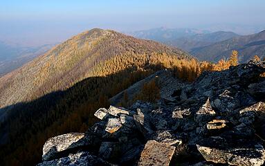
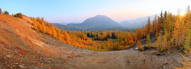 Morning light at Eagle Pass 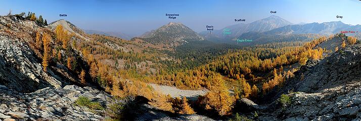 The view en route to Sun Mtn 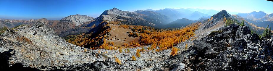 180-degree panorama from Baldy Mtn 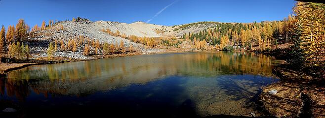 Tuckaway Lake 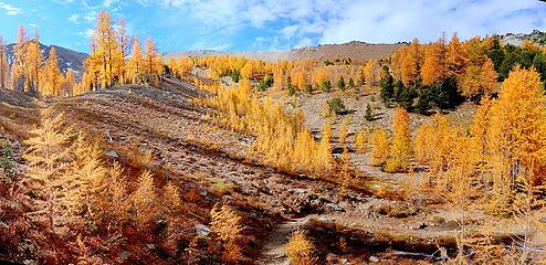 Larches east of Oval Pass 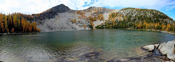 West Oval Lake 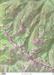 GPS Track 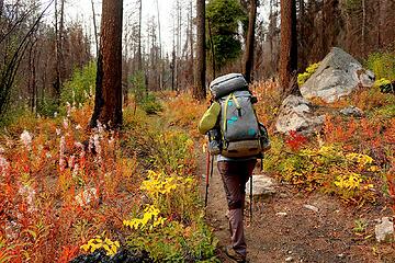 Fireweed along the Eagle Creek trail 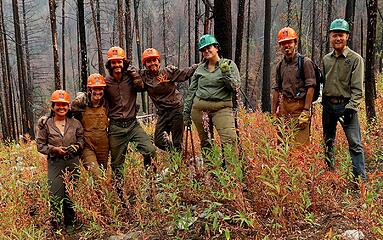 Youth group doing trail work 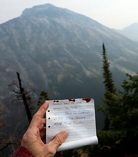 Duckhead summit register 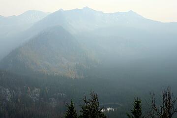 Looking upstream to Silver Lake and Eagle Pass (at right edge) 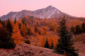 Crazy pink sunset light 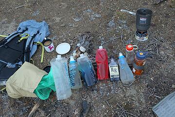 Part of our beverage supply for the night. 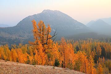 A bigger larch tree along the way 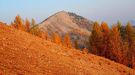 Looking up the crest to Battle, but there are some outcrops hidden in between 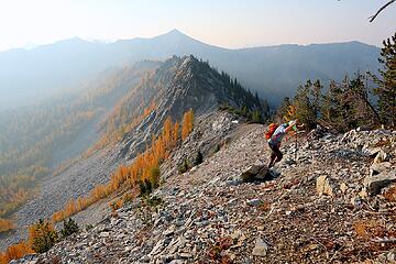 Carla after going around the rocky areas 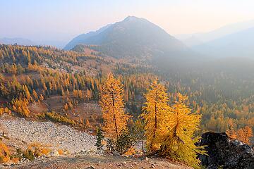 Meadows between Battle and Snowshoe 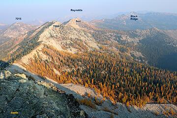 View from Battle Mtn ahead to Sun Mtn 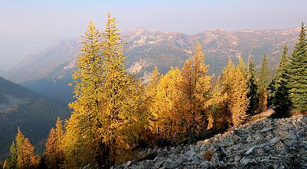 A hazy view westward to Moore and Splawn, on the far side of Fish Creek 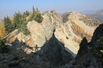 Rocky travel over high points on the crest 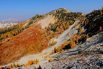 The route down scree and up the red carpet to Sun Mtn 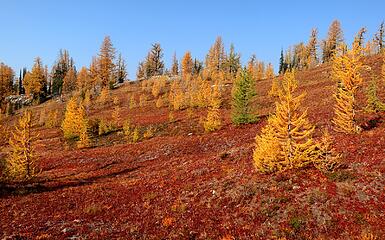 Hiking up across the red carpet 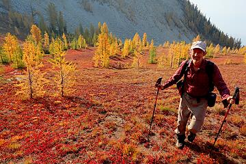 Me enjoying the red carpet 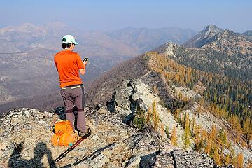 Carla on Sun Mtn, looking out toward Reynolds Peak, Williams Butte, and Black Ridge 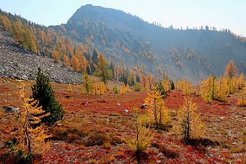 Back to the red carpet 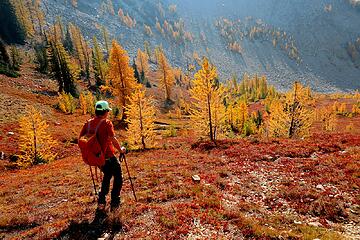 Carla descending the carpet 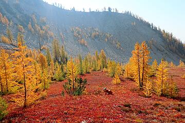 Carla foraging for miniature blueberries 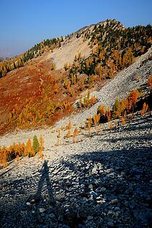 My shadow on the far side 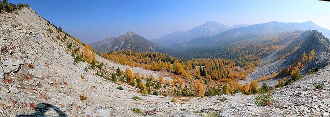 Hiking back past Battle Mtn 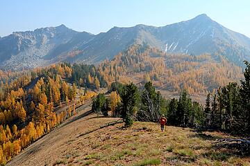 Returning to Eagle Pass 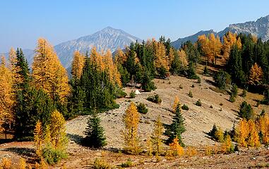 Our campsite finally in the sun  Heading down the basin west of Eagle Pass 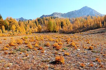 The larch nursery 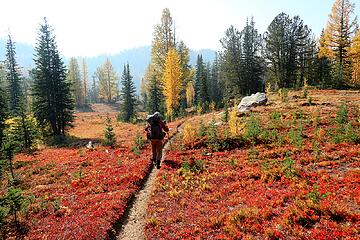 More hiking through red meadows 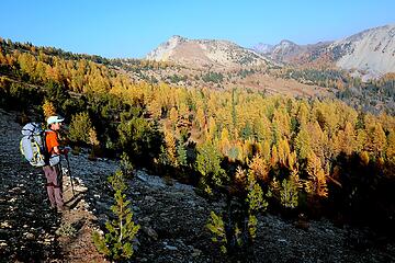 Turning back from the far point to head toward Horseshoe Basin 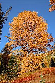 Pretty tree in Horseshoe Basin 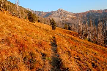 Even the grass is vivid in hazy golden evening light 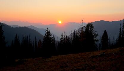 Sun going down in the smoky haze 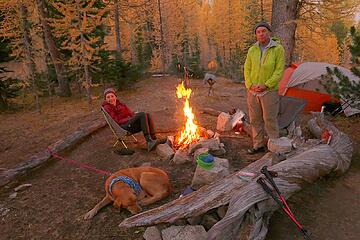 Campsite at Star Lake 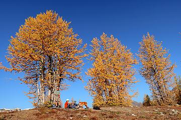 Taking a break at the Star-Baldy saddle. 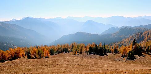 Layers of peaks southward toward the Bigelow/Cheops/Martin/Switchback crest 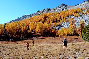 And more hiking pretty meadows toward Baldy 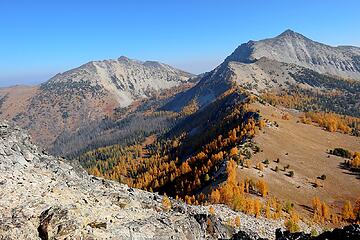 Star Lake basin between Courtney & Star 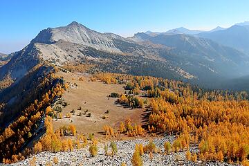 Meadows at the Star-Baldy saddle 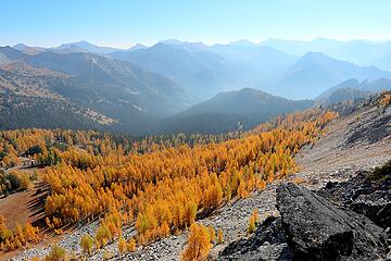 Larches and peaks stretching southward 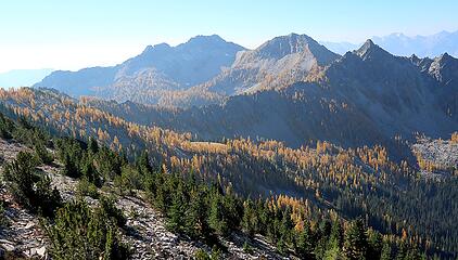 Finney Peak 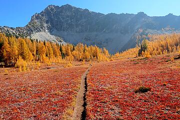 Fish Creek trail near Star Lake 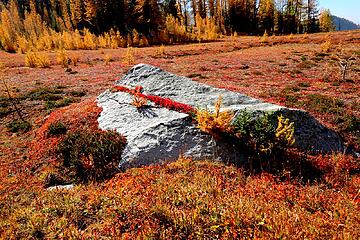 An especially decorative rock 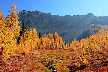 Closer to Star Lake 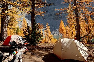 Star Lake camp at mid-day 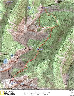 Scaffold GPS track 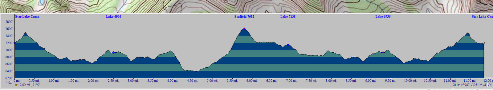 Scaffold elevation profile 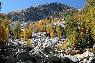 Traversing below one of the rock fields 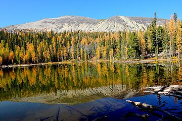 Lake 6936 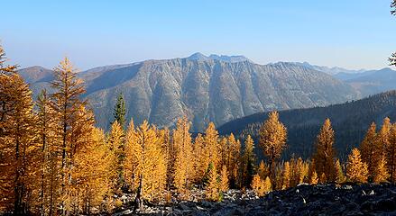 Looking across West Fork Buttermilk to Spirit Mtn 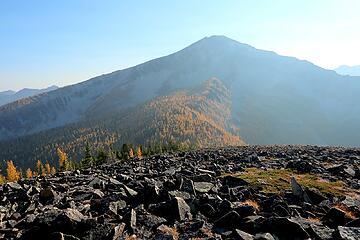 North side of Oval 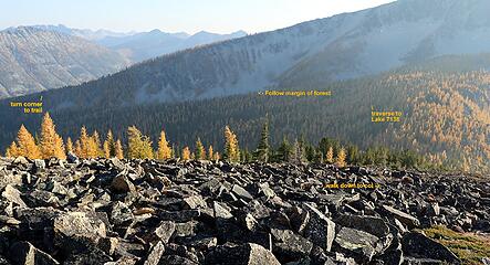 Alternate route back to Oval's east ridge 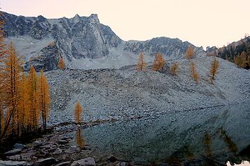 Lake 7138 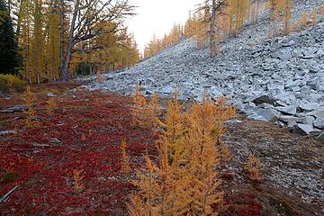 turning the corner below the talus  downed trees at night 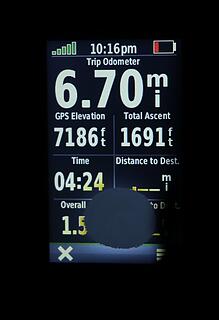 stats for the return to Star Lake 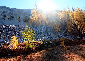 Morning sun coming over the ridge 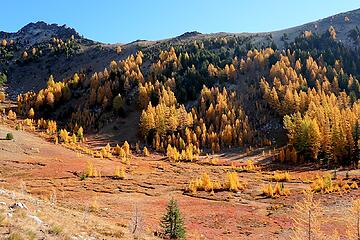 Horseshoe Basin meadows 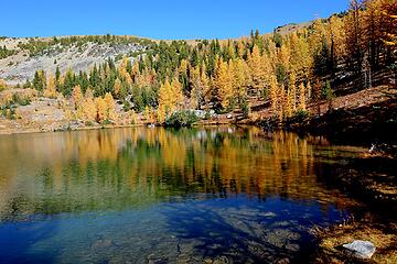 Tuckaway Lake 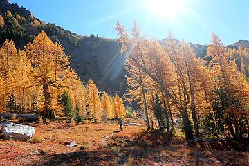 Hiking toward Oval Pass 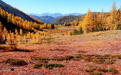 Beautiful reds and golds in the center of Horseshoe Basin 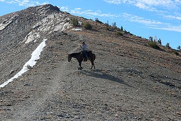 Horse at Oval Pass 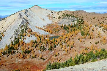 Tuckaway Lake from Oval Pass 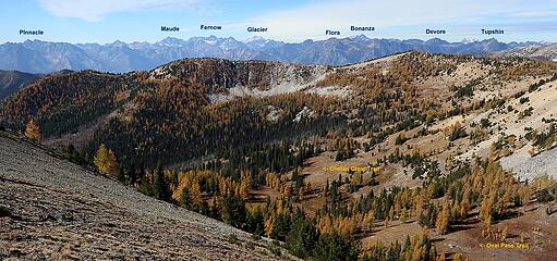 Trails in Horseshoe Basin and peaks on the far side of Lake Chelan 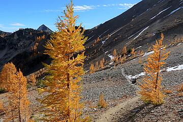 Trail travesing toward the other Oval Lakes (sort of wish I'd gone to the edge to take a look) 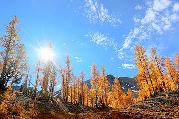 Dropping down from the pass 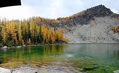 West Oval Lake
As beacons mountains burned at evening. J.R.R. Tolkien
As beacons mountains burned at evening. J.R.R. Tolkien
|
| Back to top |
  
|
|
awilsondc
Member

Joined: 03 Apr 2016
Posts: 1324 | TRs | Pics
|
|
| Back to top |
|
|
Sadie's Driver
Sadie's Driver

Joined: 24 Apr 2006
Posts: 1763 | TRs | Pics
Location: Welcome Pass |
Four-paw buddy lets me tag along!
|
| Back to top |
|
|
triad
Member

Joined: 20 Jun 2020
Posts: 29 | TRs | Pics
|
|
triad
Member
|
Fri Oct 16, 2020 10:41 am |
|
|
Great report and larch photos! Love the larch photos with the red berry plants.
Lake 7138 has been on my radar for a bit now. Thought about checking it and Buttermilk Meadows out when I went up Oval earlier this year, but ran out of time. Do you have any photos from the summit looking east toward Buttermilk Meadows/Scaffold Ridge by any chance?
|
| Back to top |
|
|
BarbE
Member

Joined: 28 Jul 2006
Posts: 1153 | TRs | Pics
|
|
BarbE
Member
|
Fri Oct 16, 2020 7:23 pm |
|
|
Impossible to pick one favorite photo, but the red carpet experience must have been spectacular!
|
| Back to top |
|
|
Matt
Tea, Earl Grey, Hot
Joined: 30 Jan 2007
Posts: 4307 | TRs | Pics
Location: Shoreline |
|
Matt
Tea, Earl Grey, Hot
|
Fri Oct 16, 2020 9:48 pm |
|
|
| triad wrote: | | Do you have any photos from the summit looking east toward Buttermilk Meadows/Scaffold Ridge by any chance? |
 Looking east to Scaffold Ridge
As beacons mountains burned at evening. J.R.R. Tolkien
As beacons mountains burned at evening. J.R.R. Tolkien
|
| Back to top |
|
|
Fletcher
Member

Joined: 29 Jul 2009
Posts: 1870 | TRs | Pics
Location: kirkland |
|
Fletcher
Member
|
Fri Oct 16, 2020 10:48 pm |
|
|
Absolutely epic fall colors!
|
| Back to top |
|
|
MangyMarmot
Member

Joined: 06 Apr 2012
Posts: 474 | TRs | Pics
|
What a trip. Awesome colors. What a great area.
|
| Back to top |
|
|
Nancyann
Member

Joined: 28 Jul 2013
Posts: 2319 | TRs | Pics
Location: Sultan Basin |
|
Nancyann
Member
|
Tue Oct 20, 2020 9:13 pm |
|
|
Wonderful trip report, Matt! You're a great storyteller and photographer. I especially loved the larches on red carpet pictures!
|
| Back to top |
|
|
|
|
You cannot post new topics in this forum
You cannot reply to topics in this forum
You cannot edit your posts in this forum
You cannot delete your posts in this forum
You cannot vote in polls in this forum
|
Disclosure: As an Amazon Associate NWHikers.net earns from qualifying purchases when you use our link(s). |


 Gorgeous trip all around - our route to Bernice Lake (the day you left) treated us to even more spectacular color. We timed this trip perfectly! Thanks for joining us.
