| Previous :: Next Topic |
| Author |
Message |
Eric Gilbertson
Member


Joined: 04 Jul 2018
Posts: 188 | TRs | Pics
Location: Seattle |
North Star Mountain (8,096ft)
Oct 31 12am 8pm
38 miles (37 hiking + 1 biking)
I headed out Friday night with the intent of hitting a few top 200 peaks in the Glacier Peak wilderness. My goal was to tag North Star and Genius, but to make it interesting by doing a big loop hike. Id recently seen this loop on a map going through Buck Pass, Suiattle Pass, and Spider Gap, and finally connected the dots that this is the loop everyone signs in as doing when Ive looked at trailhead registers at the Trinity trailhead.
Based on the NOHRSC snow coverage forecasts it looked like the long dirt chiwawa river road up to the Trinity trailhead would likely be snow covered, but perhaps only by a few inches of snow. I decided to give it a try and bring my mountain bike in case I needed to park early and bike the rest of the way to the trailhead. The bike had the added advantage that if the road was indeed driveable I could plant the bike at the Phelps Creek trailhead, then bike back the remaining 3 miles to the Trinity trailhead at the end of my loop.
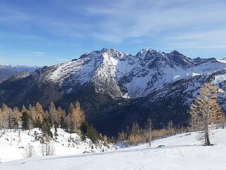 The view descending from North Star looking south to Dumbell and Greenwood 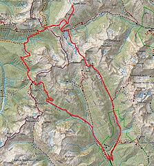 The route 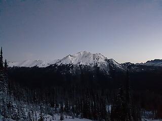 Plummer Mtn at sunrise 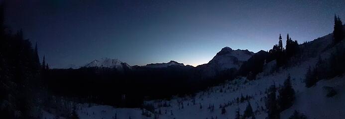 sunrise over plummer and Chiwawa 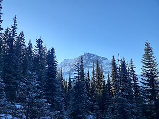 North face of Chiwawa from near Suiattle Pass 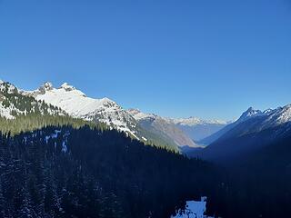 Looking down the Suiattle River valley 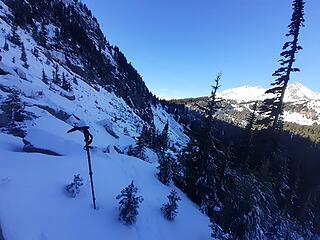 Kind of tricky finding the trail traversing to Cloud Pass 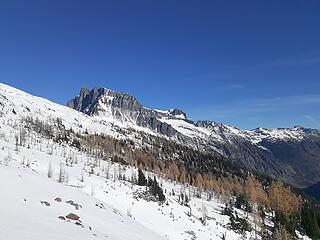 rounding the corner of the south ridge of cloud, looking at Bonanza 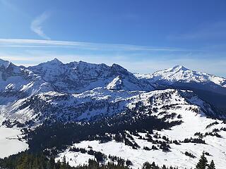 Looking back towards Glacier Peak  Nearing the summit 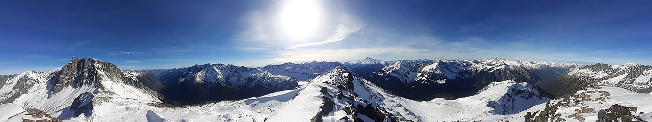 Summit panorama 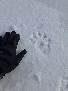 Wolverine tracks 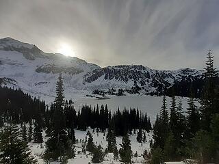 Lower Lyman Lake 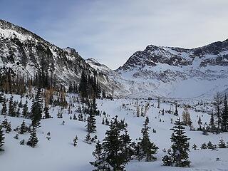 Approaching Spider Gap near upper Lyman Lakes 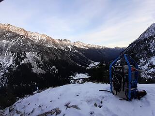 Looking down Phelps Creek 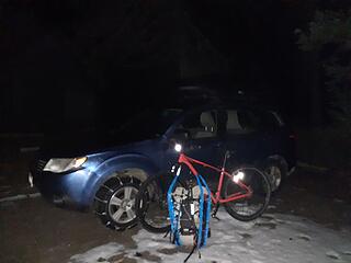 Back at the car 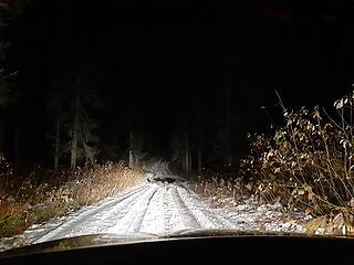 A snowy drive out
|
| Back to top |
  
|
|
kitya
Fortune Cookie

Joined: 15 Mar 2010
Posts: 842 | TRs | Pics
Location: Duvall, WA |
|
kitya
Fortune Cookie
|
 Mon Nov 02, 2020 10:58 pm |
|
|
|
| Back to top |
|
|
benneke
Member
Joined: 15 Sep 2018
Posts: 35 | TRs | Pics
|
|
benneke
Member
|
Tue Nov 03, 2020 9:32 am |
|
|
Wow, doing this loop as a single push with all that snow, very impressive. Looks like an amazing day out
|
| Back to top |
|
|
Stefan
Member

Joined: 17 Dec 2001
Posts: 5090 | TRs | Pics
|
|
Stefan
Member
|
Tue Nov 03, 2020 3:40 pm |
|
|
Do you have something called "pain receptors"? Or are they absent in your body?
|
| Back to top |
|
|
MangyMarmot
Member

Joined: 06 Apr 2012
Posts: 474 | TRs | Pics
|
That's a seriously burly trip in one day. Nice work!
|
| Back to top |
|
|
|
|
You cannot post new topics in this forum
You cannot reply to topics in this forum
You cannot edit your posts in this forum
You cannot delete your posts in this forum
You cannot vote in polls in this forum
|
Disclosure: As an Amazon Associate NWHikers.net earns from qualifying purchases when you use our link(s). |


