Forum Index > Trip Reports > Point 4906 "Ticaboo Island Peak" Possible FA in southern Utah
 Reply to topic
Previous :: Next Topic
Author Message
Matt Lemke
High on the Outdoors


Joined: 15 Jul 2010
Posts: 2052 | TRs | Pics
Location: Grand Junction
Matt Lemke
High on the Outdoors
PostTue Nov 17, 2020 12:47 am 
Over this past weekend, I met up with a friend I had not seen since 2013 and his now 18 year old son to try and find a route up an unnamed raked peak in southern Utah. From Denver, I drove out west towards Grand Junction and stopped in Eagle to catch up with a couple college friends who just bought a house there. I had one too many drinks, and at 3:30am when the alarm went off, I was feeling quite bad. Definitely didn't eat enough either, and to top it off, it had started to snow and I still had a 2 hour drive west to meet Scott and his son in Grand Junction. I sure was happy when I arrived, as it was a struggle to drive in the dark with snow and sleet coming down while buzzed! 
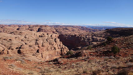
At 6:15am I hopped into Scott's car and thankfully he continued the drive while I was able to rest. It was another 3.5 hours of driving all the way down to the Ticaboo Mesa, just west of Lake Powell. We turned east onto the BLM 13400 road off Highway 276 a short ways north of the village of Ticaboo. This dirt road was initially pretty mellow, but eventually got rough enough to definitely require high clearance in a few spots, although 4WD wasn't necessairly needed. We continued east until we reached Ticaboo Shelf Spring, which was a natural spring that had a water tank embedded into the ground right on top of it which kept the tank full, which probably held many hundreds of gallons. There is an old cattle trail that descends into the valley of the South FOrk Ticaboo Canyon from the spring, starting from the edge of the mesa where a great view overlooks the canyons. This trail was construction in the 30s by a CCC group to enable jobs during the depression. Even today, the trail is occationally used by cattle ranchers, although far less so than in years past. The view from here is incredible, with Mount Ellsworth towering above to the NW, which is the southernmost large peak in the Henry Mountains. From the end of the road just above the large water tank, the trail begins off to the right and heads east, switchbacks down benches and is easily followed down to the canyon floor some 500 feet down. Once down at the bottom, we briefly explored up canyon until we hit the dryfall, where the technical section of the South Fork Ticaboo Canyon ends. This short technical section at the far upper end of the canyon consists of about 7 drops, some of which require long rappels, and some pothole navigation. Perhaps another time I'll return to make that descent. The sea of Navajo Sandstone in this area is gorgeous, and makes for some cool fin-like features separated by many deep ravines. Navigation through this terrain can be tricky but fun as the sandstone erodes into steep domes and fins, that are all impossible to see very well on topo maps. Our main goal for this trip however was to ascend Point 4906, a Carmel Formation capped flat topped peak sitting atop the Navajo with deep canyons on all sides. Actually, from the parking spot at Ticaboo Shelf Spring, this peak is clearly defined off to the NE not too far away by it's red island among a sea of white Navajo. It's summit is about the same elevation as the spring where we parked, however it's surrounded on all sides by various forks of the Ticaboo Canyons drainage basin, which gives it more than enough prominence to be one of the few ranked peaks in the immediate area. After some studying of satellite imagery prior to leaving, we determined the only feasible route up was via the SW ridge. So we then hiked down canyon as it curved in a NE direction passing a side canyon coming in from the left. Here the main fork made a bend to the right and began heading due east. Perhaps a half mile further down we reached a second side canyon coming in from the left and headed up this fork. The SW ridge begins with a broad dome that is the first thing visible as you hike up the side drainage.
View from Ticaboo Shelf Spring
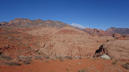
Mount Ellsworth from the spring
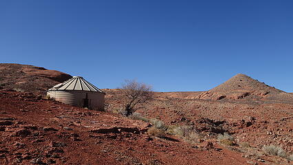
The water tank near the parking spot
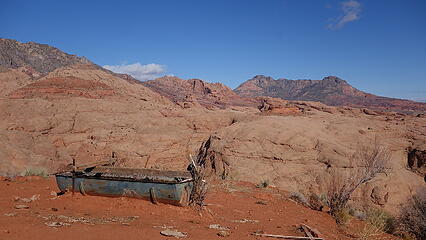
Old cattle trough with Mount Holmes behind
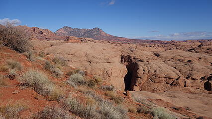
Ticaboo Canyons dropping down below in the sea of Navajo
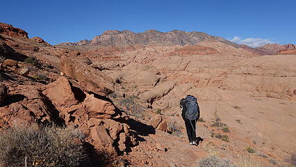
Hiking down the old cattle trail
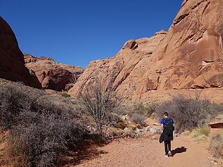
At the bottom of the canyon
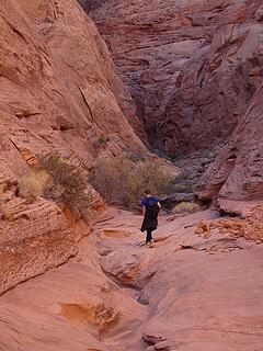
Exploring the upper South Fork Ticaboo
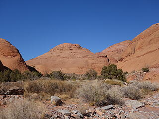
Hiking towards the dome at the start of Point 4906 SW ridge
We started the ascent by first ascending the slickrock slopes up the dome pictured above, and traversed right around it's summit without going over the top, aiming for the small saddle. I climbed a super steep spot for a more direct route but veering further left at the start, then circling back right the terrain wasn't as steep. From the small saddle, we continued scrambling up and left, traversing around the left end of two large fins that could not be climbed over due to vertical sides. The crux of the climb ended up involving a class 3 narrow exposed ledge traverse around the end of the second fin to access the next gully on the other side. From there the route mostly weaved around small Navajo domes and fins, occationally coming across a class 3 move or two until we reached the base of the darker red caprock. I won't spoil all the fun and leave some of the routefinding up to you! Once on the red rock layer it was a short walk to the highest spot, which had absolutely no evidence of ever being ascended before. I made a small cairn on the top and Kessler and I waited for Scott to finish the route up. He had initially stayed back at the crux ledge traverse, but as we got close to the summit we saw him on his way, having decided to give it a go. The views from the top were stunning, with a part of Lake Powell visible to the east and an endless expanse of Navajo domes and canyons. The Henry Mountains rose high above and all the sedimentary layers were clearly visible, curving steeper as they got closer to the mountains. The geology there is so cool, as the granitic and diorite intrusive force punched up through the sedimentary layers and forcing them to steep dip angles away from the peaks. As time passed, many thousands of feet of over burden layers eroded away faster than the granitic rock erodes, and left the high peaks towering above the less resistant sandstone layers. We could also see the car on the rim of the Ticaboo Mesa looking back from where we came from. After a relaxing 15 minute rest Scott also had made the summit, and we all 3 started back down. The descent was quick, as we now had the route memorized (although since there were so many turns it was still easy to not remember exactly where we went). We returned back to the canyon bottom, and met back up with our packs and continued hiking downstream the South Fork Ticaboo another half mile to a spring where water was slowly flowing out. Along the way, we passed a very nice alcome with a perfectly flat wall under an arching cover. The wall had signitures from people who had been there in the 30s through the 60s, but very few after that, indicating people wised up and quit defacing the rocks! At the spring, we setup camp and had a small campfire as the sun set and it got dark. Since I had only slept 3 hours the night before, I laid out my sleeping pad and went to sleep at 6:30, just sleeping under the stars. The meteors were quite active during the night and I saw at least a dozen during the times I had my eyes open. Since there was also no moon, the star gazing was spectacular.
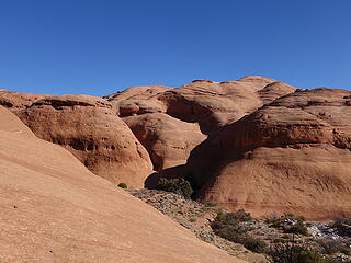
Starting up the slickrock on the first dome
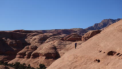
Traversing across the first dome
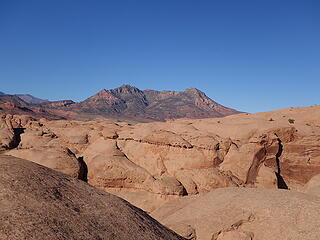
Mount Ellsworth
Mount Ellsworth
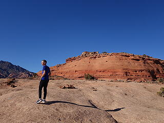
The summit area up ahead
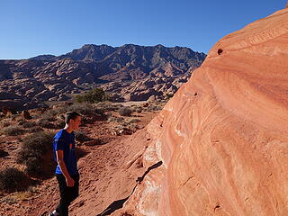
Darker orange Page Sandstone layer just below the dark red Carmel caprock
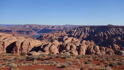
Navajo domes and fins for miles with Lake Powell visible
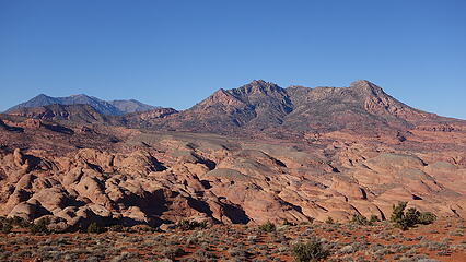
Mount Holmes
Mount Holmes
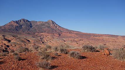
Mount Holmes from the summit
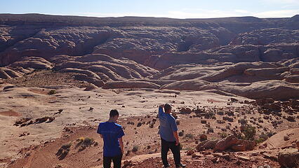
Looking back towards the rim of the mesa where the car is
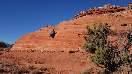
Scott sliding down the Page sandstone layer just below the summit
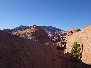
Walking between some of the many fins
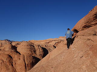
Scott finishing the narrow crux traverse on the way back
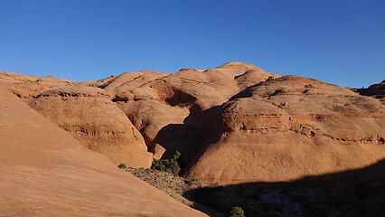
Nearing the canyon bottom again
The next morning, we explored a little further down canyon, heading towards Lake Powell. We didn't go that far though, and just hiked up a couple side drainages and up to a couple large alcoves. Since I had a total of 7 hours of driving to do in order to get back to Denver we started hiking out pretty early and was back at the car by early afternoon. We enjoyed burgers at Stans Burger shack in Hanksville on the way out, which is always awesome (although there prices did go up since I was last there!). Believe it or not, this was my first trip back to the Utah desert since 2017 and I was happy to have made it happen. The last time I saw Kessler he was only 11...time flies!
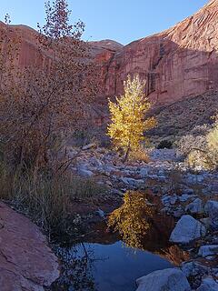
Still some color left!
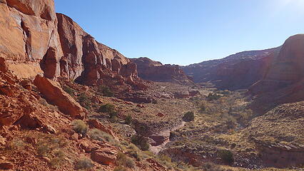
Looking down South Fork Ticaboo Canyon
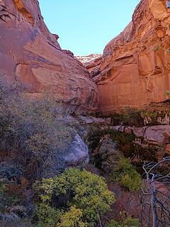
Another side canyon
Another side canyon
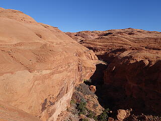
I scrambled up to the top of a small ridge
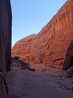
Glow on the canyon walls
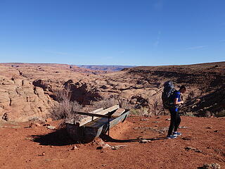
Back at Ticaboo Shelf Spring
Overview map of the route shown below:
This peak can also be found on Lists of John Here. For such a rarely done peak, it is only 3.25 miles each way, and about 1000 feet of gain each way making it a great addition to any exploration trip to this area. It is also the only ranked peak in the whole area, with Mount Ellsworth itself being the closest ranked peak to Point 4906.

The Pacific coast to the Great Plains = my playground!!! SummitPost Profile See my website at: http://www.lemkeclimbs.com
Back to top Reply to topic Reply with quote Send private message
timberghost
Member
Member


Joined: 06 Dec 2011
Posts: 1328 | TRs | Pics
timberghost
Member
PostTue Nov 17, 2020 6:51 am 
very cool

Back to top Reply to topic Reply with quote Send private message
   All times are GMT - 8 Hours
 Reply to topic
Forum Index > Trip Reports > Point 4906 "Ticaboo Island Peak" Possible FA in southern Utah
  Happy Birthday Traildad!
Jump to:   
Search this topic:

You cannot post new topics in this forum
You cannot reply to topics in this forum
You cannot edit your posts in this forum
You cannot delete your posts in this forum
You cannot vote in polls in this forum