| Previous :: Next Topic |
| Author |
Message |
Gimpilator
infinity/21M


Joined: 12 Oct 2006
Posts: 1684 | TRs | Pics
Location: Edmonds, WA |
11-20
North Wilson Ridge - 5358'
We wanted to do this peak for the view. More than one source claimed that the upper ridge traverse route was difficult and crappy, so we explored a different route starting near the Fortification Ridge trailhead. We followed sandy washes with wild cat prints to Teakettle Pass.
From the pass we ascended the central ridge of 3 adjacent ridges to reach the main crest of the range. Near the summit, large granitic rocks presented a final challenge.
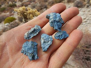 blue rocks 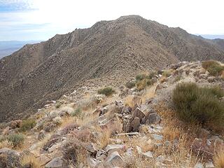 summit ahead 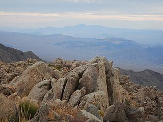 Spirit 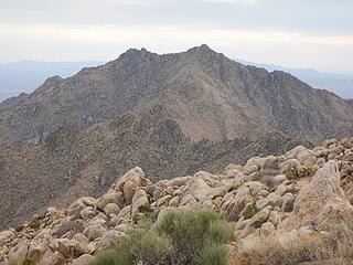 Wilson main peak 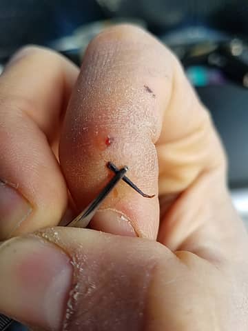 Oy!  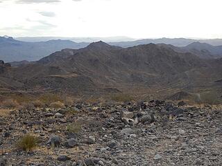 Peak 2570 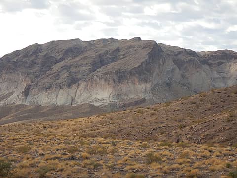 Peak 2867 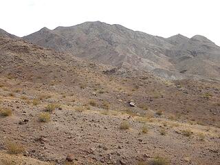 Peak 2300 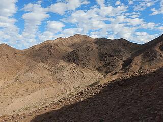 Peak 2403 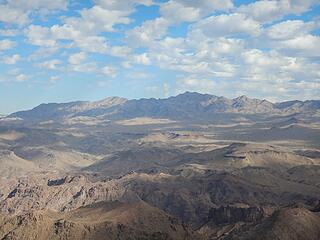 North Wilson and Wilson 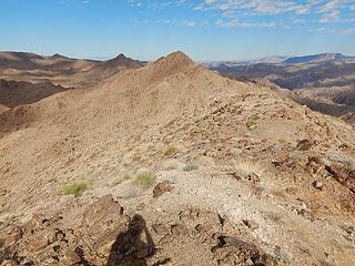 Peak 2570 and Peak 2402 are up next 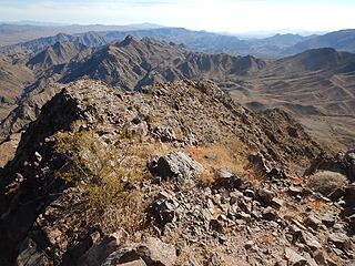 Peak 2402 down there 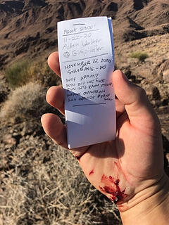 text image from Stav 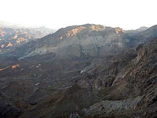 Peak 2867 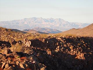 here comes Stav 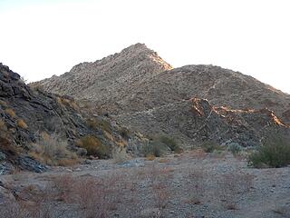 Picture Canyon Point 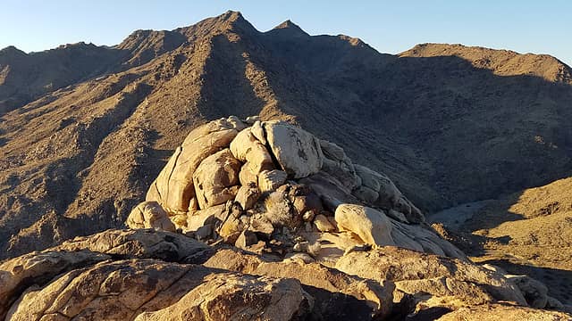 Peak 3467 and Peak 3448 up next 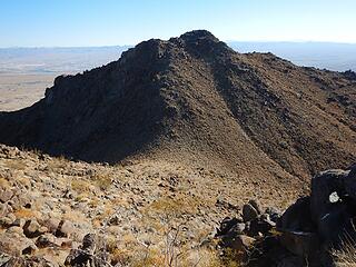 Peak 3467 from Peak 3448 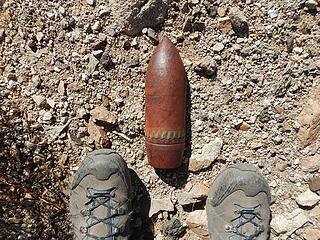 General MacArthur I presume? 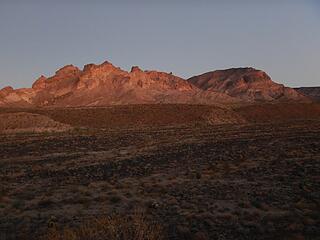 Peak 3418 and Warm Springs Butte 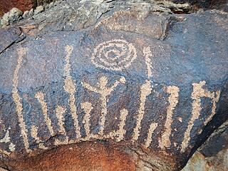 the most beautiful petroglyph I have seen to date 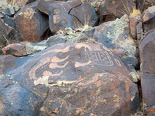 phalluses on parade 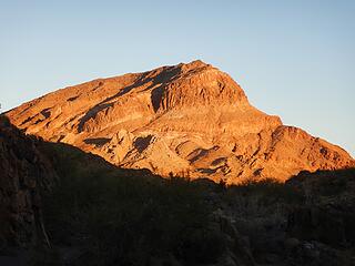 First light on Warm Springs Butte 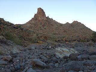 Peak 2374 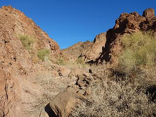 rugged canyon 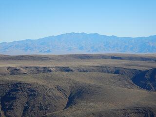 Hualapi 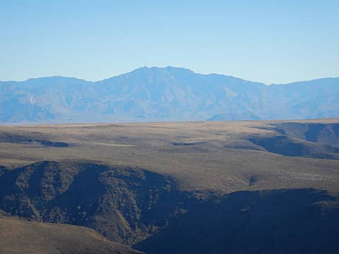 Wabayuma 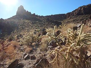 traverse under tower 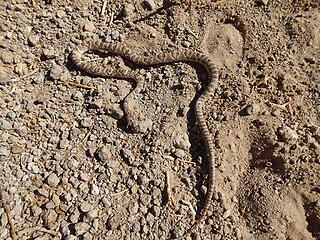 Dead, or just pretending? 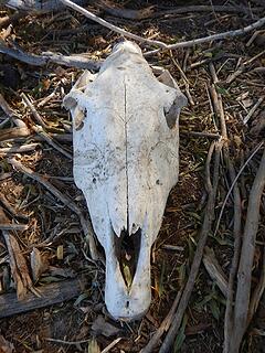 The old 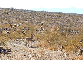 ...and the new
|
| Back to top |
  
|
|
pcg
Member

Joined: 09 Jun 2012
Posts: 334 | TRs | Pics
|
|
pcg
Member
|
 Thu Nov 26, 2020 10:38 am |
|
|
|
| Back to top |
|
|
Brushbuffalo
Member

Joined: 17 Sep 2015
Posts: 1887 | TRs | Pics
Location: there earlier, here now, somewhere later... Bellingham in between |
What a surprise to run into a friend on such a seldom- climbed peak!
| Gimpilator wrote: | text image from Stav |
He gets the 'best blood' award of the day.
| Gimpilator wrote: | | road was rough in a volcanic way, |
I love that!
So, you mean it was really bad, the kind where you wish you had a spare spare tire
Passing rocks and trees like they were standing still
Passing rocks and trees like they were standing still
|
| Back to top |
|
|
Anne Elk
BrontosaurusTheorist

Joined: 07 Sep 2018
Posts: 2422 | TRs | Pics
Location: Seattle |
|
Anne Elk
BrontosaurusTheorist
|
Fri Nov 27, 2020 1:45 pm |
|
|
Hey, Brushbuffalo - can you ID the mineral that makes "blue rocks" - in the photo?
Adam - I'm continually amazed by your penchant for desert off-trailing to bag obscure bumps in the landscape.  Thanks for sharing all the petroglyph pics, too. I've only ever seen them in the Wind Rivers, and not many. BTW - watch that puncture wound! I was disabused of my misunderstandings about tetanus et al by a nurse-neighbor after a wound I got during yard work turned an angry-looking red. "Rusty nail puncture wounds only" is a myth. She urged me to get a tetanus shot (my last had been more than 10 years prior). What stuck in my mind was her comment, "Once you get symptoms, it's too late." Yipes! Thanks for sharing all the petroglyph pics, too. I've only ever seen them in the Wind Rivers, and not many. BTW - watch that puncture wound! I was disabused of my misunderstandings about tetanus et al by a nurse-neighbor after a wound I got during yard work turned an angry-looking red. "Rusty nail puncture wounds only" is a myth. She urged me to get a tetanus shot (my last had been more than 10 years prior). What stuck in my mind was her comment, "Once you get symptoms, it's too late." Yipes!
"There are yahoos out there. Its why we cant have nice things." - Tom Mahood
"There are yahoos out there. Its why we cant have nice things." - Tom Mahood
|
| Back to top |
|
|
Brushbuffalo
Member
Joined: 17 Sep 2015
Posts: 1887 | TRs | Pics
Location: there earlier, here now, somewhere later... Bellingham in between |
| Anne Elk wrote: | | the mineral that makes "blue rocks" - in the photo? |
Really hard to say just from the one picture. I think the blue mineral could be sodalite, found in some low-silica ( felsic) plutonic rocks, which are generally light in color such as Adam's pictures for that peak show.
Some other possibilities are apatite (appropriate the day after Thanksgiving), glaucophane, or kyanite. The latter two are found in some metamorphic rocks.
To ID minerals that aren't common to me, I usually need more info about rock types in the area, along with a specimen or two in hand to examine hardness, cleavage and fracture, crystal form, luster, diaphaneity*, and any other properties
* diaphaneity refers to a substance's light-transmitting properties, either transparent, translucent, or opaque.
Passing rocks and trees like they were standing still
Passing rocks and trees like they were standing still
|
| Back to top |
|
|
Gimpilator
infinity/21M
Joined: 12 Oct 2006
Posts: 1684 | TRs | Pics
Location: Edmonds, WA |
| Brushbuffalo wrote: | | So, you mean it was really bad, the kind where you wish you had a spare spare tire |
Exactly right. I stopped about 6.5 miles from the end, but a very jeeps and trucks might make it another 4 miles beyond that. Once I saw what the road was like beyond where I camped, it was a huge relief, because there was no way I would have driven on that sort of volcanic rock.
| Anne Elk wrote: | | Adam - I'm continually amazed by your penchant for desert off-trailing to bag obscure bumps in the landscape. Thanks for sharing all the petroglyph pics, too. I've only ever seen them in the Wind Rivers, and not many. BTW - watch that puncture wound! I was disabused of my misunderstandings about tetanus et al by a nurse-neighbor after a wound I got during yard work turned an angry-looking red. "Rusty nail puncture wounds only" is a myth. She urged me to get a tetanus shot (my last had been more than 10 years prior). What stuck in my mind was her comment, "Once you get symptoms, it's too late." Yipes! |
Thank you Anne. Petroglyphs are one of my favorite things about desert hiking. And thank you for for bringing up an important point. That spear point was embedded for 9 days, plenty long enough to culture some bacteria. Last February, I learned that the my most recent shot was expired, so I got another one before the subsequent trip to Africa. It's definitely something to keep in mind. Minor injuries are common in the wilderness and it would be easy to forget about such details.
|
| Back to top |
|
|
|
|
You cannot post new topics in this forum
You cannot reply to topics in this forum
You cannot edit your posts in this forum
You cannot delete your posts in this forum
You cannot vote in polls in this forum
|
Disclosure: As an Amazon Associate NWHikers.net earns from qualifying purchases when you use our link(s). |


