Here is a link to a website I find helpful to research snow levels: Sentinel Hub EO Browser.
The tool allows you to browse recent satellite images of your place of interest. I will check to see if I can visibly see snow in the area of travel and then I combo this up with recent weather and trip reports. This can yield a solid idea of the snow coverage in a given area.
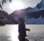
Right now you can see snow on the ground as low as 2200' so it's a safe bet that there will be snow up the NF Teanaway at pretty low elevations.
As a final note - I found the browser from an old thread here on NW Hikers and I want to give a huge THANK YOU to whoever posted it originally. It's an amazing tool.
TEANAWAY / 29 PINES (PDF)
Mobile Friendly Map (PDF)
Cle Elum Ranger District
Phone: 509-852-1100
Staging AreaSnowmobile Sno-ParkSnowshoe Area
Icon Legend
Directions: 6 miles east of Cle Elum. Highway 97 north to North Fork Teanaway Road north to end of plowing
Elevation: 2,400 feet
25 spaces.
Trails: 1.) 9737 / North Fork Teanaway 2.) 9738 / Blue Cr / Jack Cr 3.) Teanaway to Last Resort
Trail system 36 miles
No sanitary facilities
No Sno-Park permit required. Staging area, available parking depends on conditions. This information is provided as a courtesy.
Please note: After periods of extreme weather, work crews may be on trails during the day to clear debris or drifts. Please exercise caution.
USE CAUTION ACTIVE LOGGING ON THE MIDDLE FORK RD AND TEANAWAY BUTTE RD
2020-2021SEASON GROOMING UPDATES:
Groomer: Cle Elum Ranger District USFS
REMEMBER: Grooming reports are updated when trail grooming information is provided. Reports are posted Monday thru Saturday. No updates on Sundays or holidays.
You cannot post new topics in this forum You cannot reply to topics in this forum You cannot edit your posts in this forum You cannot delete your posts in this forum You cannot vote in polls in this forum
Disclosure: As an Amazon Associate NWHikers.net earns from qualifying purchases when you use our link(s).