| Previous :: Next Topic |
| Author |
Message |
Kellbell
Member


Joined: 01 Oct 2011
Posts: 580 | TRs | Pics
|
|
Kellbell
Member
|
 Tue Dec 22, 2020 7:21 pm |
|
|
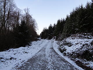
After doing 500 miles on the Appalachian Trail when I turned 50, I thought I would just work slowly on completing the PCT. I am almost done with all of Washington (just the 30ish miles to the border left!) which will make 500 miles completed on the PCT. Then I got the idea to try and finish 500 miles on 5 different thru trails. The Pacific Northwest Trail is great for winter walking because there is quite a bit accessible close to me that really isn't too high...so that is what I've been up to. Plus I went through all my old hikes, and found I'd already done around 70ish miles without realizing it. So here are my TR's for my last couple hikes at the Olympic Hot Springs and the Larry Scott Trail. I'm dreaming of all my other hikes once the snow is gone (you'll see my goals on my blog post ) but I'd love to hear about your favorite hikes on the PNT  http://slowesthiker.com/blog/working-on-500-miles-of-the-pnt/
http://slowesthiker.com/blog/santa-hike-economy-boost/
http://slowesthiker.com/blog/working-on-500-miles-of-the-pnt/
http://slowesthiker.com/blog/santa-hike-economy-boost/
|
| Back to top |
  
|
|
Stefan
Member

Joined: 17 Dec 2001
Posts: 5093 | TRs | Pics
|
|
Stefan
Member
|
Wed Dec 23, 2020 1:55 pm |
|
|
Any trail leading to an operating whiskey mill is a great trail. I gotta check out that trail!
|
| Back to top |
|
|
RichP
Member

Joined: 13 Jul 2006
Posts: 5634 | TRs | Pics
Location: here |
|
RichP
Member
|
Fri Dec 25, 2020 7:26 am |
|
|
I hiked a bit of it yesterday on Anderson Mtn north of Sedro-Woolley. You gotta really want it to complete the PNT in its entirety as there are some large chunks of road walking to connect the nicer areas.
 6.5 miles each way of walking of this. 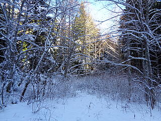 PNT cutoff trail. I decided to stay on the road. 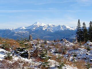 Baker and clearcuts. 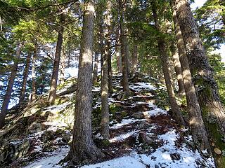 Short scramble toward the summit. 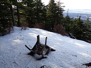 One of several chairs at viewpoints. 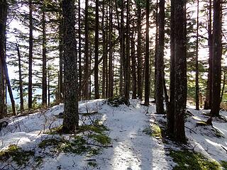 One of several contenders for the highpoint.  Chuckanuts and San Juans. 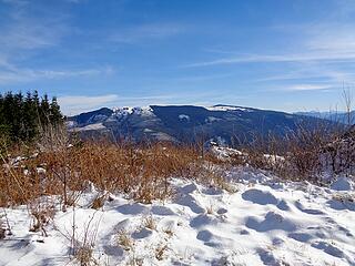 Lyman Hil, another P3k.
|
| Back to top |
|
|
Brushbuffalo
Member

Joined: 17 Sep 2015
Posts: 1887 | TRs | Pics
Location: there earlier, here now, somewhere later... Bellingham in between |
Anderson is a fun hike with interesting geology.
First time I've ever seen a chair 'on belay,' no doubt to keep it from blowing into the forest below.| RichP wrote: | One of several chairs at viewpoints. |
Passing rocks and trees like they were standing still
Passing rocks and trees like they were standing still
|
| Back to top |
|
|
RichP
Member
Joined: 13 Jul 2006
Posts: 5634 | TRs | Pics
Location: here |
|
RichP
Member
|
Sat Dec 26, 2020 1:12 pm |
|
|
Thanks for your report, BB. It was helpful in finding that opening by the puddle. I walked right by it at first as it's not super easy to see.
Pardon the thread drift: I noticed that a trail is cut out and descends from the highpoint down the north side of Anderson. I walked down it a bit but had a long way to get back out and turned around. Any idea where this trail goes?
|
| Back to top |
|
|
Nancyann
Member

Joined: 28 Jul 2013
Posts: 2319 | TRs | Pics
Location: Sultan Basin |
|
Nancyann
Member
|
Sat Dec 26, 2020 1:26 pm |
|
|
Its great to see how many miles you have been covering, Kellbell!
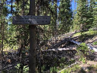
Ive been on some pretty sweet sections of the PNT such as the Boundary Trail from Iron Gate towards Spanish Camp in the Pasayten, which is classic high lonesome wandering, and this past summer took on the section from the Pasayten Airstrip up Frosty Creek to Frosty Pass and down the PCT. We brought saws on our eight day trip because we heard from the Forest Service that there were about 300 blowdowns to negotiate through that section. It was slow going and a lot of work, but I loved the solitude, (We saw only one person in two days) and Frosty Pass was gorgeous. Later in the summer the Forest Service got in there and cleared the blowdowns, but check before you go if you decide to try out that section, because if its not cleared again after this winters storms, it would be very slow going.
Here are a few pics and you can see my full trip report, Slate Pass>Buckskin Ridge>Frosty Pass>PCT 8/12-8/19/20 in the Trip Report section.
 Boundary Trail from Pasayten Airstrip, Slate Pass, Buckskin Ridge, Frosty Pass, PCT Loop 8/12-8/19/20 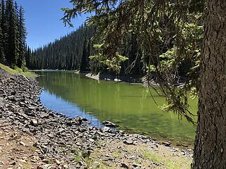 Dead Lake swimming spot, Slate Peak, Buckskin Ridge, Frosty Pass, PCT Loop 8/12-8/19/20 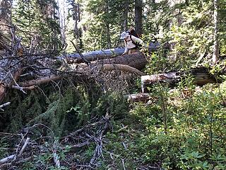 Boundary Trail at Frosty Creek, Slate Pass, Buckskin Ridge, Frosty Pass, PCT Loop, 8/12-8/19/20 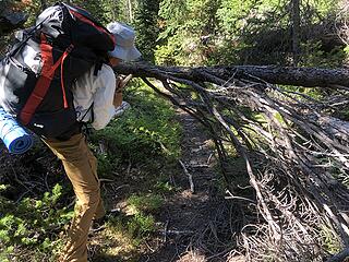 Boundary Trail at Frosty Creek, Slate Pass, Buckskin Ridge, Frosty Pass, PCT Loop, 8/12-8/19/20 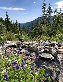 Ascending Frosty Pass, Slate Pass, Buckskin Ridge, Frosty Pass, PCT Loop 8/12-8/19/20 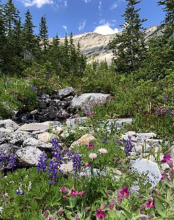 Ascending Frosty Pass, Slate Pass, Buckskin Ridge, Frosty Pass, PCT Loop 8/12-8/19/20 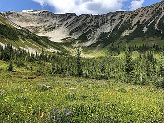 Ascending Frosty Pass, Slate Pass, Buckskin Ridge, Frosty Pass, PCT Loop 8/12-8/19/20 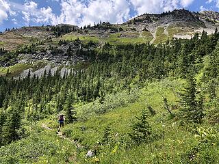 Ascending Frosty Pass, Slate Pass, Buckskin Ridge, Frosty Pass, PCT Loop 8/12-8/19/20 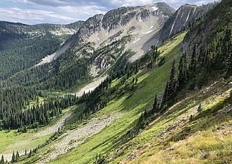 Blizzard Peak from Frosty Pass, Slate Peak, Buckskin Ridge, Frosty Pass Loop 8/12-8/19/20 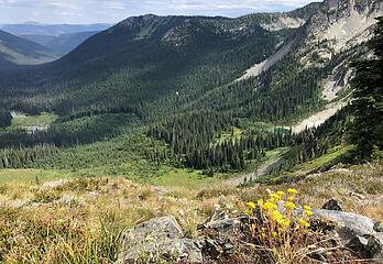 Looking east from Frosty Pass, Slate Pass, Buckskin Ridge, Frosty Pass, PCT Loop 8/12-8/19/20 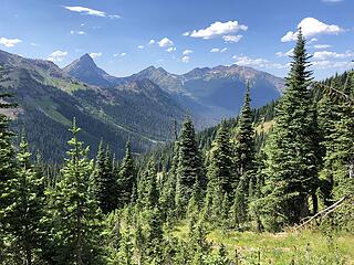 Looking toward Canada, Slate Pass, Buckskin Ridge, Frosty Pass, PCT Loop 8/12-8/19/20
|
| Back to top |
|
|
Kellbell
Member
Joined: 01 Oct 2011
Posts: 580 | TRs | Pics
|
|
Kellbell
Member
|
Tue Dec 29, 2020 9:27 pm |
|
|
WOW WOW and WOW!!!! NancyAnn those are incredible photos! So inspiring. Do you leave TR's on WTA or have a blog? I want details!!!
|
| Back to top |
|
|
Kellbell
Member
Joined: 01 Oct 2011
Posts: 580 | TRs | Pics
|
|
Kellbell
Member
|
Tue Dec 29, 2020 9:35 pm |
|
|
| RichP wrote: | | You gotta really want it to complete the PNT in its entirety as there are some large chunks of road walking to connect the nicer areas. |
That's exactly why I decided there was no way I could complete the whole thing...well that, and the bushwhacking...and the fact in general so much of it looks just next level hard. But man, it would be SO COOL to be someone who could. I admire thru hikers so much. And this hike on Anderson Mt...where did you park, if you don't mind me asking.
|
| Back to top |
|
|
Kellbell
Member
Joined: 01 Oct 2011
Posts: 580 | TRs | Pics
|
|
Kellbell
Member
|
Tue Dec 29, 2020 9:38 pm |
|
|
| Nancyann wrote: | | you can see my full trip report, Slate Pass>Buckskin Ridge>Frosty Pass>PCT 8/12-8/19/20 in the Trip Report section. |
Just noticed this  I will check it out!!! I will check it out!!!
|
| Back to top |
|
|
Nancyann
Member
Joined: 28 Jul 2013
Posts: 2319 | TRs | Pics
Location: Sultan Basin |
|
Nancyann
Member
|
Tue Dec 29, 2020 10:41 pm |
|
|
Kellbell, the only place you will ever find my trip reports is on NWHikers. 
|
| Back to top |
|
|
Brushbuffalo
Member
Joined: 17 Sep 2015
Posts: 1887 | TRs | Pics
Location: there earlier, here now, somewhere later... Bellingham in between |
| Kellbell wrote: | | this hike on Anderson Mt...where did you park, if you don't mind me asking. |
Good hike! If you don't mind me answering for Rich, you can go here
There are at least three ways to the top: 1) the PNT from the west, 2)a gravel road from the east off highway 9, usually gated, and 3) the mostly drive-up route from the south, assuming it is ungated. This DNR access road (Alger Mountain road) from the south is unlocked September 1 to December 31 annually.
Good trip reports for Anderson Mountain abound on NWHikers including by Fletcher and Gimpilator, and on Jim Kuresman's website. Here is Jim's report for a hike from the west approach.
Passing rocks and trees like they were standing still
Passing rocks and trees like they were standing still
|
| Back to top |
|
|
Brushbuffalo
Member
Joined: 17 Sep 2015
Posts: 1887 | TRs | Pics
Location: there earlier, here now, somewhere later... Bellingham in between |
| RichP wrote: | | noticed that a trail is cut out and descends from the highpoint down the north side of Anderson. I walked down it a bit but had a long way to get back out and turned around. Any idea where this trail goes? |
Rich, it is my understanding that this is a reroute of the PNT so that hikers can avoid part of the annoying road walk in going over Anderson. It wasn't finished the last time I was up there (2017).
Passing rocks and trees like they were standing still
Passing rocks and trees like they were standing still
|
| Back to top |
|
|
coldrain108
Thundering Herd

Joined: 05 Aug 2010
Posts: 1858 | TRs | Pics
Location: somewhere over the rainbow |
One year I was camped at the top of Grand Pass and these 3 guys came cruising through at sunset. They were doing the re-route of the PNT trail. The portion past Hayden Pass was closed due to fire damage so they were going up and over Grand Pass and then walking the Obstruction point road eventually reaching the Whiskey Bend trail head. They were moving pretty fast, planned to make it to the Hurricane Ridge visitors center before dark. A funny bunch.
I spent another extremely windy night at Grand Pass. My bell-weather site for my tent needs - one that can withstand really strong winds. My Big Sky Chinook passes with flying colors. I had a Nemo 3 season tent that got destroyed up there...there was another guy there that night in an REI something or another tent. He had to take his tent down and wrap it around himself to keep it from getting getting shredded. This is why I use "4" season tents all year round.
Since I have no expectations of forgiveness, I don't do it in the first place. That loop hole needs to be closed to everyone.
Since I have no expectations of forgiveness, I don't do it in the first place. That loop hole needs to be closed to everyone.
|
| Back to top |
|
|
|
|
You cannot post new topics in this forum
You cannot reply to topics in this forum
You cannot edit your posts in this forum
You cannot delete your posts in this forum
You cannot vote in polls in this forum
|
Disclosure: As an Amazon Associate NWHikers.net earns from qualifying purchases when you use our link(s). |


