Matt Lemke
High on the Outdoors


Joined: 15 Jul 2010
Posts: 2052 | TRs | Pics
Location: Grand Junction |
|
Matt Lemke
High on the Outdoors
|
 Mon May 03, 2021 6:49 pm |
|
|
The following day after Josh, Elaine and I descended Lower Baptist Draw, Josh and I drove my stationwagon all the way out to the east side of the Dirty Devil. Getting to the start of this infamous slot canyon can be a decent part of the adventure! It is wise to have a good map handy, and pre-load the area on your phone with GPS as there are a lot of turns. We drove east out on the graded Hans Flat Road passing the little flat tops enroute to the first major junction in the road, where a handful of signs with some information and maps are located, which are about 25 miles from the paved Highway 24. We then continued south for another 7 miles to a second prominent junction which we went right again. After another 12.5 miles on increasingly washboarded and sandy roads we reached the Ekker Ranch Junction, which you'd want to continue to the right (road turns into the Angel Point Road). If you go left into the ranch, there is no guarantee you'll return haha. After a few more miles we reached the end of the road at an abrupt cliff, which marks the start of Alcatraz Canyon. The last half mile or so just followed the dry wash which got sandy in spots, but was passable for my stationwagon...4WD not required unless maybe if it's wet.
I know it's confusing, so I have linked the Google Maps driving directions starting from Hanksville to the parking spot here!
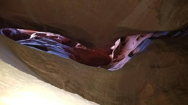
With a brisk early spring wind but perfectly clear skies, Josh and I packed up our smallest pack and I rigged up a rappel anchor off the tow hooks on the back of my car. Knowing the rappel is about 35-40 meters long, we used two ropes, tied them together and threw them over the edge. Of course, the wind blew them into oblivion, but Josh agreed to rappel first and organize them if I agreed to get some profile photos of him going over the edge. I added large rocks under each of my tires as chocks, in the extremely unlikely event the car started to roll over the cliff as we were rappelling down! As he started down, I walked off to the side to get some photos of the exhilerating start. Most of the rappel was free hanging, and really unique. We left the two ropes and continued with another 30 meter rope and started down canyon, which quickly narrowed up into a narrow slot, with just a couple open V shaped sections offerring good stemming practice. We didn't have too much trouble at all getting down the initial upper part of the slot, and didn't encounter anything super narrow that required any serious worming. We came across a small chockstone with decent webbing around it right above the one pothole in the canyon. Both Josh and I were easily to crawl over the lip of the pothole and make the 7-8 meter rappel down without any assistance.
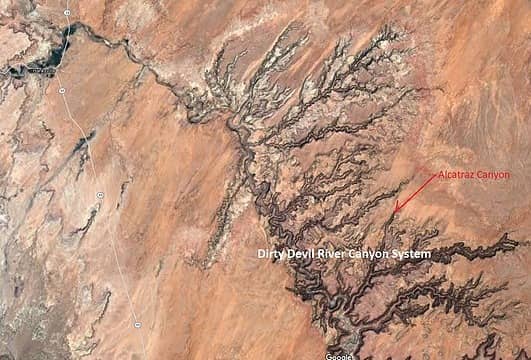 Alcatraz Canyon Location Map 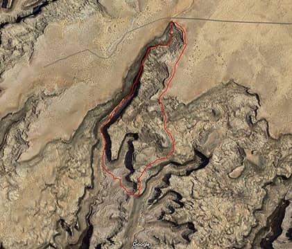 Alcatraz Canyon Route Topo 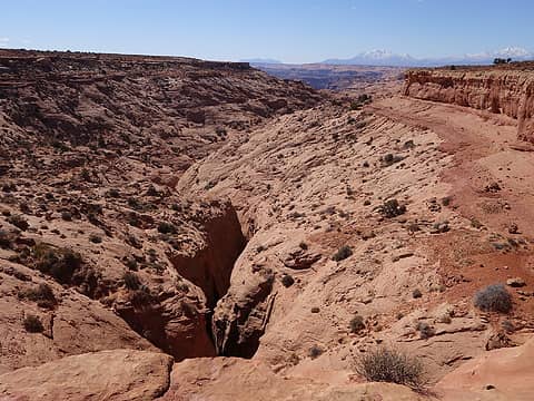 Looking down Alcatraz slot from the parking spot 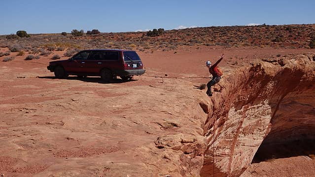 Josh dropping over the edge 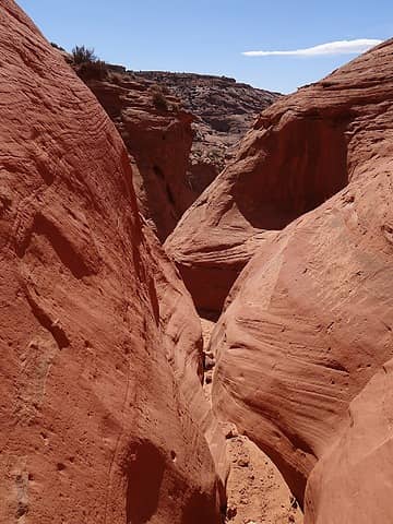 Down canyon from base of first rappel 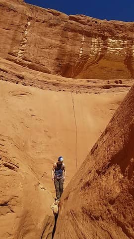 Looking back up at the rappel 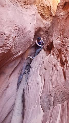 Sideways section 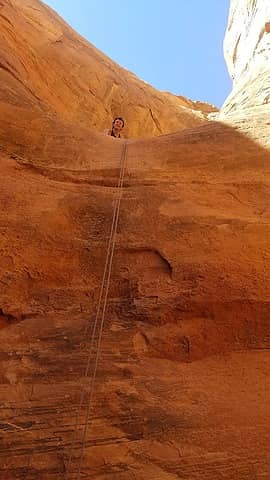 Josh peering over the 8 meter rappel 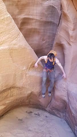 Some small jumps required  We continued following the path of least resistance up towards the Carmel rim. A short ways before the top of the Navajo, we saw a metal rod sticking out of the rock, on a Navajo slope where the angle was about 40 degrees steep. To my surprise this was a USGS benchmark! I found it strange someone put one here, where the angle of the rock was so steep, when just a few feet lower the terrain was flat. We reached the Carmel rim and hiked north back to the car along the east side of the canyon. It was maybe just 4.5 hours round trip and much less committing than I had always envisioned Alcatraz would be based on stores from friends back in college. The round trip loop distance was only 4 miles. Once we got back, we pulled the two ropes back up, and escaped the wind as fast as possible just throwing everything inside and grabbing a snack in the car. Moments later just as we started eating, a couple came out of nowhere walking the road to which Josh proclaimed "Hikers!" These were the first people we had seen all day and it turns out they were walking back from Larry Canyon, the next major drainage just to the north. We offered them a ride on the bumber of my car back up the road to save them a mile and a half of walking. When Josh and I did Larry Canyon back in 2012, we walked close to the canyon rim the whole way back rather than hike the road slightly further southeast...perhaps had we done the same thing all those years ago we could have avoided that 100 degree heat stroke inducing hike back!
We had some photography fun as the sun was setting on the drive back. The area of sand dunes along the Hans Flat Road that I got stuck in 2012 has not been raised at least 20 feet by road crews to prevent the sand dunes from blowing over the road. At the end of the day, more burgers at Stans Burger Shack in Hanksville were had, and another excellent day in the desert was in the books!
We continued following the path of least resistance up towards the Carmel rim. A short ways before the top of the Navajo, we saw a metal rod sticking out of the rock, on a Navajo slope where the angle was about 40 degrees steep. To my surprise this was a USGS benchmark! I found it strange someone put one here, where the angle of the rock was so steep, when just a few feet lower the terrain was flat. We reached the Carmel rim and hiked north back to the car along the east side of the canyon. It was maybe just 4.5 hours round trip and much less committing than I had always envisioned Alcatraz would be based on stores from friends back in college. The round trip loop distance was only 4 miles. Once we got back, we pulled the two ropes back up, and escaped the wind as fast as possible just throwing everything inside and grabbing a snack in the car. Moments later just as we started eating, a couple came out of nowhere walking the road to which Josh proclaimed "Hikers!" These were the first people we had seen all day and it turns out they were walking back from Larry Canyon, the next major drainage just to the north. We offered them a ride on the bumber of my car back up the road to save them a mile and a half of walking. When Josh and I did Larry Canyon back in 2012, we walked close to the canyon rim the whole way back rather than hike the road slightly further southeast...perhaps had we done the same thing all those years ago we could have avoided that 100 degree heat stroke inducing hike back!
We had some photography fun as the sun was setting on the drive back. The area of sand dunes along the Hans Flat Road that I got stuck in 2012 has not been raised at least 20 feet by road crews to prevent the sand dunes from blowing over the road. At the end of the day, more burgers at Stans Burger Shack in Hanksville were had, and another excellent day in the desert was in the books!
 Looking straight up  Mature Crypto 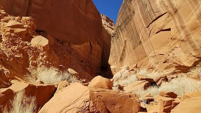 Looking back up canyon 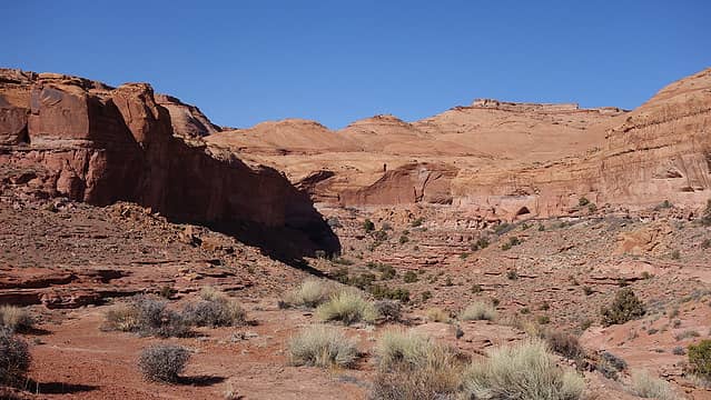 Crossing the first smaller ridge 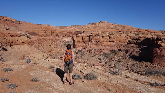 View from the first smaller ridge 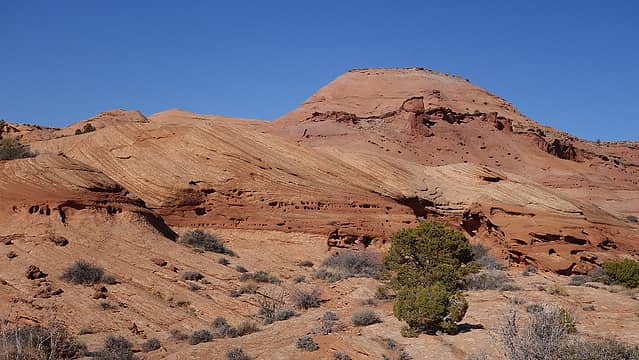 The prominent Navajo dome 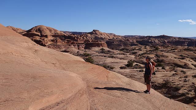 Scrambling up the Navajo 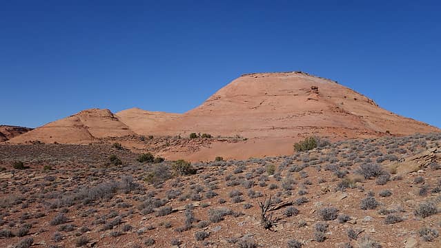 Navajo dome 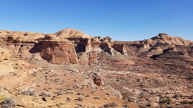 View east 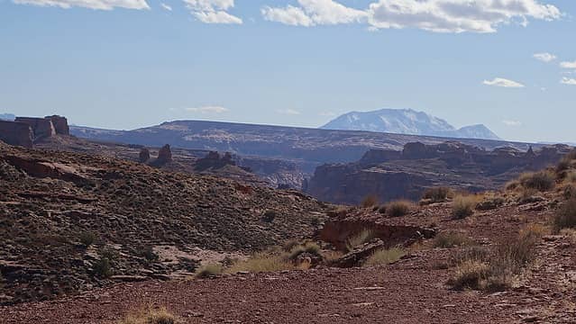 Henry Mountains towering above 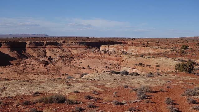 Emerging back on the Carmel Rim 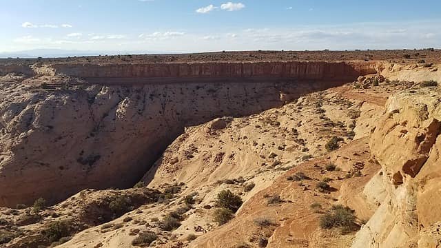 Walking the rim 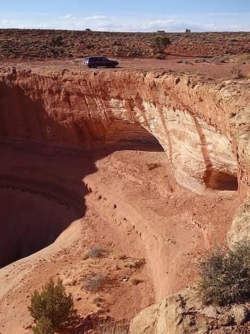 Almost back 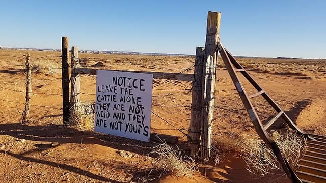 Awesome sign near Ekker Ranch 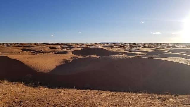 Sand Dunes
|


