| Previous :: Next Topic |
| Author |
Message |
Matt
Tea, Earl Grey, Hot


Joined: 30 Jan 2007
Posts: 4307 | TRs | Pics
Location: Shoreline |
|
Matt
Tea, Earl Grey, Hot
|
 Mon May 03, 2021 12:30 am |
|
|
Dates: April 17-18
Peaks: Eagle Point, Obstruction Peak, and Hurricane 5645 via Obstruction Peak Road.
Party: Matt, Carla
Tragically forgot her boots: Elle
We hiked the Obstruction Peak Road and nearby ridge crests to camp near Eagle Point and visit Obstruction Peak and Hurricane Point 5645.
This trip provided a wonderful getaway to enjoy roaming and camping on high snow ridges on a gloriously clear and warm spring weekend. For much of the trip, we were able to leave the road and follow delightful rolling ridge crests from one high point to another. For days afterward, back in town, I felt refreshed just by the memory of cruising along from one ridge to another, and relaxing overnight watching the dusk and dawn shift colors across space ranging from ocean shore to mountain crests.
The letdown was that Elle was supposed to be with us, but then discovered at the Hurricane Ridge parking lot that she had forgotten to bring her hiking boots, so she wasn't able to accompany us.
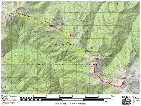 Obstruction peaks GPS track 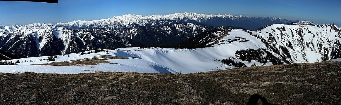 Looking back from Obstruction Peak to Eagle Point, with Long Ridge and the Bailey Range (plus Visitors Center at right in the farther distance) 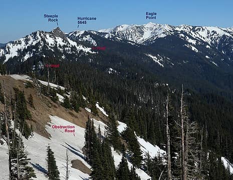 Road departing Visitor's Center 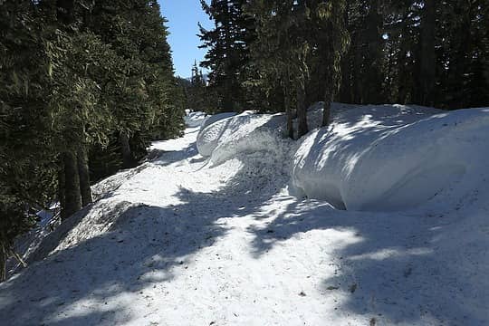 Cornices in the woods on the road 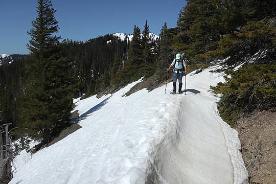 Arete on the road 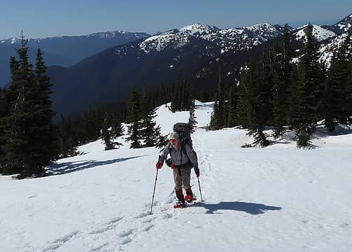 Hiking off-road up toward Eagle Point 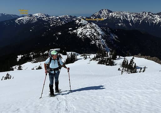 Higher up toward Eagle Point 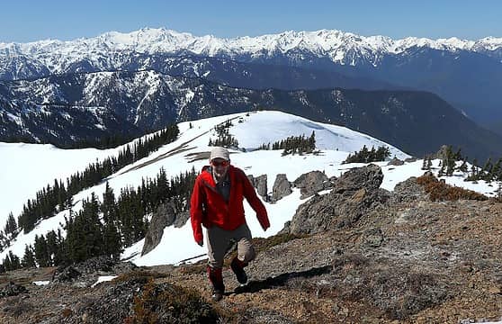 Near Eagle Point summit 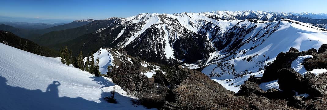 Eagle Point view from sea to summits 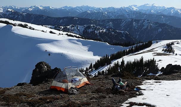 Relaxing in the afternoon 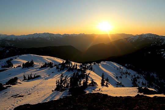 Golden Sun 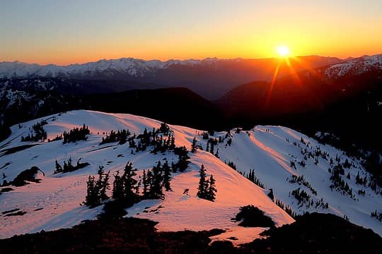 Rosy Sun 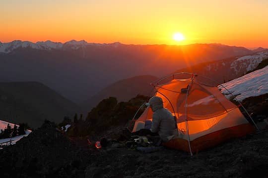 Orange Sun 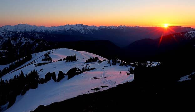 Sunset 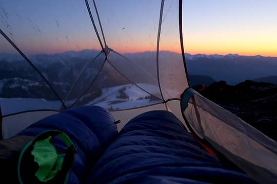 Bedding down for a beautiful warm night 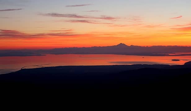 Dungeness Spit and Mt. Baker before sunrise 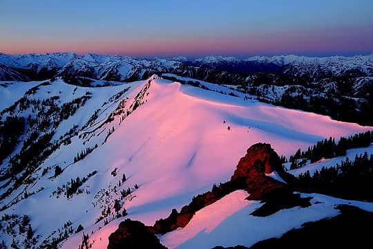 Light on the route ahead 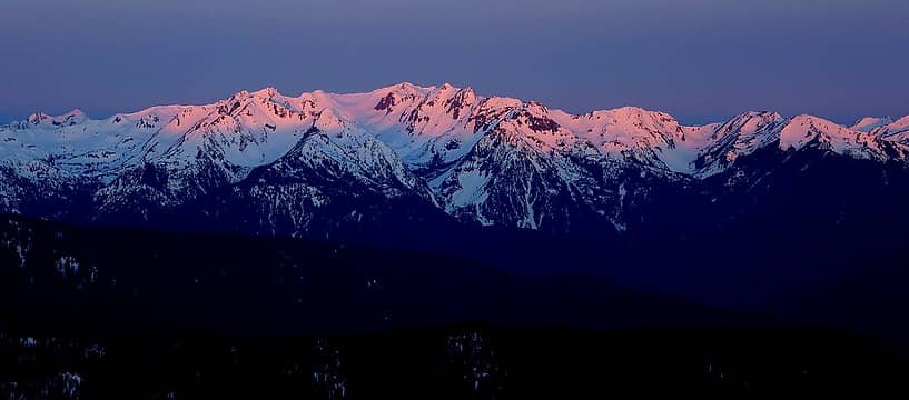 Mt. Carrie area 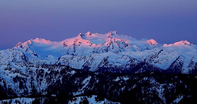 Pink, lavender, and blue Olympus 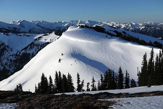 Point 6023, our route curves in from the right and follows the crest 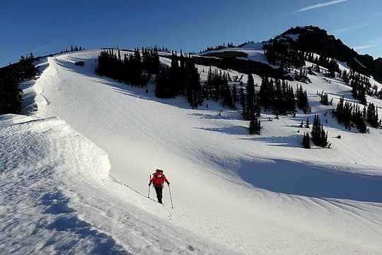 Hiking down from Eagle Point 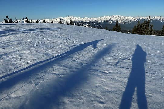 Shadows hiking along the wide crest 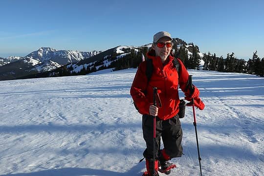 Easy fun gamboling along the wide crest 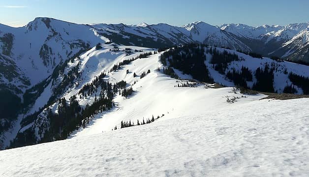 Ridges from Point 6032 to Obstruction 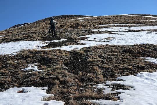 Carla ascending the last slope of Obstruction 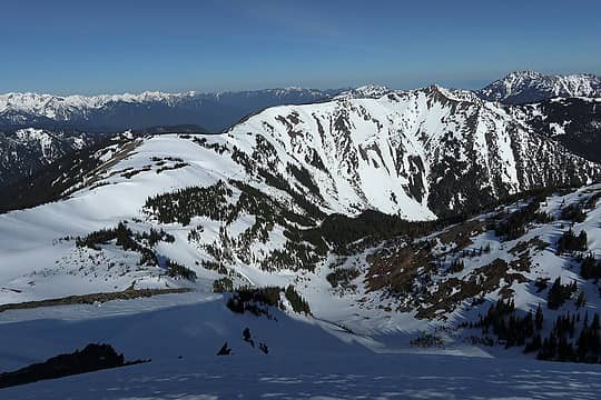 The view back to Eagle Point 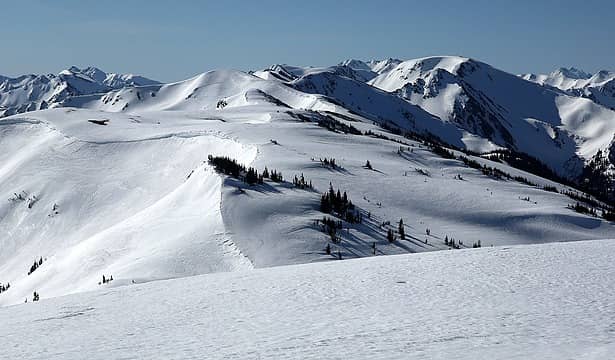 Ridges rolling onward out toward Grand Pass 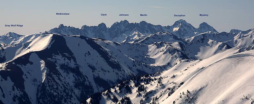 Needles Range in the distance 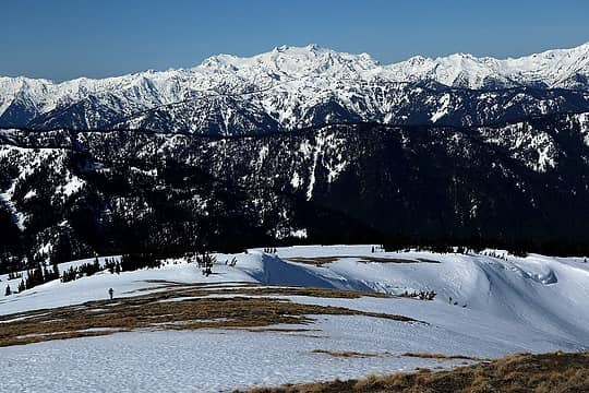 Carla hiking back down off of Obstruction 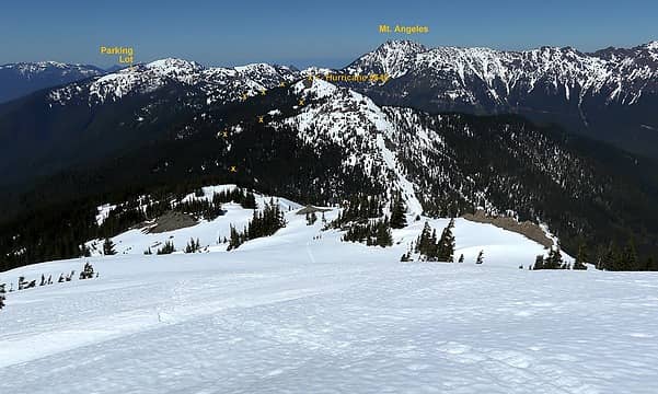 Heading down from Eagle toward Hurricane Point 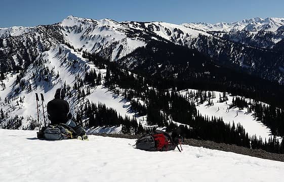 Relaxing on the summit of Hurricane Point, looking back toward Eagle Point 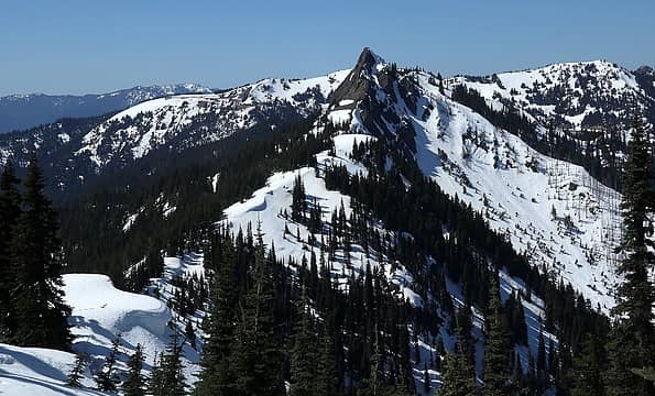 Down the next ridge to the col and then traverse past Steeple Rock
As beacons mountains burned at evening. J.R.R. Tolkien
As beacons mountains burned at evening. J.R.R. Tolkien
|
| Back to top |
  
|
|
Stefan
Member

Joined: 17 Dec 2001
Posts: 5093 | TRs | Pics
|
|
Stefan
Member
|
Tue May 04, 2021 8:47 am |
|
|
wow. I am jealous you did that!!
|
| Back to top |
|
|
reststep
Member

Joined: 17 Dec 2001
Posts: 4757 | TRs | Pics
|
|
reststep
Member
|
Tue May 04, 2021 10:51 am |
|
|
Great idea for a hike, especially with that weather.
Thanks for sharing Matt.
Thanks for adding the labels also.
"The mountains are calling and I must go." - John Muir
"The mountains are calling and I must go." - John Muir
|
| Back to top |
|
|
bertman
Member

Joined: 17 Jul 2006
Posts: 362 | TRs | Pics
|
|
bertman
Member
|
Tue May 04, 2021 11:25 am |
|
|
Glorious sunset and sunrise! Thanks for sharing.
|
| Back to top |
|
|
MojaveGeek
Member
Joined: 16 Aug 2009
Posts: 49 | TRs | Pics
|
What a great way to go out that ridge. I've driven it plenty, but going out along the snowy ridge tops looks really awesome, and it seems you got perfect weather. Maybe worth walking the ridge in summer, above and perhaps out of ear shot of the road?
|
| Back to top |
|
|
RodF
Member

Joined: 01 Sep 2007
Posts: 2593 | TRs | Pics
Location: Sequim WA |
|
RodF
Member
|
Mon May 17, 2021 7:56 am |
|
|
Thank you for sharing your spectacular photos!
"of all the paths you take in life, make sure a few of them are dirt" - John Muir
"the wild is not the opposite of cultivated. It is the opposite of the captivated - Vandana Shiva
"of all the paths you take in life, make sure a few of them are dirt" - John Muir
"the wild is not the opposite of cultivated. It is the opposite of the captivated - Vandana Shiva
|
| Back to top |
|
|
|
|
You cannot post new topics in this forum
You cannot reply to topics in this forum
You cannot edit your posts in this forum
You cannot delete your posts in this forum
You cannot vote in polls in this forum
|
Disclosure: As an Amazon Associate NWHikers.net earns from qualifying purchases when you use our link(s). |


