| Previous :: Next Topic |
| Author |
Message |
Sundance Kid
Hiking the Wasatch


Joined: 07 Jun 2002
Posts: 120 | TRs | Pics
Location: Orem, Utah |
OK, I know this is very old, but I haven't talked about it here and I have only seen one website with any information about the area. One morning my sister and I drove up to the Melakwa Lake trailhead, fully loaded with 40 pounds of camping gear. We made it up to the lake in a couple or three hours, and then our real adventure began. Our goal was to hike from Melakwa Lake over to Edelweiss Bowl and camp under Chair 2 somewhere. Looking at the maps, the best route seemed to be to maybe leave the trail somewhere before Melakwa Lake and hike straight up the hill to Pineapple Pass, where we could gain the ridge and make it over to Alpental. This did not happen. We were too wussy to bushwhack up to Pineapple Pass (since we had never been there before and didn't know exactly where it was anyway), so we headed up to Melakwa Lake and decided what to do from there. We ended up hiking straight up the big rockslide to the east of the lake. After unsuccessfully trying to find a way around the lower part of Bryant Peak over to Pineapple pass on a small bench about 1/3 of the way up the rockslide, we continued up and eventually made the pass to the north of Bryant Peak. Correct me if I'm wrong, but I believe that this is the China area of the Alpental backcountry. We worked our way down, slowly, in front of Bryant and Hemlock Peaks, eventually into Great Scott Bowl, where we picked up the climbers' trail up to Pineapple Pass. We were not expecting what we found once we arrived there. There didn't seem to be anyplace to go. Everything dropped off or went straight up in all directions but the one from which we had just come. After doing a little scouting, I determined that if we were careful, we could traverse just below the ridgeline (on the west side), heading south toward Denny Peak. We found a pair of ski goggles, and after a while ended up back on the top of the ridge. This is very scary and I don't recommend this route to inexperienced hikers. I definitely don't recommend this route to anyone carrying a 40-pound pack. The ridgeline is very narrow with dropoffs on both sides. There are a couple of spots where it is helpful to take off your pack and downclimb some questionable drops. Eventually, we ended up on a flatter, wider section of the ridge, just north of Denny Peak. Here we left the ridgetop in favor of a relatively flat bench to the east of the ridge. I believe this is called Waterfall Bench. It was getting dark so we decided to set up camp there instead of trying to conquer Denny Mountain AND try to get down it into Edelweiss Bowl in the dark. We woke up at about 8:00 am to the wonderful sound of pouring rain. Gotta love Washington. We went back to sleep thinking that it would let up after a while, but when noon came around and it still hadn't let up, we said, "screw this" and just packed everything up wet, and headed down. Waterfall bench only has one real way off, and it's pretty scary, especially when you're getting poured on. There is one chute at the north end of the bench that drops down into Upper Internationale. From there we walked down the rest of Internationale, and down the long road back to the trailhead. A great hike, but next time I'm doing it with just a daypack. If anyone has any other info about this particular area, I'd love to hear about it.
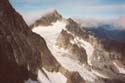
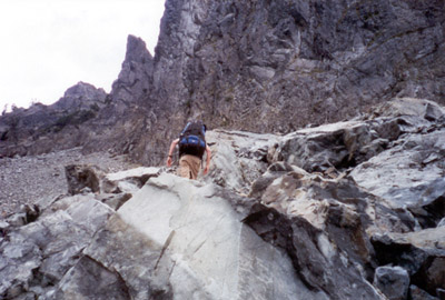 Ascending the climbers' route up through Great Scott Bowl 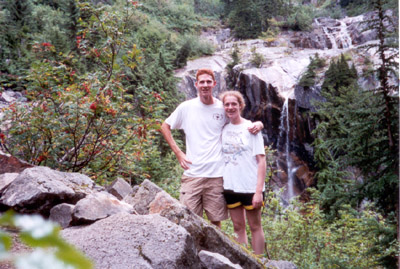 My sister and me near the lower waterfall on the trail 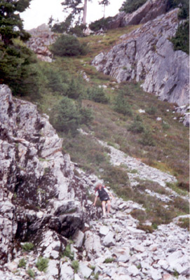 My sister descending from the pass north of Bryant Peak 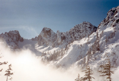 Great Scott Bowl during a snowshoe trip 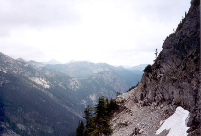 A view toward the Alpental base area 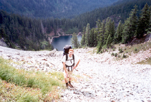 On the rockslide high above Melakwa Lake 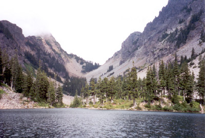 Melakwa Lake from the south 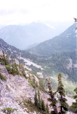 Upper Source Lake drainage looking into MidFork Snoq. River
Just where is it I can find beaver, bear, and other critters that are worth cash money when skint?
Just where is it I can find beaver, bear, and other critters that are worth cash money when skint?
|
| Back to top |
  
|
|
mvs
Member
Joined: 08 Mar 2002
Posts: 123 | TRs | Pics
Location: München, Deutschland |
|
mvs
Member
|
 Mon Nov 18, 2002 8:34 pm Not so bad if you know what to expect
|
|
|
Hi Sundance Kid,
I made that traverse as a rock climb in June. We made an effort to stay right on the crest (temporary insanity).
I have my own pictures and text of the traverse here:
http://www.mountainwerks.org/cma/2002/datoof.htm
Anyway, it's something fun and well-known to rock climbers, but I don't know any who'd want to do it with a big pack! Sounds like you did a great job getting off safely.
--Michael
|
| Back to top |
|
|
|
|
You cannot post new topics in this forum
You cannot reply to topics in this forum
You cannot edit your posts in this forum
You cannot delete your posts in this forum
You cannot vote in polls in this forum
|
Disclosure: As an Amazon Associate NWHikers.net earns from qualifying purchases when you use our link(s). |


