| Previous :: Next Topic |
| Author |
Message |
Eric Gilbertson
Member


Joined: 04 Jul 2018
Posts: 188 | TRs | Pics
Location: Seattle |
Isolation Traverse in a Day
Eric and Duncan
May 22, 2021, 1:45am 1:45am May 23
29 miles, 14kft gain
This spring Ive been wanting to do one of the classic ski traverses in the cascades to mix things up a bit from my standard peakbagging trips. I would say the major classic ski traverses are Ptarmigan and Isolation. The Ptarmigan Traverse is unfortunately difficult to complete this year because the main exit point, the Downey Creek trail, is still closed from a fire last fall. But the Isolation traverse doesnt have restrictions like that.
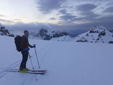 Sunset on the Neve Glacier 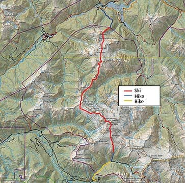 The route 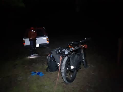 Biking up with skis 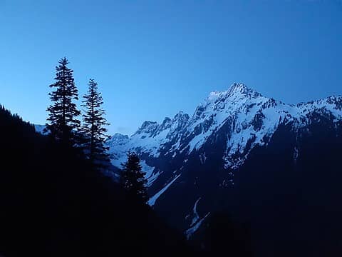 Sun rising on Johannesburg 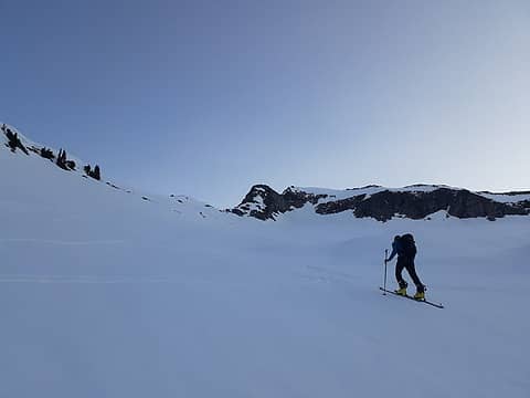 Heading up above the boulder field 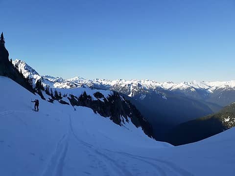 Skinning up the Roush Creek drainage 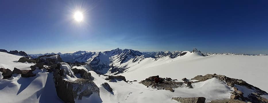 Looking towards Forbidden Peak from the Eldo bivy site 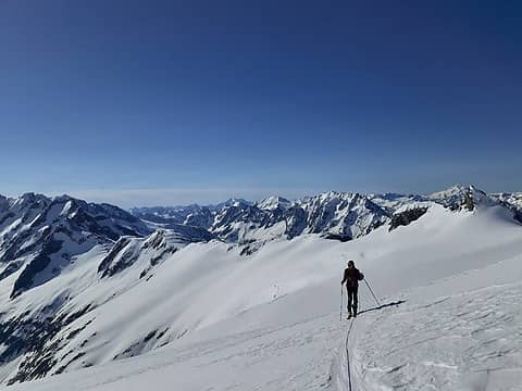 Crossing the Inspiration Glacier 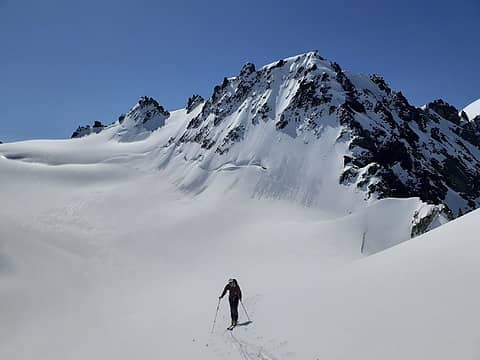 Crossing the McAllister Glacier near Dorado Needle 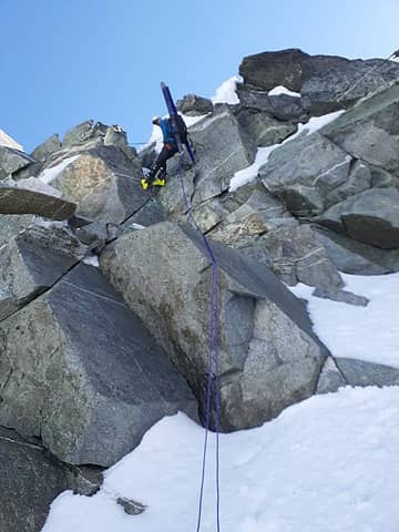 Rapping over the north ridge from Dorado Needle off the McAllister 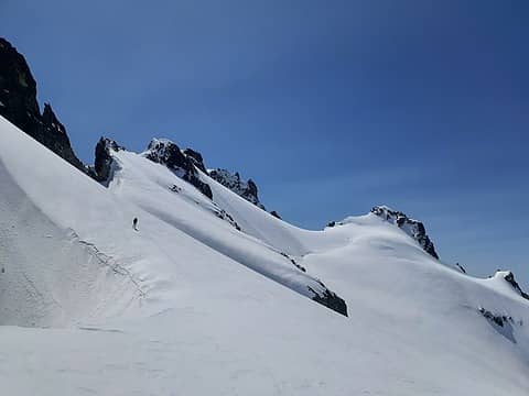 Traversing below Perdition Peak 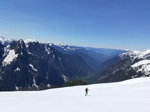 Good views down Marble Creek drainage 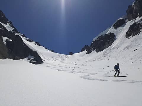 Skiing the Ice Elation couloir 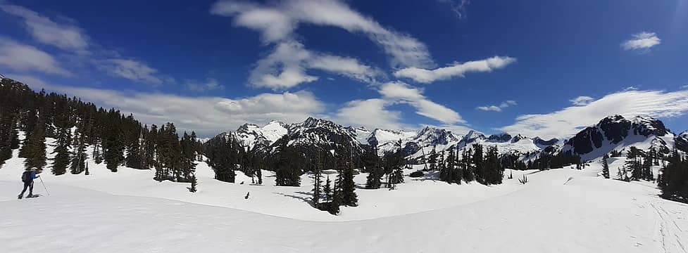 The view from just above Wilcox Lakes looking southeast 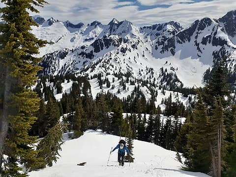 Booting up Isolation Peak 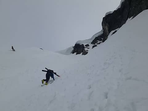 Downclimbing Isolation 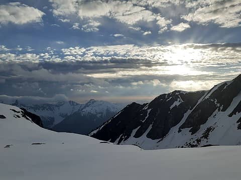 Clouds hitting the Coccyx 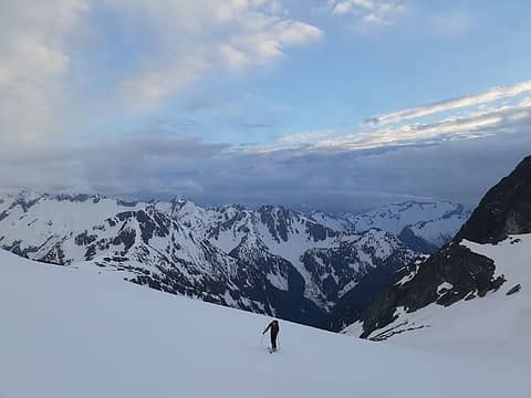 Last view back towards Eldo 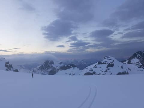 Descending the Neve Glacier 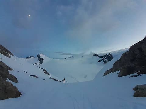 Climbing to the Neve-Colonial col 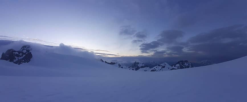 Clouds engulfing Horsemans Pack 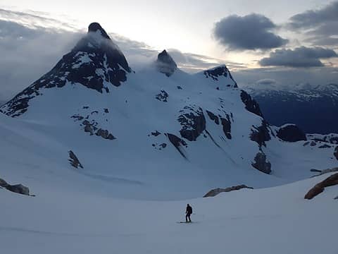 Skiing down the Colonial Glacier 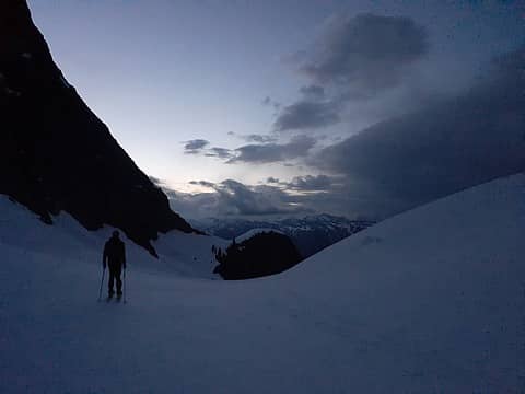 Crossing under Pyramid Peak 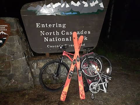 Lots of different modes of transportation used
 reststep reststep
reststep |
| Back to top |
  
|
|
raising3hikers
Member
Joined: 21 Sep 2007
Posts: 2344 | TRs | Pics
Location: Edmonds, Wa |
Early morning starts and finishes, wow! You're the slog dog!
Nice terrain you guys visited
|
| Back to top |
|
|
Fletcher
Member

Joined: 29 Jul 2009
Posts: 1870 | TRs | Pics
Location: kirkland |
|
Fletcher
Member
|
 Tue May 25, 2021 8:14 pm |
|
|
The Slog Dog is a fitting name! But, not one new summit tagged??? Im not sure the trip counts in this case... 
|
| Back to top |
|
|
Eric Gilbertson
Member
Joined: 04 Jul 2018
Posts: 188 | TRs | Pics
Location: Seattle |
| Quote: | | But, not one new summit tagged??? |
Yeah, definitely doesn't count as a peakbagging trip. I was intending to tag Isolation Peak to get at least one green dot, but our progress was slower than hoped for by that point and we were worried about getting stuck on the Neve Glacier in the dark and whiteout with weather predicted to come it. As it was, we got stuck in a whiteout 30 min before dark on the Neve, but was light enough still to navigate.
|
| Back to top |
|
|
timberghost
Member
Joined: 06 Dec 2011
Posts: 1328 | TRs | Pics
|
|
| Back to top |
|
|
MangyMarmot
Member

Joined: 06 Apr 2012
Posts: 474 | TRs | Pics
|
Awesome trip. That's a hell of a route to do in a day. Well done!
|
| Back to top |
|
|
cascadetraverser
Member

Joined: 16 Sep 2007
Posts: 1407 | TRs | Pics
|
Wow! Another amazing trip. I hiked that in summer and I took a week!
|
| Back to top |
|
|
Brushbuffalo
Member

Joined: 17 Sep 2015
Posts: 1887 | TRs | Pics
Location: there earlier, here now, somewhere later... Bellingham in between |
| Eric Gilbertson wrote: | | I ended up just holding the end of the rope in one hand and my handlebars with the other. It actually worked surprisingly well. |
You should write a book featuring the many ways you and your buds have used innovative twists on transport means.
Passing rocks and trees like they were standing still
Passing rocks and trees like they were standing still
|
| Back to top |
|
|
Eric Gilbertson
Member
Joined: 04 Jul 2018
Posts: 188 | TRs | Pics
Location: Seattle |
| Quote: | | You should write a book featuring the many ways you and your buds have used innovative twists on transport means. |
Yes, the cascades provide so many opportunities to get creative with transportation! Gated roads, snowed over roads, and ross lake are all great opportunities.
|
| Back to top |
|
|
|
|
You cannot post new topics in this forum
You cannot reply to topics in this forum
You cannot edit your posts in this forum
You cannot delete your posts in this forum
You cannot vote in polls in this forum
|
Disclosure: As an Amazon Associate NWHikers.net earns from qualifying purchases when you use our link(s). |


