| Previous :: Next Topic |
| Author |
Message |
mbravenboer
Member


Joined: 20 Oct 2013
Posts: 1422 | TRs | Pics
Location: Seattle |
The trail to Rainy Lake is pretty well maintained and mostly free of obstacles. Spotty snow starts at 2500ft and is continuous from about 2800ft, so after that you're on your own finding your way to Rainy Lake. The trail is lightly used with some recent footprints.
Rainy Lake itself is not in the Alpine Lakes Wilderness I think, but after 1600ft or so there is some old growth to enjoy. Lots of Trillium and there is a Skunk Cabbage patch too. The views of the creek are quite nice.
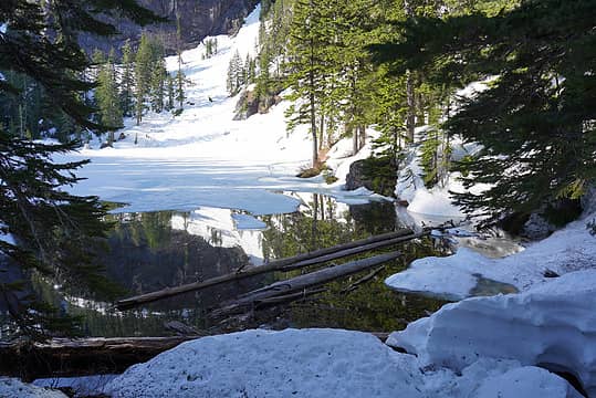 Rainy Lake outlet 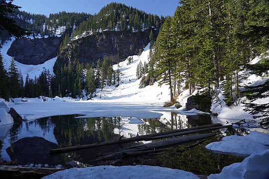 Rainy Lake in the early morning 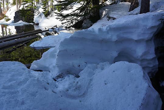 Crossing the outlet was a little tricky due to the snow pictured above. On the way back I cut off the top a bit to make it easier. This pile was 4-5ft high and the jump down was a bit scary because you can't see if there is a tree trunk or water below it. 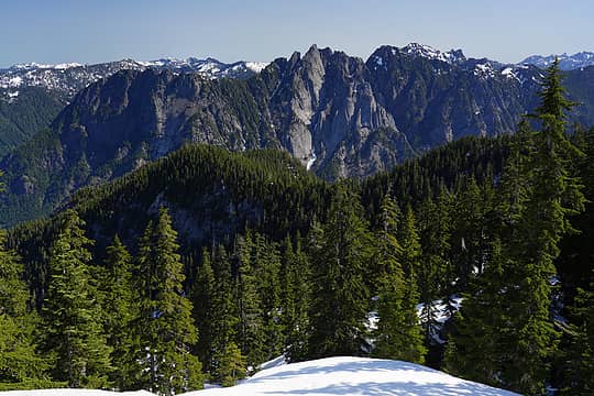 Garfield Mountain (all the cliffs in the foreground) from the ridge above Rainy Lake to Preacher 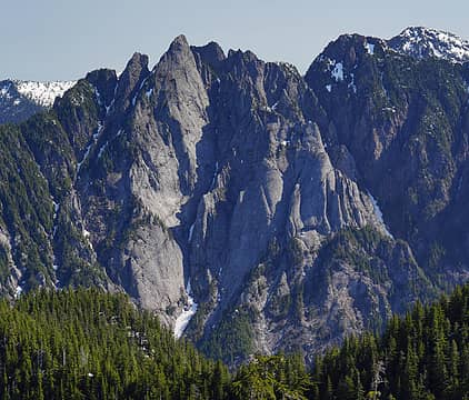 The rock formations of Garfield Mountain are quite something! 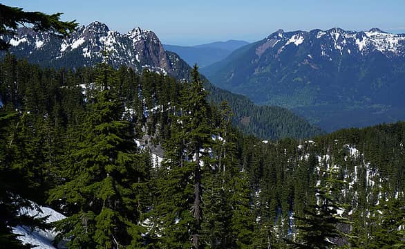 Russian Butte on the left-side of MFK (Middle Fork Snoqualmie). Right is the Teneriffe - Green ridge 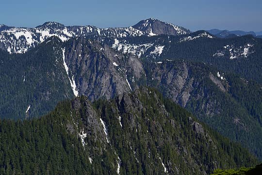 I think these are Quartz and Twin Peaks in the distance, but I'm not sure. It seems like Twin Peaks should have some pretty good views. 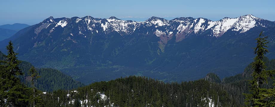 Teneriffe - Green ridge and the Olympics in the far distance. 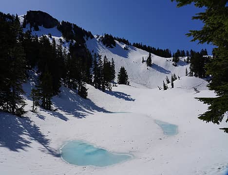 The 5200ft tarn just below the ridge to Preacher is starting to melt. I filtered some water from it later in the day. Next I need to get up the ridge in the background. 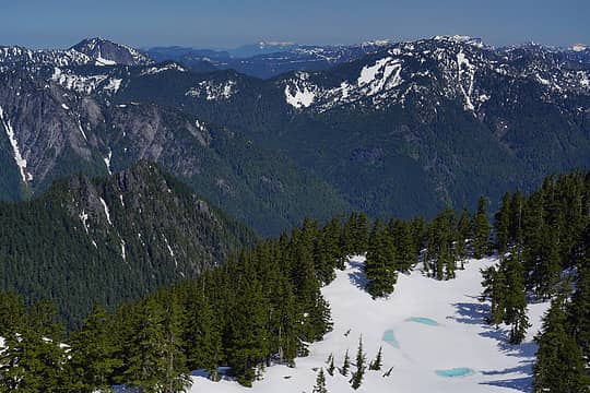 The snowy peaks in the far distance is Mt Pilchuck. Baker is hiding just behind Rooster and Goat and Index. The highest peak on the left is Twin Peaks. In the foreground is the tarn below Preacher Mountain. 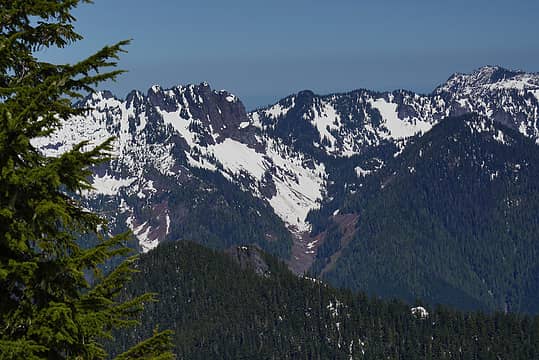 The cliffy peak is Bessemer Mountain. To the right is Bessequartz in the foreground. The peak in the back right may be Paperboy, but I'm not sure. 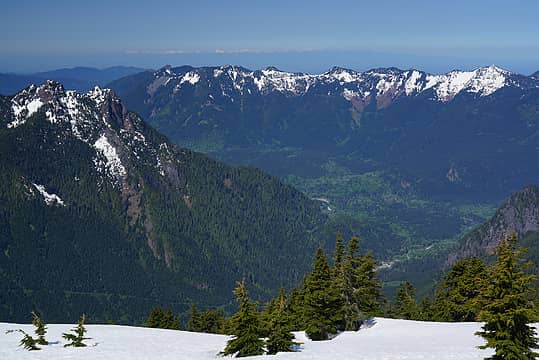 MFK with Olympics in the far distance (if you zoom in you can see Seattle and Bellevue too). Taken from Preacher Mountain 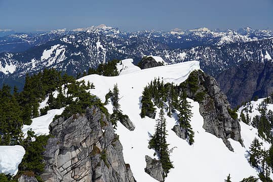 The Preacher Mountain summit ridge looking north towards Baker and Shuksan, with Del Campo and Gothic Peak to the right 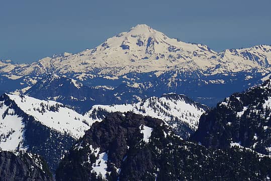 Glacier Peak from Preacher Mountain 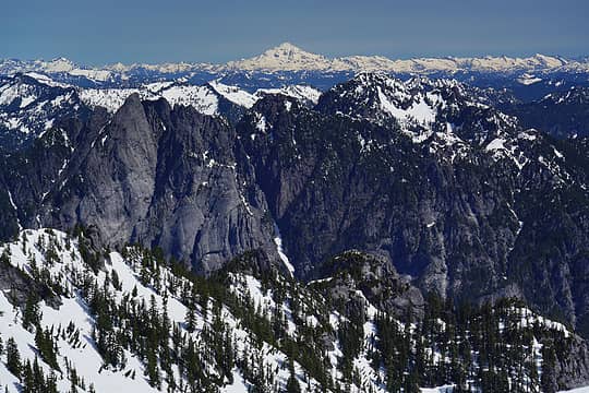 View towards Glacier Peak with Garfield Mountain in the foreground 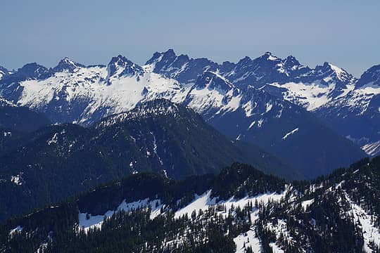 Burntboot Peak ridge in the center, with the Middle Fork Snoqualmie River drainage in front of it (and Price on the other side), and the Burtboot Creek drainage behind it, leading to Overcoat Peak. In the back is the ridge of Chimney Rock, Lemah, Chikamin 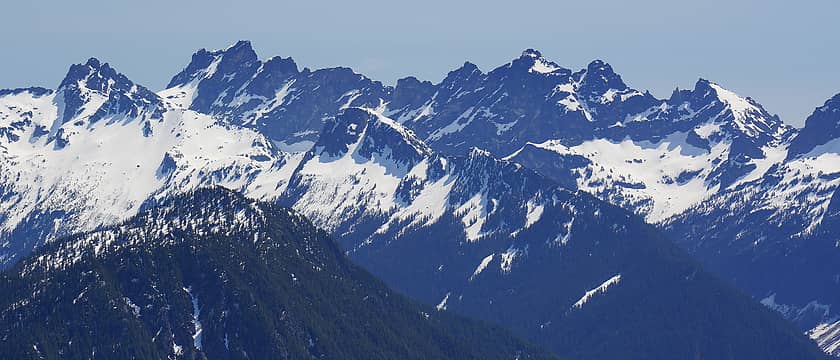 Burntboot Peak tto Overcoat in the center and the Lemah/Chikamin ridge in the background 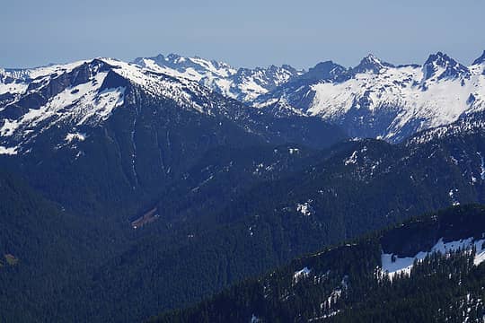 View up the Dingford Creek drainage towards Big Snow Mountain. Mt Daniel in the background 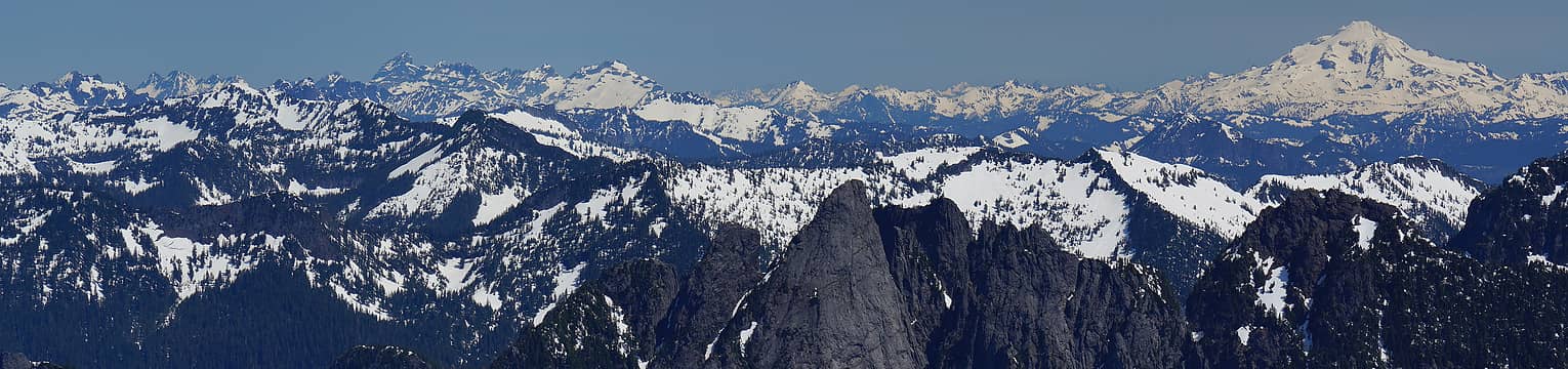 Panorama north towards the Monte Cristo group and Glacier Peak 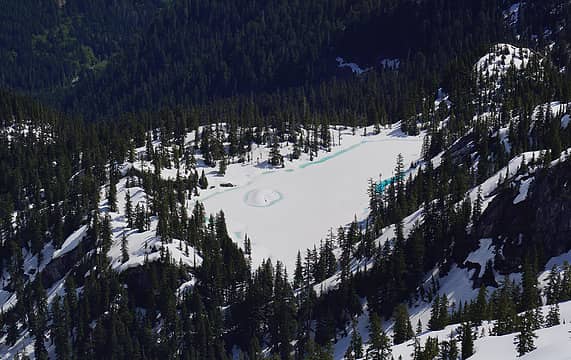 Hatchet Lake below Preacher Mountain 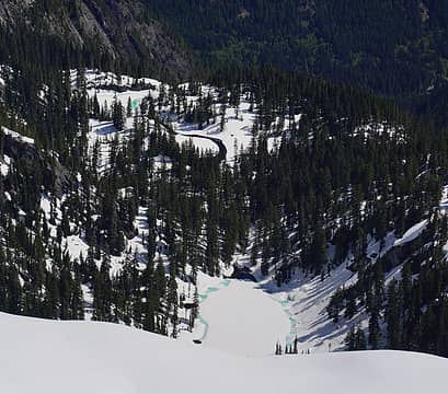 Shamrock Lake and Elbow Lake below Preacher Mountain 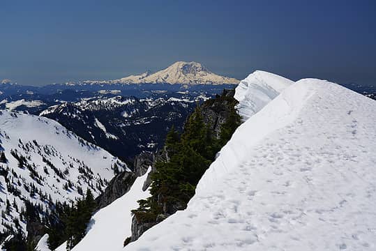 Mt Rainier from Preacher Mountain 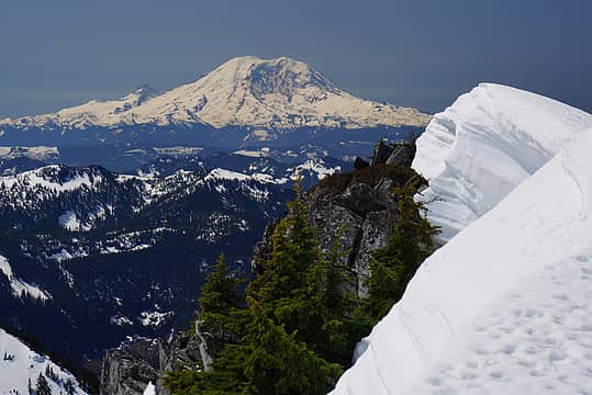 Mt Rainier from Preacher Mountain 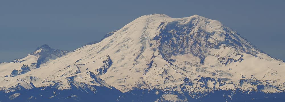 Mt Rainier from Preacher Mountain (Mt Rainier is about 50 miles from Preacher in a straight line) 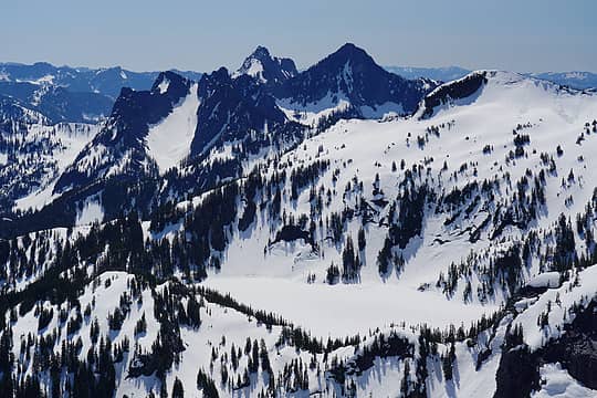 Lake Caroline in the foreground and Chair Peak and Kaleetan Peak in the background 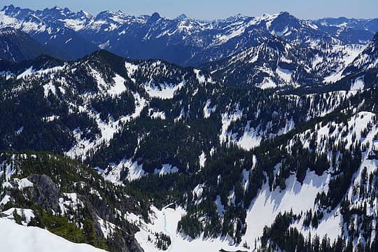 Hatchet Lake below, then Wild Dare, then Wright Mountain (Snow Lake behind there) to the right with Snoqualmie Mountain above it, and then in the background from left to right: Lemah, Chikamin, Mount Thomson, Three Queens in the far distance 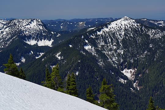 Left: Web Mountain. Right: Revolution Peak. Between the two is Thompson Lake (barely visible) 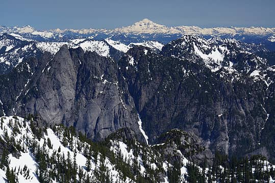 View towards Glacier Peak with Garfield Mountain in the foreground 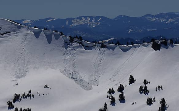 Some fresh cornice failures above Lake Caroline 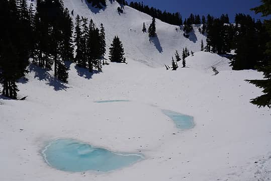 The tarn at 5200ft with my tracks up the ridge in the background 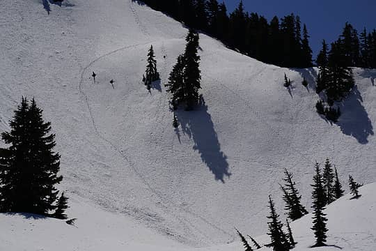 Snow conditions were good enough to just go straight up the ridge above the 5200ft tarn. I took a slightly less steep route down (left track)
 Tom, RichP Tom, RichP
Tom, RichP |
| Back to top |
  
|
|
zephyr
aka friendly hiker

Joined: 21 Jun 2009
Posts: 3370 | TRs | Pics
Location: West Seattle |
|
zephyr
aka friendly hiker
|
 Mon May 17, 2021 8:59 pm |
|
|
Fantastic report, Martin. Looks like terrific conditions and a superb place to be on such a bluebird day. Those views! Beautiful photos as always. I really appreciate your taking the time to label various peaks and put together a smart narrative. It's so helpful in many ways to those of us who have been to several of the places you highlight and would love to go back--as well as recognize what I am seeing when I am up there (in the mountains). Thanks, ~z
|
| Back to top |
|
|
Type E
Member

Joined: 19 Aug 2006
Posts: 1381 | TRs | Pics
|
|
Type E
Member
|
Mon May 17, 2021 9:07 pm |
|
|
Inspiring post , wish I could refund the time
E
|
| Back to top |
|
|
Brushbuffalo
Member

Joined: 17 Sep 2015
Posts: 1887 | TRs | Pics
Location: there earlier, here now, somewhere later... Bellingham in between |
Great pictures and description!
I speak for others, I'm sure, when I say we've missed your reports. Looking forward to more as your time and inclination afford.
Is Jake getting close to the age where he can carry his own gear?
Passing rocks and trees like they were standing still
Passing rocks and trees like they were standing still
|
| Back to top |
|
|
mbravenboer
Member
Joined: 20 Oct 2013
Posts: 1422 | TRs | Pics
Location: Seattle |
| Brushbuffalo wrote: | | I speak for others, I'm sure, when I say we've missed your reports. Looking forward to more as your time and inclination afford. |
I hope to do some nice hikes this summer, but we'll see what time and weather allows  . Mostly my trips have not been as interesting lately due to other demands on my time. I did one trip to Alta via Gold Creek in winter that was interesting but I didn't entirely make it. . Mostly my trips have not been as interesting lately due to other demands on my time. I did one trip to Alta via Gold Creek in winter that was interesting but I didn't entirely make it.
| Brushbuffalo wrote: | | Is Jake getting close to the age where he can carry his own gear? |
Last year in spring we did quite a few nice hikes when everything was closed due to COVID and we couldn't do anything else, but he clearly started not liking it too much and also often got very car sick. I'm not applying too much pressure for now in the hope he gets interested again later . He likes going with friends on short hikes, so we do that now and then (Twin Falls, Denny Creek etc).
| zephyr wrote: | | Looks like terrific conditions and a superb place to be on such a bluebird day. Those views! Beautiful photos as always. |
Thanks, glad you liked it!
|
| Back to top |
|
|
mosey
Member

Joined: 18 Dec 2018
Posts: 163 | TRs | Pics
|
|
mosey
Member
|
Tue May 18, 2021 3:21 pm |
|
|
Great photography. Really good captures of mid fork in there.
|
| Back to top |
|
|
Brucester
Member
Joined: 02 Jun 2013
Posts: 1102 | TRs | Pics
Location: Greenwood |
I was just looking at this to see if I'd give it another try.
Thanks for the report!
|
| Back to top |
|
|
dcA2dc
Member
Joined: 11 Feb 2021
Posts: 9 | TRs | Pics
|
|
dcA2dc
Member
|
Thu Jun 03, 2021 6:31 am |
|
|
Thanks for labeling all those peaks in the photos! Really cool to look through.
|
| Back to top |
|
|
|
|


