| Previous :: Next Topic |
| Author |
Message |
Alden Ryno
Member


Joined: 04 Jun 2019
Posts: 150 | TRs | Pics
Location: Issaquah, WA |
Trip Stats: 31 miles, 9,500' gain,
Route: Swamp Creek
Gear: Bivy, Axe, Glacier Gear, Poles, Crampons.
With an entire clear, sunny week predicted with snow modeled to be around 4,000' to 4,500' ("confirm" by Stehekin rangers), we chose to climb Dark Peak via the Darkfin Col approach noted by Fletcher and Jake in 2017 which was soon followed by Eric and Duncan following year. However, a year later Rikki et al. remarked that the eastern slopes were no longer as open and had transformed into a steep jungle gym, likely due to deadfall from a beetle infestation.
I took Jake's advice last year and used Memorial Day for Tupshin, Devore, and Flora. He had noted using Memorial Day this year as an "easy" Swamp Creek approach for Dark. Two years now he's given me fruitful Memorial Day outings.
Despite the horror stories about the Swamp Creek approach, we had a hard time deciding between the two. Snow up to 4,000' plus meant that much of the brush in Swamp Creek may be exposed while the upper slopes to Darkfin Col would be loaded with snow yet covering the steep talus beneath. We set off with Darkfin Col as the approach of choice. Rikki had summitted Dark but not Storm King while the opposite was true for me. We choose to attempt to grab both, making our plans last until Tuesday while Sam aimed for Dark and Sinister. Unfortunately, the Red Bus shuttles weren't running on June 1st or June 2nd so we decided to bring bikes to ride the road back from High Bridge to Stehekin.
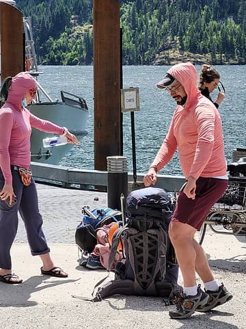
We caught the slow boat from Field's Point at 0945 and rode it to Stehekin. Before departing, we learned that a party of four Mountaineers were also aiming for Dark Peak via Swamp Creek: an A/B Test for the approaches! A supposed 1230 arrival ended up being nearly 1330 but thankfully the shuttle wasn't set to leave until 1400 anyway. Gratefully the bus wasn't loaded down so we were able to get all three bikes up the road with us, though one of them was in the bus. We departed from the High Bridge TH around 1500 and rode bikes 0.25 miles up to the High Bridge Campground to store some food in a bear box and the bikes in the woods for our return.
The PCT was the PCT and didn't afford much in the way of views as it paralleled Agnes Creek west then southwest. This section until Cutthroat Pass has to be one of the worst sections of PCT with sparse views while the trail remains low. Fortunately for me, I rolled my ankle hard about a mile in. Yay! I sat down, articulated it to ensure range of motion, and we were on our way within a minute or two so that the ankle wouldn't freeze up.
We encountered consistent snow all the way down at 2,600', nearly 2 miles before Swamp Creek. I broached the subject of potentially changing approaches soon thereafter since an additional four miles of snow travel might be enough to offset any advantage of Darkfin Col while ensuring Swamp Creek would still have the brush covered. Additionally, we may be too slow to make it to Hemlock camp that night before dark. We diverted plans to the Swamp Creek approach.
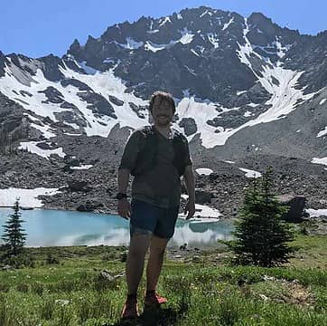
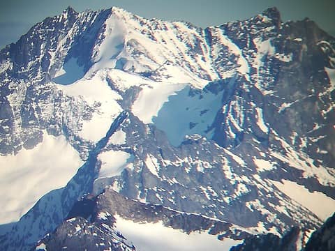
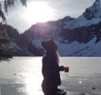
 Goobers on the dock 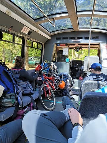 Who put their *poop* up front?! 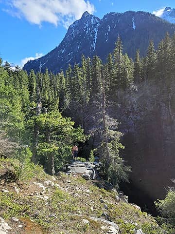 Snow began immediately after the gorge along the SF Agnes Creek 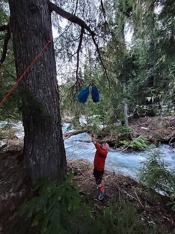 Action shot hanging food above along Swamp Creek 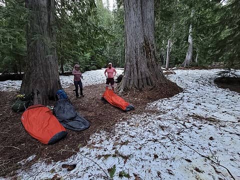 About to head out the next morning 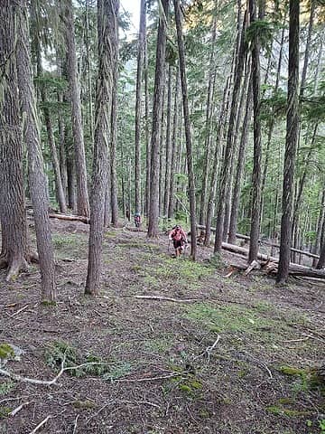 Where's the bee...snow? 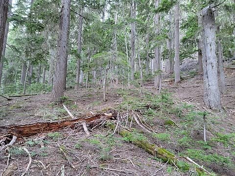 Very easy travel for nearly 1,000' of vertical 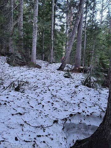 A-ha! There it is. About 3,600' elevation 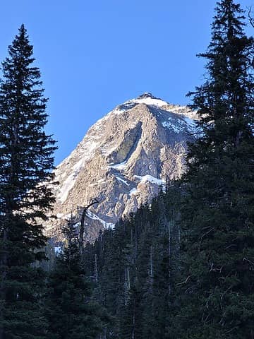 May be Needle Peak 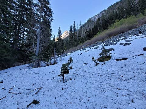 Brush? 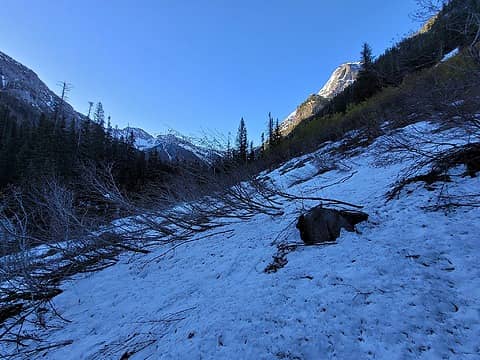 Brush! 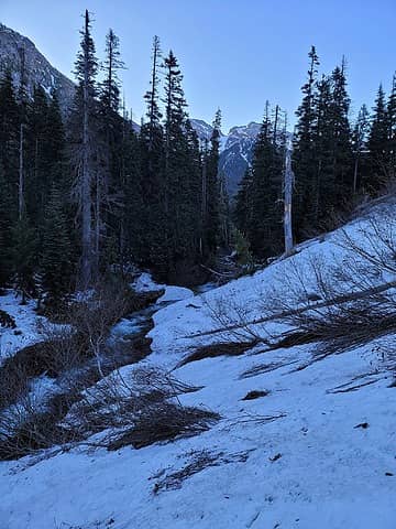 Where we began scouting for a crossing, 3,800' 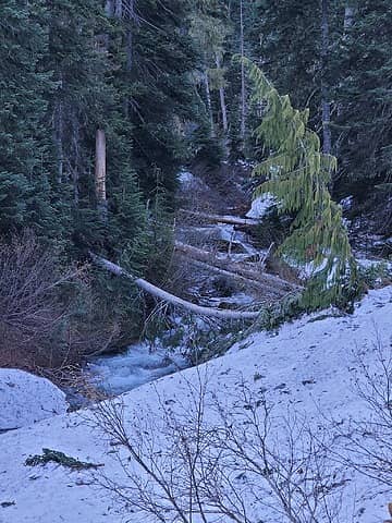 I crossed on the big one (not the bendy one), as did Sam 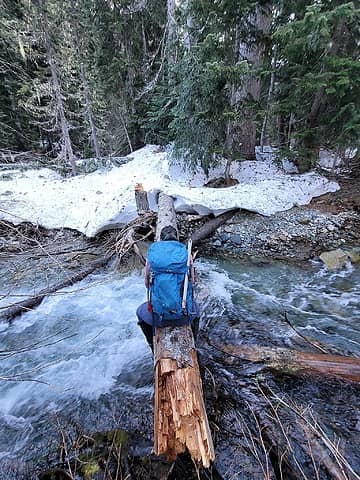 Where Rikki crossed on the way in and we all crossed on the way out 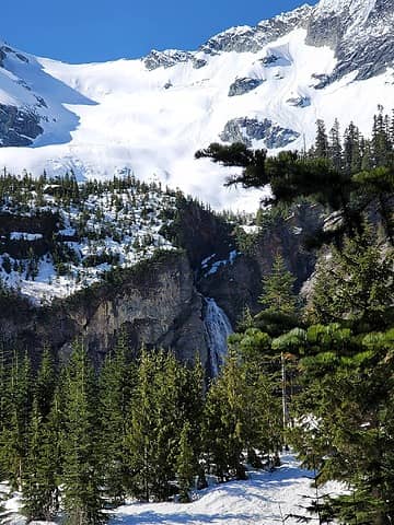 Lower basin falls and glacier above 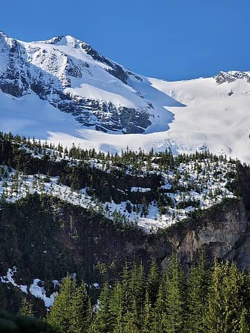 First full view of the summit area 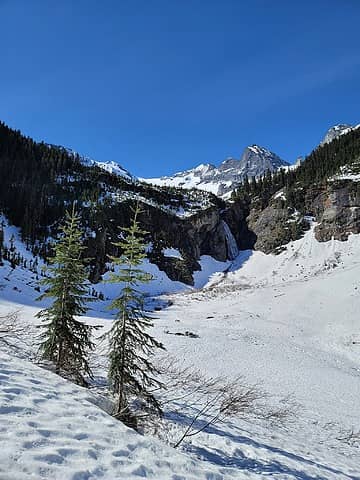 Broader view of basin. Ascended left out of frame 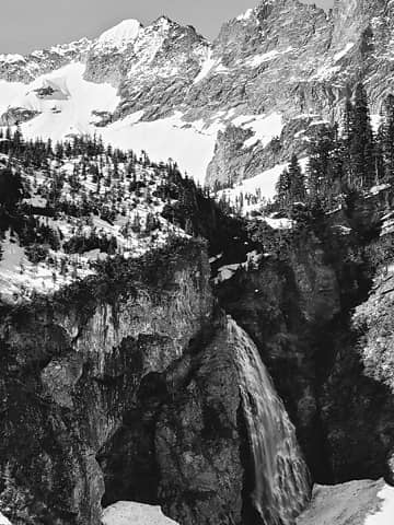 Noice 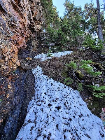 The gross exit 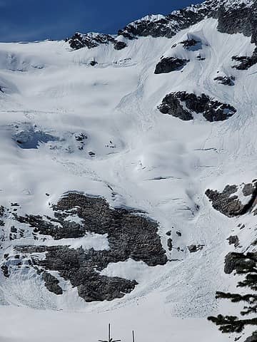 Team moving up when we arrived in the upper basin 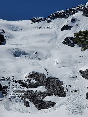 Where they were when we took off across the basin 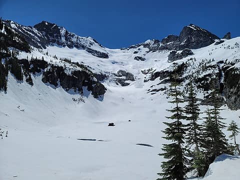 Wider view 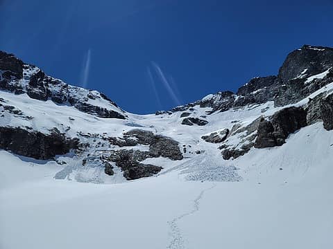 Moving up! 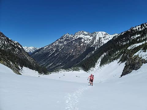 Looking back 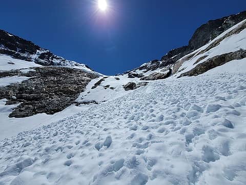 In the midst of an older slide swath 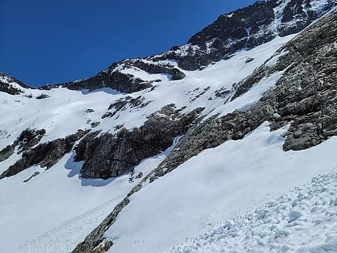 I pondered if this terrain would've been "safer" 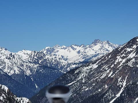 Enjoying Goode views while we roped up 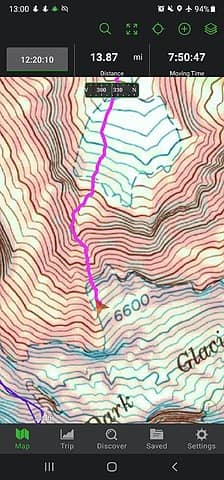 Where we roped up 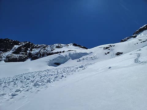 Not that way. But, we did ponder if it would be "safer" to traverse under then around this rather than follow the steps through a slide funnel. We figured time saving would be a better safety margin, so we took the established steps. 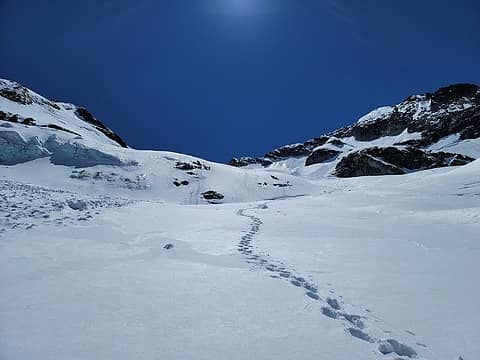 Thattaway 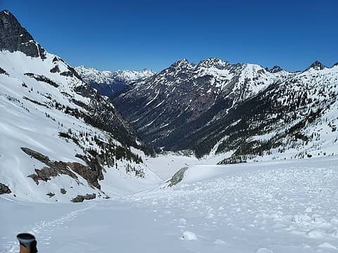 Lyall Ridge was nearly devoid of snow... 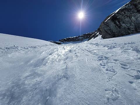 Not the best place to be going up. Pure sugar beneath. 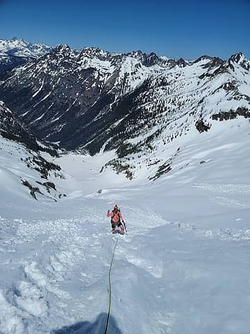 Stoke in the scorching heat 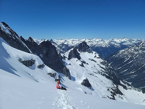 We both had neglected water and needed it bad so we found a spot on the upper glacier with less overhead hazard and popped a squat for a brief water and snack break before plodding on 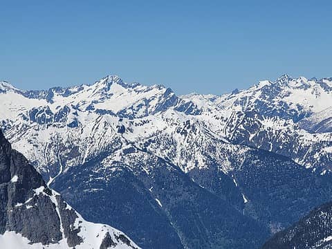 Buckner 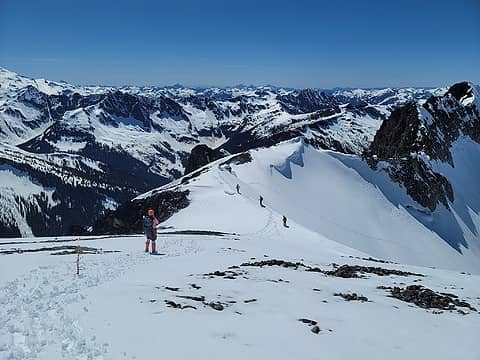 pretty 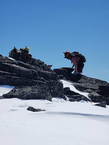 summit shot of Sam 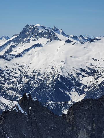 Sinister and Dome 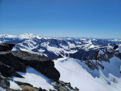 Dakobed 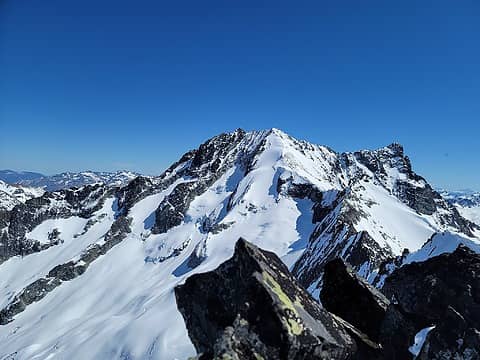 Bonanza. The traverse looked sweet 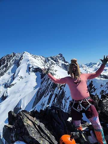 screaming summit slot 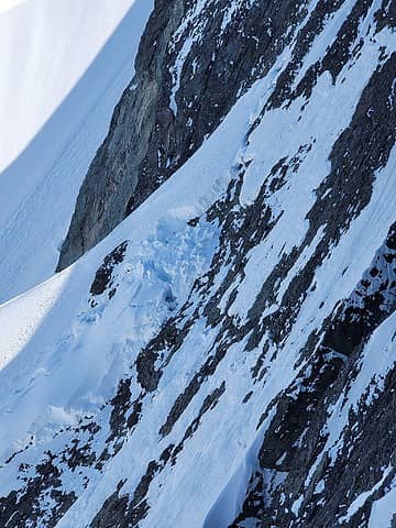 Fracture above the Company Glacier 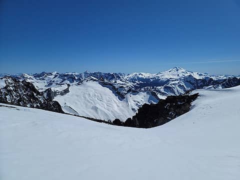 North Star and the Grant Glacier. North Star was another add-on idea for Rikki and I. We'll have to return for it, Buckskin, and Foreskin out of Holden. 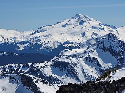 Dakobed 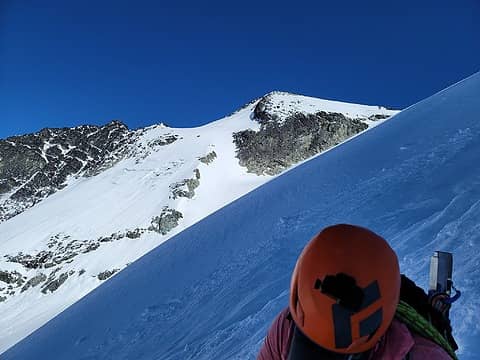 Big crack in the background (didn't happen while we were out there) 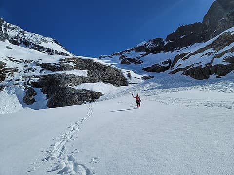 Nearly out of terrain traps 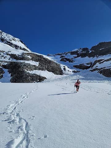 Action Shotz 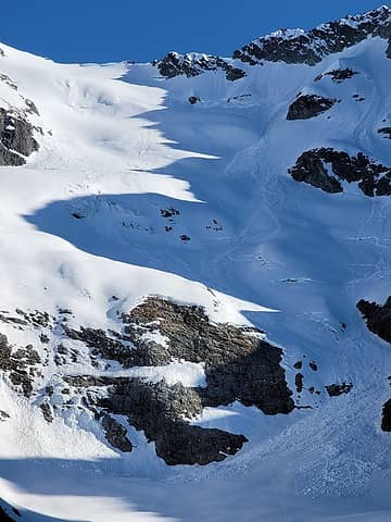 After the fact 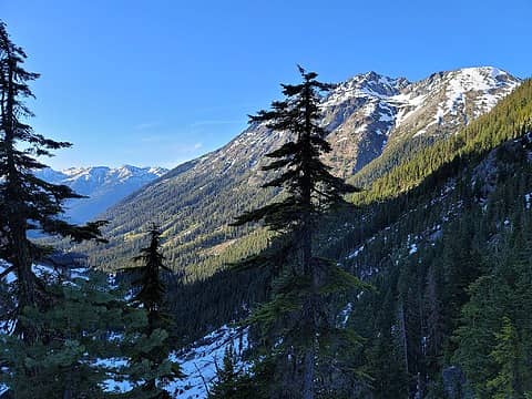 mmmm 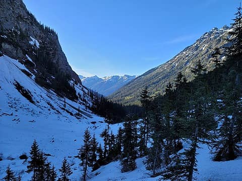 Staying closer to the creek rather than farther away from seems to be a key factor in the Swamp Creek approach and deproach 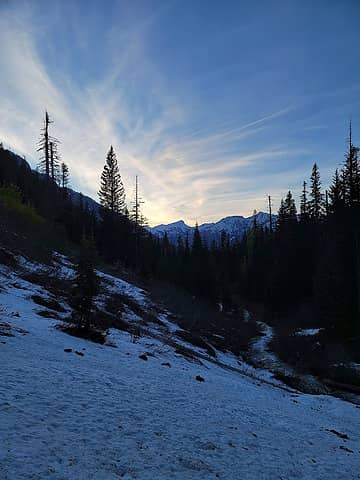 outro sights 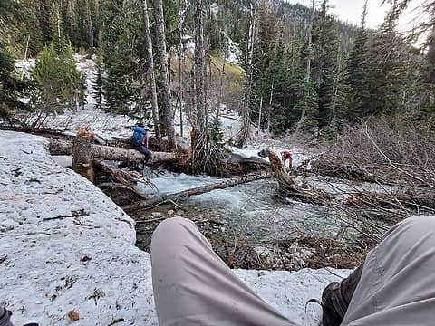 Creek crossing on the way out 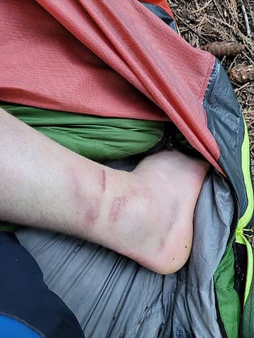 ankle 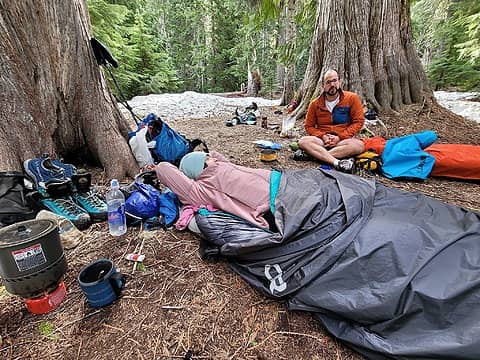 hoodlums at camp
 BensonM, Pef, RichP, KascadeFlat, Cyclopath, reststep, Tom BensonM, Pef, RichP, KascadeFlat, Cyclopath, reststep, Tom
BensonM, Pef, RichP, KascadeFlat, Cyclopath, reststep, Tom |
| Back to top |
  
|
|
zimmertr
TJ Zimmerman
Joined: 24 Jun 2018
Posts: 1228 | TRs | Pics
Location: Issaquah |
|
zimmertr
TJ Zimmerman
|
 Thu Jun 03, 2021 9:40 pm |
|
|
I wonder if y'all were the ones to lay the tracks for this party:
|
| Back to top |
|
|
rstoddard24
BBQWingz

Joined: 30 Dec 2016
Posts: 74 | TRs | Pics
|
awesome trip! we also found very smooth conditions in 2018 on the dark fin col route; I guess only 3 parties took that route before the beetles created all the deadfall. I am curious what will emerge as the "modern" standard route in the coming years.
that boot track must have been great; we could see it thru binocs from the inspiration glacier over 20mi away. The photo (taken thru binocs) isn't super clear, but I think its pretty cool (photo cred = Westy)
 tracks on the Dark glacier as seen from Tepeh Towers on Inspiration gl
|
| Back to top |
|
|
KascadeFlat
Member
Joined: 06 Jul 2020
Posts: 320 | TRs | Pics
Location: Eating peanut M&Ms under my blue tarp |
Great write up! Reads like a mini-adventure novel. Now I never have to brave Swamp Creek or the Dark glacier for myself. 
For a good time call: 1-800-SLD-ALDR.
For a good time call: 1-800-SLD-ALDR.
|
| Back to top |
|
|
awilsondc
Member

Joined: 03 Apr 2016
Posts: 1324 | TRs | Pics
|
Nice trip Alden! Getting closer to 100/100!!! It's good to see you roping up on glaciers. 
|
| Back to top |
|
|
Alden Ryno
Member
Joined: 04 Jun 2019
Posts: 150 | TRs | Pics
Location: Issaquah, WA |
Yeah, that's Ian, one of the co-leaders (I think) of the group that went up the next day! We were able to catch them and chat in Stehekin before they took off on the boat while we relaxed another day.
Ryan, that's crazy. I told Rikki what you said in your Strava about our tracks and she thought you were kidding but that was before I had even uploaded my track to Strava haha!
Thank you, Aaron! Fingers crossed, I'll be able to finish the first week of July...but that border closing will not make it easy by any means. Ryan, Dave and I (with a few others) may all finish this year if all goes well. Going up what's known to be a broken glacier in the late season made that a requirement for me. I've reconsidered a lot after Jake's accident.
|
| Back to top |
|
|
raising3hikers
Member
Joined: 21 Sep 2007
Posts: 2344 | TRs | Pics
Location: Edmonds, Wa |
|
| Back to top |
|
|
Magellan
Brutally Handsome

Joined: 26 Jul 2006
Posts: 13116 | TRs | Pics
Location: Inexorable descent |
|
Magellan
Brutally Handsome
|
Sat Jun 05, 2021 7:14 pm |
|
|
Outstanding! Thanks for the write up Alden. 
|
| Back to top |
|
|
|
|
You cannot post new topics in this forum
You cannot reply to topics in this forum
You cannot edit your posts in this forum
You cannot delete your posts in this forum
You cannot vote in polls in this forum
|
Disclosure: As an Amazon Associate NWHikers.net earns from qualifying purchases when you use our link(s). |


