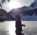
After missing Copper last December with soft snow conditions it was calling to get climbed and tik this one off once and for all, and now glad I don't have a reason to go up the wagonwheel trail anytime soon. After getting through the steep switchbacks I hit snow on the slopes leading to the lake and followed steps until the lake was reached.
Cruiser and sawtooth ridge
Lincoln seems like a somewhat difficult summit to reach, any info?
Didn't bring an ice axe, just crampons thinking the snow gully that splits the ridge would be short and not terribly steep. But the gully slants a bit up and left over a small cliff and it seemed like if I were to slip on the hardpacked snow I could potentially fall over this small cliff. Odds seemed low I would slip but didn't want to take the chance and walked to the east and went up a mellow slope and traversed the ridge from the east summit (5410') to the main summit (5425').
Constance group
Mt. Stone, want to say Mt. Mystery poking out on the left
Tried to keep going on the traverse and descend down a gully on the west side of the cirque but it cliffed out and had to walk all the back across the ridge
I like Copper Mt, that's a fun one! Looks like the weather was great, thanks for posting all of those photos of the conditions.
As for Mt. Lincoln, you can take a look at my old trip report. The first time I tried from the SW end of the Mildred Lakes basin (via the Mildred Lakes trail), but it was all cliffs. I came up from the old Mt Lincoln trail the next attempt a couple years later. I made it to the flattish knob just left of the summit point in your photos, but got fogged in and couldn't figure out how to get to the summit (drop to the SE side a bit then probably could have reached the summit).
*Just say NO to Rent-Seeking, don't give up the concept of "ownership"*
JasonK806, KascadeFlat
*Just say NO to Rent-Seeking, don't give up the concept of "ownership"*
That's interesting meck, I have seen that trail near staircase but figured it would be brushy and disappear, might try it at some point. Looks like a solid day out, didn't realize there was a chute on the west side, looks like all cliffs on the topo map.
You cannot post new topics in this forum You cannot reply to topics in this forum You cannot edit your posts in this forum You cannot delete your posts in this forum You cannot vote in polls in this forum
Disclosure: As an Amazon Associate NWHikers.net earns from qualifying purchases when you use our link(s).