| Previous :: Next Topic |
| Author |
Message |
williswall
poser


Joined: 30 Sep 2007
Posts: 1968 | TRs | Pics
Location: Redmond |
Joined my daughter for this hike, she snagged a permit for entry at Crescent Meadow (Sequoia NP). The High Sierra Trail is 72 miles long and ends up also as part of the JMT and PCT to climb Mt. Whitney. We elected to carry over to the Whitney Portal for the entire trail and arranged for transportation back to the vehicle at Sequoia. I won't go into day to day details on this hike as this is NWHikers, but it truly is a classic Sierra hike. Most of our time was spent above 10,000'. There is spectacular scenery along the way, very different from the PNW. We enjoyed mild temps and no rain or rain showers. The Whitney climb is actually a hike, on trail the entire way. I thought I might have some problems with the altitude when I passed 12,000' as my stomach started feeling a little sour, but this soon passed and we both didn't notice the altitude at all, all the way to the summit at 14,508'. We started the climb at Guitar Lake, on the trail at 3:45 AM and this worked out well. When on the summit there were only about 10 people there so we missed the early and later crowds. And this trail is crowded, I'm actually impressed by the number of people who were doing this as a day hike from Whitney Portal (8300') to the summit and back, about 21 miles RT. Once we returned to the junction of the east/west trails from the summit, there were 99 switchbacks to descend on the other side of Whitney to the area of Constitution Lake. We ended up, as planned, camping on summit day at Outpost Camp, just over 3 miles from the Portal. This enabled us to arrive at the Portal around 8 for breakfast and a pseudo clean up before the long ride back. The following photos represent each day and the stats were from Strava, which are always exaggerated on mileage at least. As stated above, the entire trail is listed at 72 miles with just short of 14,000' of climb.
Day 1: Crescent Meadow to Big Hamilton Lake (19 miles/3700')
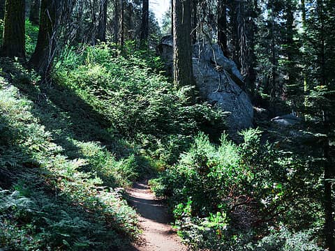 1.1 Forest beyond Crescent Meadow 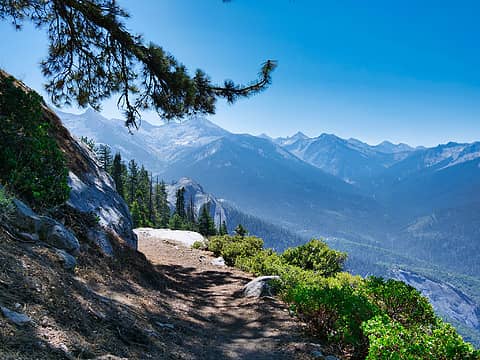 1.2 Climbing higher 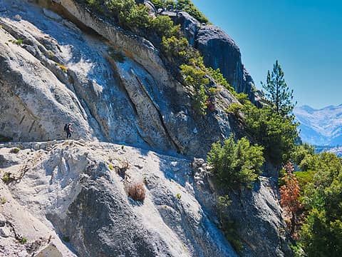 1.3 Trail cut in 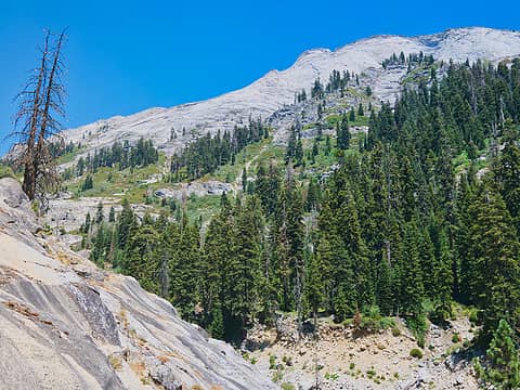 1.4 typical Sierra scene 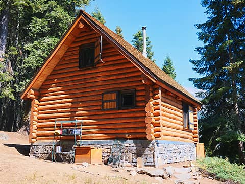 1.5 Cabin at Bear Paw 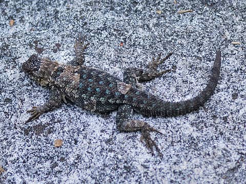 1.6 Lizard Camo 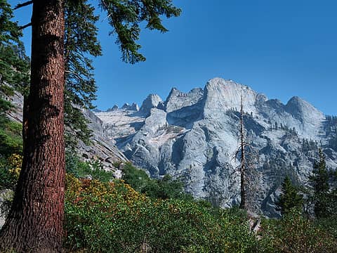 1.7 Approaching Hamilton Lake 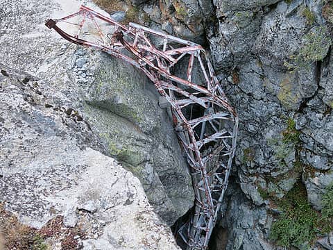 1.7 Old bridge remnants from Hamilton Gorge 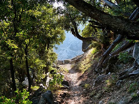 1.8 The trail behind us 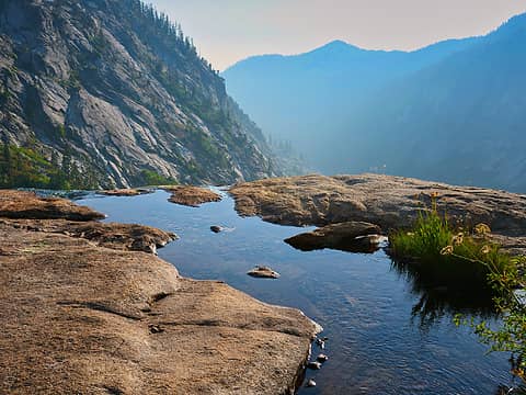 1.9 Pool below Hamilton Lake 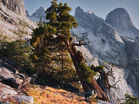 1.10 Gnarly tree 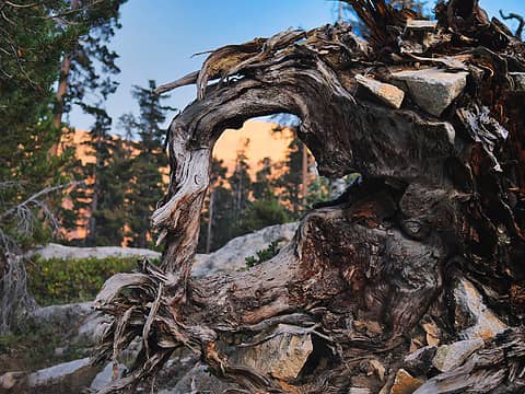 1.11 View to a sunset 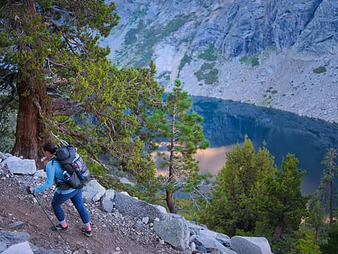 2.1 Above Hamilton Lake 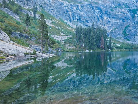 2.1 Hamilton Lake early morning 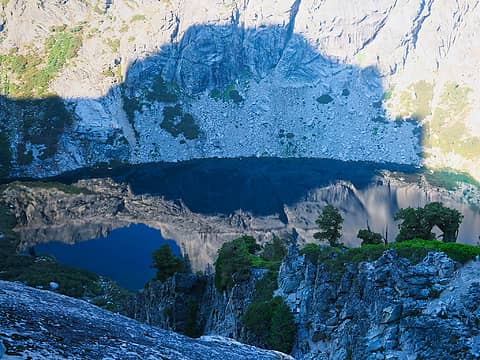 2.3 The sun also rises 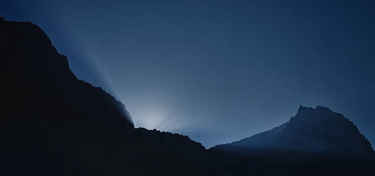 2.4 Get ready 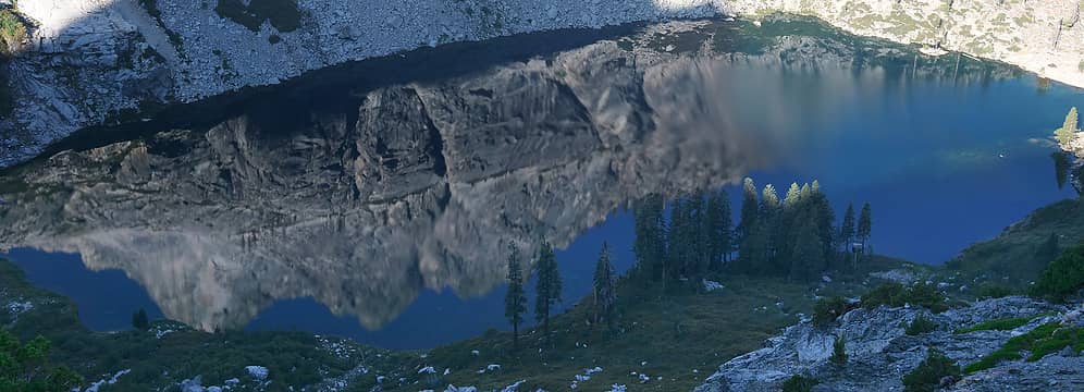 2.5 Hamilton Reflections 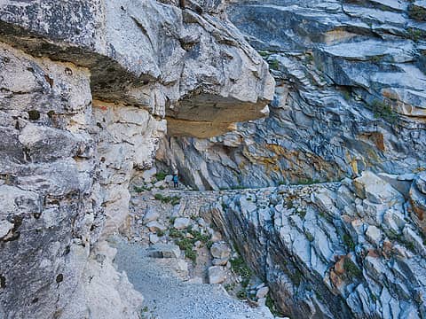 2.6 Hamilton Gorge 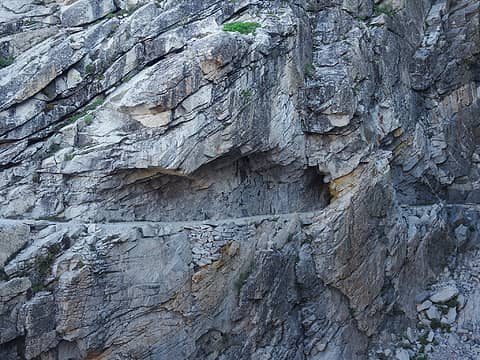 2.7 Hamilton Gorge trail and tunnel 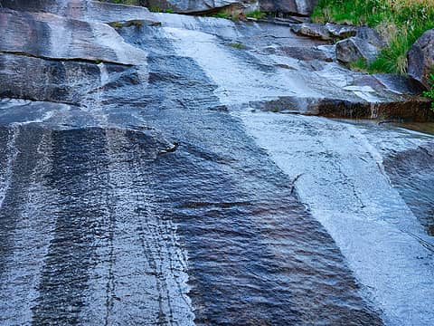 2.8 Slippery rock 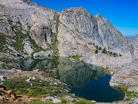 2.9 Tarn below Precipice Lake 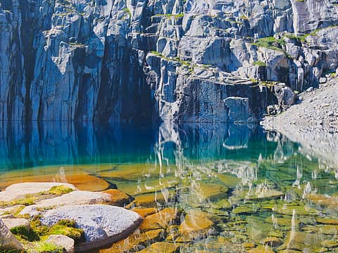 2.10 Precipice Lake 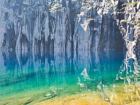 2.11 Precipice Lake 2 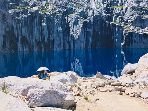 2.12 Leaving Precipice Lake 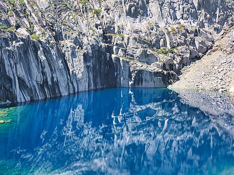 2.13 Precipice Lake 3 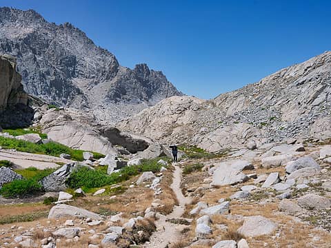 2.14 Approaching Kaweah Gap 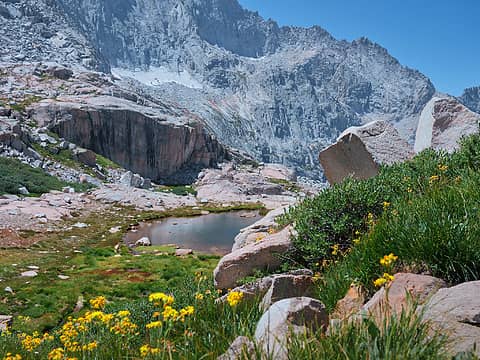 2.15 High oasis 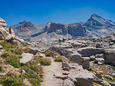 2.16 Kaweah Gap (10,689') 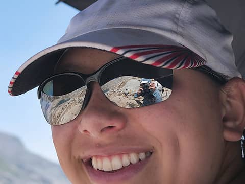 2.17 Selfie 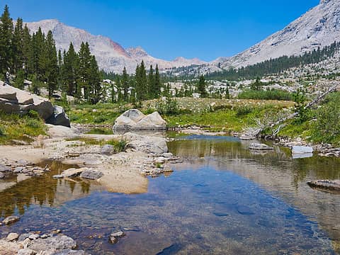 2.18 Big Arroyo 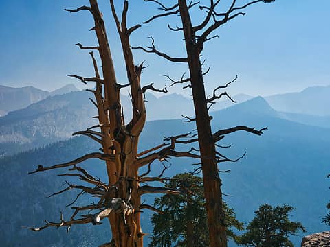 2.20 Chagoopa Plateau 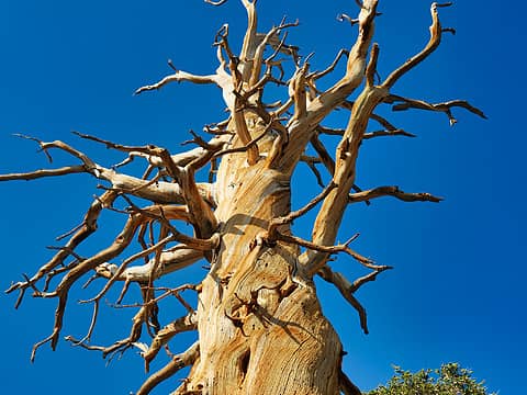 2.21 Barren tree 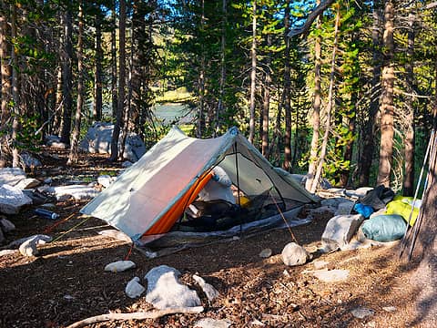 2.22 Camping at 10,500' 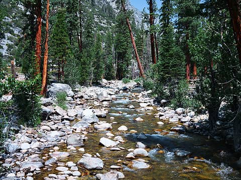 3.1 Kern River 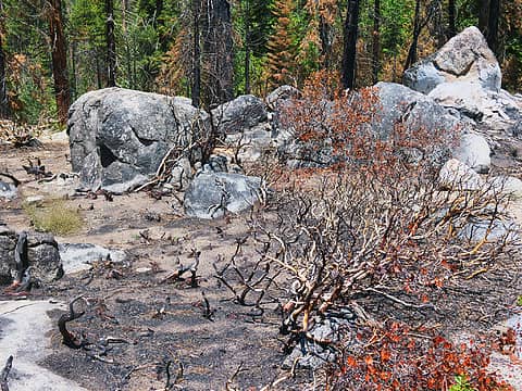 3.2 Kern burn zone 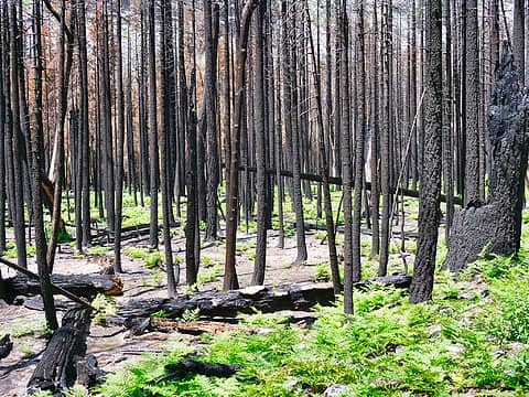 3.3 Kern burn zone 2 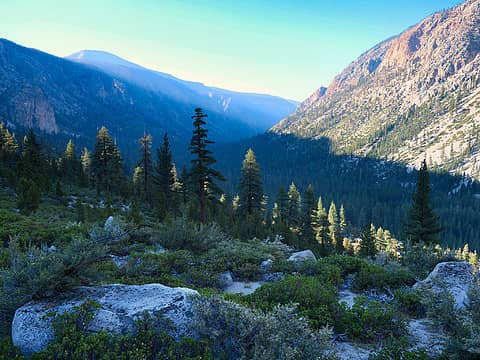 4.1 Looking back at Kern Canyon 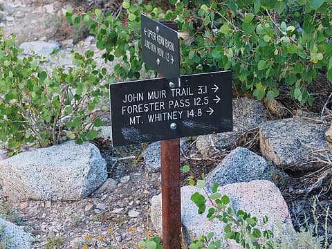 4.2 Getting closer 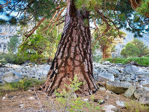 4.4 Thatsa tree! 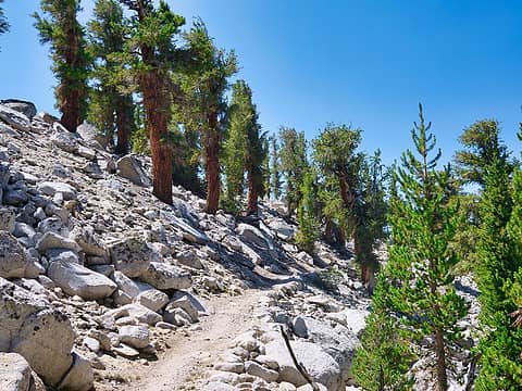 4.5 Approaching Forester Pass 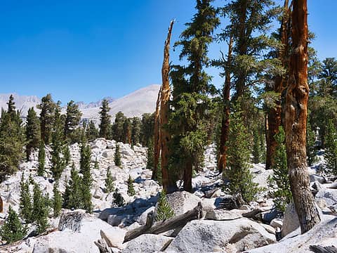 4.6 Rock and trees 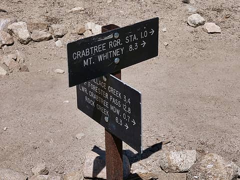 4.7 Crabtree-last stop before Guitar Lake 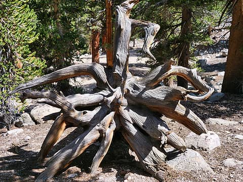 4.8 Roots 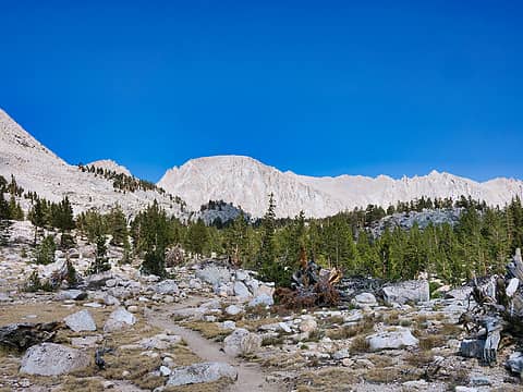 4.9 Whitney in sight 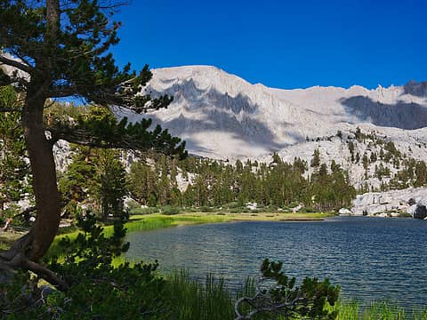 4.10 Timberline Lake 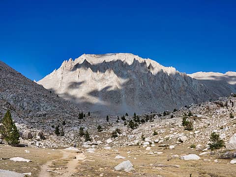 4.12 Whitney approaching Guitar Lake 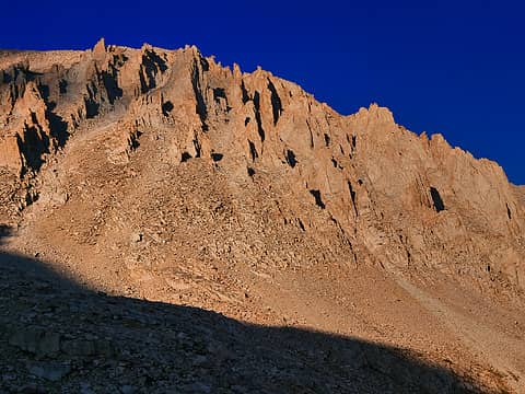 4.13 Sunset on Whitney 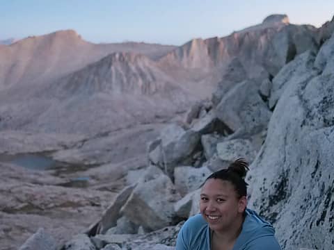 5.1 Daughter shot! 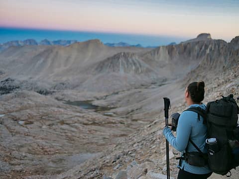 5.2 Terminator 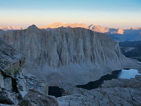 5.3 View on the climb 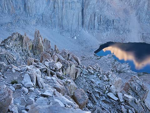 5.4 Whitney reflection 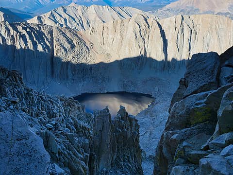 5.5 View on the climb 2 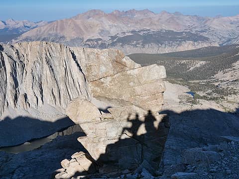 5.6 The Pose 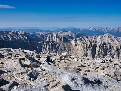 5.7 Summit 1 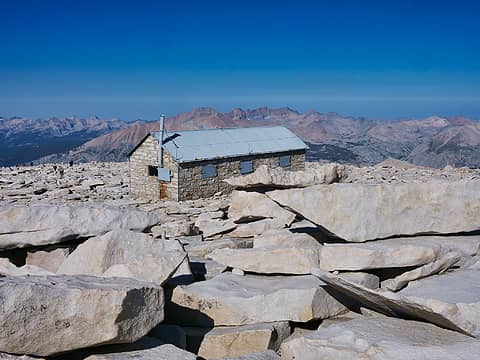 5.8 Summit 2 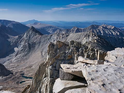 5.9 Summit 3 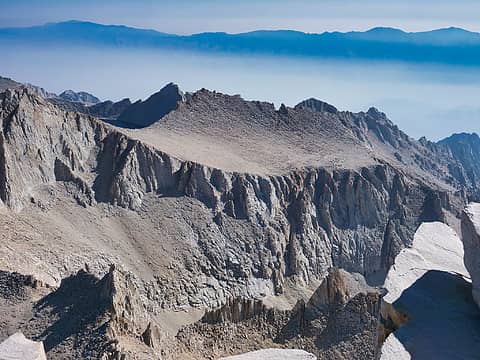 5.10 Summit 4 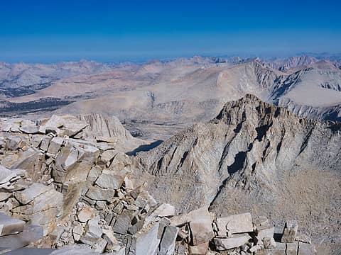 5.11 Summit 5 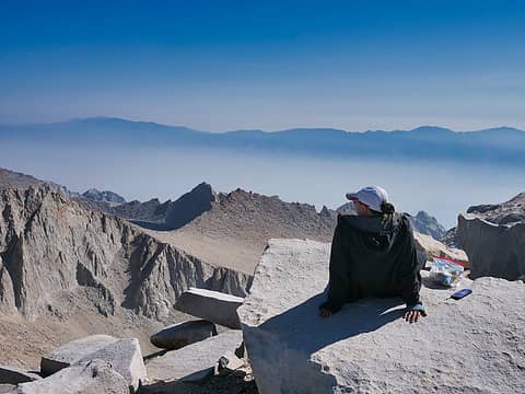 5.12 Taking in the view 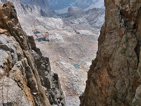 5.13 Where we'll go next 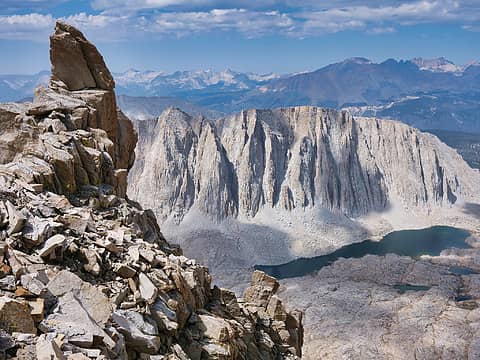 5.14 Rugged terrain 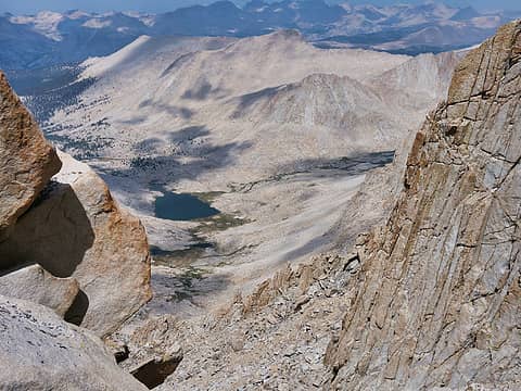 5.15 Guitar Lake below 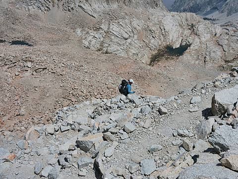 5.16 99 Switchbacks 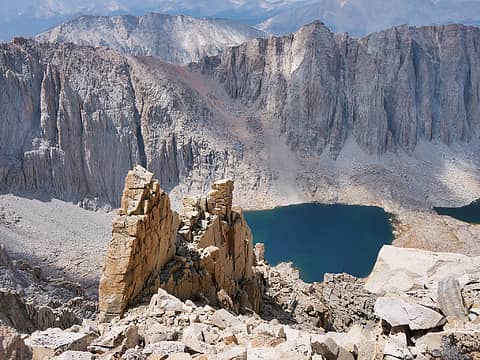 5.16 On the descent 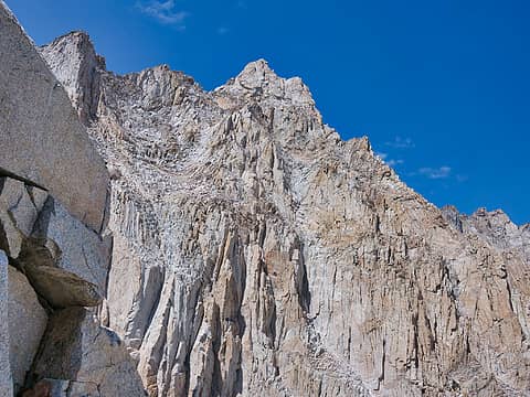 5.17 Whitney from the other side 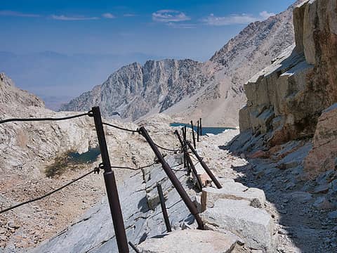 5.18 Descending towards Constitution Lake 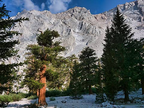 5.19 Heading to Outpost camp 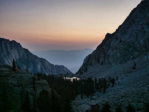 6.1 Drop to the Portal 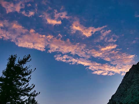 6.2 Sunrise clouds 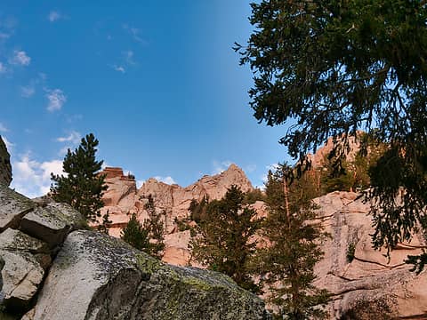 6.3 Morning light 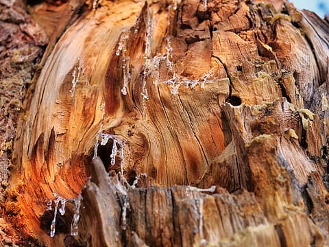 6.4 Dripping sap 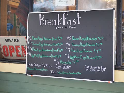 6.5 The End
I desire medium danger
williswall.com
 Pef, YoDutch, jaysway, awilsondc, reststep, kite, RichP Pef, YoDutch, jaysway, awilsondc, reststep, kite, RichP  zimmertr zimmertr
I desire medium danger
williswall.com
Pef, YoDutch, jaysway, awilsondc, reststep, kite, RichP zimmertr
|
| Back to top |
  
|
|
MtnManic
Member

Joined: 27 Feb 2008
Posts: 502 | TRs | Pics
Location: Kirkland WA |
|
MtnManic
Member
|
 Tue Aug 17, 2021 5:45 pm |
|
|
Looks like a fantastic hike - brought back memories of my (backpack) to Whitney from Whitney Portal many years back (in and out only). One person in our group (four of us backpacked, several others day hiked it our second day) had a leak in his water bottle and did the entire trip with minimal water. I have never seen that guy so wiped by a hike - this guy does not ever get wiped. Except that one time (hi Jerry,  ) )
Backpacking: limited to one pack at a time. Cameras: limited to as many as I can carry.
Backpacking: limited to one pack at a time. Cameras: limited to as many as I can carry.
|
| Back to top |
|
|
Eric Hansen
Member
Joined: 23 Mar 2015
Posts: 866 | TRs | Pics
Location: Wisconsin |
Nice pictures. I was wondering if you went. Remember your concern about fires/smoke earlier in the year. Back in the day I came in from the West, past Hamilton Lake and swung north at the Kern (looking pretty low in your picture). Fishing at Hamilton was primo.
|
| Back to top |
|
|
williswall
poser
Joined: 30 Sep 2007
Posts: 1968 | TRs | Pics
Location: Redmond |
Eric, we got lucky on the weather and smoke. Slightly hazy in the distance on the descent to Whitney Portal but otherwise real nice. Last year every place we hiked (Yosemite/Sequoia/Lassen/Big Sur) was whacked by fires shortly thereafter...guess we got lucky then also.
|
| Back to top |
|
|
|
|
You cannot post new topics in this forum
You cannot reply to topics in this forum
You cannot edit your posts in this forum
You cannot delete your posts in this forum
You cannot vote in polls in this forum
|
Disclosure: As an Amazon Associate NWHikers.net earns from qualifying purchases when you use our link(s). |


