| Previous :: Next Topic |
| Author |
Message |
neek
Member


Joined: 12 Sep 2011
Posts: 2337 | TRs | Pics
Location: Seattle, WA |
|
neek
Member
|
 Fri Sep 10, 2021 1:22 pm |
|
|
It's been hard to focus on writing this with all the amazing trip reports trickling in from the three-day weekend. Stop distracting me, folks!
I went up Phelps Creek on Monday, when everyone else was heading out. (Yes, the road is still as bad as ever.) My plan was to climb Dumbell and Greenwood on the first day, Dark Peak on the second, and Sitting Bull on the third. This was a bit too ambitious, so I settled for North Star instead of Dark. And I failed to find a way up Sitting Bull. Too bad, because it's rarely climbed, and would have a great view.
Day 1:Dumbell and Greenwood
The route to these two peaks from Phelps Basin is no secret. There is some fun and easy scrambling on Dumbell, and Greenwood is a walk-up. The ledge between the two is fun because it looks scarier than it is. Aside from one minor squeeze point, it's comfortably wide. Turns out these two peaks are Bulgers--I didn't even know! I was hoping to make it all the way to Lyman Lake after climbing them, but at some point it became clear I wasn't going to make it nearly that far. I settled for the lovely site at 6200' on the Spider Gap trail and cooked my dinner in the dark.
 dumb trick 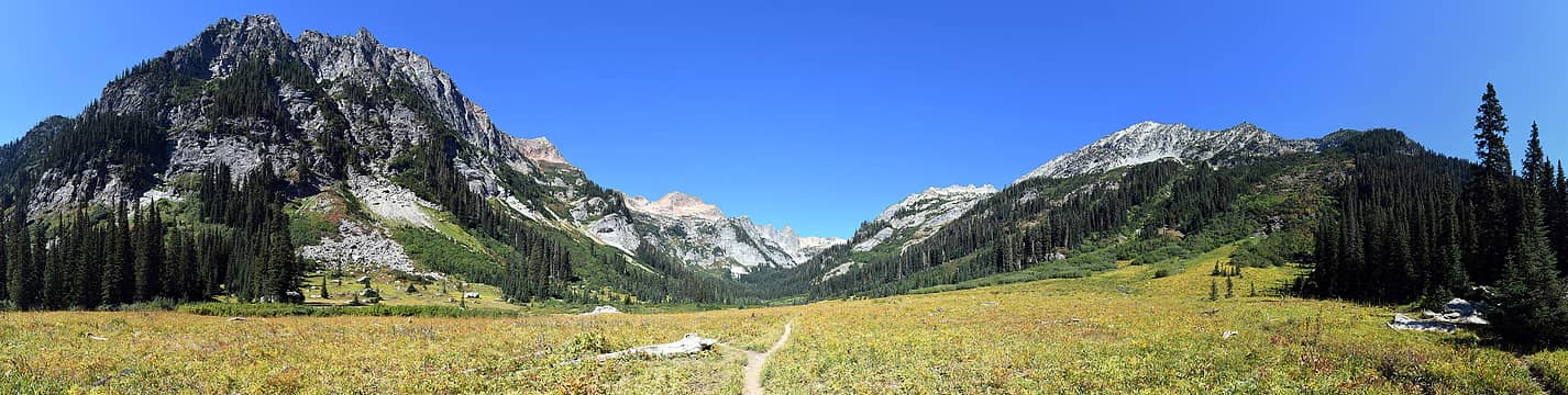 Spider Meadow 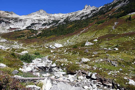 Heading up Phelps Basin 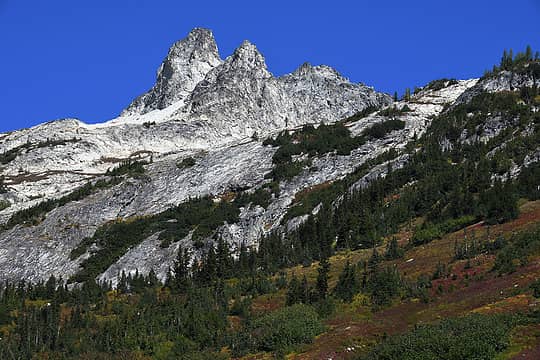 Dumbell 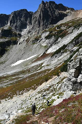 Some guys I met coming down from Dumbell 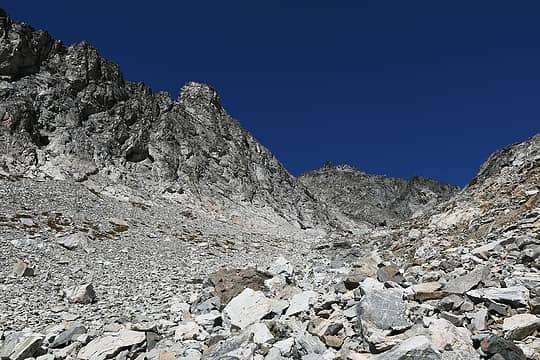 Heading up talus slope on Dumbell 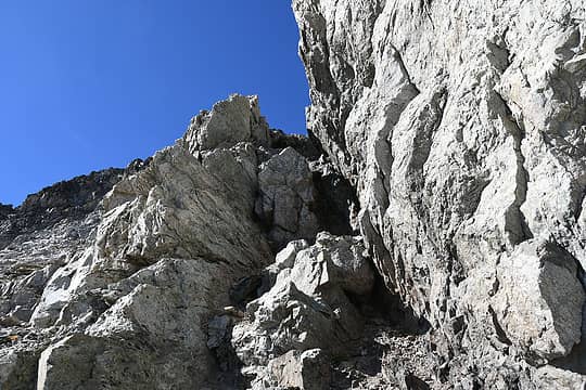 Fun scramble bit on Dumbell 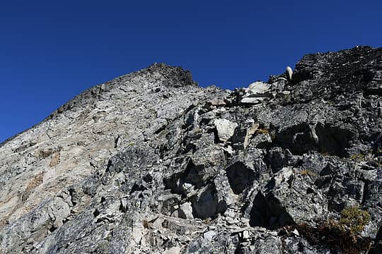 Final ridge to Dumbell summit 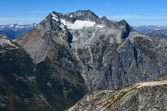 Bonanza was with me for a good bit of the trip 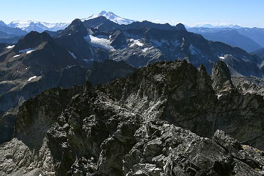 Glacier Peak behind Fortress and Chiwawa 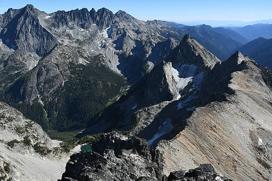 Fernow, 7FJ, Maude 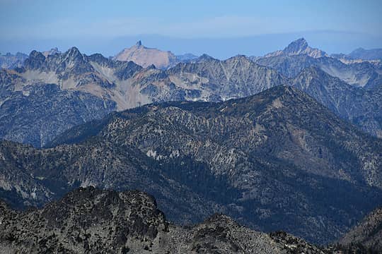 Golden Horn and Tower 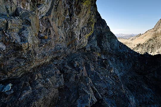 The ledge to get around Dumbell is wider than it looks and not scary 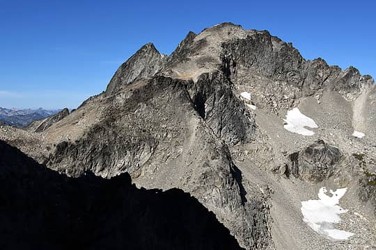 Greenwood 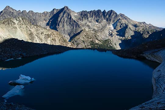 Lake between Dumbell and Greenwood 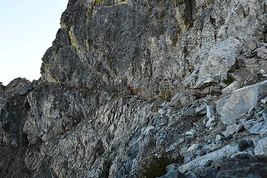 Selfie 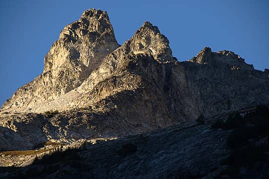 Evening light on Dumbell 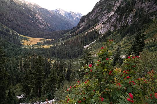 Phelps valley 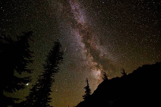 From camp below Spider Glacier 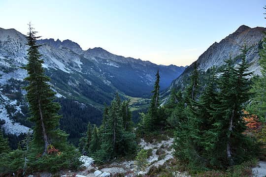 Continuing up, looking back 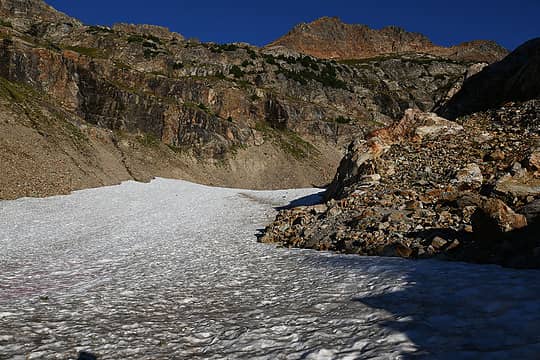 Spider Glacier 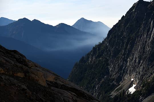 Smoke creeping in 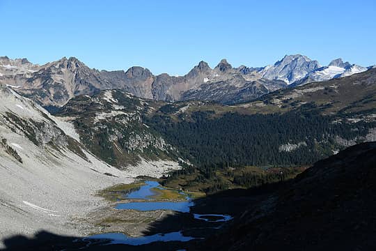 Spider Gap 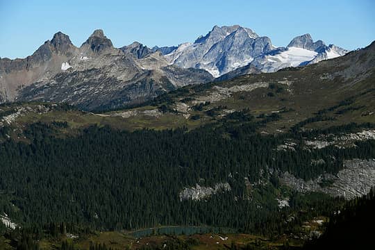 Sitting Bull on left 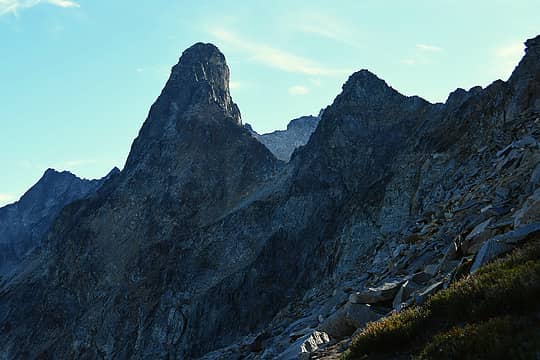 Other side of Dumbell 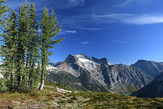 Bonanza 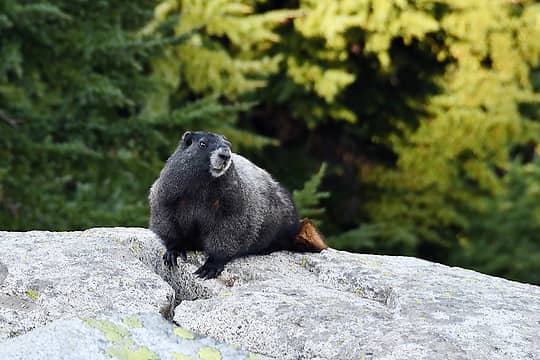 Marmot 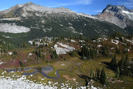 Cloudy, North Star, Bonanza 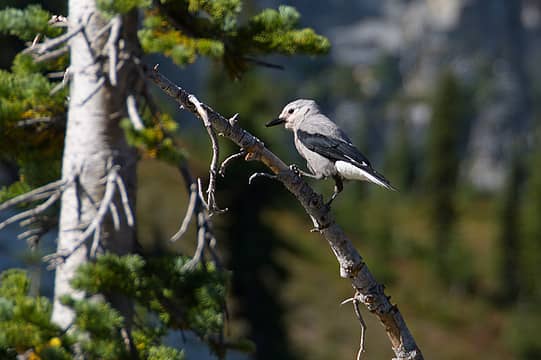 Clark's nutcracker 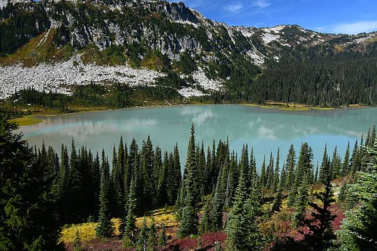 Lower Lyman Lake 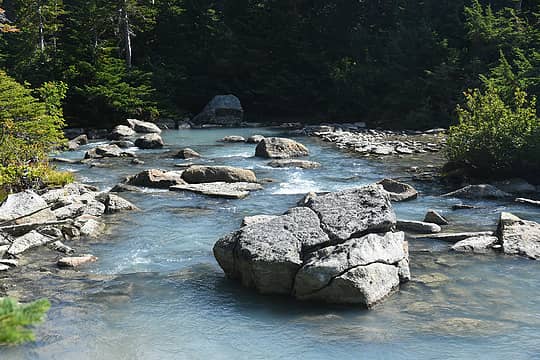 Lower Lyman Lake outlet 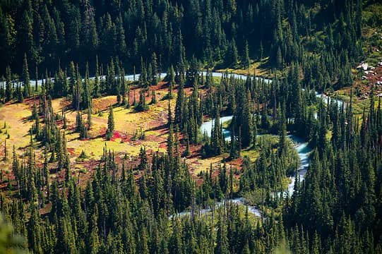 I later noticed the tiny bear in this zoom shot 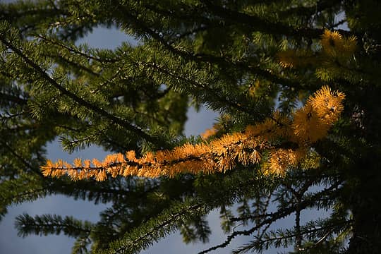 Some very early larch color 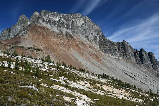 Approaching North Star - Bonanza saddle 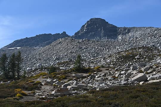 North Star 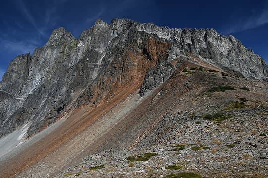 Bonanza from saddle 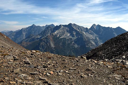 Looking north from saddle 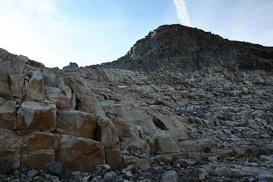 Heading up North Star 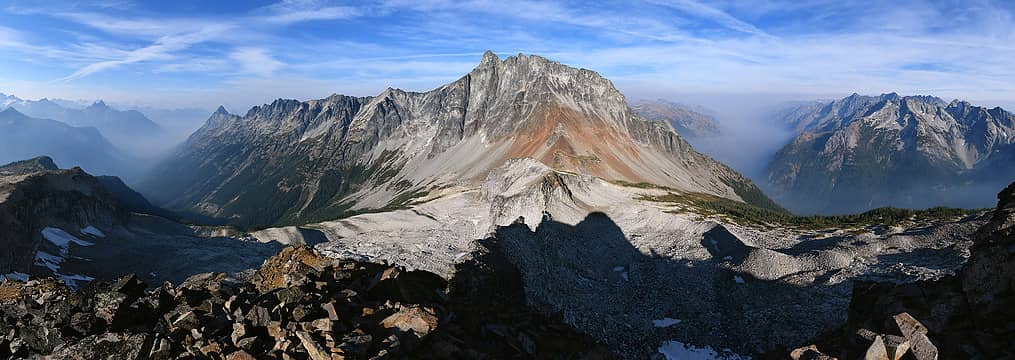 North Star summit pano 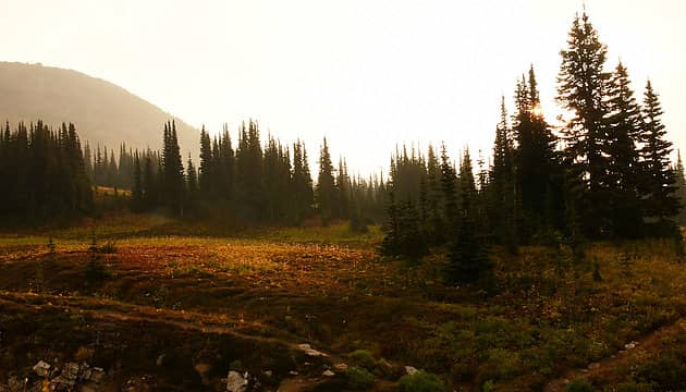 Smoky morning 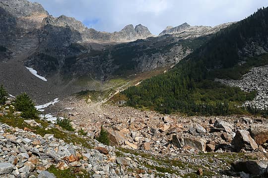 Sitting Bull - summit is on the right, and I think you go up that forested slope on the right. I tried a gully just to the right of those trees in the middle 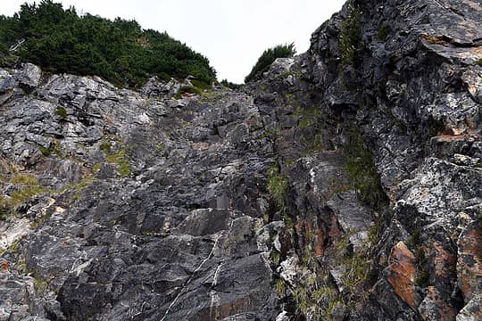 Going up this was a bad idea 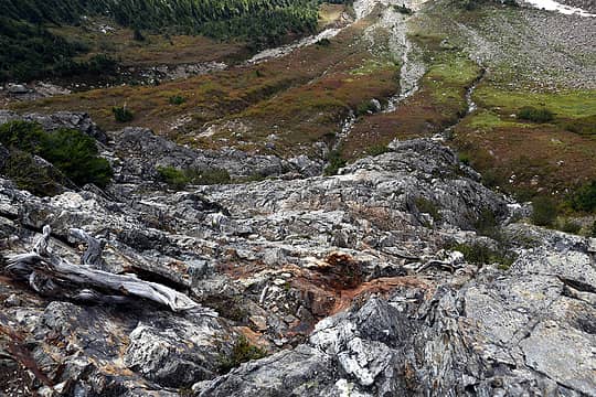 The easier part of the downclimb 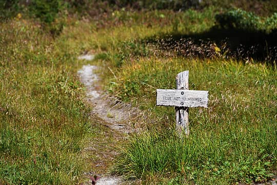 I think this is the South Fork Agnes Creek trail 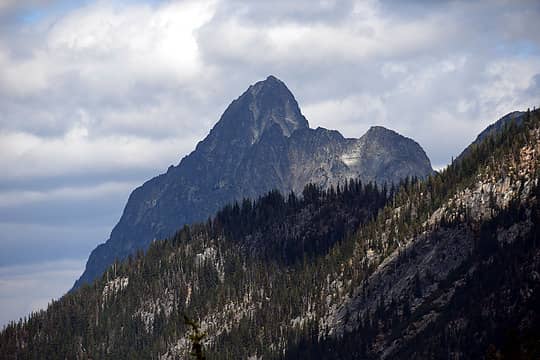 Dark Peak - for another day...  Mushroom resembling a giraffe 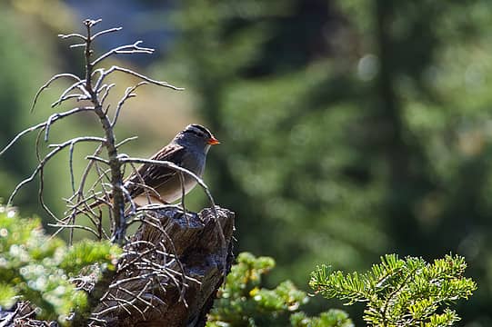 White crowned sparrow 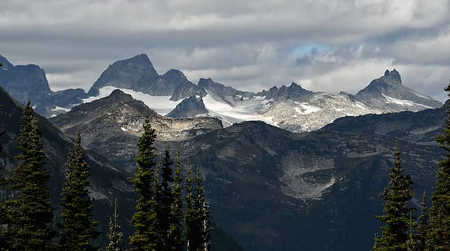 Not really sure! Looking northish from Cloudy Pass trail 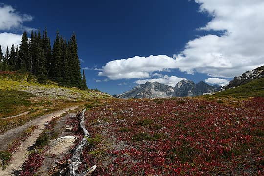 Going back to Cloudy Pass - smoke has vanished 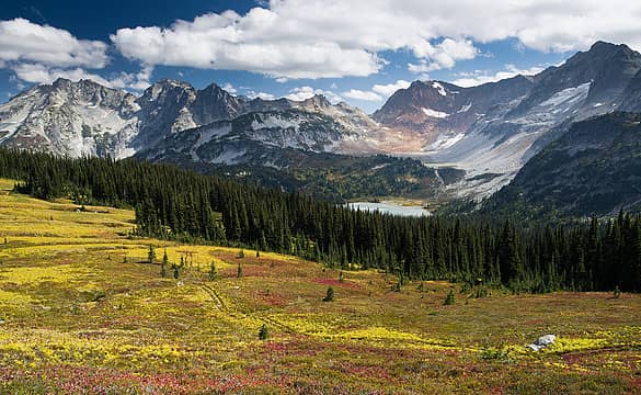 Cloudy Pass 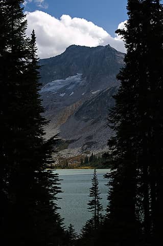 Back at lower Lyman 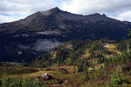 Looking back at Cloudy and North Star 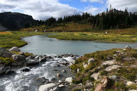 Upper Lyman 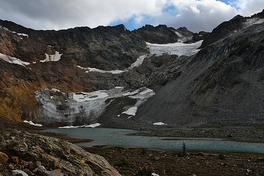 Lyman Glacier 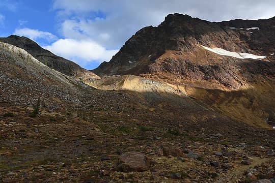 Going back up to Spider Gap 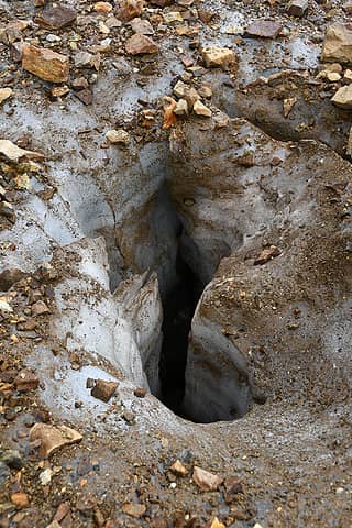 Hole 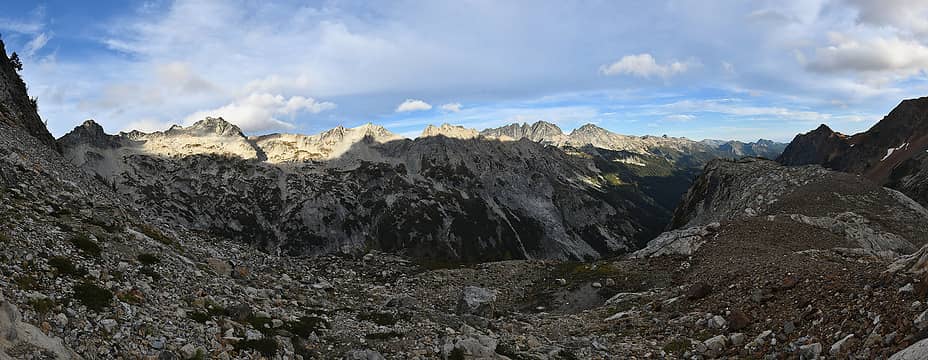 Back on the other side - 7FJ, Maude, etc
 BensonM, rstoddard24, Bowregard, Prosit, fourteen410, Dave Weyrick, Nancyann, hapemask, RichP, Gimpilator, rubywrangler, Eric Gilbertson, Tom BensonM, rstoddard24, Bowregard, Prosit, fourteen410, Dave Weyrick, Nancyann, hapemask, RichP, Gimpilator, rubywrangler, Eric Gilbertson, Tom  awilsondc awilsondc
BensonM, rstoddard24, Bowregard, Prosit, fourteen410, Dave Weyrick, Nancyann, hapemask, RichP, Gimpilator, rubywrangler, Eric Gilbertson, Tom awilsondc |
| Back to top |
  
|
|
Tom
Admin
Joined: 15 Dec 2001
Posts: 17853 | TRs | Pics
|
|
Tom
Admin
|
Fri Sep 10, 2021 1:27 pm |
|
|
Good stuff, nice to see the fall colors coming out. Hopefully the weather will hold for an extended hiking season.
|
| Back to top |
|
|
Gimpilator
infinity/21M

Joined: 12 Oct 2006
Posts: 1684 | TRs | Pics
Location: Edmonds, WA |
Great report! The peaks in question are Sinister and Gunsight.
>>>"Not really sure! Looking northish from Cloudy Pass trail"
|
| Back to top |
|
|
Roald
Member

Joined: 06 Aug 2007
Posts: 367 | TRs | Pics
Location: Seattle |
|
Roald
Member
|
Fri Sep 10, 2021 1:57 pm |
|
|
Wow, what an impressive trip! And your pics are beautiful. The meadows on the traverse below Cloudy and North Star are pretty sweet, and probably even more so with autumn colors coming out.
|
| Back to top |
|
|
RichP
Member

Joined: 13 Jul 2006
Posts: 5634 | TRs | Pics
Location: here |
|
RichP
Member
|
Fri Sep 10, 2021 2:43 pm |
|
|
Nice set of photos. 
williswall
williswall |
| Back to top |
|
|
Fletcher
Member

Joined: 29 Jul 2009
Posts: 1870 | TRs | Pics
Location: kirkland |
|
Fletcher
Member
|
Fri Sep 10, 2021 3:07 pm |
|
|
Beautiful Nick! Ive been trying to get out to North Star all summer but havent made it yet.
|
| Back to top |
|
|
raising3hikers
Member

Joined: 21 Sep 2007
Posts: 2344 | TRs | Pics
Location: Edmonds, Wa |
neek, you hit that area at a good time! great pics phelps basin, cloudy pass is so nice..
|
| Back to top |
|
|
puzzlr
Mid Fork Rocks

Joined: 13 Feb 2007
Posts: 7220 | TRs | Pics
Location: Stuck in the middle |
|
puzzlr
Mid Fork Rocks
|
Fri Sep 10, 2021 9:36 pm |
|
|
That looks like a really great trip. And you seem to have hit a weather/smoke window perfectly.
| neek wrote: | Cloudy Pass |
This is a poster child shot of why not to drive a vehicle through mountain meadows. How long has it been?
|
| Back to top |
|
|
Nancyann
Member
Joined: 28 Jul 2013
Posts: 2318 | TRs | Pics
Location: Sultan Basin |
|
Nancyann
Member
|
Fri Sep 10, 2021 10:21 pm |
|
|
Nice work, Nick, I especially enjoyed your close-up pictures and those fall colors!
|
| Back to top |
|
|
Brushbuffalo
Member

Joined: 17 Sep 2015
Posts: 1887 | TRs | Pics
Location: there earlier, here now, somewhere later... Bellingham in between |
Textbook picture of a xenolith. The inclusion is schist. . As granodiorite magma intruded the host rock (schist), fragments of schist were broken away from surrounding rock but not melted.
'Xenolith' (literally 'foreign rock') is one of very few geologic terms starting with X.
Passing rocks and trees like they were standing still
Passing rocks and trees like they were standing still
|
| Back to top |
|
|
fourteen410
Member

Joined: 23 May 2008
Posts: 2629 | TRs | Pics
|
|
| Back to top |
|
|
neek
Member
Joined: 12 Sep 2011
Posts: 2337 | TRs | Pics
Location: Seattle, WA |
|
neek
Member
|
Sat Sep 11, 2021 9:36 am |
|
|
Thanks all - fun trip, definitely ended in a better mood than I started.
| Brushbuffalo wrote: | | Textbook picture of a xenolith. The inclusion is schist. . As granodiorite magma intruded the host rock (schist), fragments of schist were broken away from surrounding rock but not melted. |
Thought you might chime in. Thanks! Wikipedia says "Schist is a medium-grained metamorphic rock showing pronounced schistosity". Good to know. Please let me know if I ever start showing pronounced schistosity.
| puzzlr wrote: | | This is a poster child shot of why not to drive a vehicle through mountain meadows. How long has it been? |
Right? Aerial imagery shows the track extending past Cloudy Pass. Came all the way from Holden once I guess?
|
| Back to top |
|
|
Bowregard
Member
Joined: 05 Feb 2019
Posts: 562 | TRs | Pics
Location: Sammamish |
Fantastic photos. From landscapes to wildlife to macros you really covered the spectrum well.
I love the meadow shot especially the upper section. The wispy clouds really add to the scene:
|
| Back to top |
|
|
Malachai Constant
Member

Joined: 13 Jan 2002
Posts: 16092 | TRs | Pics
Location: Back Again Like A Bad Penny |
The Meadow pix might be a leftover from prospecting activity on Miners Ridge in the 1970s.
"You do not laugh when you look at the mountains, or when you look at the sea." Lafcadio Hearn
"You do not laugh when you look at the mountains, or when you look at the sea." Lafcadio Hearn
|
| Back to top |
|
|
RichP
Member
Joined: 13 Jul 2006
Posts: 5634 | TRs | Pics
Location: here |
|
RichP
Member
|
Sat Sep 11, 2021 1:17 pm |
|
|
I don't think cars ever made it to Cloudy Pass. More than likely the result of heavy horse use in the past. The area around Lyman Lake was lovingly restored after many decades of heavy use. I talked to one of the people involved and they packed up grass seedlings to plant after busting up the hard pan around the lake. I spent a summer up there as a wilderness volunteer and one of my duties was shooing people from camping on the grass right beside the lake in spite of signs indicating not to do so.
neek
neek |
| Back to top |
|
|
|
|
You cannot post new topics in this forum
You cannot reply to topics in this forum
You cannot edit your posts in this forum
You cannot delete your posts in this forum
You cannot vote in polls in this forum
|
Disclosure: As an Amazon Associate NWHikers.net earns from qualifying purchases when you use our link(s). |


