| Previous :: Next Topic |
| Author |
Message |
hapemask
Member


Joined: 17 May 2021
Posts: 29 | TRs | Pics
|
|
hapemask
Member
|
 Sun Sep 12, 2021 12:56 am |
|
|
I first read about Johnson Peak in Fred Beckey's Cascade Alpine Guide. Of the route on the south face from Heart Lake, he says, "... (est 6200ft). Ascend due N; no difficulties." Well, it turns out that if you forget the elevation where you're supposed to leave the trail, as I did on my first visit to the area last fall, you may in fact have some difficulties. I still had a great night camping at the lake, and decided I'd have to return for the peak, maybe as a day hike.
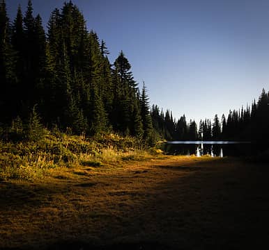 Sunset at Heart Lake last year. 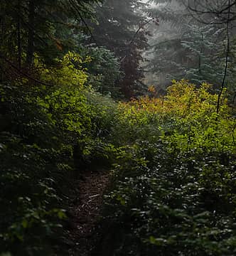 "Early morning start" for me is 7am, after snoozing my alarm for an hour. 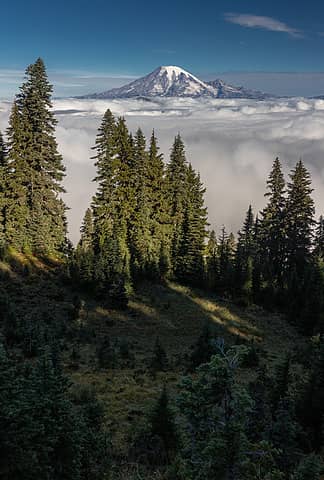 The Lake Creek valley to the north was full of clouds which slowly drifted away as the sun rose. 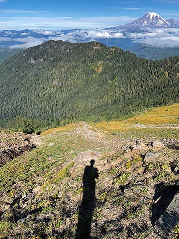 Looking back from the base of the scramble. I came up the meadow in between the two gullies. 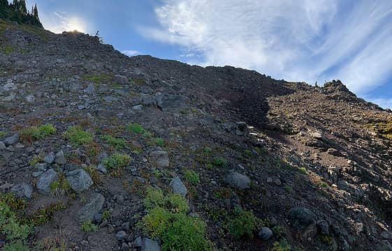 I scrambled up on the left, directly towards the sun. 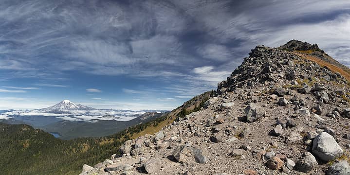 The first view of the peak from the ridge. 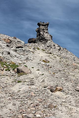 Gendarme higher up the ridge. You could probably climb this, but I wouldn't. 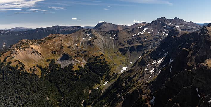 Old (not-very) Snowy, Mt. Ives 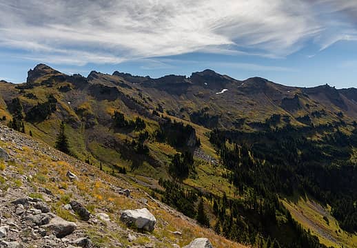 Hawkeye Point and the rest of the Lily Basin trail to the SE. 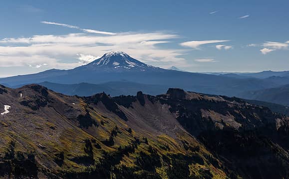 Mt. Adams 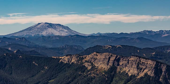 Mt. St. Helens 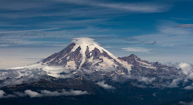 This is my favorite view of Rainier I've had so far.
 Tom, jaysway, runup, JimK, Dave Weyrick, neek, RichP, fourteen410 Tom, jaysway, runup, JimK, Dave Weyrick, neek, RichP, fourteen410  HikingBex, awilsondc HikingBex, awilsondc
Tom, jaysway, runup, JimK, Dave Weyrick, neek, RichP, fourteen410 HikingBex, awilsondc |
| Back to top |
  
|
|
Bootpathguy
Member

Joined: 18 Jun 2015
Posts: 1790 | TRs | Pics
Location: United States |
| hapemask wrote: | Sunset at Heart Lake last year. |
I really like these images. So beautiful! Thanks for sharing 👍
Experience is what'cha get, when you get what'cha don't want
hapemask
Experience is what'cha get, when you get what'cha don't want
hapemask
|
| Back to top |
|
|
BW
Member

Joined: 18 Aug 2008
Posts: 91 | TRs | Pics
Location: Seattle, WA |
|
BW
Member
|
Sun Sep 12, 2021 9:40 pm |
|
|
Yeah that light coming through the trees is something special. Great texture on the Rainier zoom, too.
hapemask
hapemask |
| Back to top |
|
|
jaysway
Member

Joined: 16 Jul 2020
Posts: 347 | TRs | Pics
|
|
jaysway
Member
|
Mon Sep 13, 2021 7:12 am |
|
|
Those views from Johnson are fantastic  I guess I'll have to add this to my ever-growing list?
How was the road getting to the Lily Basin TH? I was going to camp at Heart Lake this weekend, but TRs from the last year or so list the road as having one truly awful section, so I bailed. I guess I'll have to add this to my ever-growing list?
How was the road getting to the Lily Basin TH? I was going to camp at Heart Lake this weekend, but TRs from the last year or so list the road as having one truly awful section, so I bailed.
|
| Back to top |
|
|
hapemask
Member
Joined: 17 May 2021
Posts: 29 | TRs | Pics
|
|
hapemask
Member
|
Mon Sep 13, 2021 12:30 pm |
|
|
| iRemeberToby wrote: | | How was the road getting to the Lily Basin TH? I was going to camp at Heart Lake this weekend, but TRs from the last year or so list the road as having one truly awful section, so I bailed. |
It does still have one truly awful section. An SUV should be able to get up it with careful driving, a sedan may have issues. Supposedly at least one sedan has been spotted up there after stacking rocks to bridge the gap in the hill.
If you want to go to the lake and are concerned about the road, you should try the approach from the Berry Patch TH. When I went last year I was still driving a Honda Civic and so I chose that TH, it was an easy drive (the hike is a bit longer though via the Goat Ridge trail).
jaysway
jaysway |
| Back to top |
|
|
|
|
You cannot post new topics in this forum
You cannot reply to topics in this forum
You cannot edit your posts in this forum
You cannot delete your posts in this forum
You cannot vote in polls in this forum
|
Disclosure: As an Amazon Associate NWHikers.net earns from qualifying purchases when you use our link(s). |


