| Previous :: Next Topic |
| Author |
Message |
haydenslides
Member

Joined: 23 Feb 2009
Posts: 78 | TRs | Pics
|
This was our second trip to the Bailey's...the first time we went was in August of 2009.
Here's a link for a trip report on our 2009 expedition:
https://www.nwhikers.net/forums/viewtopic.php?t=7978008
We were a little wiser, older and "grey-er" our second time around/12 years later, but we had a hell of a good trip!
My buddy and I have been hiking with each other for almost 20 years... I couldn't think of a better trip partner:
*BAILEY RANGE VETERAN PRO TIP: If you are considering attempting the Baileys, know that this is largely an OFF TRAIL trip that involves some risk! If you dont like exposure or risk, are inexperienced with off trail navigation, or if youre not physically prepared, this route will hurt you or kill you! Prepare yourself before you go!*
The Route:
Sol Duc TH - Appleton Pass - Cat Basin - The Catwalk - Cream Lake - Ferry Basin - Lone Tree Pass - Bear Pass - Queets Basin - Elwha Snowfinger - Elwha Basin - Low Divide - 16 Mile - North Fork Quinault TH
I'm going to part this one out into daily trip report uploads...
Day 1 - 7/26/2021, Sol Duc TH to Appleton Pass
Due to ONP Goat Removal Operations, we were only allowed to hike to Appleton Pass the first day, and hold there until heli ops were complete the following day at 1100 hrs.
We got a ride up to the Sol Duc TH to begin our journey.
We were stopped by a friendly ranger who checked our BC permit at the Sol Duc/Appleton trail junction.
We had a beautiful, sunny day to hike up to Appleton Pass.
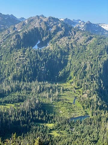
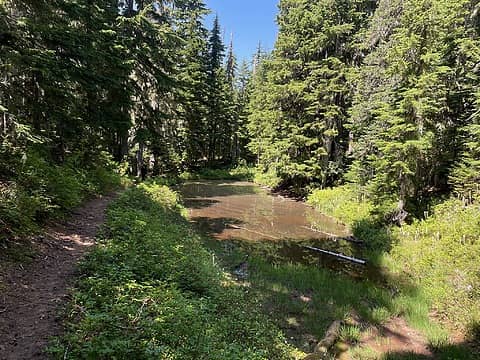 Pond along Appleton Pass Trail 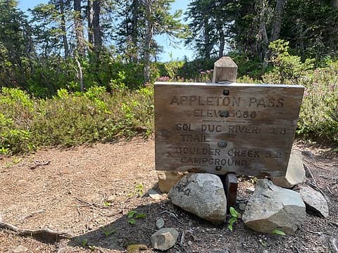 Appleton Pass 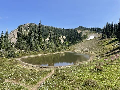 Oyster Lake 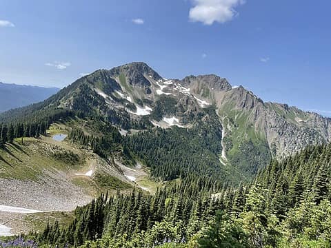 Mt Appleton 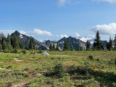 Appleton Pass Camp 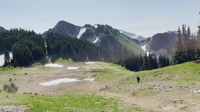 This was a lovely section of trail with beautiful meadows 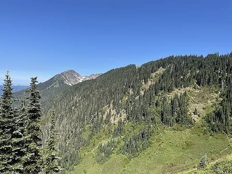 Looking back towards Mt. Appleton 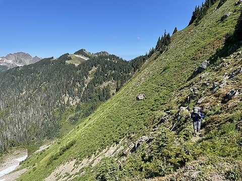 Trail En Route 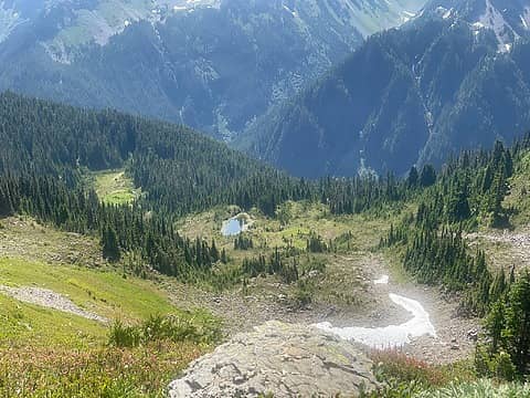 Looking down from Spread Eagle Pass (Windy Hollow) 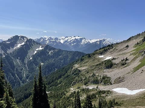 Mt Olympus from Cat Basin Way 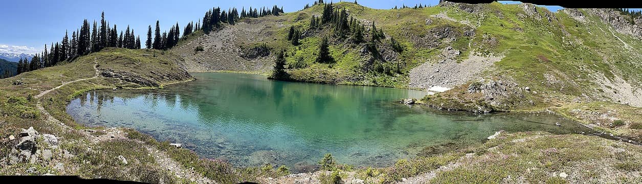 Cat Lake aka Swimming Bear Lake 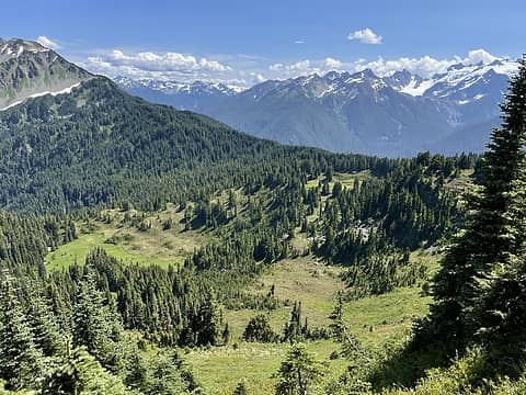 Cat Basin 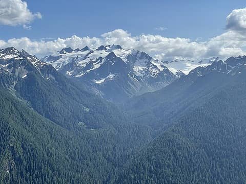 Mt Olympus 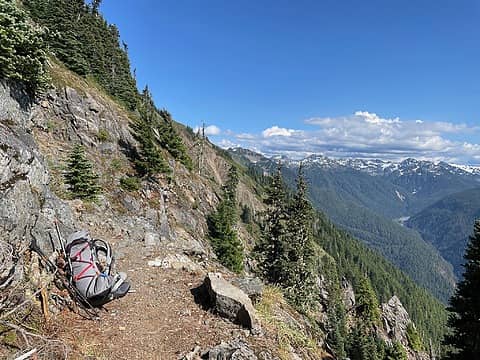 End of the Trail 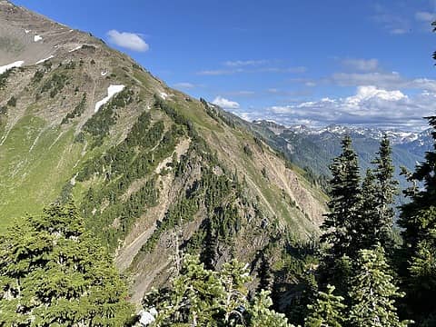 The Catwalk 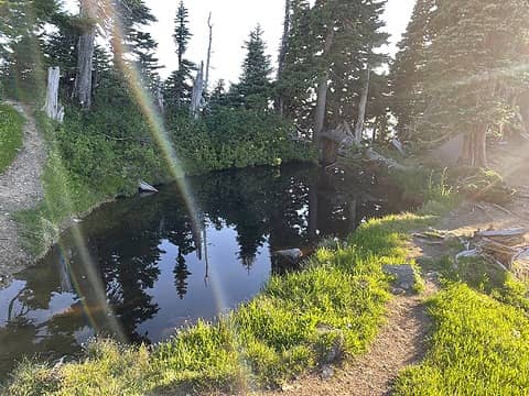 Boston Charlies 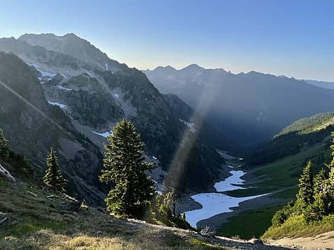 Looking North from Boston Charlies, Cat Creek 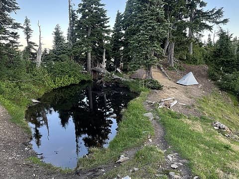 Boston Charlies camp, Night 2 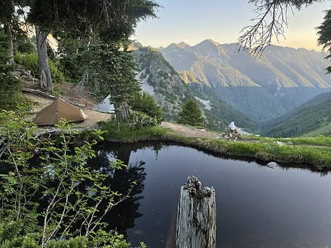 Boston Charlies 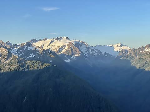 Epic bluebird view of Mt Olympus after departing Boston Charlies 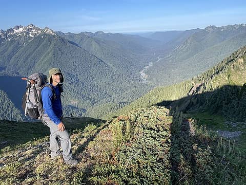 Looking west down the Hoh 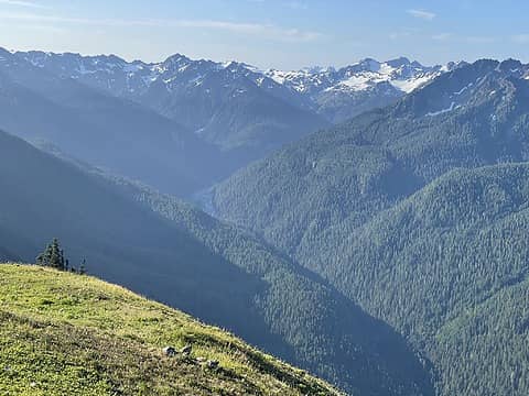 Headwaters of the Hoh 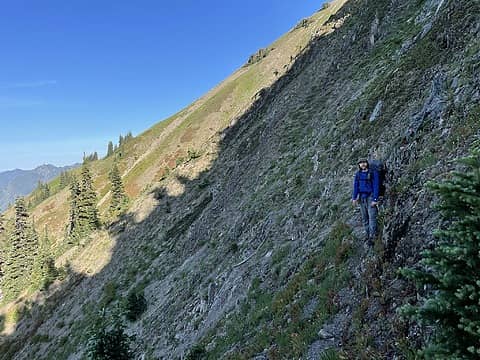 Flanks of Carrie 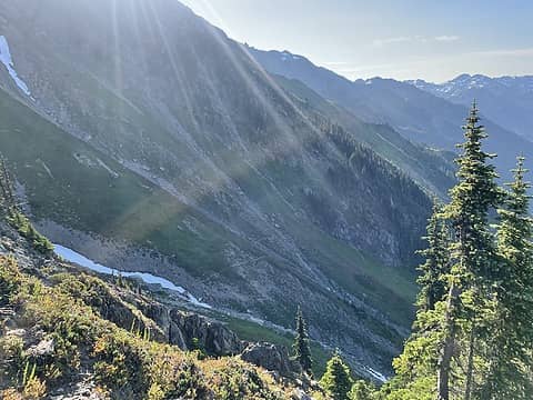 and the gulley crossings begin 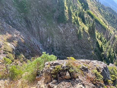 there was a particularly nasty drop to this gulley 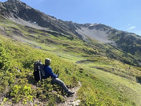 11 Bull Basin 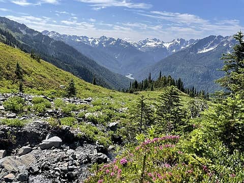 11 Bull Basin 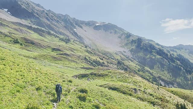 11 Bull 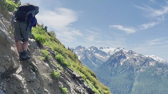 Sporty 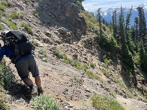 Sportiest dry gulley crossing of the trip 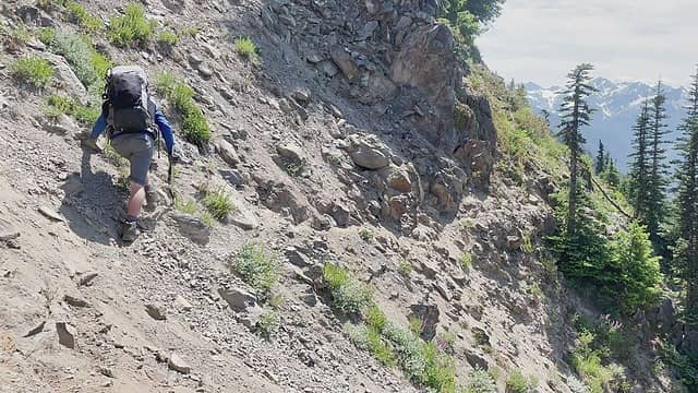 Gnar gnar loose and steeper than it looks 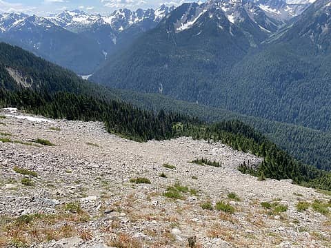 I believe we made an unplanned camp at the bottom of this slope on our last trip...glad to cruise right on by this time! 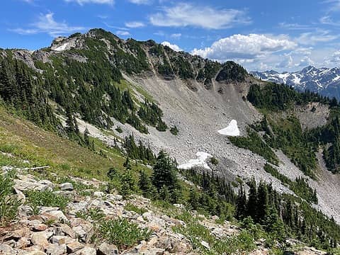 We wanted to scout the Stephen Lake route, so we ascended to the notch/saddle on climbers right. It was an ass burner going up the talus slope 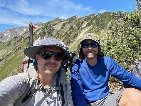 Top of the ridge 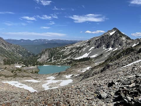 View down towards Stephen Lake. Epic.  NEXT TIME we will go the Stephen Lake Route!
We dropped off the Stephen Lake notch back to the traditional route.
NEXT TIME we will go the Stephen Lake Route!
We dropped off the Stephen Lake notch back to the traditional route.
 Lower Cream Lake 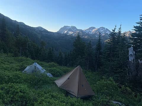 This hellhole we christened "Dehydration/Mosquito Camp"  Say what you will about the hell that is the descent into Cream Lake Basin...but there is no denying the serene beauty of Cream Lake:
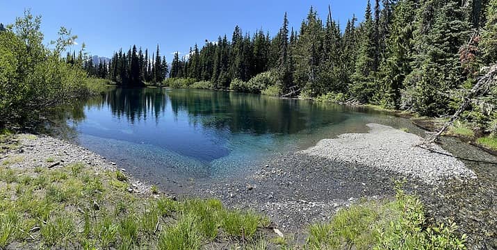 Cream Lake 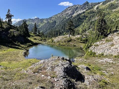 Reflection Lake, Ferry Basin 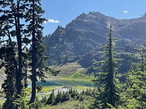 Lake Billy Everett 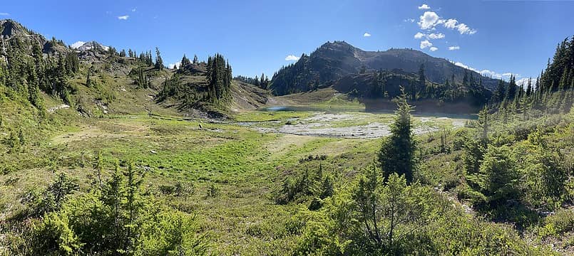 Lake Billy Everett 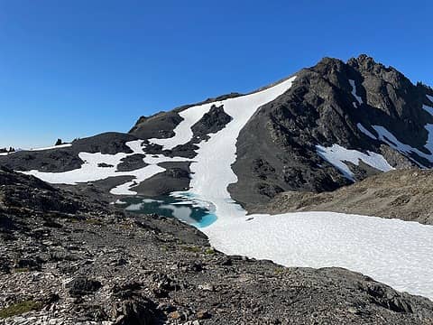 Ferry Pullitzer Saddle 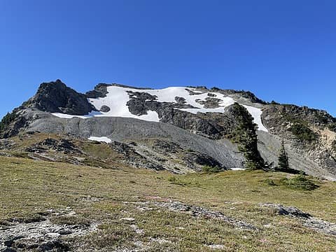 Lone Tree Pass 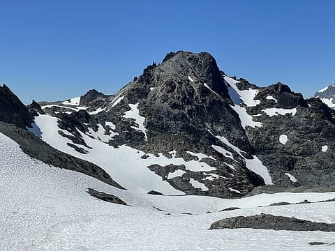 Mt Childs Glacier - The glacier was significantly more melted out than it was when we were here in 2009 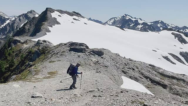 Traversing to Bear Pass Glacier 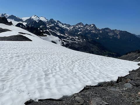 Bear Pass Glacier 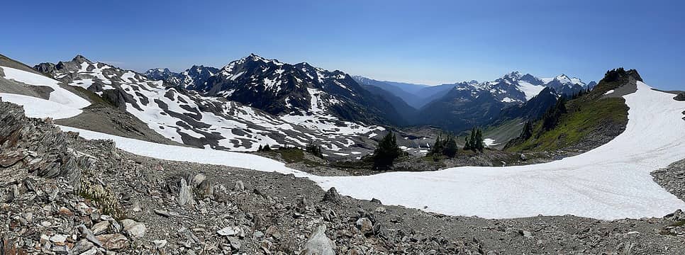 Queets Basin 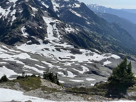 Upper Queets Basin 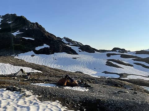 Dodwell Rixon Camp 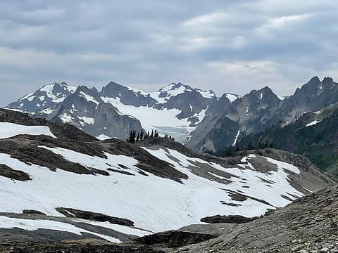 Mt. Olympus/Humes Glacier 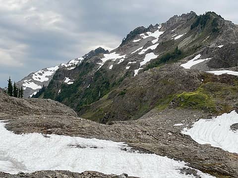 Top of the Snow Finger 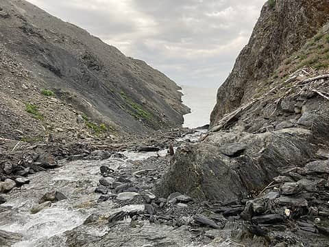 Big Snow Hump was easy peasy 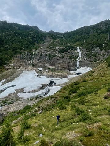 Elwha Basin 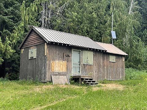 Low Divide RS 
 RodF, RichP, call-151, RAW-dad, meck, reststep, jaysway RodF, RichP, call-151, RAW-dad, meck, reststep, jaysway
RodF, RichP, call-151, RAW-dad, meck, reststep, jaysway |
| Back to top |
  
|
|
jaysway
Member

Joined: 16 Jul 2020
Posts: 347 | TRs | Pics
|
|
jaysway
Member
|
 Mon Oct 18, 2021 3:36 pm |
|
|
I love the picture of your Appleton Pass Camp, what a beautiful spot with the meadow in the foreground with the giant glaciers of Olympus in the background. I would love to do this whole traverse some day, but I'm worried about my fear of heights on the Catwalk. Glad it went easier this time versus last time.
|
| Back to top |
|
|
haydenslides
Member
Joined: 23 Feb 2009
Posts: 78 | TRs | Pics
|
jaysway- thank you for comment! Yes there are some places on the route that do have some exposure... I think that a person could work their way up to it by getting out on some more exposed spots a little bit here and there, gradually increasing their comfort level 
|
| Back to top |
|
|
RAW-dad
Member

Joined: 07 Jul 2017
Posts: 119 | TRs | Pics
Location: Oregon |
|
RAW-dad
Member
|
Tue Oct 19, 2021 5:23 pm |
|
|
|
| Back to top |
|
|
meck
Member

Joined: 31 Dec 2010
Posts: 920 | TRs | Pics
|
|
meck
Member
|
Tue Oct 19, 2021 5:38 pm |
|
|
I really enjoyed this TR and your photos (brought back "fun" memories of both the gullies and the Cream Lake vortex, and running out of water above it as well).
*Just say NO to Rent-Seeking, don't give up the concept of "ownership"*
*Just say NO to Rent-Seeking, don't give up the concept of "ownership"*
|
| Back to top |
|
|
haydenslides
Member
Joined: 23 Feb 2009
Posts: 78 | TRs | Pics
|
Raw-Dad- ha! Yeah we were right in the area of your picture...  Yes, we both have agreed that we'll attempt the Stephen Lake route next time...It looks beautiful and we talked to two different parties that had done it recently after we had gotten back, and per their report it was not bad. Thanks for your comments!
meck - too funny, sounds like we had very similar experiences Yes, we both have agreed that we'll attempt the Stephen Lake route next time...It looks beautiful and we talked to two different parties that had done it recently after we had gotten back, and per their report it was not bad. Thanks for your comments!
meck - too funny, sounds like we had very similar experiences
|
| Back to top |
|
|
graywolf
Member
Joined: 03 Feb 2005
Posts: 808 | TRs | Pics
Location: Sequim |
|
graywolf
Member
|
Sat Oct 23, 2021 2:01 pm |
|
|
I've only done the traverse once back in September 1976. There wasn't an obvious trail back then like there appears to be now (not in all sections, obviously). We traversed Olympus on our trip so had ice axes and crampons with us, and the ice axes did come in handy on the side of Mt. Carrie. Those gullies sucked! I still remember how the left side of my foot soles felt like they were being torn off. I know it may be hard for some folks to believe, but boots back then didn't come with insoles, and we just toughed it out.
We camped at Cream Lake, and as beautiful as it was, I swear that the sun set early behind the cloud of mosquitoes.
Great trip report and photos - thanks for the memories.
The only easy day was yesterday...
The only easy day was yesterday...
|
| Back to top |
|
|
haydenslides
Member
Joined: 23 Feb 2009
Posts: 78 | TRs | Pics
|
graywolf - oh man I can relate to your memory about your left foot!
No insoles?!
Thanks for you comments!
|
| Back to top |
|
|
Trailhead
PCT Class of 2012

Joined: 25 Jul 2007
Posts: 444 | TRs | Pics
Location: PDX |
|
Trailhead
PCT Class of 2012
|
Tue Nov 09, 2021 2:04 pm |
|
|
Great photos and TR.
After 7 trips across the Baileys, many of them solo, I admire your achievement but I no longer consider this route "off trail". The well worn boot path has become very easy to follow. I've made the rookie mistake of dropping into the Cream Lake vortex once but learned from the real veteran pro's of the route. The elk have shown me there's a much easier way....The cairn above the lake doesn't mark where you should go down, it actually marks when you turn off and go up.
|
| Back to top |
|
|
|
|
You cannot post new topics in this forum
You cannot reply to topics in this forum
You cannot edit your posts in this forum
You cannot delete your posts in this forum
You cannot vote in polls in this forum
|
Disclosure: As an Amazon Associate NWHikers.net earns from qualifying purchases when you use our link(s). |


