| Previous :: Next Topic |
| Author |
Message |
xallas
Member


Joined: 05 Feb 2017
Posts: 17 | TRs | Pics
Location: Seattle |
|
xallas
Member
|
 Sun Dec 12, 2021 12:10 am |
|
|
This might be helpful for some who do end up venturning out there.
Did Northway trail on Crystal this morning till sunset.
Access road and trailhead was plowed (Norse parkinglot was gated i think?). Started with snowshoes from there since it had nice 3-6" already on the ground.
Snow was mostly good until we gained the ridge. On the ascent Eastern slopes had a ton of snow, well bonded to the previous snowpack but not that well bonded to itself yet. One avy chute just north of Crystal mountain-northway notch peak was a bit of a concern but it is avoidable by ignoring summer switchback and just gaining the ridge to the flats. On western slopes thou we did come across few Whomps luckily we were on much more gentle slopes with significant tree anchoring, saw no cracks or movement, just sound. Snow on western slopes was as expected way different and significantly modified by all of the wind currents. Decided to turn around at the top of Morning glory bowl when we got reception and heard about the accident.
 Cyclopath, Fedor, awilsondc, RichP Cyclopath, Fedor, awilsondc, RichP
Cyclopath, Fedor, awilsondc, RichP |
| Back to top |
  
|
|
Cyclopath
Faster than light

Joined: 20 Mar 2012
Posts: 7745 | TRs | Pics
Location: Seattle |
|
Cyclopath
Faster than light
|
Sun Dec 26, 2021 7:23 pm |
|
|
I go to the Methow this time every year to celebrate my birthday on a ski trail.
NWtrax, Bowregard, half fast, Tom, zimmertr, Slim, neek
NWtrax, Bowregard, half fast, Tom, zimmertr, Slim, neek |
| Back to top |
|
|
Malachai Constant
Member

Joined: 13 Jan 2002
Posts: 16093 | TRs | Pics
Location: Back Again Like A Bad Penny |
Square loop from Home Bullet Fireplace trail to Debbie's View Chibiniski loop to home 6.3 mi 1475' gain.
"You do not laugh when you look at the mountains, or when you look at the sea." Lafcadio Hearn
"You do not laugh when you look at the mountains, or when you look at the sea." Lafcadio Hearn
|
| Back to top |
|
|
zimmertr
TJ Zimmerman
Joined: 24 Jun 2018
Posts: 1228 | TRs | Pics
Location: Issaquah |
|
zimmertr
TJ Zimmerman
|
Sat Jan 01, 2022 4:55 pm |
|
|
Discovery Park is a sheet of ice right now. I'm ready for summer.
|
| Back to top |
|
|
Cyclopath
Faster than light
Joined: 20 Mar 2012
Posts: 7745 | TRs | Pics
Location: Seattle |
|
Cyclopath
Faster than light
|
Sun Jan 02, 2022 6:06 pm |
|
|
awilsondc, mike, half fast  zimmertr zimmertr |
| Back to top |
|
|
Cyclopath
Faster than light
Joined: 20 Mar 2012
Posts: 7745 | TRs | Pics
Location: Seattle |
|
Cyclopath
Faster than light
|
Sun Jan 02, 2022 9:03 pm |
|
|
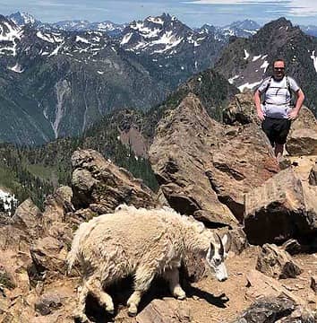
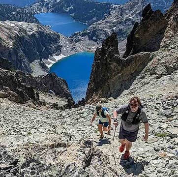
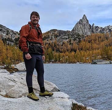
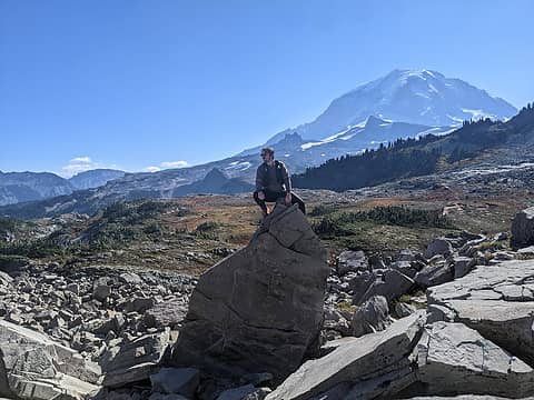
For the record, those pics are from October. My home computer died this spring and I'm still going through my backlog of photos from hiking, cycling, etc all year.
|
| Back to top |
|
|
zimmertr
TJ Zimmerman
Joined: 24 Jun 2018
Posts: 1228 | TRs | Pics
Location: Issaquah |
|
zimmertr
TJ Zimmerman
|
Wed Jan 05, 2022 5:10 pm |
|
|
I went to climb Si today and found 6-12" of very wet and sloppy snow in the parking lot and multiple stuck cars. Here's a diagram:
C was a stuck and abandoned FWD sedan of some sort and was blocking a large part of the road. And D was a stuck RWD Ford Mustang Mach-E EV. Both were originally headed towards the exit.
I parked my AWD Subaru (A) behind another AWD Subaru (B) and walked over towards the Mustang to help them out. I helped push them for about 20 minutes as they tried to get back towards the entrance. Eventually they gave up where E is shown and told me they would just wait for the tow they had called. Evidently they had already been there for over 3 hours.
I continued on towards the trailhead but felt paranoid that they would end up sliding into my car in their desparate attempts to get out. They seemed inexperienced driving in snow and the ruts in the parking lot looked like they would steer them towards my car as well.
About a half mile up the trail I decided I didn't feel comfortable leaving my car where it was given the situation. I stopped and considered turning around and then someone appeared on the trail heading towards me. I asked them if they were the owner of a Subaru in the parking lot and told them about the situation and offered to walk out with them. I had been planning on turning around when I met them anyway, but really hoped it wouldn't be for another mile or two.
I was concerned that, in the Mustang owner's continued attempts to leave, they would potentially drift in front of the other Subaru owner's car and leave them stuck between them and myself. And I didn't want to leave them angrily waiting in the parking lot sandwich for a couple hours for me to return.
When we finally made it back to the trailhead that turned out to be just the case. The Mustang was now stuck where F is shown. I reversed my car, drove out the entrance, and got the heck out of there. So now I'm back at home and only managed to walk a mile in slush after driving for 90 minutes today.
Not really sure why I'm posting this. People make mistakes and I probably could have avoided the whole situation by parking in the second or third row instead. Or at least moving my car to one of those rows after seeing the Mustang end up at E. But it really leaves me wondering why a trailhead that receives hundreds of thousands of visitors a year is both unpaved and unplowed.
So it goes. I'm ready for summer to get here already. 
|
| Back to top |
|
|
neek
Member

Joined: 12 Sep 2011
Posts: 2338 | TRs | Pics
Location: Seattle, WA |
|
neek
Member
|
Wed Jan 05, 2022 5:21 pm |
|
|
| zimmertr wrote: | | Not really sure why I'm posting this. |
Because it's highly entertaining and informational?
| zimmertr wrote: | | But it really leaves me wondering why a trailhead that receives hundreds of thousands of visitors a year is both unpaved and unplowed. |
No kidding! Thanks for the report. Sunday looks nice; things could get interesting depending on conditions.
|
| Back to top |
|
|
Malachai Constant
Member
Joined: 13 Jan 2002
Posts: 16093 | TRs | Pics
Location: Back Again Like A Bad Penny |
Squak Sortie Squak is a good place when roads are icy, passes closed, avy danger high, and forecast doubtful. Today we did a loop from our house over the top. House to East Access Trail to East Ridge Trail to Phils Creek Trail to Summit Trail to Summit to Central Peak Trail to Bullett Fireplace Trail to Mountainside TH to Home. 7.0 mi 2200 gain. Above 1000 it was beautiful with snow covered trees. Summit had 2 to 3 unconsolidated snow. Traction vey helpful where people had walked. Central Peak Trail had too many blowdowns to count some of which were difficult. No cars at Mountainside TH probably because 6 were broken into on Monday lots of fresh glass. Better choice than Si from above report.
"You do not laugh when you look at the mountains, or when you look at the sea." Lafcadio Hearn
zimmertr
"You do not laugh when you look at the mountains, or when you look at the sea." Lafcadio Hearn
zimmertr
|
| Back to top |
|
|
NorthBen
Member
Joined: 29 Feb 2012
Posts: 55 | TRs | Pics
|
|
NorthBen
Member
|
Wed Jan 05, 2022 7:30 pm |
|
|
| zimmertr wrote: | | But it really leaves me wondering why a trailhead that receives hundreds of thousands of visitors a year is both unpaved and unplowed. |
We get what we pay for
rossb
rossb |
| Back to top |
|
|
puzzlr
Mid Fork Rocks

Joined: 13 Feb 2007
Posts: 7220 | TRs | Pics
Location: Stuck in the middle |
|
puzzlr
Mid Fork Rocks
|
Fri Jan 07, 2022 9:21 pm |
|
|
NorthBen, I hope we paid for this because there are proposed plans in the East Snoqualmie Corridor Recreation Planning Area Phase 2 Trail Renovation, unfortunately no longer online. It would be fantastic if this were funded and implemented.
| Quote: | | Mount Si Trailhead Renovation
Proposed renovation work will involve pavement surfacing and striping an existing approximate 1.57-acre size gravel parking area to improve safety and ensure emergency access. The existing gravel trailhead parking lot has no defined parking spaces, so upwards of 250 cars have been counted parking disorganized into the trailhead and blocking drive aisles. The renovated trailhead will provide approximately 170 clearly delineated parking spaces (including 6 ADA spaces) and drive aisles that are signed "No Parking, Emergency Access". The picnic facilities will be renovated with new picnic tables and provide an area that can be used for staging of volunteer events. The ramp to self- contained outhouses will be rebuilt to be ADA compliant and planted bioretention areas will be constructed to improve management of storm water runoff. DNR will also work with tribes to provide interpretation for Mount Si. |
|
| Back to top |
|
|
Nancyann
Member
Joined: 28 Jul 2013
Posts: 2319 | TRs | Pics
Location: Sultan Basin |
|
Nancyann
Member
|
Sun Jan 09, 2022 10:24 pm |
|
|
Finally got to enjoy a day of full sun after over two weeks of gloomy clouds, freezing rain, powder snow blizzard, more freezing rain, ice storm, power outage, and the final blow the night before last, another foot of snow, this time Cascade Concrete, the absolute worst! When I woke up to sun this morning I couldnt wait to hit the trail, er.. logging roads. Not wanting to go anywhere near Highway 2, I chose a network of snowy roads in the Sultan Basin that I knew would provide both solitude and expansive views. Breaking trail was a lot of work, but luck was with us, and we were able to follow an illegal snowmobile track for most of the afternoon which made travel so much easier.
Olney Creek was running high today.
Naughty snowmobile made life easier for us.
Nice views higher up.
Interesting jet trails.
Lengthening shadows signal that its time for the long walk back.
A perfect day for the first hike of 2022! Not wanting to go anywhere near Highway 2, I chose a network of snowy roads in the Sultan Basin that I knew would provide both solitude and expansive views. Breaking trail was a lot of work, but luck was with us, and we were able to follow an illegal snowmobile track for most of the afternoon which made travel so much easier.
Olney Creek was running high today.
Naughty snowmobile made life easier for us.
Nice views higher up.
Interesting jet trails.
Lengthening shadows signal that its time for the long walk back.
A perfect day for the first hike of 2022!
Songs2, Lindsay, Cyclopath
Songs2, Lindsay, Cyclopath |
| Back to top |
|
|
zimmertr
TJ Zimmerman
Joined: 24 Jun 2018
Posts: 1228 | TRs | Pics
Location: Issaquah |
|
zimmertr
TJ Zimmerman
|
Sun Jan 09, 2022 10:26 pm |
|
|
My partner and I did a loop up to West Tiger 1, 2, & 3 from the High Point Trailhead and the east/northeast side of Tiger Mountain was not very fun today.
From High Point to Dwight's Way the trail was wet but snow free and we passed a couple WTA work crews dealing with some mud. (Thank you <3) Once we got on Dwight's Trail things were mostly snow covered and there were many blowdowns. We crossed a few dozen from there and continuing on the Preston Trail until we reached the Bootleg Trail. They mostly stopped at that point but were replaced with tons of standing water and high running creeks.
The bootpath we were following until then disappeared at the railroad grade and we basically broke trail from there until we topped out on West Tiger 1. Plunge stepping the whole way. Once we left the tree line the snow was more than waist deep and very soft. Not fun. Check out our splits. Mile 4 took over an HOUR. It was not a fun hour.
Once we reached the summit the snow was pretty consolidated and by time we made it to WT2 things mostly went from snowy to muddy. But the views were some of the best I've ever seen in the Issaquah area.
After we ducked back in the trees at WT3 it was lights out so we donned our headlamps. Things were icy for a while but switched to mud again after we dropped a thousand feet or so. My girlfriend told me she needs a hiking hiatus until the snow is gone. I can't say I blame her.
|
| Back to top |
|
|
fourteen410
Member

Joined: 23 May 2008
Posts: 2629 | TRs | Pics
|
^^ I think I saw you on the trail around sunset heading down from #2 - Pebbles and I stepped aside to let you both by  Views are pretty incredible up there now.
Songs2, Cyclopath, zimmertr
Songs2, Cyclopath, zimmertr |
| Back to top |
|
|
zimmertr
TJ Zimmerman
Joined: 24 Jun 2018
Posts: 1228 | TRs | Pics
Location: Issaquah |
|
zimmertr
TJ Zimmerman
|
Mon Jan 10, 2022 12:56 am |
|
|
| fourteen410 wrote: | | ^^ I think I saw you on the trail around sunset heading down from #2 - Pebbles and I stepped aside to let you both by |
Too cool!! You're officially the first person from this site I've knowingly crossed paths with in person.
Was the helmet for the nighttime trip down cable line?
|
| Back to top |
|
|
|
|
You cannot post new topics in this forum
You cannot reply to topics in this forum
You cannot edit your posts in this forum
You cannot delete your posts in this forum
You cannot vote in polls in this forum
|
Disclosure: As an Amazon Associate NWHikers.net earns from qualifying purchases when you use our link(s). |


