| Previous :: Next Topic |
| Author |
Message |
Matt Lemke
High on the Outdoors


Joined: 15 Jul 2010
Posts: 2052 | TRs | Pics
Location: Grand Junction |
|
Matt Lemke
High on the Outdoors
|
 Fri Apr 02, 2021 11:29 am |
|
|
Josh Lewis made his way over my direction for the week of March 6-13th for some desert exploring and we had a super fun time climbing some peaks and descending some cool slot canyons. This report depicts our first climb for the trip, so feel free to check back for the rest of the reports that will be posted throughout the next week or so!
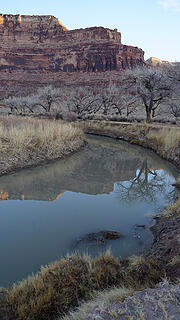
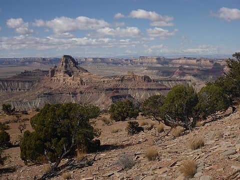
Our first objective for the trip was to climb Window Blind Peak, a towering monolith of Navajo sandstone deep in the San Rafael Swell that I've eyed for nearly 8 years. Few people have heard of this peak, let alone have climbed it, but it sits above the San Rafael River about 15 miles north of I-70. The San Rafael Swell is a huge anticline sitting in the heart of Utah where there are no settlements or services of any kind for about a 2500 square mile area. The region is chock full of technical towers to climb and canyons to squeeze down, and the majority of the area is still rarely visited. Dirt roads criss cross the area, many of which are suitable for my stationwagon despite their remoteness simply because of the soft sandstones and shales found in the area. Window Blind Peak itself has a 5.7 route up to the top that is said to be difficult and runout, and not suitable for beginner climbers. This sounded just like the type of climb I love the most so Josh and I, along with my friend Elaine parked along the San Rafael River, driving a short ways east on the Mexican Mountain Road and to a good spot just north of the peak and started the approach across the desert around 10:30am.
Right away, we had to ford across the river, which we found a somewhat shallow spot to do so, however the water was so cloudy we could not see the rocks metely a foot deep. The three of us carefully waded across the frigid water and were on our way. The approach isn't too long, and we began going up a slowly steepening hill towards the peak following a ravine draining to the north of the summit. The route had us walk around the east side of Assembly Hall Peak which sits just across from Window Blind and offers a few more challenging rock climbing routes in the 5.10 and 5.11 range (too hard for us). As we got closer to the peak, there was a section of huge boulders to navigate through that had falled off the lower cliff band that guards most of the lower slopes of the peak, but broken enough to surmount through in spots where valleys have carved down with just class 3 scrambling. Above this initial obstacle the terrain was flat again for a short while, and more shaded which resulted in 1-3 inches of lingering snow to deal with. We could see the technical portion of the climb getting closer and towering above us.
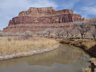 The San Rafael River 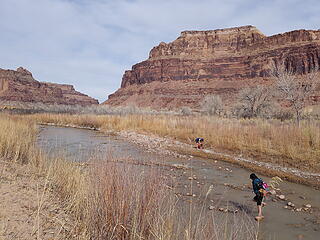 Fording the river 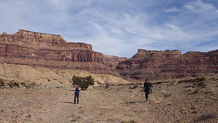 Hiking towards the peak 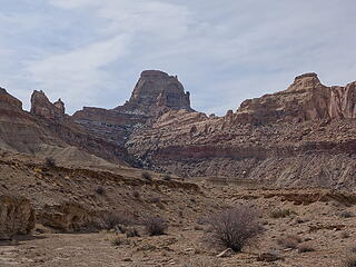 Window Blind Peak 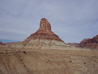 Assembly Hall Peak 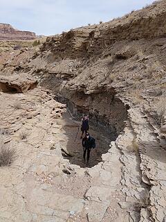 A small ravine on the approach 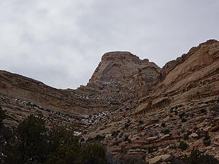 Approaching Window Blind Peak 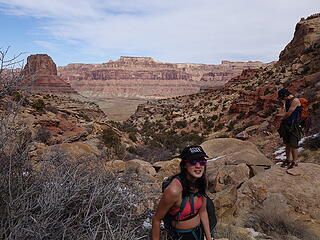 Elaine happy to be in the desert 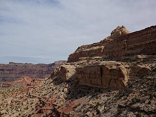 Looking across at the upper cliffs draping from Window Blind 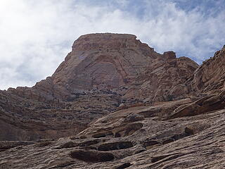 Looking up at Window Blind Peak 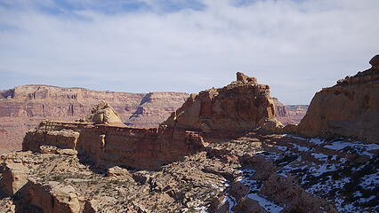 Some residual snow to deal with 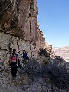 One of the many ledges used on the route 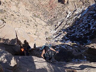 Scrambling to the base of the upper cliffs 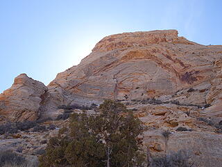 Looking up at the east window 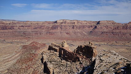 View south 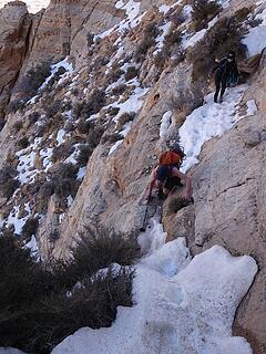 Navigating the icy narrow ledge 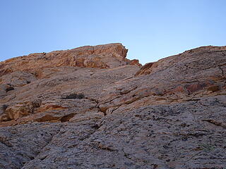 Looking up the second pitch 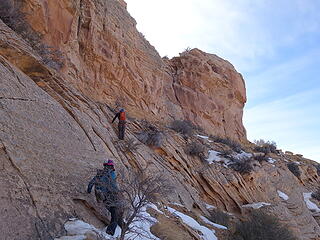 Traversing right after the 2nd pitch 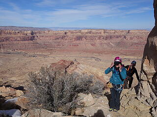 Rounding the west ridge 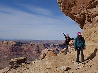 Walking the ledge around to the south side 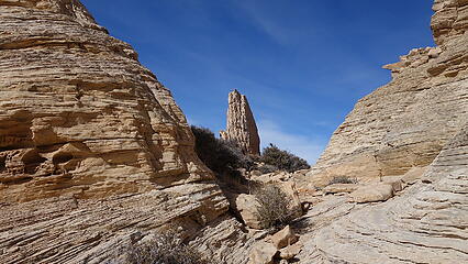 The flat bench; remaining route heads right 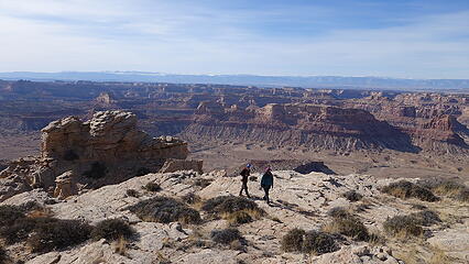 Walking the summit plateau 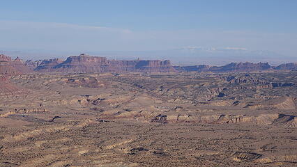 Summit view 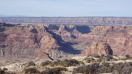 View north 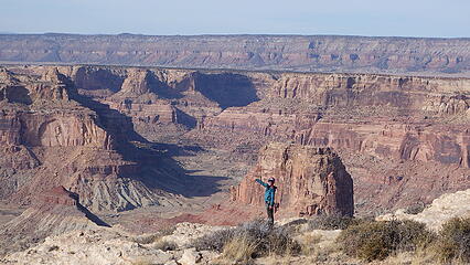 Elaine enjoys the view 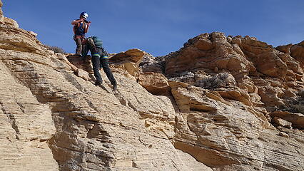 Downclimbing the final rotten slab 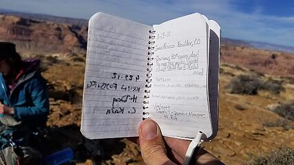 Summit register entires 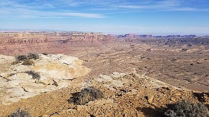 View east 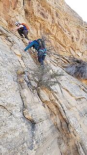 Downclimbing to our ropes 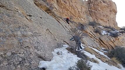 Remnant snow above the 2nd pitch 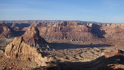 Afternoon glow beginning 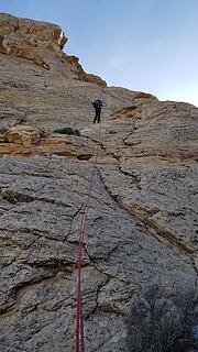 Rapelling the long 2nd pitch 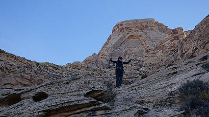 Happy for a successful day 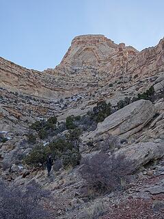 Looking back at what we'd climbed 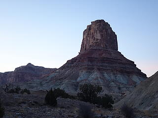 Twilight on Assembly Hall Peak 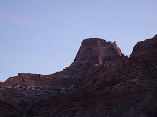 Last light on Window Blind 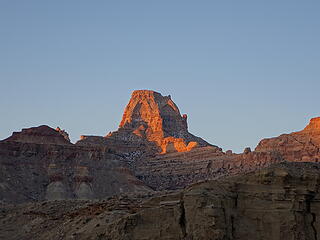 Sunrise on Window Blind 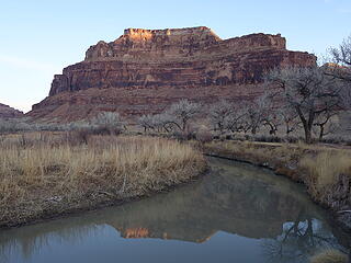 San Rafael River 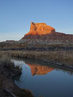 Sunrise on Assembly Hall Peak
|
| Back to top |
  
|
|
Josh Journey
a.k.a Josh Lewis
Joined: 01 Nov 2007
Posts: 4836 | TRs | Pics
|
This peak turned out to be much nicer than anticipated. Thanks Matt for leading.  Utah is quite impressive at this time of year. Utah is quite impressive at this time of year.
 Desert Cliff Reflection 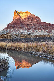 Morning Sunrise Reflection 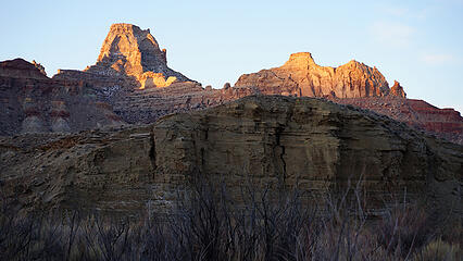 Window Blind Peak Sunrise 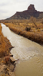 Creek Crossing to Window Blind Peak 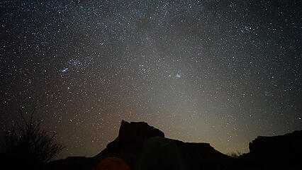 Astrophotography of Utah Night Sky
|
| Back to top |
|
|
John Morrow
Member

Joined: 03 Apr 2007
Posts: 1526 | TRs | Pics
Location: Roslyn |
How did I miss this?
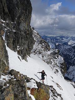
I recently went up its little sibling to the south with the one difficult move at the summit block. I recommend the east ridge below it, though, which had nice steps to scramble.
Looking across at this, I figured there was nothing less than aid climbing. Still out of my reach, though. Wish I randomly found you all and insisted you drag me up it!
 Window Blind to Sids Mountain
Tell me, what is it you plan to do with your one wild and precious life?-Mary Oliver
A nation that continues year after year to spend more money on military defense than on programs of social uplift is approaching spiritual doom.
― MLK Jr.
Tell me, what is it you plan to do with your one wild and precious life?-Mary Oliver
A nation that continues year after year to spend more money on military defense than on programs of social uplift is approaching spiritual doom.
― MLK Jr.
|
| Back to top |
|
|
|
|
You cannot post new topics in this forum
You cannot reply to topics in this forum
You cannot edit your posts in this forum
You cannot delete your posts in this forum
You cannot vote in polls in this forum
|
Disclosure: As an Amazon Associate NWHikers.net earns from qualifying purchases when you use our link(s). |


