| Previous :: Next Topic |
| Author |
Message |
thunderhead
Member


Joined: 14 Oct 2015
Posts: 1519 | TRs | Pics
|
I know its april but what looks like a pretty big winter storm exists in many forecast models. Rough time to be up high, I think. Might even see some pass closures Monday? Hopefully the late date wont catch too many unaware. Being late in the weekend helps I hope.
|
| Back to top |
  
|
|
kiliki
Member
Joined: 07 Apr 2003
Posts: 2325 | TRs | Pics
Location: Seattle |
|
kiliki
Member
|
 Fri Apr 01, 2022 3:57 pm |
|
|
Good news for skiing and for the snowpack. I just saw that snowpack at Rainier is only 70% of normal. And I tried to ski yesterday and oof, it was grabby, leg breaker stuff.
|
| Back to top |
|
|
thunderhead
Member
Joined: 14 Oct 2015
Posts: 1519 | TRs | Pics
|
Ya, the snow yesterday was so sticky. Almost as much work going down as up!
|
| Back to top |
|
|
Joey
verrry senior member

Joined: 05 Jun 2005
Posts: 2798 | TRs | Pics
Location: Redmond |
|
Joey
verrry senior member
|
Sat Apr 02, 2022 4:25 pm |
|
|
This map will always display any current weather watches and warnings. Click a colored area and follow the link for all the official details from NOAA.
View larger size in new window
|
| Back to top |
|
|
Fedor
Member
Joined: 06 May 2009
Posts: 126 | TRs | Pics
|
|
Fedor
Member
|
Sun Apr 03, 2022 5:54 pm |
|
|
https://nwac.us/mountain-weather-forecast/
| Quote: | | Our weather pattern is in for a big change as we head into the long-range forecast. This kind of dynamic spring-like weather can give us (and the snowpack) a bit of whiplash. After a cold and partly clear night Tuesday, the building high-pressure ridge will take full control of our weather. Warmer air should start to flood into the Pacific Northwest Wednesday and send our freezing levels skyrocketing. Fueled by the strong April sun and longer days, we could see an increase of 9-10,000' in a span of only 48 hrs. So, we'll go from a very strong winter storm, back to warm and dry spring-like weather in just a blink of an eye. |
|
| Back to top |
|
|
gb
Member
Joined: 01 Jul 2010
Posts: 6310 | TRs | Pics
|
|
gb
Member
|
Mon Apr 04, 2022 1:46 pm |
|
|
And then it gets colder. Freezing levels below 2000' Sunday night. Finally, starting to look like March-April weather. My best ski days other than LB area have always been between the 1st and 15th of March. This year was a total bust.
Currently strong thunderstorms in the Hoh and Queets/Quinault as well as St. Helens. (1:30 pm). Currently 36 degrees west of Lake Quinault at 600 ft.
Finally, very good rains on the east slopes of the Cascades after months of nothing but sun.
 Fedor, Chief Joseph Fedor, Chief Joseph
Fedor, Chief Joseph |
| Back to top |
|
|
Malachai Constant
Member

Joined: 13 Jan 2002
Posts: 16092 | TRs | Pics
Location: Back Again Like A Bad Penny |
Alternating between hail and sunshine, friend wanted to go up Cableline this afternoon but postponed, go figure.
"You do not laugh when you look at the mountains, or when you look at the sea." Lafcadio Hearn
"You do not laugh when you look at the mountains, or when you look at the sea." Lafcadio Hearn
|
| Back to top |
|
|
RichP
Member

Joined: 13 Jul 2006
Posts: 5634 | TRs | Pics
Location: here |
|
RichP
Member
|
Mon Apr 04, 2022 7:12 pm |
|
|
I drove across the state today and it was indeed windy. Stopped for a hike around Wenatchee and was almost blown away.
|
| Back to top |
|
|
Fedor
Member
Joined: 06 May 2009
Posts: 126 | TRs | Pics
|
|
Fedor
Member
|
Tue Apr 05, 2022 2:14 am |
|
|
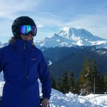
Kamikaze Trail this afternoon.
zimmertr
zimmertr |
| Back to top |
|
|
Malachai Constant
Member
Joined: 13 Jan 2002
Posts: 16092 | TRs | Pics
Location: Back Again Like A Bad Penny |
According to NWAC Avy danger looks to be bad this weekend so be careful out there folks. We are in Southern New Mexico and Texas Avy danger is zero, fire danger is off the charts with red flag warnings most every day anatemps in the 100s and gusty winds to 50mph.
"You do not laugh when you look at the mountains, or when you look at the sea." Lafcadio Hearn
jaysway
"You do not laugh when you look at the mountains, or when you look at the sea." Lafcadio Hearn
jaysway
|
| Back to top |
|
|
jaysway
Member

Joined: 16 Jul 2020
Posts: 347 | TRs | Pics
|
|
jaysway
Member
|
Fri May 06, 2022 5:26 pm |
|
|
The mid-elevation ski area 5-day forecasts that I am looking at are estimating 2.5 feet at Timberline, 2 feet at Bachelor, 1.5 feet at Alpental, 1 foot at Stevens, and only half a foot at Baker. Unseasonably cold temps and chances for snow at these elevations for the next 9 days.
|
| Back to top |
|
|
Chief Joseph
Member

Joined: 10 Nov 2007
Posts: 7707 | TRs | Pics
Location: Verlot-Priest Lake |
Snow and hail today at Priest lake and more to come plus down to 32 degrees tonight, glad I still have some firewood left.
Go placidly amid the noise and waste, and remember what comfort there may be in owning a piece thereof.
Go placidly amid the noise and waste, and remember what comfort there may be in owning a piece thereof.
|
| Back to top |
|
|
|
|


