| Previous :: Next Topic |
| Author |
Message |
rubywrangler
Member


Joined: 04 Aug 2015
Posts: 511 | TRs | Pics
|
Julia suggested a spring Grand Canyon trip and we decided on this remote, half trail-less 37 mi north rim loop described in George Stecks book Grand Canyon loops 2 which I think is out of print now but can be found online. We knew both canyons are very scrambly, and neither of us are rock climbers, but based on trip reports and Julias previous experience in lower Tuckup we believed the route was within our capabilities. (It was
mostly
 ) Our biggest concern was route finding out of Stairway canyon, which had stumped at least one previous party.
After a delayed departure due to some annoying last minute shenanigans* in Seattle, I made it to our rendezvous location at the Schmutz spring trailhead the night before our start date. The last 8 miles of road to the trailhead was horrible and the CRV barely made it without getting high centered. Julia fared slightly better with 1.5 more clearance in a RAV4 the next morning.
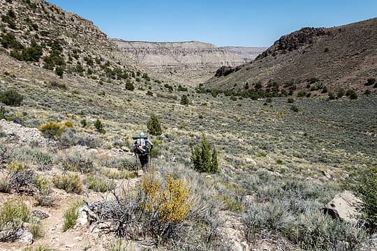
We hiked down to the esplanade and then into the wash of upper Tuckup canyon. The beginning of the route is used to dayhike to the shamans gallery, a huge rock art panel. The upper trail is also lined with tons of crinoid fossils - 300 million year old sea creatures! We walked right by the shamans gallery at first and had to backtrack to it
It is pretty spectacular. Would be even more amazing if annie schmit and others hadnt written their names over it. ) Our biggest concern was route finding out of Stairway canyon, which had stumped at least one previous party.
After a delayed departure due to some annoying last minute shenanigans* in Seattle, I made it to our rendezvous location at the Schmutz spring trailhead the night before our start date. The last 8 miles of road to the trailhead was horrible and the CRV barely made it without getting high centered. Julia fared slightly better with 1.5 more clearance in a RAV4 the next morning.
We hiked down to the esplanade and then into the wash of upper Tuckup canyon. The beginning of the route is used to dayhike to the shamans gallery, a huge rock art panel. The upper trail is also lined with tons of crinoid fossils - 300 million year old sea creatures! We walked right by the shamans gallery at first and had to backtrack to it
It is pretty spectacular. Would be even more amazing if annie schmit and others hadnt written their names over it.  
 entry 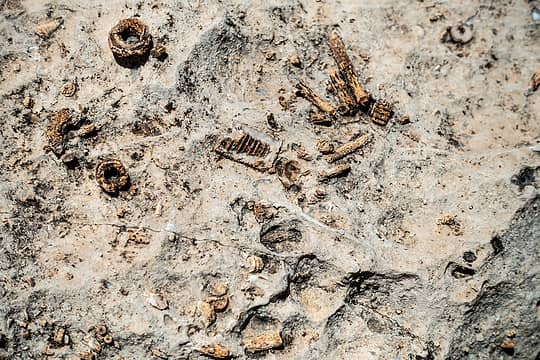 crinoids 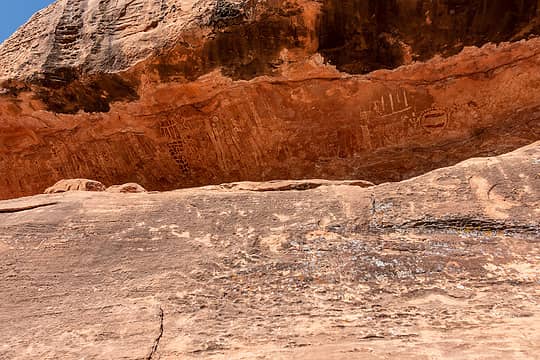 shamans gallery 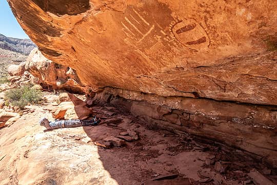 shamans gallery 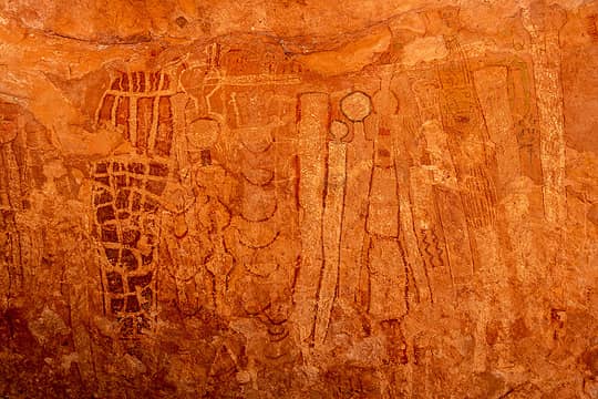 shamans gallery 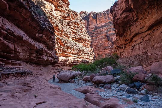 tuckup cyn 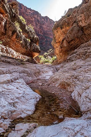 cottonwood cyn jxn 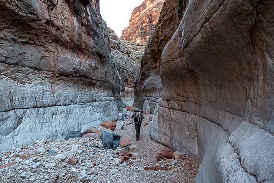 tuckup cyn 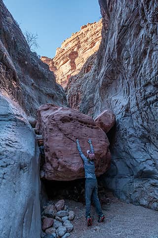 the difficult boulder obstacle from below 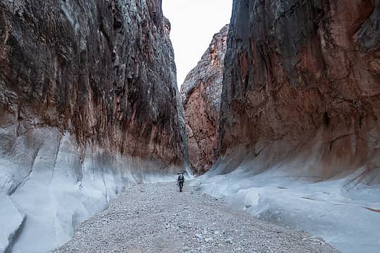 tuckup cyn 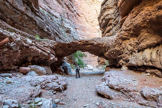 conglomerate arch 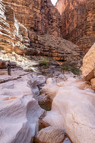 tuckup cyn 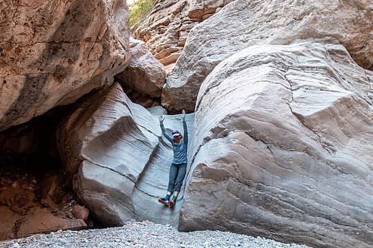 whee! 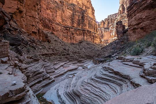 tuckup cyn 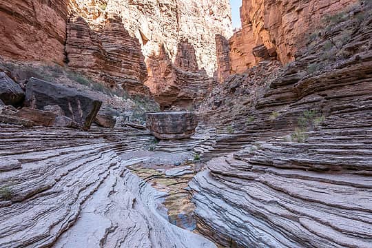 tuckup cyn 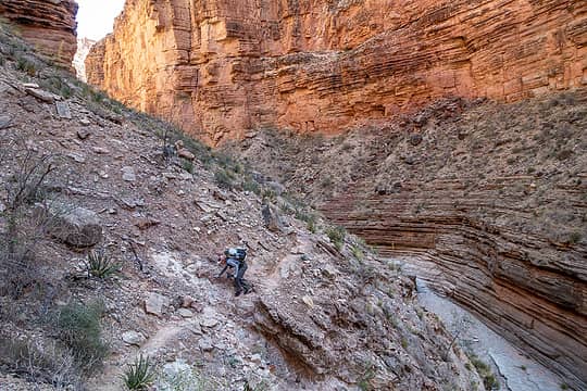 bypass 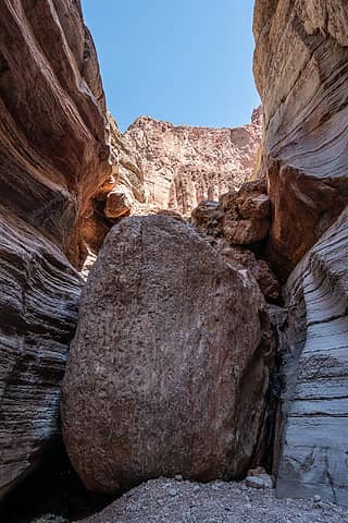 tuckup boulder 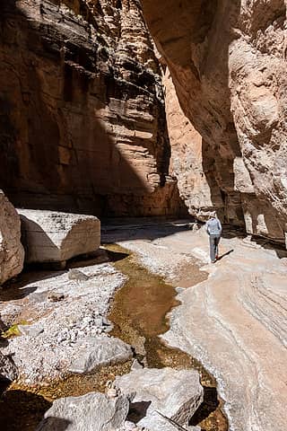 national cyn 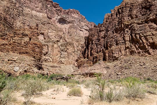 stairway cyn 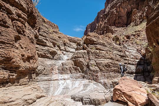 first dryfall 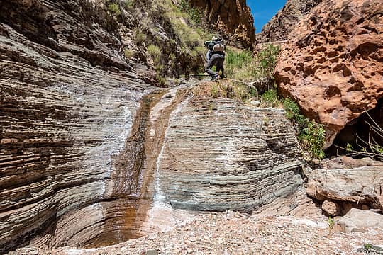 another pouroff 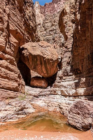 chockstone tunnel 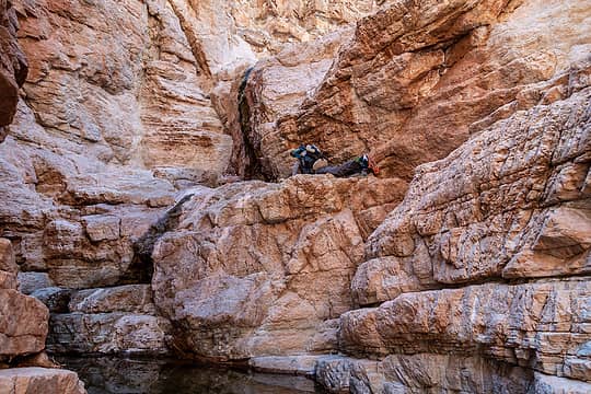 awkward scramble up 30' falls 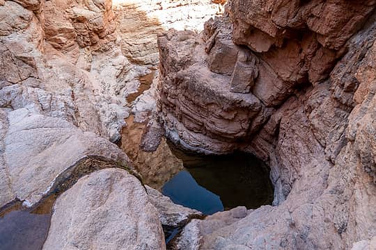 top of the 30' falls 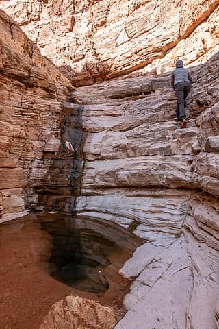 stairway cyn 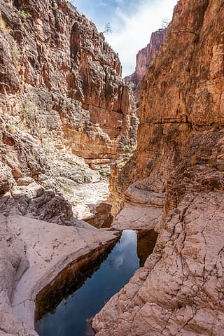 stairway cyn 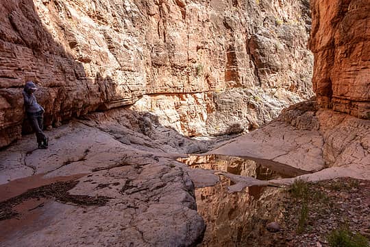 stairway cyn 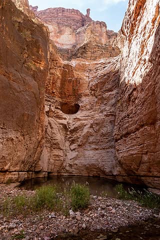 50' pouroff 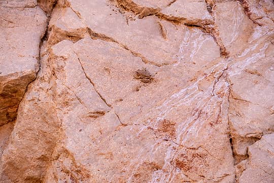 the only quiet frog 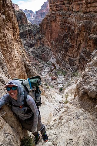 approaching top of the gully 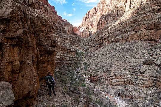 300' pouroff ahead 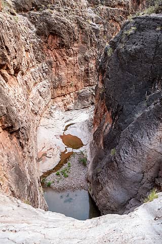 top of 50' pouroff 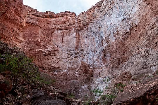 300' pouroff 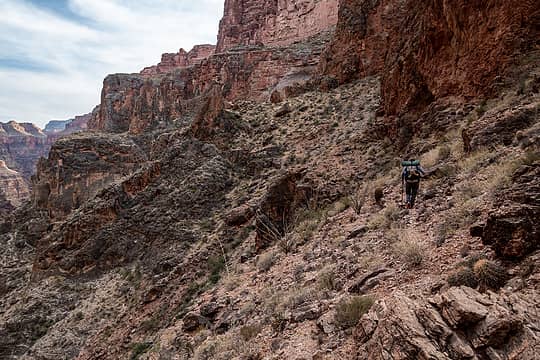 on the bypass trail 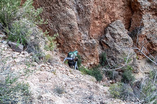 julia climbing the easy crack 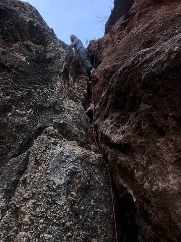 only picture from climbing the crack 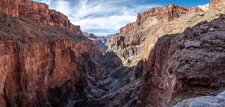 stairway canyon from camp 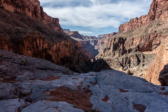 i camped on the sand patch 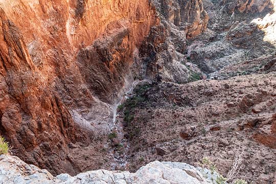 looking over 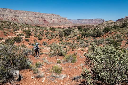 on the esplanade 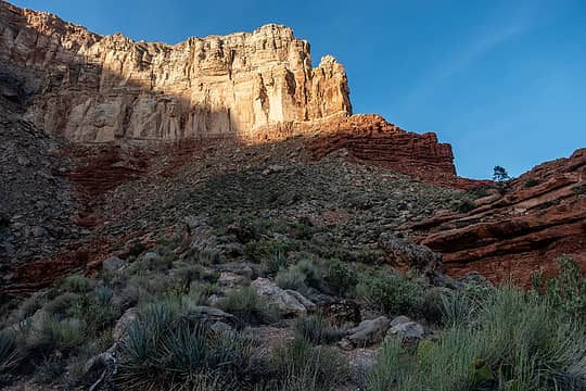 tuckup point 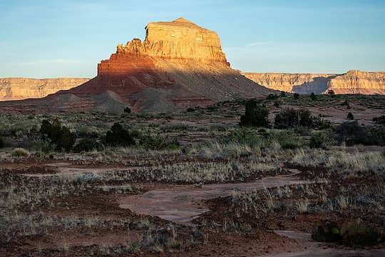 the dome 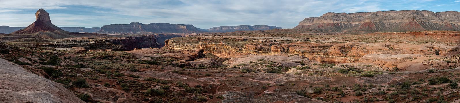 esplano 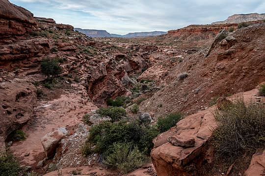 around another finger  More photos
* 2 nights before I planned to leave, my car was smashed-and-grabbed for the third time! It was parked in front of my house in NE Seattle. There was nothing of value inside; the only thing stolen was tire chains. But cost to replace window $290. Yes I know this is not only a WA or Seattle problem but it sure feels like it to me. I basically lived out of my car during a 9 month road trip and left it at remote trailheads across the southwest, CA and OR with no issues...
More photos
* 2 nights before I planned to leave, my car was smashed-and-grabbed for the third time! It was parked in front of my house in NE Seattle. There was nothing of value inside; the only thing stolen was tire chains. But cost to replace window $290. Yes I know this is not only a WA or Seattle problem but it sure feels like it to me. I basically lived out of my car during a 9 month road trip and left it at remote trailheads across the southwest, CA and OR with no issues...
 RAW-dad, Prosit, Nancyann, jstern, Kascadia, jaysway, GeoTom, fffej50, Sculpin, reststep RAW-dad, Prosit, Nancyann, jstern, Kascadia, jaysway, GeoTom, fffej50, Sculpin, reststep  Lindsay, Gimpilator, awilsondc, GaliWalker Lindsay, Gimpilator, awilsondc, GaliWalker  fourteen410 fourteen410
RAW-dad, Prosit, Nancyann, jstern, Kascadia, jaysway, GeoTom, fffej50, Sculpin, reststep Lindsay, Gimpilator, awilsondc, GaliWalker fourteen410 |
| Back to top |
  
|
|
GaliWalker
Have camera will use

Joined: 10 Dec 2007
Posts: 4930 | TRs | Pics
Location: Pittsburgh |
|
GaliWalker
Have camera will use
|
 Thu May 19, 2022 5:35 am |
|
|
What a great report! Tuckup Canyon alone looks worth the trip.
|
| Back to top |
|
|
Eric Hansen
Member

Joined: 23 Mar 2015
Posts: 866 | TRs | Pics
Location: Wisconsin |
Wow! Congrats on a great trip and trip report. 
|
| Back to top |
|
|
Nancyann
Member
Joined: 28 Jul 2013
Posts: 2319 | TRs | Pics
Location: Sultan Basin |
|
Nancyann
Member
|
Thu May 19, 2022 12:40 pm |
|
|
Looks like a super fun and fairly challenging adventure. Great pictures as usual!
|
| Back to top |
|
|
zephyr
aka friendly hiker

Joined: 21 Jun 2009
Posts: 3370 | TRs | Pics
Location: West Seattle |
|
zephyr
aka friendly hiker
|
Thu May 19, 2022 2:03 pm |
|
|
| rubywrangler wrote: | the difficult boulder obstacle from below |
Great adventure for a strong team. Love the rocks in this photo. I am guessing weathered sandstone. The colors and texture.  Sorry about the smashed window. What a horrible send off. But it didn't seem to slow you down too much. ~z
|
| Back to top |
|
|
|
|
You cannot post new topics in this forum
You cannot reply to topics in this forum
You cannot edit your posts in this forum
You cannot delete your posts in this forum
You cannot vote in polls in this forum
|
Disclosure: As an Amazon Associate NWHikers.net earns from qualifying purchases when you use our link(s). |


