| Previous :: Next Topic |
| Author |
Message |
naturealbeing
Member


Joined: 05 Dec 2004
Posts: 1565 | TRs | Pics
Location: Great Mystery |
The itch to get up to White Chuck Mtn. was to great to ignore, so Wednesday was the chosen day. Unfortunately 7 miles in on FS-24 one of my tires decided to go flat. This took me 3.5 miles of hiking and a ride of 3.5 miles to get back into Darrington for help. The lesson learned here; next time I buy a car make sure the spare has the right bolt pattern.
Fast forward. I reloaded on Friday and used the same route that Mesahchie Mark and Hichen used on their trip on the 18th. The only difference was that I had absolutely beautiful weather.
I dont know if MM or H had enough clear weather to see below while on their ascent, but I did and Ill tell you that the travel across the upper slabs and ledges take you to within a few feet of the abyss a number of times. At one such location I decided to bypass it and climb up a gully. On my way up, a rock the size of my fist ricocheted by; that was entertaining. While high up near the ridge I heard some voices and spied two people down on the trail. I quickly down climbed another gully back to the trail and was now 50 yards from the gap. I beat the two other folks to the gap and dropped down and up to the other side and reached the summit 15 minutes before their arrival. I wasnt in a race; I just didnt want them below me in the event that I kicked some rocks loose.
The two people were a father (Don) and son (Micheal) team. They had come up from FS-2437 (?) and came up the slabs on the E face of the NW summit of White Chuck Mtn. and came across the saddle onto the W face.
While we were at the summit we were entertained by a kid (young goat) and Crystal. Crystal was on the N side of the gap and the kid was on the S side. I could tell by Crystals whimpering that she wanted to meet that kid, but the kid displayed a sense of caution and wanted nothing to do with her. At times they would just stare at each other while trying to read each others intentions.
After a well-deserved food break, along with some good conversations, and many pictures it was time to head back.
On the way out the sun was much lower in the sky and everything had that nice warm orange glow (pre alpenglow).
When I got to bottom of the main gully, I was relieved to leave all that steep exposed rock and potential rock fall behind. Now I could relax and take a leisurely pace back to my car.
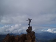
Here are some Pics for your viewing enjoyment.
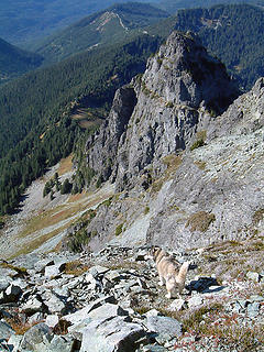 Crystal with NW lower WCM summit. 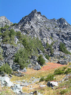 Wht. Chuck NW lower summit as seen while exiting the forest. 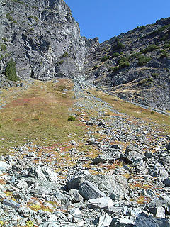 Looking up the main guly that divides the two summits. 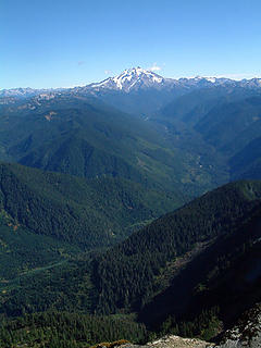 Glacier Peak, Wht. Chuck River 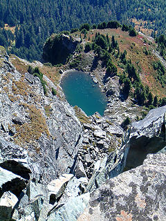 No name lake as seen from the summit of White Chuck Mtn. 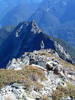 Don checking out the no named lake below, as seen from the summit of White Chuck Mtn. 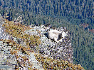 As I reached the summit of White Chuck Mtn., this young goat was lazing in the sun on this ledge. 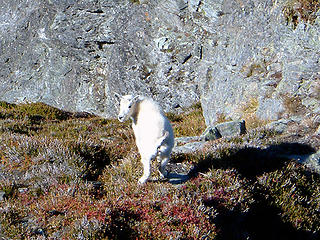 You lookin at me? I said, are you lookin at me. 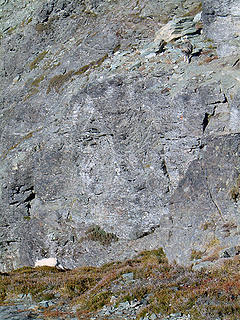 Crystal and Kid have a stare down and Crystal preserves. 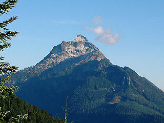 Mt. Pugh from FS-2436. 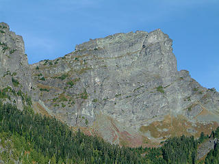 Wht. Chuck from FS-2436. 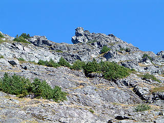 Wht. Chuck Mtn. ridge as seen while descending along the W face. 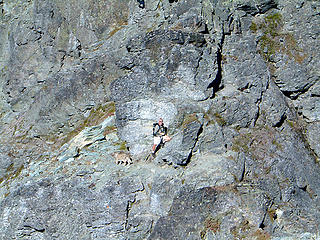 Crystal and Don at the gap as seen from the summit of White Chuck Mtn. 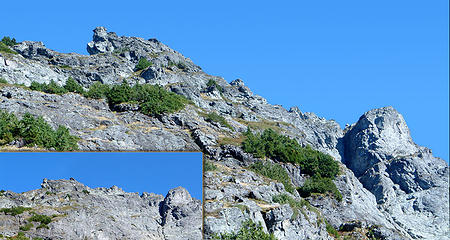 Wht. Chuck Mtn. 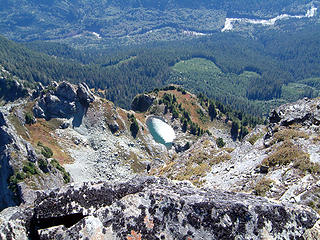 No name lake. 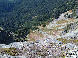 Looking down from the upper slabs on Wht. Chuck Mtn.
|
| Back to top |
  
|
|
Jeff R
Closet hiker.
Joined: 10 Apr 2005
Posts: 972 | TRs | Pics
Location: Everret |
|
Jeff R
Closet hiker.
|
 Mon Sep 26, 2005 8:11 am |
|
|
Thanks, for the great pictures Frenchy.  What a treat to see the "kid", did you document the sighting into the goat register? What a treat to see the "kid", did you document the sighting into the goat register?
| naturealbeing wrote: | | I dont know if MM or H had enough clear weather to see below while on their ascent, but I did and Ill tell you that the travel across the upper slabs and ledges take you to within a few feet of the abyss a number of times. |
On our descent, the weather had cleared enough to see the exposure below the bootpath, we were all amazed to see that path threading through and above those lofty cliffs.
|
| Back to top |
|
|
naturealbeing
Member
Joined: 05 Dec 2004
Posts: 1565 | TRs | Pics
Location: Great Mystery |
Hichen,
Glad you enjoyed the pics.
Micheal recorded the sighting of the kid into the register.
After being up there and seeing that exposure; it made me thankful that you guys made it up and down without any mishaps. I would not care to be up there when that rock is damp; a slip would be one hell of a human roller coaster ride down.
|
| Back to top |
|
|
schmmd
Member

Joined: 30 Aug 2005
Posts: 2 | TRs | Pics
|
|
schmmd
Member
|
Wed Sep 28, 2005 12:19 am Approach and Decent
|
|
|
We now believe we came from FS-2435. However, the maps of the area seem to be highly inaccurate with regard to scale, and numerous roads marked on the map no longer exist. From the parking spot (at the very end of the road) we found a well-defined trail that we left once we saw the first rocky peak. We skirted below it on the ascent.
Our desent was much easier. Once we departed from Richard, it was a flat, half-hour hike on a well-defined ridge trail. I would definitely recommend this route over our ascent's route, as it is much less exposed and better-defined.
|
| Back to top |
|
|
Mesahchie Mark
A Lerxst

Joined: 10 May 2005
Posts: 700 | TRs | Pics
Location: In Wonderland |
Nice job, NB! It's great to "see" the views that Hichen and I missed. I will definitely return sometime for the eye candy...
|
| Back to top |
|
|
naturealbeing
Member
Joined: 05 Dec 2004
Posts: 1565 | TRs | Pics
Location: Great Mystery |
schmmd/Micheal,
Glad to hear you guys made it out safely and quick.
BTW, I know Don took quite a few pictures of that kid. I'd sure like to see them if its possible. Maybe you could post some. Thanks in advance.
Mesahchie Mark,
Thanks for the compliment. When you go back up there, you might consider taking off from FS-2435. From all of the reports I've read recently, they all claim a higher starting point and a well defined path. Anyways variety is the spice of LIFE.
Richard,
|
| Back to top |
|
|
|
|


