| Previous :: Next Topic |
| Author |
Message |
Karen
Member


Joined: 22 Dec 2001
Posts: 2866 | TRs | Pics
|
|
Karen
Member
|
 Fri May 02, 2003 7:20 pm |
|
|
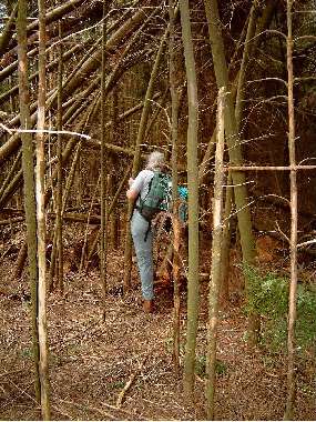
Here's a pic of my friend Kathy -- we were exploring on Frailey Mountain and this is the kind of stuff we ended up getting into (familiar territory for us). Anyway after looking at THREE different guidebooks (past and present) with different directions we never ended up at a particular destination but at least we never got lost and we did have a heckuva good time.
Karen
 I think the trail is this way
stay together, learn the flowers, go light - from Turtle Island, Gary Snyder
stay together, learn the flowers, go light - from Turtle Island, Gary Snyder
|
| Back to top |
  
|
|
McPilchuck
Wild Bagger

Joined: 17 Dec 2001
Posts: 856 | TRs | Pics
Location: near Snohomish, Wa. |
I have been all over Frailey Mtn. Sadly tho, much of its beautiful 2nd growth has now been logged out. For many decades there were old spur roads that started low down and climbed the mountain...a great place for grouse hunting, mushoom hunting, exploring in the fall...have a cabin a Oso so I spent alot of time wandering those hills...
Glad you had a good time.
McPil
|
| Back to top |
|
|
Karen
Member
Joined: 22 Dec 2001
Posts: 2866 | TRs | Pics
|
|
Karen
Member
|
Tue May 06, 2003 7:24 pm Is there is or is there isn't?
|
|
|
McPil, is there still a look-out of some sort on Frailey? One hiking guide says it's gone and another one seems to indicate that there is still something there. Despite the clearcuts and ugliness I'd still like to go back sometime and sample the bits and pieces of old trails/roads/railroad grades that remain. It's a good project on an "iffy" weather day in late fall.
Just the little bit of it I saw gave me the impression that it must have really been a gorgeous place once upon a time.
Karen
stay together, learn the flowers, go light - from Turtle Island, Gary Snyder
stay together, learn the flowers, go light - from Turtle Island, Gary Snyder
|
| Back to top |
|
|
McPilchuck
Wild Bagger
Joined: 17 Dec 2001
Posts: 856 | TRs | Pics
Location: near Snohomish, Wa. |
Karen,
There is no Lookout left up there. There is however a radio relay station of some kind similar to the Pilchuck one on the Mt. Pilchuck Rd. about a 1/4 mile before the trailhead. The Frailey one was operational the last time I was up there - drove right to it tho needed a 4x4 to do it. This site (logged strip) can be seen from the Hwy below, the radio shack sits atop the logged spot at the roads end near the drop off. Not sure what it is used for? Is not military otherwise it would be gated off and perhaps armed with guards these days.
McPil
PS. Green Mtn. across from Pilchuck has one of these (smaller sub stations - not in use) which sits on the end of an abandon road, that I have been to and photographed. Just when you think you are nowhere on an abandon road, up pops these radio relay shacks made in concrete or steel...
|
| Back to top |
|
|
McPilchuck
Wild Bagger
Joined: 17 Dec 2001
Posts: 856 | TRs | Pics
Location: near Snohomish, Wa. |
For an extra special place of wander on old railroad logging grades and hidden trails, near Hazel, we used to take a right turn a 1/4 mile before the Hazel Mill Ponds and go up to the powerlines, then proceed on the road thru beautiful 2nd growth for miles as it climbed up Mt. Wheeler adjacent to the "now" Boulder River Wilderness. Lots of waterfalls and ponds back in there - and mushrooms before they logged my patch to Hell. The road is still there tho gated on DNR land...foot or mtn bike now...but much of the beautiful 2nd growth was logged and the trails as well as the old "ferny" spur roads were destroyed...sigh. At times, I even camped back in there near ponds (all named) on the edge of the Boulder River...seldom visied side of Mt. Wheeler and the wilderness.
McPil
|
| Back to top |
|
|
Karen
Member
Joined: 22 Dec 2001
Posts: 2866 | TRs | Pics
|
|
Karen
Member
|
Sat May 10, 2003 2:22 pm A question for you McPil
|
|
|
That place near Hazel -- is it still worth looking at or would it just be an exercise in futility to walk the road? I'm thinking of hikes or walks like these for those transitional months in early spring and late fall.
Thanks for the information on Frailey -- what little bit of wilderness on that mountain is still pretty. Just wish there was more of it.
Karen
stay together, learn the flowers, go light - from Turtle Island, Gary Snyder
stay together, learn the flowers, go light - from Turtle Island, Gary Snyder
|
| Back to top |
|
|
McPilchuck
Wild Bagger
Joined: 17 Dec 2001
Posts: 856 | TRs | Pics
Location: near Snohomish, Wa. |
"That place near Hazel -- is it still worth looking at or would it just be an exercise in futility to walk the road? I'm thinking of hikes or walks like these for those transitional months in early spring and late fall."
I am sure you will find it exercise worthy probably best on a mtn. bike. The roads go all over up there now thru the void or lack of forest. When they logged it right down to some of my favorite little wterfalls I quit going as it wasn't the same for me anymore. In winter, the old main spur road that led up the mountain from Hazel (know as Grand Dad Hill) was mine alone, well except for a few friends. My parents use to walk in there mostly in the fall from where the road ended too, clear into their 70s and Dad would fly fish one of the ponds while Mom picked berries. The wildlife was prolific in the second growth, too BTW. The gate near the Hwy excluded my parents from visiting the area further, then of course it was logged.
You may still find it worthy of wandering...clear up to where you can hear the waterfalls coming off the Wheeler Mtn. shoulder as it boarders the wilderness...a long hike from the Hwy on alder overgrown log spurs for sure. Nice views of Mt. Higgins tho...
McPil
|
| Back to top |
|
|
Karen
Member
Joined: 22 Dec 2001
Posts: 2866 | TRs | Pics
|
|
Karen
Member
|
Sun May 11, 2003 8:10 am Old roads
|
|
|
Guess I'll have to learn how to ride a bike. Hope it's not too late for that.
McPil, here's another road I'm curious about, the old French Creek Road that takes off near the trailhead for Boulder River. A friend and I hiked it part-way about three years ago in late fall and it was an interesting walk. The road is badly overgrown and if you didn't know it was there you'd never find it. Anyway, according to the old hiking guides the road went on for several miles, crossed a creek, and then at the end of a road a trail continued to .... ? French Mountain, maybe, or to views of Whitehorse. We turned around that day because of time constraints but we were able to walk it about 2.5 miles and though it was overgrown with small evergreens it looked it could still be walked but it also looked like it would be a bit of struggle. Since so much of your past is tied up in that area, I'm wondering if you know anything about that road or hiked there in the past. I'm saving that one for a late fall day when the vegetation dies back and before the snow flies.
Karen
stay together, learn the flowers, go light - from Turtle Island, Gary Snyder
stay together, learn the flowers, go light - from Turtle Island, Gary Snyder
|
| Back to top |
|
|
McPilchuck
Wild Bagger
Joined: 17 Dec 2001
Posts: 856 | TRs | Pics
Location: near Snohomish, Wa. |
Karen,
Yes I have been up that many times in the past, one could drive it (4x4 preferred) clear to its end many years ago. Course you had too drive across the creek as to continue on up the steep part of the mountain left side of the creek. Once going up the steep grade, one could view some ponds down in the creek drainage below the ridge to the right. The road ended about where the logging quit. On could skirt/scrample up the steep ridge (actually part of Whitehorse Ridge) for views, but little traversing after that as the country there is pretty steep or straight forward. Nowadays, it's seldom visited. My last attempt up the road was in the month of Nov. in the snow shortly before it was to be ditched or decommitioned years back, the ride was pretty hairy and I only made it a mile or so before turning around...that must have been in the 1970s. Also, back then, near the creek were a few camps used by deer hunters. As far as walking the road to the end and scrampling up the ridge, I don't see it as problem, tho in places overgrown perhaps.
McPil
|
| Back to top |
|
|
|
|
You cannot post new topics in this forum
You cannot reply to topics in this forum
You cannot edit your posts in this forum
You cannot delete your posts in this forum
You cannot vote in polls in this forum
|
Disclosure: As an Amazon Associate NWHikers.net earns from qualifying purchases when you use our link(s). |


