| Previous :: Next Topic |
| Author |
Message |
Foist
Sultan of Sweat


Joined: 08 May 2006
Posts: 3974 | TRs | Pics
Location: Back! |
|
Foist
Sultan of Sweat
|
 Sat Sep 09, 2006 9:20 pm |
|
|
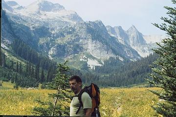
This week was the time for the annual backpacking trip with Lodd. The plan was a classic loop I've wanted to do for a while -- the Spider Gap/Buck Creek Pass circuit. On Sunday, we drove the 3+ hours from Seattle, which included a miserable section of dirt road. Apparently, the Chiwawa River road has not been graded this year past the Little Giant Pass trailhead, and the Phelps Creek road is even worse. We managed, slowly and carefully, in our Corolla... twice, as you'll see in a minute. Amazingly, at the Spider Meadows trailhead we even saw a Prius, which we know from personal experience has awful clearance.
We parked at the trailhead, and first thing's first: strap on the boots! Except, my old man had only the sandals on his feet. He forgot his boots. With a 35 pound pack and the boulders and snow around Spider Gap, this would have been a problem. So we just day hiked to Spider Meadows on Sunday. That trail was a long, dusty, horse-poopy highway -- the longest section of road-turned-trail I've seen. The meadows were vast and stunning, but I don't quite see how this is so popular as a day hike, considering the long drive and the road-walk slog. But we did it and enjoyed, and drove home.
So the new plan: a 3-day trip to Buck Creek Pass, with a day hike to High Pass in the middle. We tackled the road again on Labor Day, and parked in the huge lot before Trinity, this time loaded with Lodd's boots.
The Buck Creek trail was possibly even dustier than the Phelps Creek trail. It sometimes was several inches deep and resembled hiking in soft snow. There were also many horses coming down from the holiday weekend, including one guy with about SIX horses!! They weren't even carrying very much. We could not figure out why a guy would be coming down the trail with so many lightly-loaded horses.
One striking stretch of the trail goes through a swath of dead forest, but seemingly not a burn. There were no signs of charring or ashes. Anyone been here and know what happened? A tree disease of some kind?
We decided to camp at Buck Creek Pass rather than another campsite that someone had recommended on the way up to Pass No Pass. Incidentally, that has to be the oddest place name I've seen in the Cascades. A running joke on our trip was coming up with ways to punctuate the name:
Pass. No Pass?
Pass? No. Pass.
Pass. No? Pass!
But we pretty much settled on:
Pass? ... No pass.
We hoped to camp with a view of Glacier Peak, but the camps at Buck Creek Pass don't actually provide this. The trail actually traverses a hundred feet or so above the actual pass. The junction with the trail down to the pass and its camps has a terrific view of Glacier. It also had a "PCT detour" sign, on which someone had written "<- North" and "South ->" with a marker. We thought this was pretty funny -- if you're hiking the PCT and you don't know which way is south and which is north, you're in some trouble. The first couple campsites you pass on the way down have a view of Glacier through the trees, but are still far above the water. We continued down and camped at one of the main sites closer to the spring. We scampered back up to the junction later after dinner to see the volcano in the moonlight.
The next day we hiked the high country, the famously spectacular trail to High Pass. It's possible now to make it all the way to the Pass without crossing any steep snow (or really any snow at all, but it's actually a bit easier to walk across one small easy patch). That evening, we watched the sun set behind Glacier from around the trail junction, and picked blueberries from the ample supply there. We had them in oatmeal the following morning (mmmm...).
Tuesday we hiked out. We concentrated on understanding that this was a long hike in itself, which made it seem much less interminable. Quite reasonable, actually. It's a psychological thing.
Spider Meadows:
 9-7-2006-18 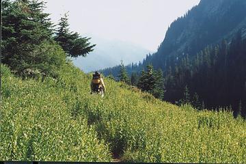 9-7-2006-16 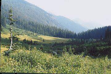 9-7-2006-12 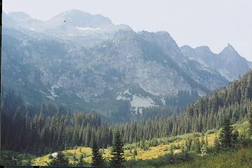 9-7-2006-11 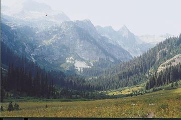 9-7-2006-10 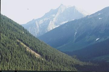 9-7-2006-08 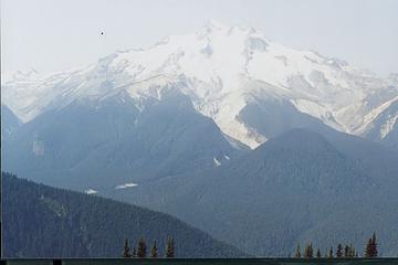 9-7-2006-01 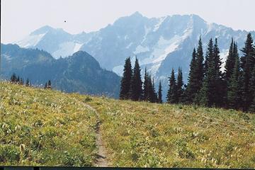 9-7-2006-05 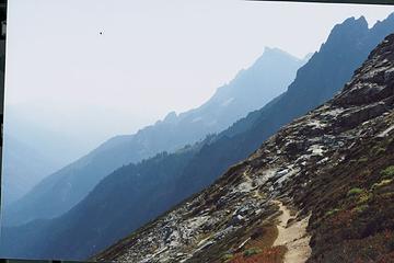 9-7-2006-23 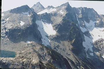 9-7-2006-20 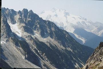 9-7-2006-18 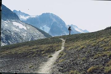 9-7-2006-17 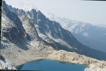 9-7-2006-16 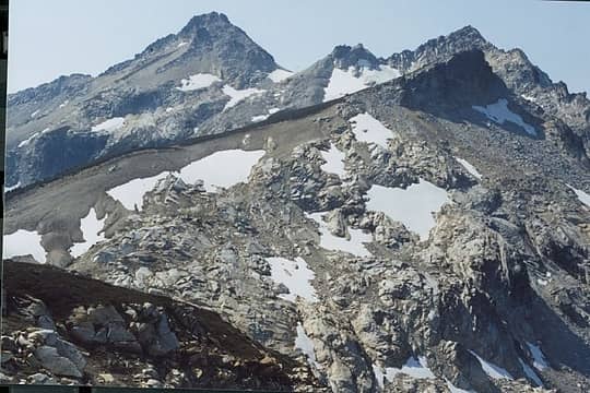 9-7-2006-15 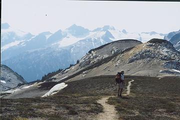 9-7-2006-14 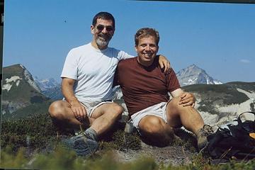 9-7-2006-10 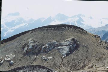 9-7-2006-09 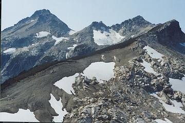 9-7-2006-08 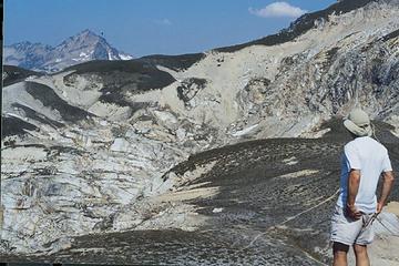 9-7-2006-07 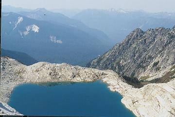 9-7-2006-06 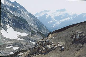 9-7-2006-05 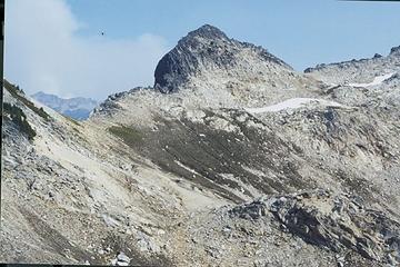 9-7-2006-04 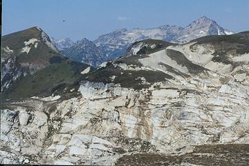 9-7-2006-03 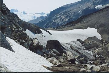 9-7-2006-02 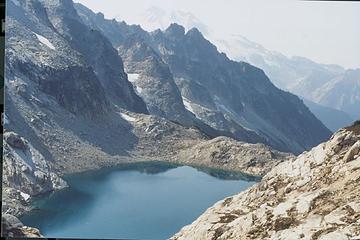 9-7-2006-01 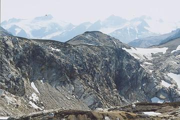 9-7-2006-23 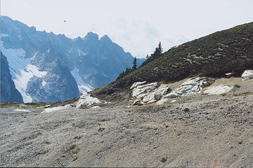 9-7-2006-22 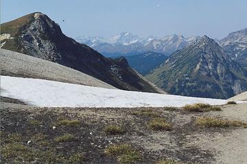 9-7-2006-21 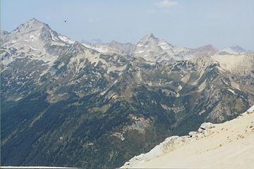 9-7-2006-20 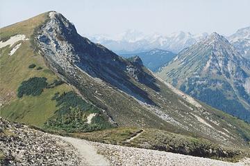 9-7-2006-19 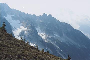 9-7-2006-18 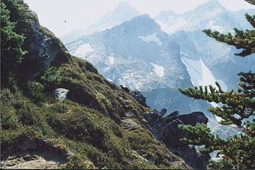 9-7-2006-17 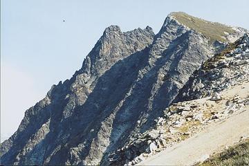 9-7-2006-15 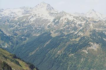 9-7-2006-14 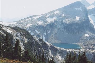 9-7-2006-12 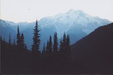 9-7-2006-08 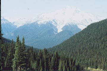 9-7-2006-06 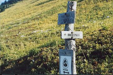 9-7-2006-05
|
| Back to top |
  
|
|
Ski
><((((°>

Joined: 28 May 2005
Posts: 12830 | TRs | Pics
Location: tacoma |
|
Ski
><((((°>
|
Sat Sep 09, 2006 9:33 pm |
|
|
A great trip and outstanding photos aside, you are one lucky guy to be
able to take a trip like that with your father. Don't get too permanently
attached to the big city. 
"I shall wear white flannel trousers, and walk upon the beach.
I have heard the mermaids singing, each to each."
"I shall wear white flannel trousers, and walk upon the beach.
I have heard the mermaids singing, each to each."
|
| Back to top |
|
|
Foist
Sultan of Sweat
Joined: 08 May 2006
Posts: 3974 | TRs | Pics
Location: Back! |
|
Foist
Sultan of Sweat
|
Sat Sep 09, 2006 9:36 pm |
|
|
Thanks, I guess I am lucky. As for the city, I've been there for 8 years, and I've been getting less and less attached all the time.
I forgot to mention that the one downside was that, as you can tell, it was VERY hazy. Hard to tell how much was smoke, but we could see plumes of it to the northeast on Tuesday. It seemed closer than the fires I knew about, so I thought maybe there was a new one. But I guess the existing ones -- Tripod, Tatoosh, Cedar Creek -- were just so huge that it made them look close.
|
| Back to top |
|
|
Gil
Member

Joined: 29 Sep 2004
Posts: 4062 | TRs | Pics
|
|
Gil
Member
|
Sat Sep 09, 2006 10:14 pm |
|
|
Nice photos!
Friends help the miles go easier.
Klahini
Friends help the miles go easier.
Klahini
|
| Back to top |
|
|
Get Out and Go
Member

Joined: 13 Nov 2004
Posts: 2128 | TRs | Pics
Location: Leavenworth |
I know what the guy with the horses was doing. We saw the same thing last September on that trail. He is probably a hunting guide. He took six fully loaded horses up somewhere to set up in advance a camp for his clients whom he will take up later to a fully prepared camp, where they will dine on steaks, sip scotch, and sleep on cots between looking for their trophy deer. BTW, great trip, same as we did 3 weeks ago.
"These are the places you will find me hiding'...These are the places I will always go."
(Down in the Valley by The Head and The Heart)
"Sometimes you're happy. Sometimes you cry.
Half of me is ocean. Half of me is sky."
(Thanks, Tom Petty)
"These are the places you will find me hiding'...These are the places I will always go."
(Down in the Valley by The Head and The Heart)
"Sometimes you're happy. Sometimes you cry.
Half of me is ocean. Half of me is sky."
(Thanks, Tom Petty)
|
| Back to top |
|
|
Foist
Sultan of Sweat
Joined: 08 May 2006
Posts: 3974 | TRs | Pics
Location: Back! |
|
Foist
Sultan of Sweat
|
Sun Sep 10, 2006 9:36 pm |
|
|
Ah, makes sense. There was a party of hunters up there. I actually made that guess on the way down. Should have said that before to make me look smarter. 
|
| Back to top |
|
|
Foist
Sultan of Sweat
Joined: 08 May 2006
Posts: 3974 | TRs | Pics
Location: Back! |
|
Foist
Sultan of Sweat
|
Sun Sep 10, 2006 10:03 pm |
|
|
Lodd wanted me to point out that he FORGOT his boots; it wasn't that he thought he didn't need them. I didn't make that clear, and he thinks this is better. You decide!
|
| Back to top |
|
|
Akula
Member

Joined: 04 Nov 2005
Posts: 477 | TRs | Pics
Location: Somewhere in middle America |
|
Akula
Member
|
Mon Sep 11, 2006 8:03 am |
|
|
Excellent pictures and T/R Thanks
Twenty years from now you will be more disappointed by the things that you didn't do than by the ones you did do. So throw off the bowlines. Sail away from the safe harbor. Catch the trade winds in your sails. Explore, dream, discover. -- Mark Twain
Twenty years from now you will be more disappointed by the things that you didn't do than by the ones you did do. So throw off the bowlines. Sail away from the safe harbor. Catch the trade winds in your sails. Explore, dream, discover. -- Mark Twain
|
| Back to top |
|
|
wildernessed
viewbagger

Joined: 31 Oct 2004
Posts: 9275 | TRs | Pics
Location: Wenatchee |
Spectacular ! 
Living in the Anthropocene
Living in the Anthropocene
|
| Back to top |
|
|
hikermike
Member

Joined: 24 Jun 2003
Posts: 1238 | TRs | Pics
Location: Tacoma |
Surprised you didn't walk out to flower dome for a classic pic. Looks like the trail to High Pass is longer now, when I last did the trail with my brother in 1968 the trail stopped at the first point you could see Triad Lake from on the North side. If it goes all the way to High Pass than it's easy down into the Napeequa....and its flies! My how trails have changed, most have disappeared but a few have shown up. Oh, there was one other party there the 3 days we were yet the guide book complained then how crowded it was. As much as I hate horses on the trails, from the 40's thru the 60's that's why the FS kept a lot of trails open. We talk so much about some trails going to be closed cuz not too many people use them and there is a shortage of money yet back then a lot of trails recieved a lot more maintainence and for only a few hunting parties to visit in the Fall!
|
| Back to top |
|
|
Foist
Sultan of Sweat
Joined: 08 May 2006
Posts: 3974 | TRs | Pics
Location: Back! |
|
Foist
Sultan of Sweat
|
Tue Sep 12, 2006 1:20 am |
|
|
The High Pass trail, as such, still only really goes to that point. Past there, there's only a very slight dent in the hillside made by boots going the same way, followed by a pick-your-own-route boulderfield (and snow).
|
| Back to top |
|
|
|
|
You cannot post new topics in this forum
You cannot reply to topics in this forum
You cannot edit your posts in this forum
You cannot delete your posts in this forum
You cannot vote in polls in this forum
|
Disclosure: As an Amazon Associate NWHikers.net earns from qualifying purchases when you use our link(s). |


