| Previous :: Next Topic |
| Author |
Message |
Guiran
Member


Joined: 03 Mar 2004
Posts: 621 | TRs | Pics
Location: University of Washington |
|
Guiran
Member
|
 Mon Apr 16, 2007 8:20 am |
|
|
Since there appears to be continued debate within the group over who's responsibility it is to write the TR, I'll start by posting some pictures.
Given the avalanche forecast, our group of seven (Dicey, Matt, Yana, Cartman, BenTheBeerman, Mark, and myself) opted out of Merchant and headed further up the valley to climb Mt. Townsend.
Pictures now, text later. Good times had by all, of course.
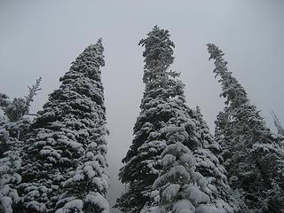
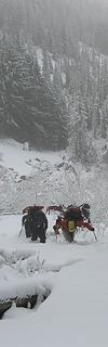 Ascending (partially) buried alder 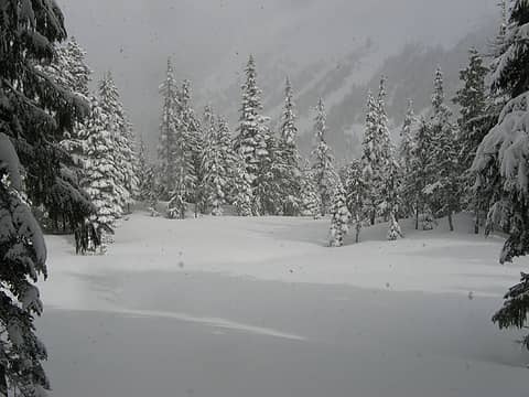 Paradise Meadows 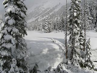 Paradise Meadows 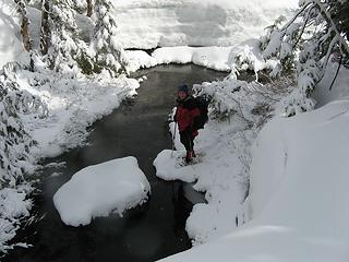 Crossing Eagle Creek 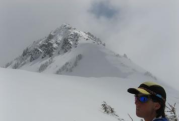 Dicey contemplates Townsend 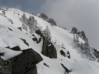 Looking towards the summit of Townsend 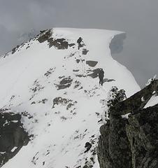 Giant Cornice of Death 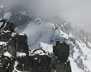 Cool blocks and untouched slopes 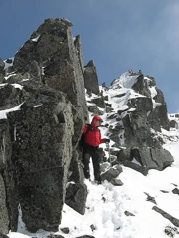 Mark coming down from the summit 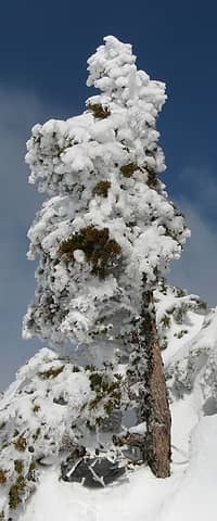 Snowy tree 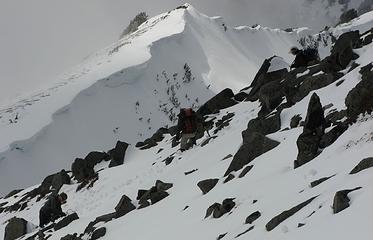 Dicey, Yana, and Cartman on the ridge 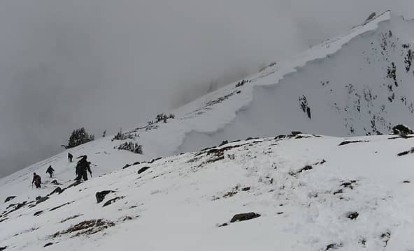 Moving back along the ridge on Townsend
|
| Back to top |
  
|
|
Tazz
Member
Joined: 27 Apr 2005
Posts: 7902 | TRs | Pics
|
|
Tazz
Member
|
Mon Apr 16, 2007 8:24 am |
|
|
 great images Brian!!! wish I was there.... good stuff!!! great images Brian!!! wish I was there.... good stuff!!!
|
| Back to top |
|
|
dacker
little black dots

Joined: 27 Sep 2006
Posts: 738 | TRs | Pics
Location: the end of my rope |
|
dacker
little black dots
|
Mon Apr 16, 2007 8:34 am |
|
|
Looks like fun stuff!
About that time, I was hanging from prusiks on a rope off of Barney's Rubble, coaching students in mountaineering boots up a thin friction slab. But when they actually "get it," and you see the little light bulb turn on...that's really gratifying. Teaching isn't for everyone, but I love it.
Now...looks like Merchant is still on the menu. Gotta cheer for that! 
We don't stop hiking because we grow old; we grow old because we stop hiking. --Finis Mitchell
We don't stop hiking because we grow old; we grow old because we stop hiking. --Finis Mitchell
|
| Back to top |
|
|
Dane
Other

Joined: 14 Mar 2006
Posts: 2466 | TRs | Pics
Location: Seattle |
|
Dane
Other
|
Mon Apr 16, 2007 12:20 pm |
|
|
Is that the Mt. Townsend in the Olympics? None of the other names are ringing a bell (Merchant, Eagle Creek) so I can't tell if this is Olys or not.
Either way, nice pics and it looks like a good trip.
Without judgement what would we do? We would be forced to look at ourselves...
-Death
Without judgement what would we do? We would be forced to look at ourselves...
-Death
|
| Back to top |
|
|
Mesahchie Mark
A Lerxst

Joined: 10 May 2005
Posts: 700 | TRs | Pics
Location: In Wonderland |
| Dane wrote: | | Is that the Mt. Townsend in the Olympics? None of the other names are ringing a bell (Merchant, Eagle Creek) so I can't tell if this is Olys or not.
Either way, nice pics and it looks like a good trip. |
This Mt Townsend is off of Hwy 2, just north of Baring...
|
| Back to top |
|
|
Canuck
Member
Joined: 05 Jun 2006
Posts: 2137 | TRs | Pics
Location: Lacey WA |
|
Canuck
Member
|
Mon Apr 16, 2007 1:14 pm |
|
|
Thank goodness. I was emailing Tamster off-line about this and said it didn't even look recognizable to me as the Mt. Townsend I know (Olympics). I thought I was losing my mind. 
|
| Back to top |
|
|
Guiran
Member
Joined: 03 Mar 2004
Posts: 621 | TRs | Pics
Location: University of Washington |
|
Guiran
Member
|
Mon Apr 16, 2007 1:15 pm |
|
|
Hmm... I would have thought the rock quality visible in the photos would have immediately disqualified a peak in the Olympics. 
|
| Back to top |
|
|
Randy
Cube Rat

Joined: 18 Dec 2001
Posts: 2910 | TRs | Pics
Location: Near the Siamangs |
|
Randy
Cube Rat
|
Mon Apr 16, 2007 4:42 pm |
|
|
Cool.  Looks a lot more intersting this time of year.
|
| Back to top |
|
|
Canuck
Member
Joined: 05 Jun 2006
Posts: 2137 | TRs | Pics
Location: Lacey WA |
|
Canuck
Member
|
Mon Apr 16, 2007 6:03 pm |
|
|
| Guiran wrote: | | Hmm... I would have thought the rock quality visible in the photos would have immediately disqualified a peak in the Olympics. |
You would think so. That, and the creek crossing you have a picture of. But for some reason (probably lack of coffee) made me question it. I sat there going "this doesn't remotely look like Mt. Townsend." I should have trusted my gut!!
|
| Back to top |
|
|
Gil
Member

Joined: 29 Sep 2004
Posts: 4062 | TRs | Pics
|
|
Gil
Member
|
Mon Apr 16, 2007 6:09 pm |
|
|
Cool! Excellent cornice!
Friends help the miles go easier.
Klahini
Friends help the miles go easier.
Klahini
|
| Back to top |
|
|
Mesahchie Mark
A Lerxst
Joined: 10 May 2005
Posts: 700 | TRs | Pics
Location: In Wonderland |
OK, I'll add something...
Fun trip! Started just before 8 AM, ended about nine hours later. Weather made it interesting - I was covering up and applying sunscreen at the same time!
Here are some more pics:
 Frosty Trees 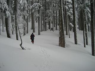 Thru The Woods 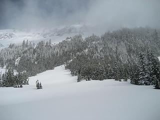 Townsend South Slope 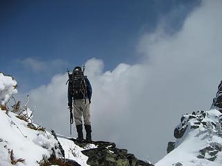 Guiran on the Edge 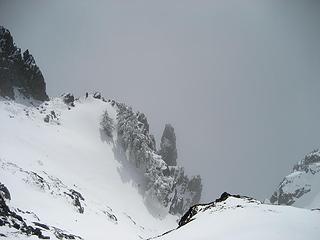 Gully_Townsend 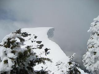 Cornice 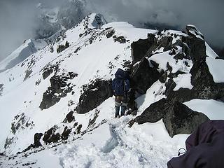 Townsend Descent 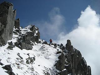 Matt The Sentinel
|
| Back to top |
|
|
Tazz
Member
Joined: 27 Apr 2005
Posts: 7902 | TRs | Pics
|
|
Tazz
Member
|
Mon Apr 16, 2007 11:29 pm |
|
|
that cornice is making me drool!!! 
|
| Back to top |
|
|
Matt
Tea, Earl Grey, Hot

Joined: 30 Jan 2007
Posts: 4307 | TRs | Pics
Location: Shoreline |
|
Matt
Tea, Earl Grey, Hot
|
Tue Apr 17, 2007 1:52 am |
|
|
We ascended Townsend (USGS Baring) by taking the trail to Barclay Lake, the fishers track to Stone Lake and Paradise Meadow, then kicking steps the wide long south face of Townsend, and following the corniced ridge to the summit at its far eastern end. Im surprised that Townsend is so rarely done as a spring trip. Once the Barclay Lake road melts out and avy conditions are moderate, its an enjoyable route, with cornices on the ridge and views of Merchant & Gunn for entertainment.
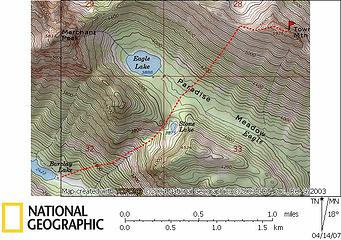 Map 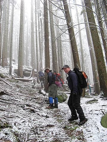 Track to Stone Lake 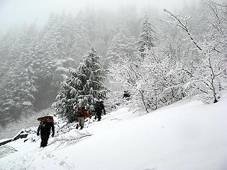 Postholing 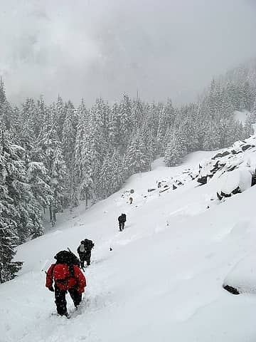 Higher in the drainage 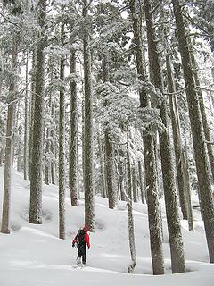 Col near Stone Lake 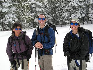 Blue snow glasses 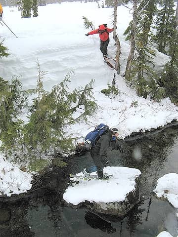 Crossing Eagle Creek 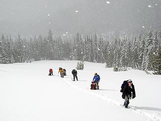 Paradise Meadow 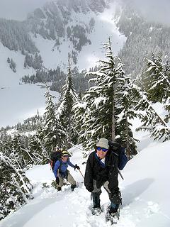 Above Eagle Lake, Dicey & Yana 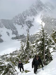 Above Eagle Lake, Mark & Eric 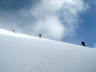 Nearing the top 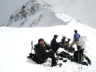 At the ridge crest. Summit is the furthest rocks in the distance. 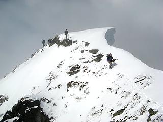 Corniced bump 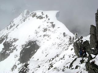 Traversing across 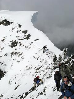 At the base of the summit rocks 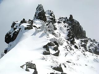 Summit 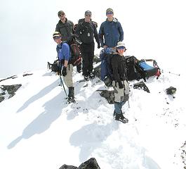 Summit Group 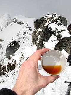 Summit Tea 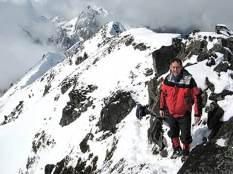 Matt at the summit 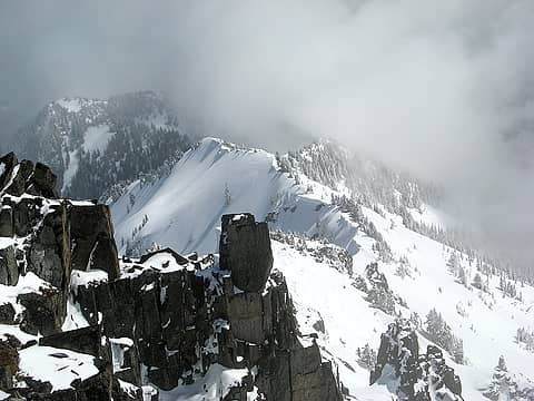 Townsend ridge east of summit 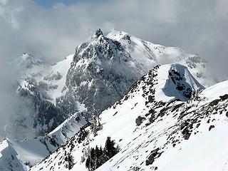 Gunn? 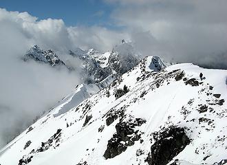 Townsend & its neighbors 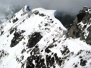 Departing the summit 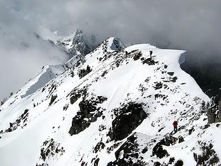 Traversing back along the ridge 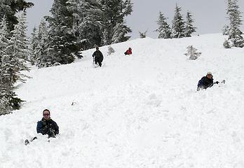 Glissading 1 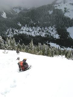 Glissading 2 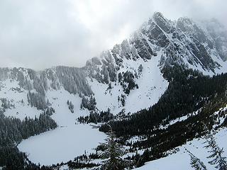 Merchant & Eagle Lake 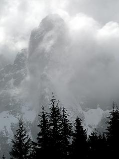 Baring emerges 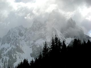 Baring
As beacons mountains burned at evening. J.R.R. Tolkien
As beacons mountains burned at evening. J.R.R. Tolkien
|
| Back to top |
|
|
Tazz
Member
Joined: 27 Apr 2005
Posts: 7902 | TRs | Pics
|
|
Tazz
Member
|
Tue Apr 17, 2007 5:56 am |
|
|
Matt you have some incredible action shots in that group. Good stuff! thanks for the report.
|
| Back to top |
|
|
dicey
custom title

Joined: 11 May 2004
Posts: 2870 | TRs | Pics
Location: giving cornices a wider berth |
|
dicey
custom title
|
Tue Apr 17, 2007 9:14 am |
|
|
| Matt wrote: | | On the way down, we got in about a thousand feet of glissading down the long slope. The snow was soft enough that I wasnt afraid of crashing so I let my speed exceed my stability, and one glissade ended with sort of a rolling somersaulting crash. I just made sure to keep all the pointy parts of my ice axe away from me until the sky and snow stopped cartwheeling around me. Then I worked on scraping the snow out of all the opening in my clothes while the others looking on with odd expressions of mixed worry and hilarity.
|
 Labels added Labels added
|
| Back to top |
|
|
|
|
You cannot post new topics in this forum
You cannot reply to topics in this forum
You cannot edit your posts in this forum
You cannot delete your posts in this forum
You cannot vote in polls in this forum
|
Disclosure: As an Amazon Associate NWHikers.net earns from qualifying purchases when you use our link(s). |


