| Previous :: Next Topic |
| Author |
Message |
MCaver
Founder


Joined: 14 Dec 2001
Posts: 5124 | TRs | Pics
|
|
MCaver
Founder
|
 Thu Aug 02, 2007 9:21 pm |
|
|
(This report is over a week old, but considering how long it's been since I wrote one, this is a vast improvement.)
Glacier Creek is rather photogenic downstream where it meets Johnson Creek, so when I saw a trail seemingly following it upstream to its headwaters in Glacier Lake, I put it on the top of my list. I had hoped this would be a trial along a creek, rather it is a trail to a lake. In fact, there is only one point along the trail where the creek is accessible at all and in the second half you are far enough away you can't even hear it.
The trail starts on an offshoot of Johnson Creek Road (FS-21) in Gifford Pinchot National Forest, south of Packwood. According to the map, it's only a net 700' elevation gain in 2 miles, but that is rather deceptive. From the trailhead, it immediately plunges downhill to Glacier Creek (the steepest part of the hike is climging back up this part) then undulates with the terrain. About half way to the lake, it crosses into the Goat Rocks Wilderness and climbs steadily upward to the lake.
Almost the entire hike is in a lush mossy forest, and there is much evidence of damage from the winter windstorm. There are a large number of down trees, but thankfully the trail has been cleared and is easily passable in all but one or two spots. It was very humid, which kept me from cooling off for most of the hike, and while the mosquitos weren't bad, they were persistent -- always two or three every time I stopped to rest.
The coolest part of the hike is just before the lake where, according to the Forest Service website, a rockslide about 600 years ago created a large boulder field that dammed the creek and created the lake. The trail passes through this boulder field, which is now covered in thick moss. There's lots of exploring to be had here if you are so inclined. I climbed around a bit, but ultiamtely headed to the lake, There are more boulders at the lake, but the most noticeable features there are the massive number of vine maples. That place must be fantastic in the fall.
The lake itself was rather uninspiring. I tried once to push through the brush to the shore but got into some nettle and decided it wasn't worth it. Rather, I found a flat mossy boulder and splayed out for a while. The breeze was blowing enough to keep the mosquitoes at bay, and a light drizzle finally cooled me off. I had the entire place to myself, so I just laid there and enjoyed the solutude and silence. I even dozed off for a short nap. That was the best part of the trip by far.
I only stopped for photos in one place, just inside the wilderness boundary, where the trees and moss caught my eye.
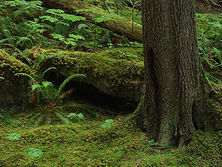 Tree and Fern in Moss 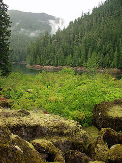 Glacier Lake 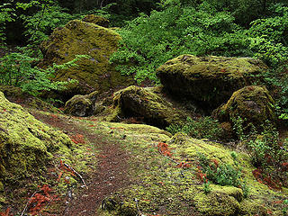 Trail Through Boulder Field 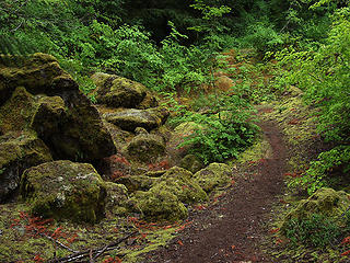 Trail Through Boulder Field 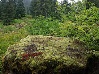 Nice Resting Spot 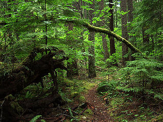 Vine Maple Arch 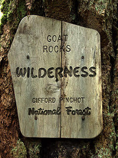 Wilderness Sign 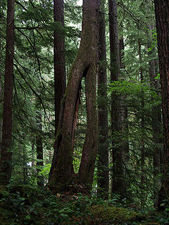 Tree Oddity
|
| Back to top |
  
|
|
Galadriel
Member

Joined: 17 Jun 2003
Posts: 249 | TRs | Pics
|
Thanks for the report, Mcaver. My friend can't go on long arduous hikes any more, and Glacier Lake was the perfect destination for her. We went there on a warm August day last year. For an easy hike, I think it doesn't get many visitors. Didn't see another person and we hung out for a couple of hours.
The lake is good for swimming, but my two favorite places are the boulder area, and the side trail down to Glacier creek where it appears to be springing out of an underground well.
 0819061 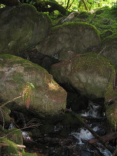 0819064 Glacier creek 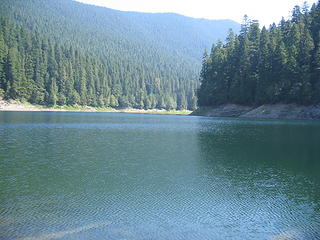 Glacier Lake 0819062
|
| Back to top |
|
|
|
|
You cannot post new topics in this forum
You cannot reply to topics in this forum
You cannot edit your posts in this forum
You cannot delete your posts in this forum
You cannot vote in polls in this forum
|
Disclosure: As an Amazon Associate NWHikers.net earns from qualifying purchases when you use our link(s). |


