| Previous :: Next Topic |
| Author |
Message |
TrailPair
Member


Joined: 17 Apr 2005
Posts: 1699 | TRs | Pics
|
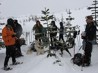
Our large group of 9(GeoTom , Walter, TDD, Silly Traveler, Bad Dog , Bruce, Opus and Trail Pair) parked at the junction of Exit 47 and FS road 55. We tried to drive to the TH, but the snow was too deep for our vehicles. However, there was a Ford Expedition with chains parked right outside the Annette Lake parking lot. We headed up the trail with snowshoes on our packs.
When we reached the Iron Horse road a decision had to be made. Bad Dog had found a report from April 2007 showing a route up Silver via Ollalie Meadow. This looked more gentle on the map than the usual winter route, leaving the trail after the switchbacks (3200ft.) It was and 8-1 decision to give it a try. So we turned left on Iron Horse for about 100 yards, then found a snowshoe track heading uphill (east). Since it seemed to be heading the way we wanted to go we followed it. This turned out to be a very nice route. It was never extremely steep, and soon we were out of the trees, just above Ollalie Meadow. We angled south, went through a clear-cut, around a few bumps, then up through a beautiful old growth forest. One a clear day this route would be very scenic, but today we had little visibility. It had been snowing lightly at the TH, and was picking up steam! We then came to a pretty basin where we were able to attain Silver's north ridge. Unfortunately, there are some serious obstacles coming from this direction.
Had the snow been more stable we think we could have traversed around the rocks, but today, with the snow coming down heavily, we felt it wasn't safe. We dropped back down to the basin, and climbed up HP (5200ft) on the east side of the basin. From here it looked like one could attain the summit ridge, by-passing the rocks. But we didn't feel the snow was stable enough to climb a steep, open slope to regain the ridge.
We turned around at this point, and relied on the GPS's to get us down to the forest, since out tracks were already filled in. This is a lovely area which we would like to explore again in better weather.
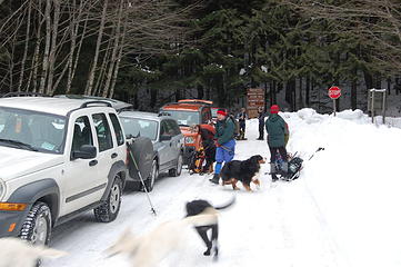 Parking conditions at the junction 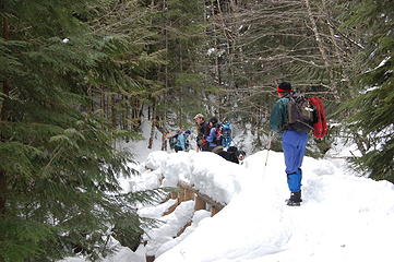 Bridge across Humpback Creek 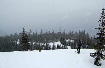 Silly Traveler at edge of Clearcut 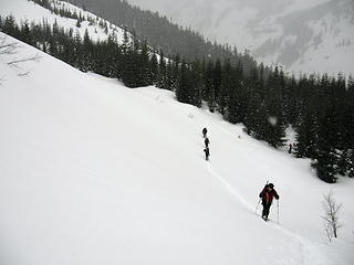 Leaving the forest 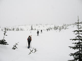 Clear cut above Ollalie Meadow 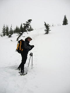 Geo Tom 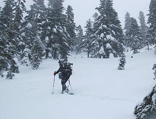 Snowing heavily 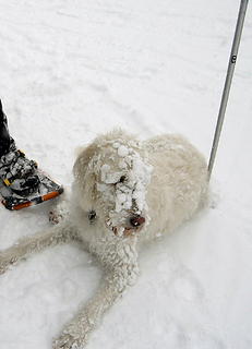 Boone 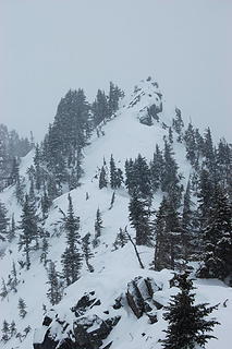 Obstacle on North Ridge 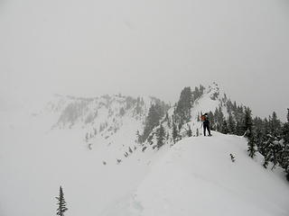 Stopping point on North Ridge 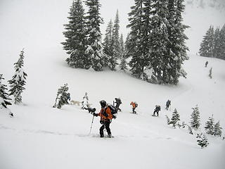 Climbing to HP 5200ft., east of Silver's North Ridge. 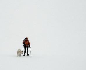 White out! 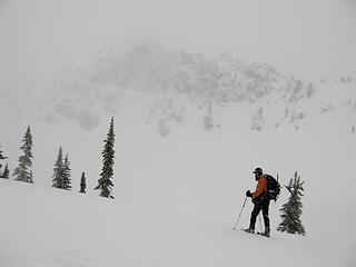 Bob with North Ridge beyond 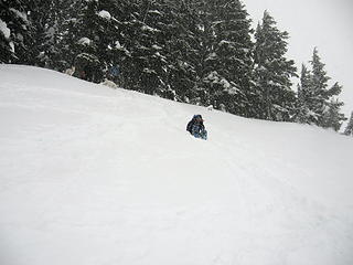 Carol attempting to glissade 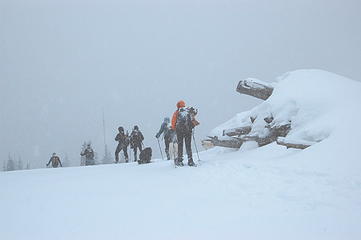 Descent
This thing called work is interfering with my play
This thing called work is interfering with my play
|
| Back to top |
  
|
|
GeoTom
Member
Joined: 19 May 2005
Posts: 3215 | TRs | Pics
Location: Earth |
|
GeoTom
Member
|
 Sat Jan 26, 2008 9:35 pm |
|
|
| TrailPair wrote: | | It was and 8-1 decision to give it a try. |
I can't believe you remembered that I was the dissenting vote  Jasper was fine at home today, although I think he would have liked to play with Holly
|
| Back to top |
|
|
Magellan
Brutally Handsome

Joined: 26 Jul 2006
Posts: 13116 | TRs | Pics
Location: Inexorable descent |
|
Magellan
Brutally Handsome
|
Sat Jan 26, 2008 9:42 pm |
|
|
Very interesting TR you guys. Thanks for the heads up on this route. Silver has been in the front of my mind.
|
| Back to top |
|
|
silly_traveler
~ roaming ~

Joined: 04 Jun 2006
Posts: 1525 | TRs | Pics
Location: Bellevue |
♫ You have brains in your head. You have feet in your shoes. You can steer yourself any direction you choose. And you're the one who will decide where you'll go. Oh the places you'll go. - Dr. Seuss
|
| Back to top |
|
|
b00
Member

Joined: 29 Sep 2003
Posts: 1144 | TRs | Pics
|
|
b00
Member
|
Sat Jan 26, 2008 10:19 pm |
|
|
| TrailPair wrote: | | ... So we turned left on Iron Horse for about 100 yards, then found a snowshoe track heading uphill (east). Since it seemed to be heading the way we wanted to go we followed it. This turned out to be a very nice route. It was never extremely steep, and soon we were out of the trees, just above Ollalie Meadow. ... |
i've met you before and i don't think nicer folks could have followed our tracks :>)
our trip report
|
| Back to top |
|
|
TrailPair
Member
Joined: 17 Apr 2005
Posts: 1699 | TRs | Pics
|
bOO, what a fun way to do Mt. Catherine! We will have to try that route someday.
This thing called work is interfering with my play
This thing called work is interfering with my play
|
| Back to top |
|
|
Bryan K
Shameless Peakbagger

Joined: 29 Sep 2005
Posts: 5129 | TRs | Pics
Location: Alaska |
|
Bryan K
Shameless Peakbagger
|
Sun Jan 27, 2008 1:03 am |
|
|
That route up through Ollalie looks fun. Thanks for the heads up for this route heading up to Silver. Should be a great route when the avy danger reduces.
|
| Back to top |
|
|
Mosquito Food
This is how we do it

Joined: 11 Jan 2008
Posts: 74 | TRs | Pics
Location: Covington |
|
| Back to top |
|
|
GeoTom
Member

Joined: 19 May 2005
Posts: 3215 | TRs | Pics
Location: Earth |
|
GeoTom
Member
|
Sun Jan 27, 2008 10:59 am |
|
|
A couple photos showing how lovely the weather was:
 Food break 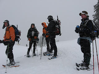 At our high point 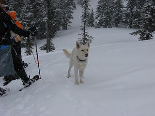 Where is that Jasper?
|
| Back to top |
|
|
Opus
Wannabe

Joined: 04 Mar 2006
Posts: 3700 | TRs | Pics
Location: The big rock candy mountain |
|
Opus
Wannabe
|
Sun Jan 27, 2008 2:45 pm |
|
|
Great trip, bad weather.  We were doing alright on our route I think. If we could have seen further and had more stable snow we could have pushed back up onto the ridge and the summit. We were doing alright on our route I think. If we could have seen further and had more stable snow we could have pushed back up onto the ridge and the summit.
 GPS tracks 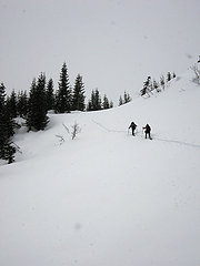 Here comes the snow 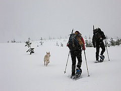 On the way 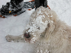 Can he see? 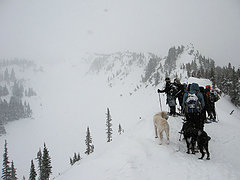 Ridge route ends  Where to now? 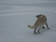 Holly 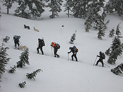 Climbing  White out 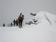 Pile of stuff
|
| Back to top |
|
|
Matt
Tea, Earl Grey, Hot

Joined: 30 Jan 2007
Posts: 4307 | TRs | Pics
Location: Shoreline |
|
Matt
Tea, Earl Grey, Hot
|
Sun Jan 27, 2008 3:13 pm |
|
|
How do you find those white dogs in the snow?
At least Jasper has some black spots.
As beacons mountains burned at evening. J.R.R. Tolkien
As beacons mountains burned at evening. J.R.R. Tolkien
|
| Back to top |
|
|
bobbi
stillaGUAMish

Joined: 13 Jul 2006
Posts: 8012 | TRs | Pics
Location: olympics! |
|
bobbi
stillaGUAMish
|
Sun Jan 27, 2008 8:47 pm |
|
|
silly, where's your shoes photo?
bobbi ૐ
"Today is your day! Your mountain is waiting. So
get on your way!" - Oh, the Places Youll Go! By Dr. Seuss
bobbi ૐ
"Today is your day! Your mountain is waiting. So
get on your way!" - Oh, the Places Youll Go! By Dr. Seuss
|
| Back to top |
|
|
GeoTom
Member
Joined: 19 May 2005
Posts: 3215 | TRs | Pics
Location: Earth |
|
GeoTom
Member
|
Mon Jan 28, 2008 11:24 am |
|
|
| Matt wrote: | | How do you find those white dogs in the snow?
At least Jasper has some black spots. |
You look for the ball of moving snow.  Underneath will likely be Holly or Boone. Underneath will likely be Holly or Boone.
|
| Back to top |
|
|
silly_traveler
~ roaming ~
Joined: 04 Jun 2006
Posts: 1525 | TRs | Pics
Location: Bellevue |
| bcfc53 wrote: | | silly, where's your shoes photo? |
Next time 
♫ You have brains in your head. You have feet in your shoes. You can steer yourself any direction you choose. And you're the one who will decide where you'll go. Oh the places you'll go. - Dr. Seuss
♫ You have brains in your head. You have feet in your shoes. You can steer yourself any direction you choose. And you're the one who will decide where you'll go. Oh the places you'll go. - Dr. Seuss
|
| Back to top |
|
|
the Zachster
Member

Joined: 17 Jan 2007
Posts: 4776 | TRs | Pics
Location: dog training |
Opus, those are some tough dogs, breaking their own trail in the "climbing" photo! 
"May I always be the kind of person my dog thinks I am"
"May I always be the kind of person my dog thinks I am"
|
| Back to top |
|
|
|
|


 good exercise and that 3600 ft. gain sure kicked my butt
 I even made him a peanut butter sandwich


