| Previous :: Next Topic |
| Author |
Message |
Matt
Tea, Earl Grey, Hot


Joined: 30 Jan 2007
Posts: 4307 | TRs | Pics
Location: Shoreline |
|
Matt
Tea, Earl Grey, Hot
|
 Sun Apr 27, 2008 12:59 am |
|
|
Since I didnt get out this weekend, Im catching up on a couple trip reports I didn't get finished last year.
Let the herald angel Gabriel blow his horn with with glad tidings.
After three years of postponements, we finally accomplished the Gabriel trip!
(And, after another 10 months, I finally finished the trip report.)
Party: Matt, mtnmike, Billie, cartman, ErinB
Summits: Mebbe, Gabriel, Elija, Joseph, Bebbe, Tarheel
Sometimes waiting pays off. The weather was clear and balmy the whole time. The snow was in great condition, soft enough to kick steps and firm enough to hold steady.
This trip cleaned up the island of peaks located west of southwest of SR20 and northeast of Panther Creek. Most of the summits are actually part of the long stretch of Elija ridge, except Gabriel, which stands on the opposite side of the Gabriel/Cabinet Creek divide.
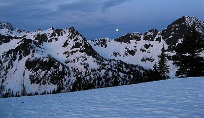
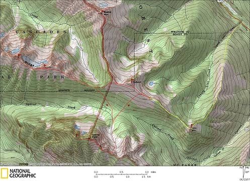 Gabriel Trip Map 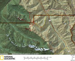 Gabriel Wider Area Map 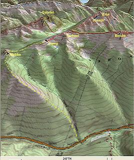 Gabriel fuzzy 3D Map 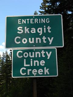 County Line Sign 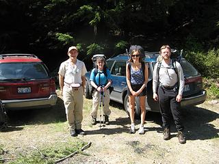 At the trailhead: Mike, Billie, Erin, Eric 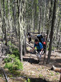 Lower part of the ridge 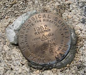 Mebbe Summit Marker 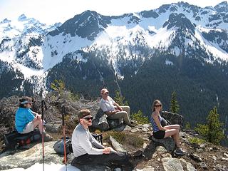 4 labels Mebbe Summit Group (Billie, Cartman, Mike, Erin) 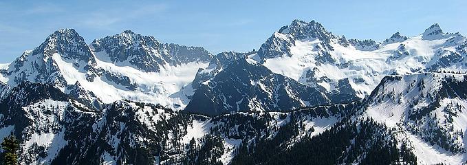 2 labels Ragged Ridge (Mesachie, Katsuk, Kimta, Cosho) 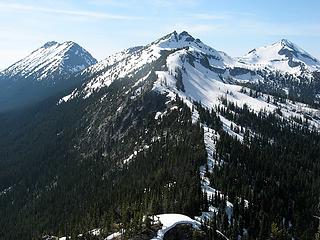 The Ridge Westward Camp at wide area in upper center. Elija & Joseph left, Tarheel center, Bebbe right. 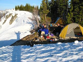 Tall photographer taking a picture of camp at dinnertime 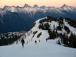 Hiking up from camp before sunset 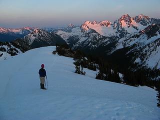 Watching the sunset  Mesachie & Katsuk Sunset 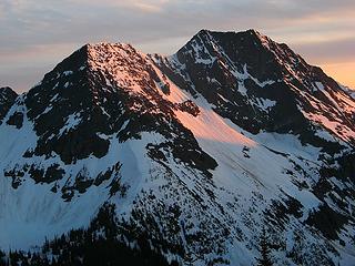 Gabriel sunset 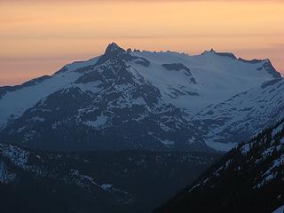 Snowfield sunset 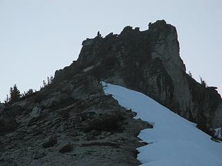 Erin & cartman on Tarheel summit - Will Matt actually get out of the tent at 4:45am to hike uphill and watch the sunrise?
- Will we find a workable route up Gabriel? How big are those cornices at the top of the gullies?
- Will we make it all the way to Elija as well? Will Matt make it back to camp before sunset?
- How much water will we consume to do all this on a hot sunny day?
- What about counter-elevation? After all, our camp elevation is only a thousand feet lower than any of the summits. But what will be the cumulative gain across the valley and along the ridges?
- Will Erin continue to leap and bound up the peaks without ever slowing down?
Day 2 will be ready sometime late tomorrow.
As beacons mountains burned at evening. J.R.R. Tolkien
 Now I Fly Now I Fly
As beacons mountains burned at evening. J.R.R. Tolkien
Now I Fly
|
| Back to top |
  
|
|
Magellan
Brutally Handsome

Joined: 26 Jul 2006
Posts: 13116 | TRs | Pics
Location: Inexorable descent |
|
Magellan
Brutally Handsome
|
Fri May 02, 2008 11:54 pm |
|
|
Is it tomorrow yet? 
|
| Back to top |
|
|
Matt
Tea, Earl Grey, Hot
Joined: 30 Jan 2007
Posts: 4307 | TRs | Pics
Location: Shoreline |
|
Matt
Tea, Earl Grey, Hot
|
Sat May 03, 2008 9:52 pm |
|
|
Okay, tomorrow is slow. Here's most of day 2, though without some of the details.
Answers to previous days questions:
Yes, both sunrise and moonset.
Yes. Quite big.
Yes. Not quite.
About 8 quarts.
4700 feet counter-elevation, 5800 feet cumulative.
Still leaping and bounding after 14 hours.
Day 2, Sunrise
Yes, I actually got out of bed before dawn and hiked up to the viewpoint above camp for the sunrise!
For an extra bonus, the moon was just setting behind Gabriel.
 Moon over Gabriel 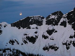 Banded Moon (Gabriel ascent gully in center) 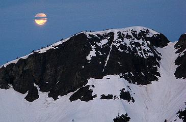 Banded Moon 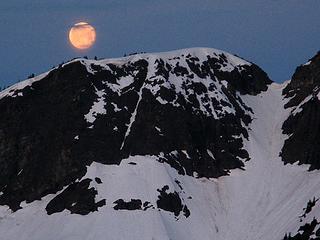 Dawntide Moonset 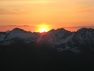 Sunrise 1 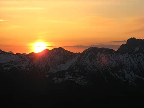 Sunrise 2 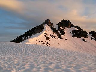 Tarheel Dawn Alpenglow 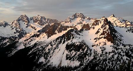 Ragged Ridge Dawn 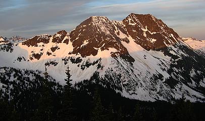 Gabriel Dawn 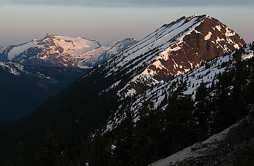 Snowfield & Elija Dawn 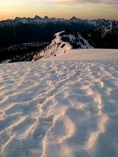 Dawn Suncups & Tracks 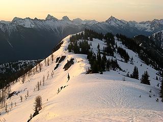 Returning to Camp 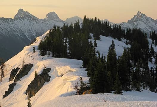 Good Morning! 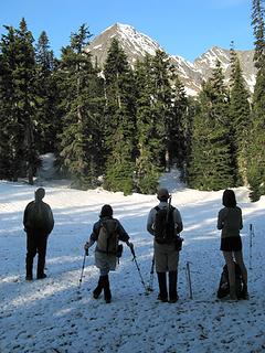 Preparing to drop to the Cabinet/Gabriel Divide 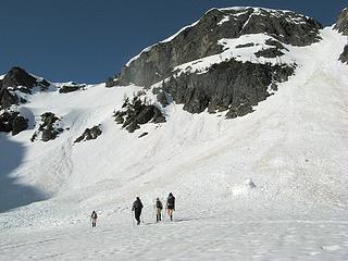 Deciding to go up the righthand gully 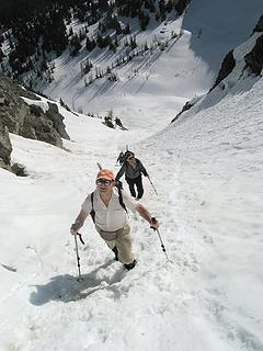 High in the gully 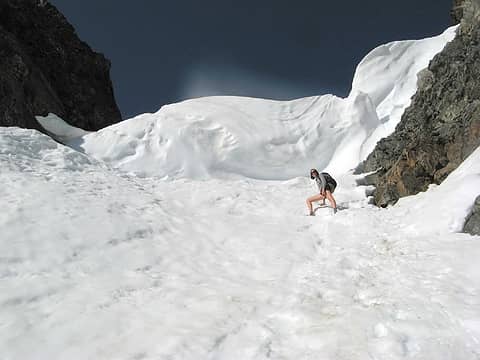 Erin & the cornice 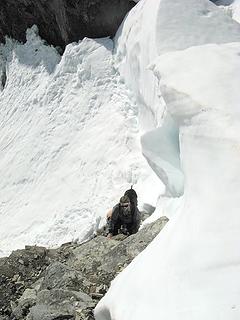 Bypassing the cornice 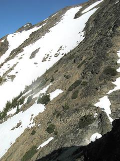 Back side of Gabriel false summit (true summit at far end) 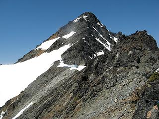 Back side of Gabriel main summit 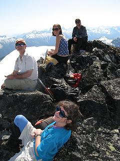 Break on Gabriel Summit 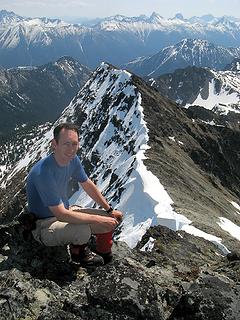 3 labels Matt on Gabriel, with approach ridge behind 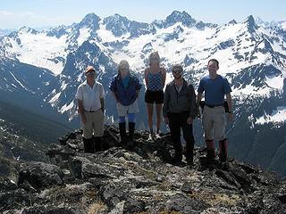 Summit Group & Ragged Ridge 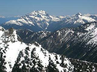 Crater & Jack (Taheel-Joseph col is at lower right, Beebe is at far right edge) 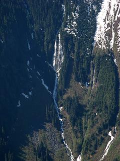 Big Waterfall into Panther Creek below Red Mountain 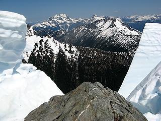 Looking through broken Gabriel cornice (Tarheel-Elija ridge, Beebe, Crater, Jack) 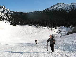 Earlier view of the Cabinet/Gabriel divide, with the Tarheel-Joseph col behind 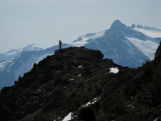 Mike on ridge, with Snowfield behind 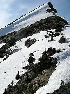 Cutting tracks to not-Elija 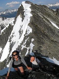 Arriving at not-Elija; real-Elija behind 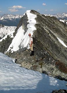 Mike on not-Elija, Eric on real-Elija 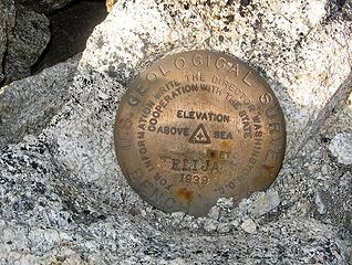 Elija summit marker 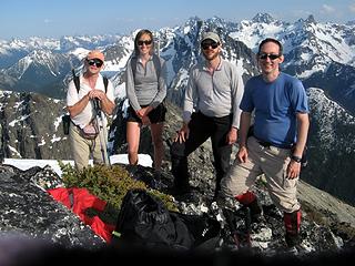 Elija summit group 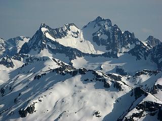 Logan 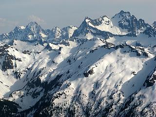 Goode, Stormking, Logan 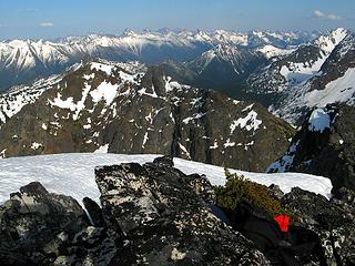 View long way back down the ridge to Joseph, Tarheel, camp, & Mebbe 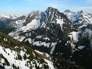 Gabriel 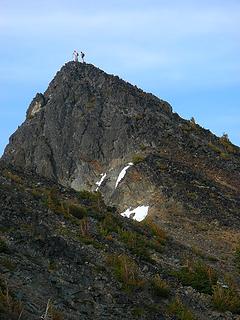 Mike & Erin on Joseph summit 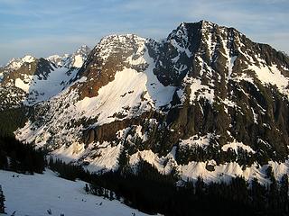 Evening light on Gabriel - Will Matt get up for the sunrise again?
- Will West Tarheel be an obstacle for getting to Beebe?
- How much counter-elevation this time?
- How many summits will Erin have duplicated during this trip?
As beacons mountains burned at evening. J.R.R. Tolkien
Now I Fly
As beacons mountains burned at evening. J.R.R. Tolkien
Now I Fly
|
| Back to top |
|
|
|
|
You cannot post new topics in this forum
You cannot reply to topics in this forum
You cannot edit your posts in this forum
You cannot delete your posts in this forum
You cannot vote in polls in this forum
|
Disclosure: As an Amazon Associate NWHikers.net earns from qualifying purchases when you use our link(s). |


