| Previous :: Next Topic |
| Author |
Message |
JimK
Member


Joined: 07 Feb 2002
Posts: 5606 | TRs | Pics
Location: Ballard |
|
JimK
Member
|
 Sun Apr 27, 2008 4:45 pm |
|
|
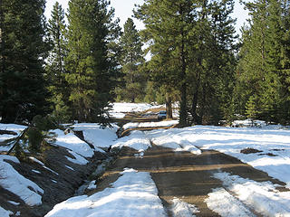
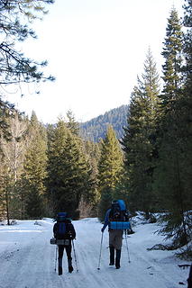
The Teanaway area is officially open for business. The last few years I've started my backpacking season with a late winter or early spring camp on top of a Teanaway Peak. Two solo trips to Iron Peak, A group camp below Earl Peak's summit, and one to Navaho Peak's saddle with summits of Navaho and Little Navaho. This year I convinced Bob, Kolleen, and David to accompany me back to Iron Peak. We met in Bellevue at 6:30 and headed off to the Teanaway. We all crammed into David's Outback. I was surprised we were able to drive half a mile beyond 29 Pines campground. There was snow and bare spots on the road.
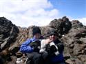
 Parking Spot 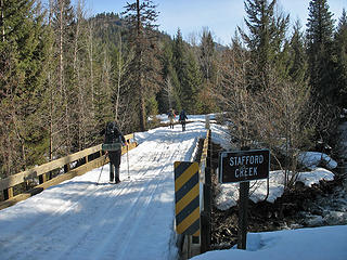 Stafford Creek 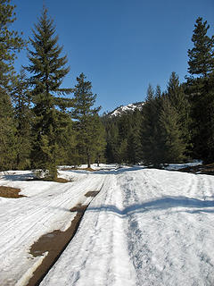 A Small Bare Spot 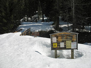 Beverly Trailhead 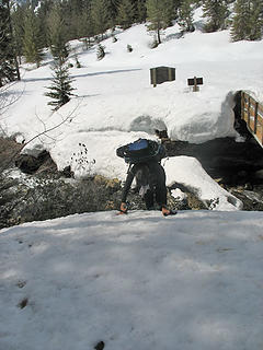 Scrambling Off Bridge 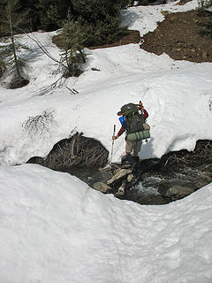 Crossing Bean Creek 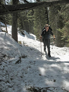 David On Route 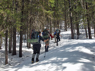 In Forest 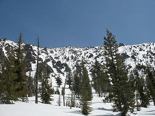 Valley Wall 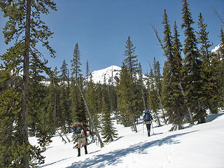 First Peak View 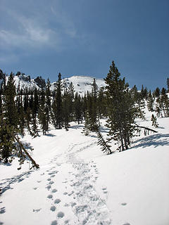 Beyond The Creek 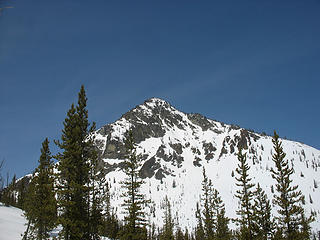 Bill Peak 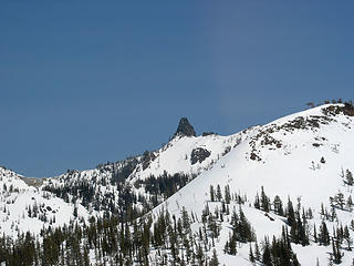 Volcanic Neck 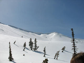 Corniced Ridge 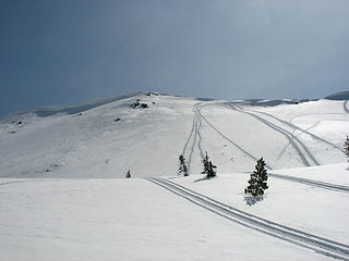 Usual Route Up & Down 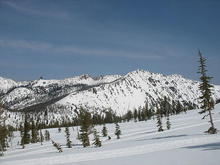 View East 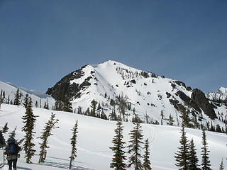 Teanaway Peak 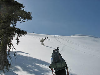 Nearing Ridge 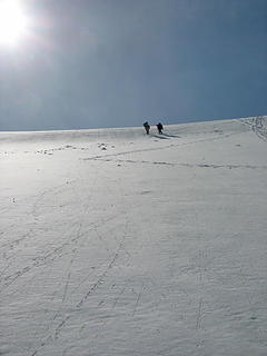 Almost To Ridge Top 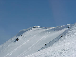 Summit From Ridge 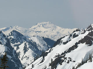 Mt. Daniel 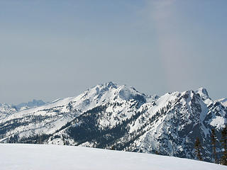 Hawkins & Esmerelda  Last Climb 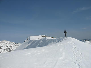 Summit Ahead 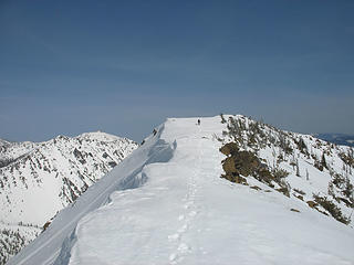 Nearly To Campsite 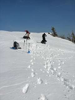 At Campsite 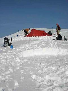 Trail Pair Site 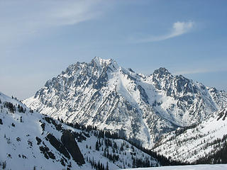 Sunny Mt. Stuart 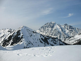 Teanaway & Stuart 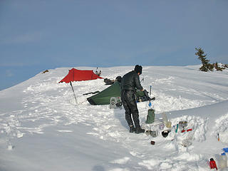 Kolleen 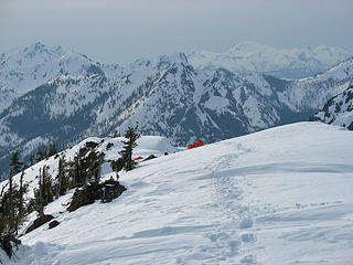 Camp From Summit 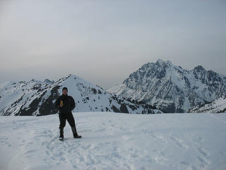 David At Summit 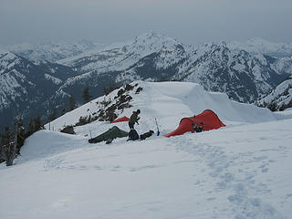 Amidst The Mountains 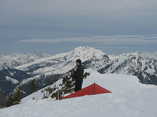 David & His Akto 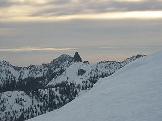 Volcanic Neck In AM 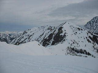 Iron Ridge 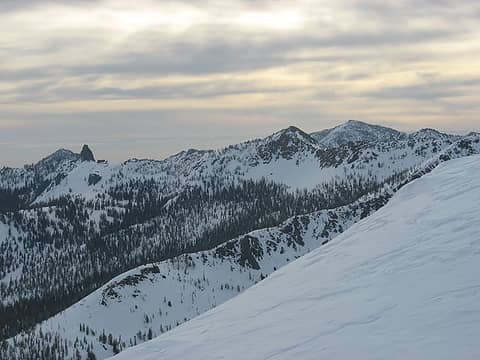 Morning View East 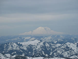 Mt. Rainier 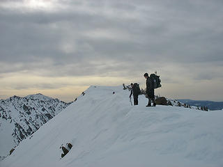 Ready To Glissade 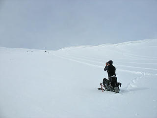 David Is Down 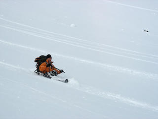 Here Comes Bob! 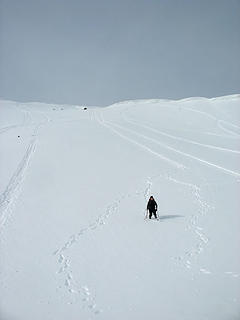 Kolleen & Tracks 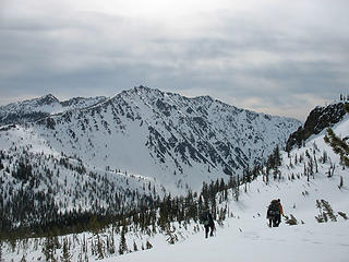 Mary Peak On Descent 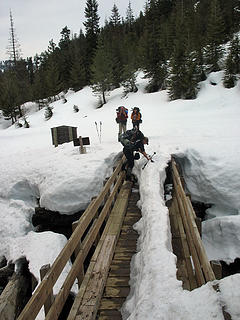 Summer Trailhead 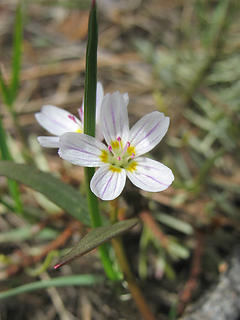 In Bloom
|
| Back to top |
  
|
|
Yet
Member

Joined: 23 Apr 2005
Posts: 2634 | TRs | Pics
Location: Happily Ever After |
|
Yet
Member
|
Sun Apr 27, 2008 4:47 pm |
|
|
| JimK wrote: | | Tune back in to find out if I made it back alive. |
Gosh, I hope so! I want to read the TR. 
|
| Back to top |
|
|
Bryan K
Shameless Peakbagger

Joined: 29 Sep 2005
Posts: 5129 | TRs | Pics
Location: Alaska |
|
Bryan K
Shameless Peakbagger
|
Sun Apr 27, 2008 5:15 pm |
|
|
I hope you made it back otherwise someone else is posing/posting as JimK  BTW Jim, your website appears to have sustained an injury too. BTW Jim, your website appears to have sustained an injury too.
|
| Back to top |
|
|
GeoTom
Member
Joined: 19 May 2005
Posts: 3215 | TRs | Pics
Location: Earth |
|
GeoTom
Member
|
Sun Apr 27, 2008 5:26 pm |
|
|
You might have avoided this injury if you were a more experienced hiker.
Looking forward to the photos, and hope you are roaming the Teanaway again soon. 
|
| Back to top |
|
|
wildernessed
viewbagger

Joined: 31 Oct 2004
Posts: 9275 | TRs | Pics
Location: Wenatchee |
Jim, my advice to you, is that you take a course before wandering into the backcountry. 
Living in the Anthropocene
Living in the Anthropocene
|
| Back to top |
|
|
silly_traveler
~ roaming ~

Joined: 04 Jun 2006
Posts: 1525 | TRs | Pics
Location: Bellevue |
♫ You have brains in your head. You have feet in your shoes. You can steer yourself any direction you choose. And you're the one who will decide where you'll go. Oh the places you'll go. - Dr. Seuss
|
| Back to top |
|
|
Middle E
no more moustache

Joined: 10 Feb 2008
Posts: 432 | TRs | Pics
Location: Seattle, WA |
|
Middle E
no more moustache
|
Sun Apr 27, 2008 6:50 pm |
|
|
Brewmaster and I also wondered whether you might be on Iron, but noted you likely missed the sunset and sunrise you were hoping for.
Sorry to hear about the knee - hope you're back in the saddle soon!
pithy yet insightful signature
pithy yet insightful signature
|
| Back to top |
|
|
Opus
Wannabe

Joined: 04 Mar 2006
Posts: 3700 | TRs | Pics
Location: The big rock candy mountain |
|
Opus
Wannabe
|
Sun Apr 27, 2008 7:16 pm |
|
|
Nope, no fantastic sunset or sunrise on this one. The views and company were both great though! As for JimK, rumors of his demise are greatly exaggerated. We all made it out of this one more or less intact, though all slightly banged up.
Click here for the full photo gallery and some huge summit panoramas.
 Sun 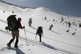 Traversing  Ridgeline 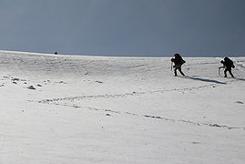 Zig zag  Jim 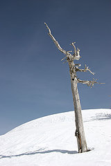 Dead tree  Huge cornices  Curious snowmobiler  Bob & Kolleens palace  Stuart range 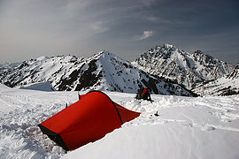 My tent  Ridge camp  Dinner 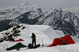 Back at camp  Pointing  Sunset  Sunrise 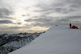 Morning  Bob  See the coyote? 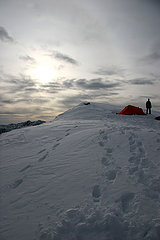 Breaking camp  Glissade!  Tricky tricky Bean creek
|
| Back to top |
|
|
Randy
Cube Rat

Joined: 18 Dec 2001
Posts: 2910 | TRs | Pics
Location: Near the Siamangs |
|
Randy
Cube Rat
|
Sun Apr 27, 2008 7:36 pm |
|
|
Sorry Jim to hear about your knee.
Can anyone one provide a road condition report?
|
| Back to top |
|
|
TrailPair
Member

Joined: 17 Apr 2005
Posts: 1699 | TRs | Pics
|
| Randy wrote: | | Sorry Jim to hear about your knee.
Can anyone one provide a road condition report? |
We were only able to drive about .5 miles beyond 29 Pines, so we had a long, long road walk of almost 5 miles! 
This thing called work is interfering with my play
This thing called work is interfering with my play
|
| Back to top |
|
|
wildernessed
viewbagger
Joined: 31 Oct 2004
Posts: 9275 | TRs | Pics
Location: Wenatchee |
Always looks nice , I like the tent pics to !
Living in the Anthropocene
Living in the Anthropocene
|
| Back to top |
|
|
Mike Collins
Member

Joined: 18 Dec 2001
Posts: 3097 | TRs | Pics
|
| JimK wrote: | | I managed to sprain my knee pretty thoroughly. |
Justus and I decided to pay some snowmobilers to drive us up that road several weeks ago to avoid that wear and tear. I hope you are fit for duty soon.
|
| Back to top |
|
|
TrailPair
Member
Joined: 17 Apr 2005
Posts: 1699 | TRs | Pics
|
Since Jim K will provide a more detailed report, we will just give a short version. While walking the Teanaway Road we had the fortune of seeing a bobcat! That was a first for all of us. The crossing of Bean Creek was a little tricky, and Jim has the misfortune of his pole collapsing while stepping across, causing him to cork screw waiste deep in 10 inches of water...spraining his knee. But he persevered.
The scenery was fantastic on Saturday, although high clouds appeared in the evening. But that kept the temperature moderate, and the snow stayed soft. We did not use the crampons we had carried. The guys briefly used snowshoes in the upper basin on Saturday, but K did fine without them.
 Teanaway road 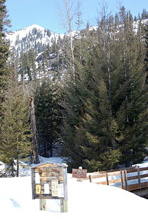 Trail Head. 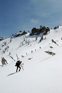 On east slope of Iron Peak 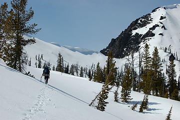 Traversine to ridge, Teanaway Peak on right. 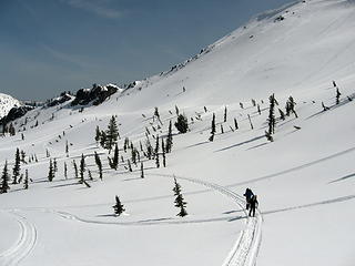 Opus and Jim K 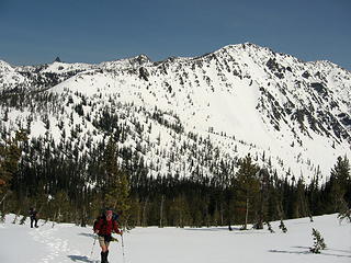 Bob, with Mary Peak beyond 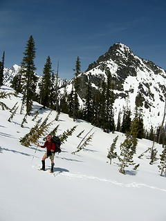 Bob and Bill Peak 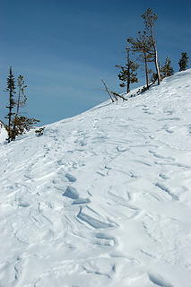 Texture 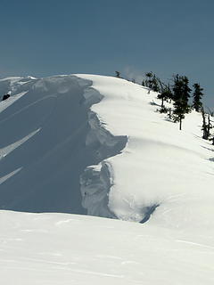 Cornices on Iron Peak 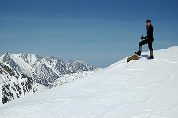 K on Iron Peak. 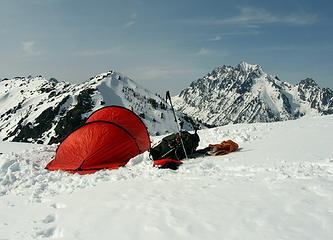 Our tent, Teanaway Peak and Stuart 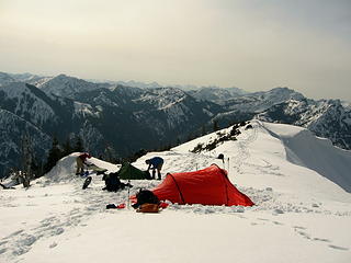 Busy campsite 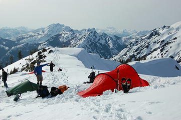 Pointing 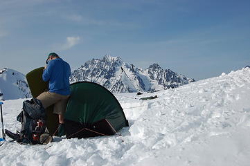 Jim K 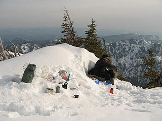 Opus and a messy kitchen 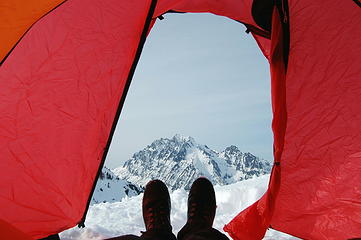 Foot shot for Silly_Traveler 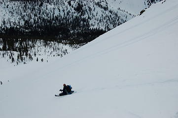 Opus 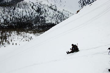 Jim the leading the glissade 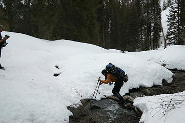 Crossing Bean Creek on way out. 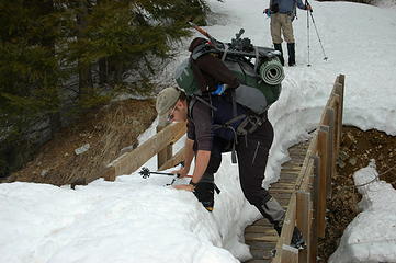 Opus on bridge by trail head.
This thing called work is interfering with my play
This thing called work is interfering with my play
|
| Back to top |
|
|
Gil
Member

Joined: 29 Sep 2004
Posts: 4062 | TRs | Pics
|
|
Gil
Member
|
Sun Apr 27, 2008 9:14 pm |
|
|
Sounds like a great trip. Sorry about your knee, Jim. Hope it's better soon.
Friends help the miles go easier.
Klahini
Friends help the miles go easier.
Klahini
|
| Back to top |
|
|
EastKing
Surfing and Hiking

Joined: 28 Mar 2007
Posts: 2082 | TRs | Pics
Location: 77 miles from Seattle! |
|
EastKing
Surfing and Hiking
|
Sun Apr 27, 2008 9:15 pm |
|
|
That looked fun (except for the injury) . Don't be surprised if you get a PM from me asking for directions to this place for next week. GREAT PHOTOS! I wish the best of luck on the injury.
YouTube | SummitPost
Saw the depths of despair. Now I am salvaging what time I have left on Earth.
YouTube | SummitPost
Saw the depths of despair. Now I am salvaging what time I have left on Earth.
|
| Back to top |
|
|
|
|


 wondering if you guys were up on Iron


