| Previous :: Next Topic |
| Author |
Message |
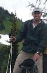
Elvis
Shuffl'n


Joined: 09 Jun 2004
Posts: 1804 | TRs | Pics
Location: del Boca Vista |
|
Elvis
Shuffl'n
|
 Sat Apr 05, 2008 5:37 pm |
|
|
A number of weeks ago I wrote a report about the Hertz Trail, aka the North Lake Whatcom Trail. Today's trip report starts at the same place, but heads up above the lake on a gated logging/DNR road.
The family has been out of town for the week and I need to pick them up in SeaTac tonight. With all the driving I really didn't want to spend MORE time in the car but I still wanted to go somewhere new. This was close enough and has been on my 'places to check out' list for a while now.
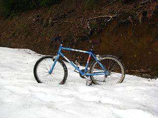
Round Trip was about 6 miles or so, with about 2,000 ft elevation gain. My plans were to go further and higher, but I called it quits when the snow became deeper than about 9 inches. I had my Stabilicers, which worked great... but forgot the gaiters. Thus, the deeper snow started to cause me some issues.
Only saw 3 others on the road, everyone else stuck to the trail along the lake. It seems this is a really popular place for people with dogs.
The trail is actually a logging road and it follows alongside, or under, the huge powerlines. So, while it's not wilderness, it is quiet and can offer some nice views of Lake Whatcom, Bellingham and the San Juan Islands.
Took lots of pictures, but most of them include power towers or power lines. There were some snow doughnuts, much to my surprise.
Despite the weather forecasts, I stayed dry and comfortable.
First, the 'close up' pics:
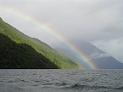
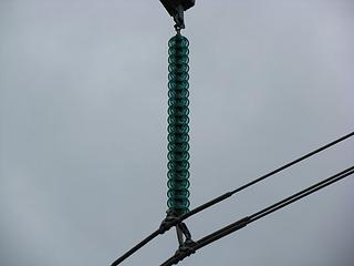 Insulator... big 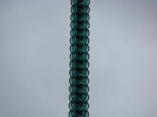 More Insulators 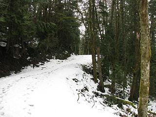 You Have Snow! 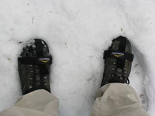 Stabilicers+Shoe Shot 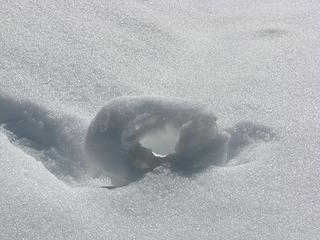 Melting Doughnut 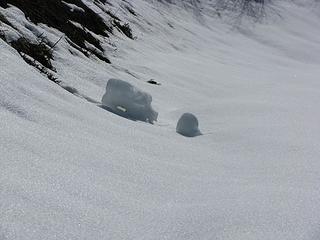 Snow Doughnut, or a pig or a Scion B? 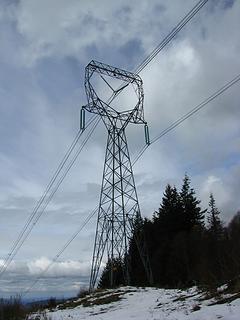 The Aliens Have Landed! 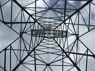 Power Tower 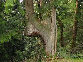 Funk'd up tree 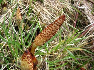 Spring being sprung 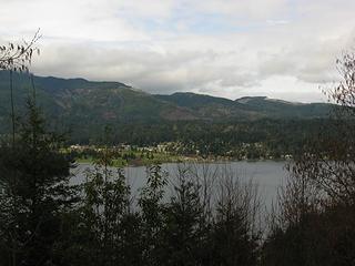 View will disappear in summer 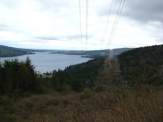 View from down low 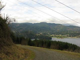 Road and Lk Whatcom and Sudden Valley 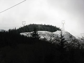 Targeted Destination Area 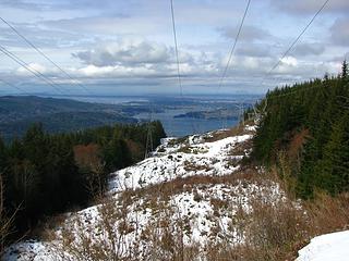 More View 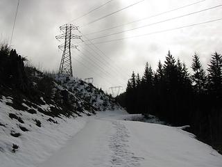 Tower, Wire, Road 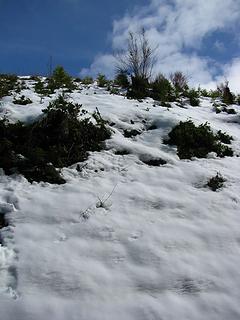 Doughnut Producing Hill and blue sky 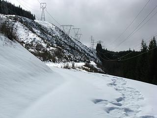 Road finally levels out 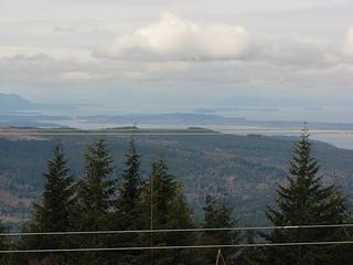 San Juans beyond Chuckanuts 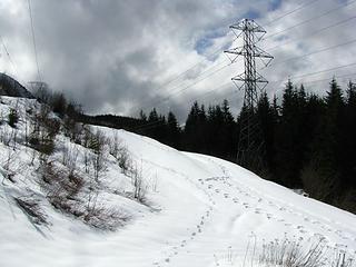 Tracks 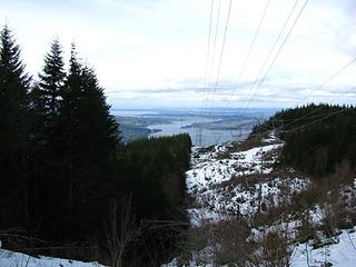 View from Power Corridor 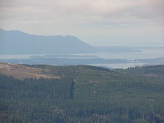 San Juans over Lookout/Galbraith Mtn 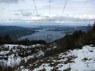 Lk Whatcom, Bham, Bham Bay 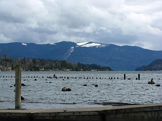 View from Bloedel Donovan Park at N. end of Lk Whatcom
"Ill habits gather unseen degrees, as brooks make rivers, rivers run to seas." ~John Dryden
My Trip List
"Ill habits gather unseen degrees, as brooks make rivers, rivers run to seas." ~John Dryden
My Trip List
|
| Back to top |
  
|
|
Eric
Peak Geek

Joined: 21 Oct 2002
Posts: 2062 | TRs | Pics
Location: In Travel Status |
|
Eric
Peak Geek
|
Sat Apr 05, 2008 6:57 pm |
|
|
Ah a familiar place. That 3087 spot is known as Whacme or Whatcom-Acme and it does have good views to the east. The actual summit is a torn up logging area but has good views to Baker and Twin Sisters.
If you go a little bit further than you did, you will be on Sierra Pacific Industries logging land. Technically I believe you need a permit to enter their land but I don't think it would be the end of the world if a person walked up there when they weren't logging. Or at least I did it and the world hadn't ended yet.
I was glad I had my iPod with when I did that one as it drowned out the buzz from the powerlines.
|
| Back to top |
|
|
yew
non-technical
Joined: 12 Dec 2005
Posts: 1173 | TRs | Pics
Location: Bellingham |
|
yew
non-technical
|
Sat Apr 05, 2008 9:53 pm |
|
|
Thanks for writing up this TR Elvis because I was wondering what the snow situation was like up there. This hillside you walked up is highly visible from southbound I-5 around the Northwest Dr. exit.
| Elvis wrote: | | It seems this is a really popular place for people with dogs. |
That's because technically (since it's a logging road) dogs are not required to be on a leash but leashes are required on the Hertz Trail.
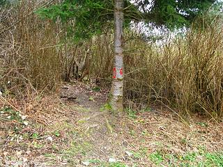
Did you see the newly constructed trail with flagging about 2000 feet up from the bottom? It goes about 3/4 miles in/north then stopped, as of last spring. A very old logging roadbed continues on but stops about 1.0 miles from the main road. It'll be great when this trail is fully constructed!
"I aint jokin woman, I got to ramble...We gonna go walkin through the park every day." - Led Zeppelin
"I aint jokin woman, I got to ramble...We gonna go walkin through the park every day." - Led Zeppelin
|
| Back to top |
|
|
Mega-Will
country bumpkin

Joined: 22 Dec 2006
Posts: 655 | TRs | Pics
Location: Olympic Peninsula |
|
Mega-Will
country bumpkin
|
Sat Apr 05, 2008 11:16 pm |
|
|
With a 35 pound pack, that steadily graded road is probably the best workout hike in NW Washington. It's had snow on it for much more of this winter than usual though. Definetely bring the tunes though!
|
| Back to top |
|
|
Elvis
Shuffl'n

Joined: 09 Jun 2004
Posts: 1804 | TRs | Pics
Location: del Boca Vista |
|
Elvis
Shuffl'n
|
Sun Apr 06, 2008 10:01 am |
|
|
Eric - thanks for the peak name. I guess I can't name it myself.  Y.B. - Just enough snow for snowshoeing at about 2,200 ft, IMO, but it's probably short lived now.
There were tracks from 1 other person that had been up there since the most recent snow. That person brought snowshoes and made good use of them. He/She continued on past my turnaround point, staying to the right at the 2,400 ft 'Y'.
I did see a couple trails branching off the road but was unsure where they were to/from. One was a short ways from the TH that headed southward (see following pics). There was another one at a slightly lower elevation that came in from North of the road. Up higher (at 2,000) I didn't see anything that resembled a trail, but it could have been obscured by snow.
Y.B. - Just enough snow for snowshoeing at about 2,200 ft, IMO, but it's probably short lived now.
There were tracks from 1 other person that had been up there since the most recent snow. That person brought snowshoes and made good use of them. He/She continued on past my turnaround point, staying to the right at the 2,400 ft 'Y'.
I did see a couple trails branching off the road but was unsure where they were to/from. One was a short ways from the TH that headed southward (see following pics). There was another one at a slightly lower elevation that came in from North of the road. Up higher (at 2,000) I didn't see anything that resembled a trail, but it could have been obscured by snow.
 0.6 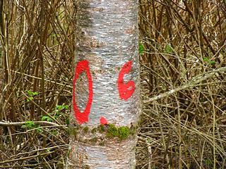 0.6
"Ill habits gather unseen degrees, as brooks make rivers, rivers run to seas." ~John Dryden
My Trip List
"Ill habits gather unseen degrees, as brooks make rivers, rivers run to seas." ~John Dryden
My Trip List
|
| Back to top |
|
|
Mega-Will
country bumpkin
Joined: 22 Dec 2006
Posts: 655 | TRs | Pics
Location: Olympic Peninsula |
|
Mega-Will
country bumpkin
|
Sun Apr 06, 2008 8:42 pm |
|
|
| Elvis wrote: | | There were signs marking off a DNR Timber Sale area at about 1,600 feet, just before the snow became consistent. |
Yeah I don't know the real specifics about that, but I think the DNR marked it off to be cut, but no contractors have bid on it or something like that. There is currently a proposal to turn about 8,000 acres of the Whatcom watershed into a county park (approx. 4,000 acre units on either side of the lake), and the east unit includes that timber sale, so it's pretty unsure whether it will go through or not. Looks like particularly mangy second growth in that area to me, but whatever. It's along a road and a major power corridor so it wouldn't be a massive loss either way.
|
| Back to top |
|
|
Elvis
Shuffl'n
Joined: 09 Jun 2004
Posts: 1804 | TRs | Pics
Location: del Boca Vista |
|
Elvis
Shuffl'n
|
Sun May 04, 2008 10:38 pm |
|
|
Had some free time this afternoon, so pumped up the bike tires and recruited CHawk to make a second attempt at reaching Whacme peak (3,087 ft).
Less snow than before, but ultimately decided to ditch the bikes as the snow was too soft for riding in when we encountered it at about 2,500 feet.
Foiled again... only made it a quarter mile or so after the second road intersection, about a mile short of the summit and hopeful views of Baker and the Twin Sisters. Third time will be a charm for sure.
Due to the steep grade of the road, we walked the bikes up the majority of the way but enjoyed the quick descent. Estimated 2.5 hours up, 30 minutes down.
Flies and mosquitoes are starting to make their presence known, but were still far from becoming a nuisance.
Saw three others on the road today.
Pictures pick up from where I turned around on the initial trip.
 Auto-Park 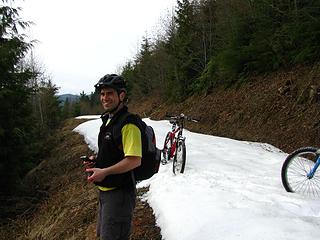 Road Conditions 5-4-08 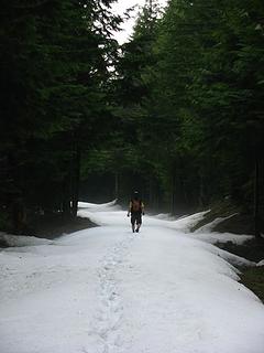 Ditched the bikes 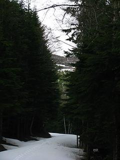 Road and Ridge 5-4-08 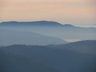 Distant scenery 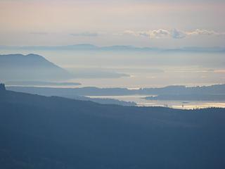 San Juans 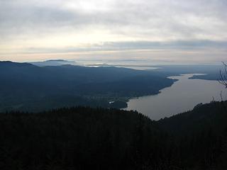 Bham and San Juans
"Ill habits gather unseen degrees, as brooks make rivers, rivers run to seas." ~John Dryden
My Trip List
"Ill habits gather unseen degrees, as brooks make rivers, rivers run to seas." ~John Dryden
My Trip List
|
| Back to top |
|
|
GaliWalker
Have camera will use

Joined: 10 Dec 2007
Posts: 4929 | TRs | Pics
Location: Pittsburgh |
|
GaliWalker
Have camera will use
|
Mon May 05, 2008 9:08 am |
|
|
Elvis, "Distant scenery" and "San Juans" are beautiful!
|
| Back to top |
|
|
Elvis
Shuffl'n

Joined: 09 Jun 2004
Posts: 1804 | TRs | Pics
Location: del Boca Vista |
|
Elvis
Shuffl'n
|
Tue May 06, 2008 12:07 am |
|
|
Thanks GW.
Too much haze, lack of a solid black and a solid white... but I enjoy them too... especially from a distance.
"Ill habits gather unseen degrees, as brooks make rivers, rivers run to seas." ~John Dryden
My Trip List
"Ill habits gather unseen degrees, as brooks make rivers, rivers run to seas." ~John Dryden
My Trip List
|
| Back to top |
|
|
|
|
You cannot post new topics in this forum
You cannot reply to topics in this forum
You cannot edit your posts in this forum
You cannot delete your posts in this forum
You cannot vote in polls in this forum
|
Disclosure: As an Amazon Associate NWHikers.net earns from qualifying purchases when you use our link(s). |


