| Previous :: Next Topic |
| Author |
Message |
Arete
Member


Joined: 29 Oct 2006
Posts: 137 | TRs | Pics
Location: Bothell, WA |
|
Arete
Member
|
 Mon May 19, 2008 12:39 am |
|
|
With the avalanche danger high in the upper elevations, we opted for a 5-summit Tiger Mountain Traverse this Saturday. It was a very pleasant 14-mile ramble (about 3,000 ft of climbing total) across the summits of Middle, East, West-1, West-2, and West-3 that took us through a lot of cool forests (with a few less-than-cool road walking sections).
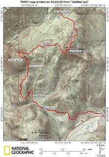 Map of first part of traverse 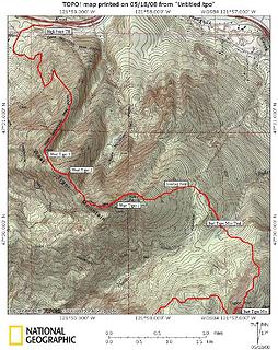 Map of second part of traverse 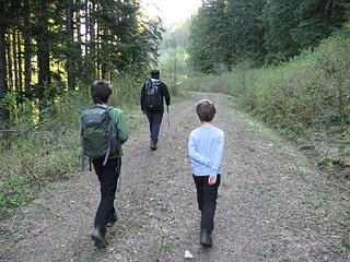 Early morning on the Westside Road 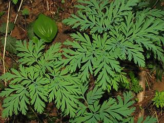 Bleeding heart foliage 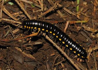 One of our wildlife distractions 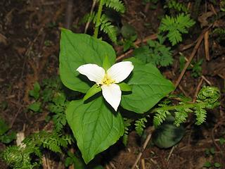 Trillium 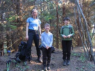 On summit #1 - Middle Tiger (still happy & cool) 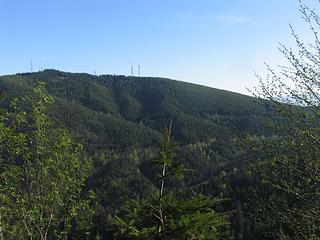 West Tiger 1 from just below Middle Tiger 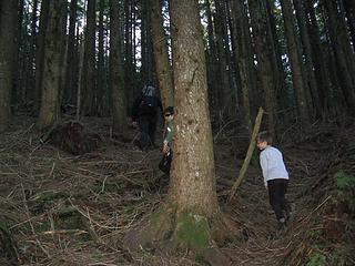 Starting up the west slope of East Tiger 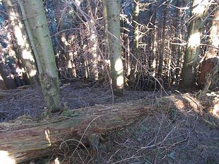 Doghair thicket slope on the west face of East Tiger 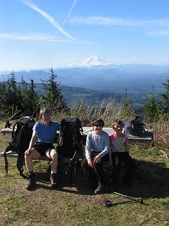 Picnic breakfast atop East Tiger 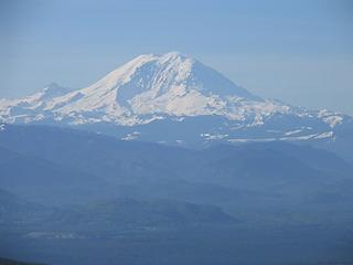 Mount Rainier from East Tiger 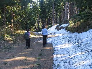 Snow on Tiger Mountain in mid-May! 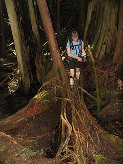 Root bridge across Soderman Creek 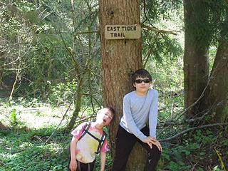 Are we hot and tired yet? 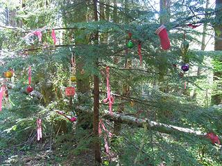 The Bootleg Christmas Tree 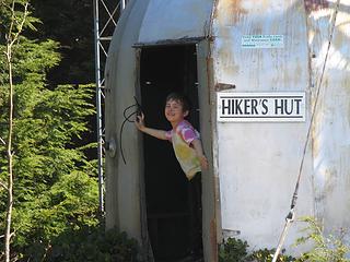 Cooling off in the Hiker's Hut on West Tiger 1 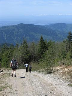 The hot road between West Tiger 1 and 2 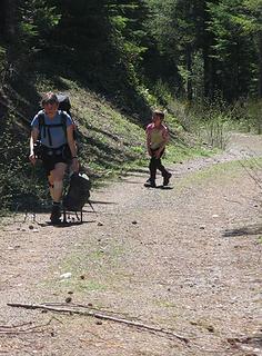 The hot road up to West Tiger 2 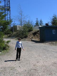 Scenic summit of West Tiger 2 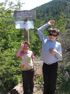 The fifth and final summit - West Tiger 3
|
| Back to top |
  
|
|
tigermn
Member

Joined: 10 Jul 2007
Posts: 9242 | TRs | Pics
Location: There... |
|
tigermn
Member
|
Mon May 19, 2008 6:28 am |
|
|
Sill some snow up there. Unbelievable. Gotta be gone soon.
I've thought about a 5 summit ordeal sometime. Definitely looks like a 2 car operation or you're in for a real long day.
|
| Back to top |
|
|
Mark Griffith
(Embrace yourself)

Joined: 14 Mar 2005
Posts: 853 | TRs | Pics
Location: Issaquah |
Nice job on getting the kids out. One of these days I want to do the trip traverse of Tiger, Squak and Cougar...
|
| Back to top |
|
|
puzzlr
Mid Fork Rocks

Joined: 13 Feb 2007
Posts: 7220 | TRs | Pics
Location: Stuck in the middle |
|
puzzlr
Mid Fork Rocks
|
Mon May 19, 2008 8:11 pm |
|
|
14 miles! Way to go kids (and you too parents) 
|
| Back to top |
|
|
Arete
Member
Joined: 29 Oct 2006
Posts: 137 | TRs | Pics
Location: Bothell, WA |
|
Arete
Member
|
Mon May 19, 2008 9:15 pm |
|
|
Thanks all - these guys love to hike, so long as it includes enough on-trail story telling (getting increasingly challenging on the uphills), sugar-laden treats, summits, interesting bugs, and either snow to glissade on or rocks to scramble on. The hardest part of this hike for them was the heat. That seems to have been the case since they started out as little hikers - so long as we began at the crack of dawn and were heading down by early afternoon they were happy campers.
MBGriffi: Last year the older boy and I did a Tiger, Squak, Cougar traverse of sorts in the wintertime. There are probably better routes but this is what we did:
From Hwy 18 trailhead we took Tiger Mountain Road to the top of East Tiger. Backtracked down the summit spur road and continued down Tiger Mtn Rd to Paw Print. Went west on the RR Grade trail to the TMT which we followed west to 15-mile gap. Then the One View trail to the Poo Poo Pt trail to the glider launch spot and down the Chirico trail.
From where we reached the Issaquah Hobart Rd we didn't know of any direct connection so we followed the Rd north to Sycamore Dr SE and up the winding streets to the Sycamore trailhead (the least favorite part of our trip (it would be ncie if someoen knew of a better connection). We ascended the nice East rdige trail on Squak through Thrush Gap and on to the central Pk of Squak. We descended the C1, N1, and W1 trails to the west access at Hwy 900 where we met the other half of our family for the trail up Wilderness Peak in Cougar Mtn Park (very little road walking needed to get to the north spur access trail going up Wilderness Peak).
All told it was not a wilderness experience by any means, but a fun day of route finding and a good long hike with a nice variety of trails, roads, landscapes, plants, and people.
|
| Back to top |
|
|
Mark Griffith
(Embrace yourself)
Joined: 14 Mar 2005
Posts: 853 | TRs | Pics
Location: Issaquah |
| Arete wrote: | | MBGriffi: Last year the older boy and I did a Tiger, Squak, Cougar traverse of sorts in the wintertime. There are probably better routes but this is what we did:
From Hwy 18 trailhead we took Tiger Mountain Road to the top of East Tiger. Backtracked down the summit spur road and continued down Tiger Mtn Rd to Paw Print. Went west on the RR Grade trail to the TMT which we followed west to 15-mile gap. Then the One View trail to the Poo Poo Pt trail to the glider launch spot and down the Chirico trail. |
Cool, when I have done my Tiger Traverse, I didn't aim for all 5 summits, just up and over, I started over off of exit 21 in Preston and up to West Summit and the hut and then down to Poo Poo Point.
| Arete wrote: | | From where we reached the Issaquah Hobart Rd we didn't know of any direct connection so we followed the Rd north to Sycamore Dr SE and up the winding streets to the Sycamore trailhead (the least favorite part of our trip (it would be ncie if someoen knew of a better connection). |
I have wondered if there is a trail you could take directly across from the landing zone on Issaquah Hobart at the trail head of the Chirico Trail :
http://www.gmap-pedometer.com/?r=1911451
Does anyone know?
| Arete wrote: | | We ascended the nice East rdige trail on Squak through Thrush Gap and on to the central Pk of Squak. We descended the C1, N1, and W1 trails to the west access at Hwy 900 where we met the other half of our family for the trail up Wilderness Peak in Cougar Mtn Park (very little road walking needed to get to the north spur access trail going up Wilderness Peak). |
When you exit Squak on 900, you should only have to walk up 900 heading south toward Rentonfor around 25 yards till come to Squak Connector trail on Cougar Mountain, its about 3/4 of a mile before the Wilderness Creek trail head :
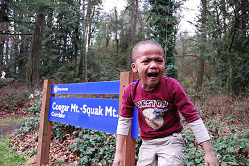 My Son none to happy to start a hike (he had fun after a few minutes) 
| Arete wrote: | | All told it was not a wilderness experience by any means, but a fun day of route finding and a good long hike with a nice variety of trails, roads, landscapes, plants, and people. |
|
| Back to top |
|
|
|
|
You cannot post new topics in this forum
You cannot reply to topics in this forum
You cannot edit your posts in this forum
You cannot delete your posts in this forum
You cannot vote in polls in this forum
|
Disclosure: As an Amazon Associate NWHikers.net earns from qualifying purchases when you use our link(s). |


