| Previous :: Next Topic |
| Author |
Message |
Matt
Tea, Earl Grey, Hot


Joined: 30 Jan 2007
Posts: 4307 | TRs | Pics
Location: Shoreline |
|
Matt
Tea, Earl Grey, Hot
|
 Fri Jun 06, 2008 1:00 am |
|
|
Date: 5/31/08
Destination: Devils Peak 5456 and Devils Thumb 5172 (USGS Silverton)
Party: Matt, mtnmike, Randy, Beave. Plus three other groups also at Devils.
Note: Randy & Craig already posted a trip report for the Devils Peak segment of this trip, with lots of photos. Im posting a separate report in order to include the routes for both peaks combined.
This trip included:
- Closed and overgrown roads Deer Creek & Coal Creek
- Very good snow for travel into and above a high basin Devils Lake.
- Traffic jam for climbers Devils Peak
- Interesting scrambling Devils Thumb
- Good summit views all around the Mountain Loop Highway area, and especially the Three Fingers Range
- Missed opportunity for a swim miniature icebergs calving into Devils Lake
Bad weather forced Mike and I to cancel our Diobsud outing for the third week in a row. But Randy & Craig were going to Devils Peak, so we joined up with them. Devils Peak & Thumb are two of the last few peaks Mike hasnt climbed on the Silverton quad.
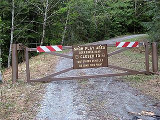
Deer Creek Gate to Devils Lake
At the Deer Creek parking lot (1575 feet), there was a red truck that Mike believed belonged to inveterate peak-bagger Mitch Blanton. While we were there, another group arrived, also heading for Devils.
We departed at 7:50am. The gate was unlocked, but the road was unusable because of numerous downed trees. We hiked the Deer Creek Road for a mile to the abandoned road along Coal Creek (1948 feet), then the Coal Creek road for 1.5 miles till it met the Devils Lake branch of the creek (2650 feet). The road along Coal Creek was variably brushy, with a decent boot path on early parts, but more brush later. Circa 2500 feet, it turned to solid snow cover, for easier travel.
 Deer Creek Road Gate 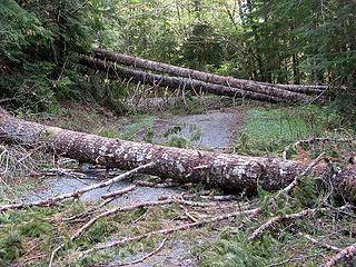 Trees down on Deer Creek Road 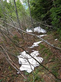 Brush on Coal Creek Road 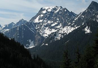 View back to Big Four from the road 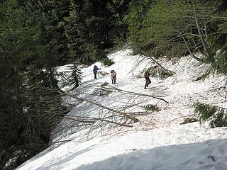 Snow cover near the end of the road 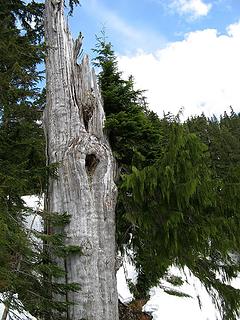 Survivor Tree along the way the cedar limb at right is growing from the silvered trunk 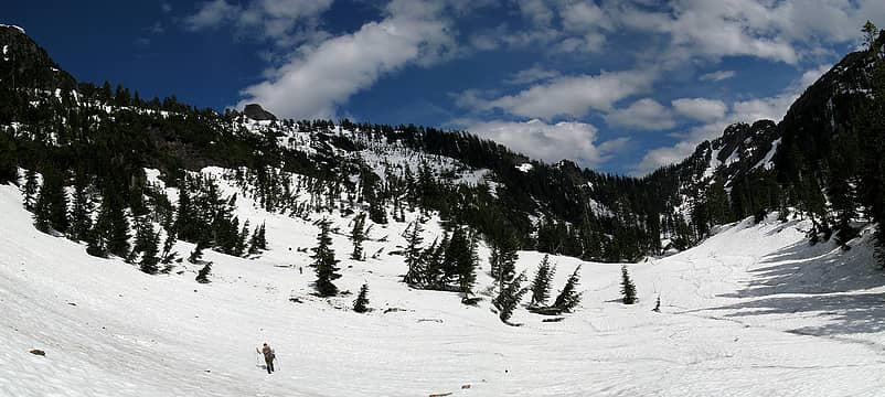 View of the summits from Devils Lakes basin 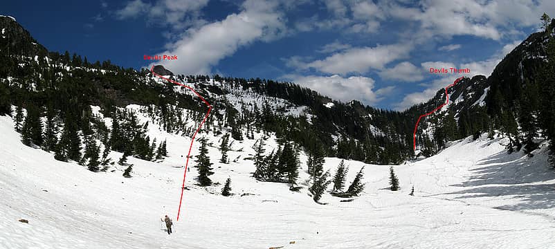 View with routes marked 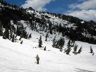 Heading up from the basin 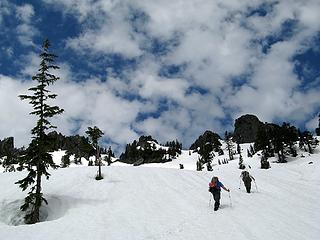 Nearing the summit block 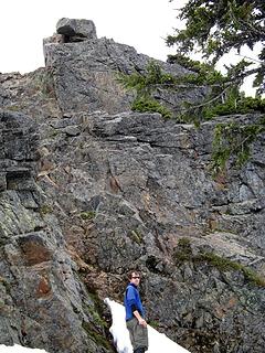 The climbing pitch up the jumble at left, right on the ledge, back left on the crest 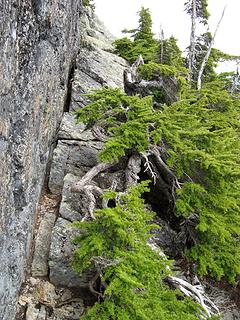 The Ledge 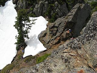 Craig and Randy at the notch; Mitch & Steve at the base of the rappel 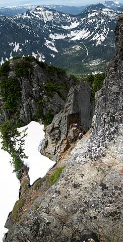 Vertical Stitch Craig starting to climb 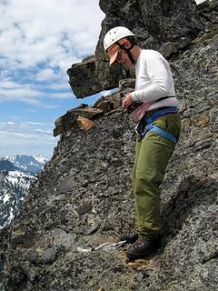 Mike photographing the climbers 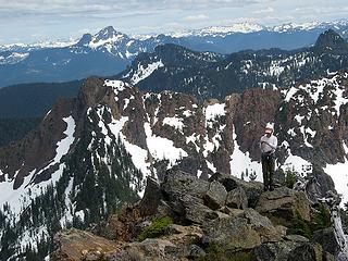 Mike near the summit, with Devils Thumb behind. 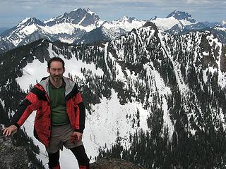 Matt & Three Fingers Peaks 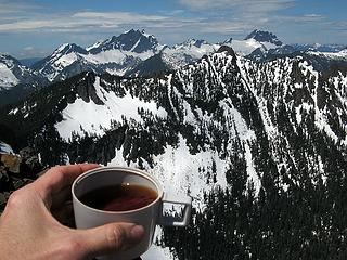 Summit Tea 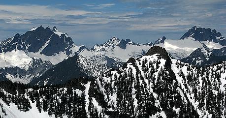 At least I climbed everything on the horizon of this shot Three Fingers, Salish, Bullon, Buckeye, Whitehorse 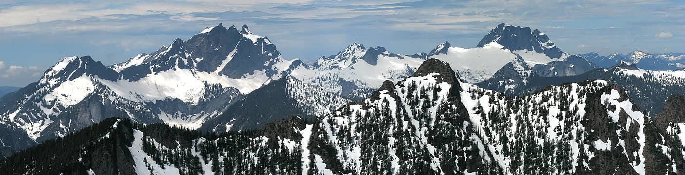 Looking Northwest: Big Bear to Whitehorse 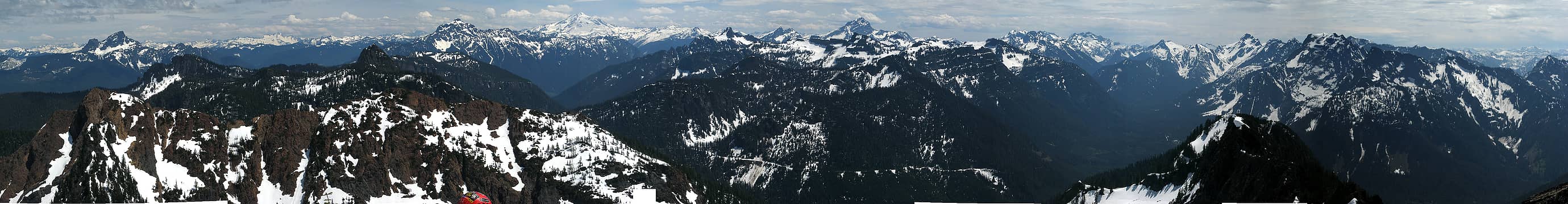 27 labels Looking north to southeast: Whitechuck to Big Four, plus Craig's helmet 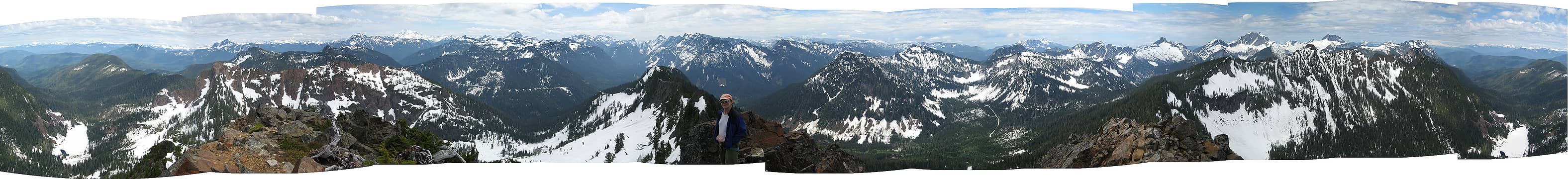 38 labels 360 View from Devils Peak, panning clockwise from Helena Lake to Helena Lake 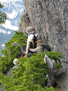 Meeting Mitch & Steve on the ledge 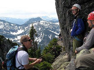 Meeting the next group on our way down 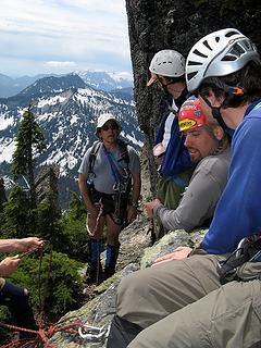 Getting cozy on the ledge 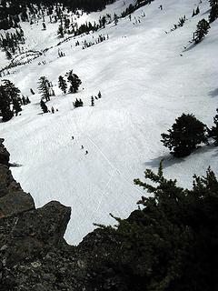 Yet another group approaching 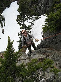 Mike rappelling 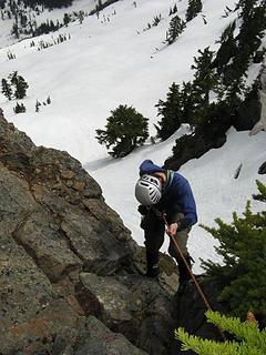 Randy rappelling 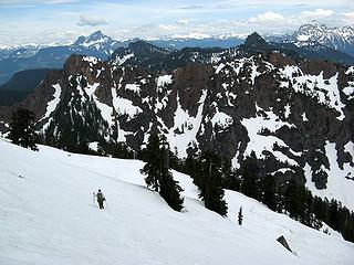 Coming off Devils and turning toward the Thumb 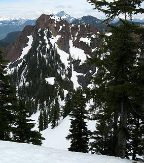 The Route to Devils Thumb 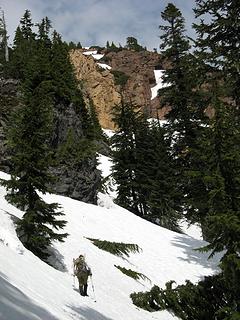 Head toward the light-colored rock, then go left of it 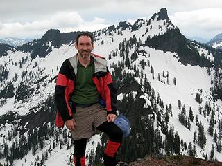 Matt & Devils Peak 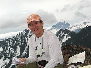 Mike drying out the register 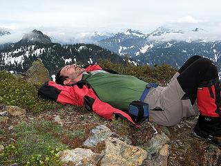 A brief nap in the brief sunshine 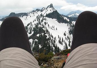 Getting a rise out of Devils 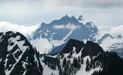 Clouds around Thee Fingers 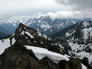 Clouds moving in on Big Four 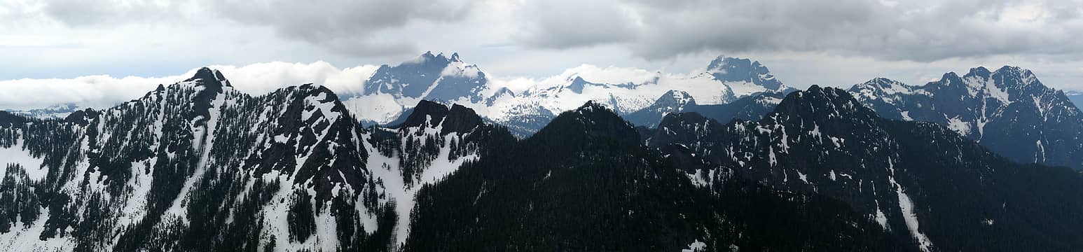 Pan looking northwest: Helena to Jumbo 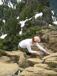 Down-climbing Sequence 1 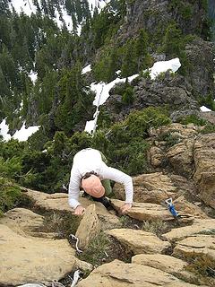 Down-climbing Sequence 2 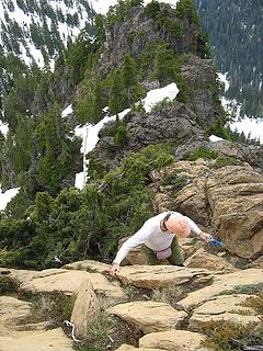 Down-climbing Sequence 3 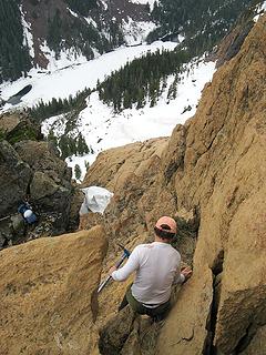 Turn left descend 20 feet and arrive at pack; turn right - drop 2000 feet and arrive at Helena lake 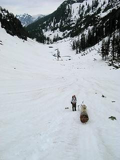 Log that glissaded into Devils Lake Basin 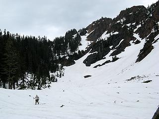 Mike arriving at the basin. Our route was on the irregular big blob of snow right of the col. 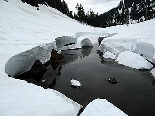 Devils Lake 1 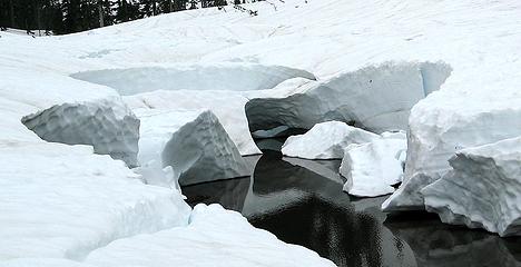 Devils Lake 2 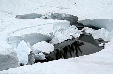 Devils Lake 3 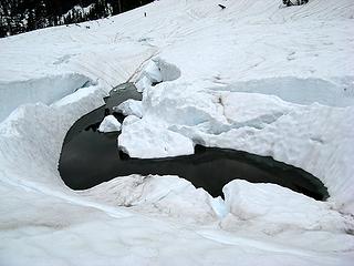 Devils Lake 5 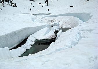 Devils Lake 8 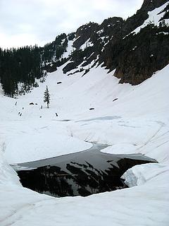 Devils Lake Final Reflection
As beacons mountains burned at evening. J.R.R. Tolkien
As beacons mountains burned at evening. J.R.R. Tolkien
|
| Back to top |
  
|
|
wildernessed
viewbagger

Joined: 31 Oct 2004
Posts: 9275 | TRs | Pics
Location: Wenatchee |
 Nice pics and scenery as usual ! Nice pics and scenery as usual !
Living in the Anthropocene
Living in the Anthropocene
|
| Back to top |
|
|
Hulksmash
Cleaning up.

Joined: 20 Apr 2008
Posts: 7113 | TRs | Pics
Location: Arlington |
|
Hulksmash
Cleaning up.
|
Fri Jun 06, 2008 9:57 am |
|
|
"Bears couldn't care less about us....we smell bad and don't taste too good. Bugs on the other hand see us as vending machines." - WetDog
Albuterol! it's the 11th essential
"Bears couldn't care less about us....we smell bad and don't taste too good. Bugs on the other hand see us as vending machines." - WetDog
Albuterol! it's the 11th essential
|
| Back to top |
|
|
paultkuhn
Member

Joined: 11 Jun 2007
Posts: 103 | TRs | Pics
|
Nice TR Matt. I tried Devils years ago in winter. The continual spindrift made our interest wane. Good to see what it actually looks like.
|
| Back to top |
|
|
Andy Schmidt
Formerly Fuu

Joined: 02 Jul 2007
Posts: 210 | TRs | Pics
Location: 98133 |
I love the Lake pics with the snow breaking up. If you toyed with the perspective you could pass it off as glaciers breaking off Antartica.
|
| Back to top |
|
|
|
|
You cannot post new topics in this forum
You cannot reply to topics in this forum
You cannot edit your posts in this forum
You cannot delete your posts in this forum
You cannot vote in polls in this forum
|
Disclosure: As an Amazon Associate NWHikers.net earns from qualifying purchases when you use our link(s). |


