| Previous :: Next Topic |
| Author |
Message |
Matt
Tea, Earl Grey, Hot


Joined: 30 Jan 2007
Posts: 4307 | TRs | Pics
Location: Shoreline |
|
Matt
Tea, Earl Grey, Hot
|
 Sat Jul 12, 2008 1:44 am |
|
|
Heres my trip report from the other half of the party climbing Bonanza last weekend.
Dates: July 6-8, 2008
Peak: Bonanza 9511
Party: Matt, Dicey, Yana, Randy, DonB
Bonanza highest non-volcanic peak in Washington
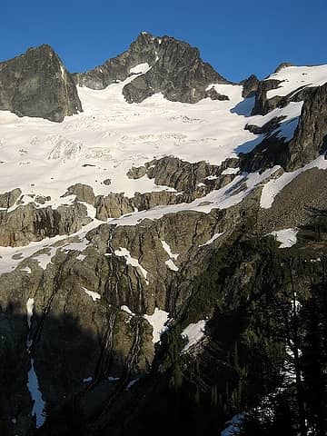
Bonanza big blocky peak dominating the eastern edge of the north-central Cascades.
Bonanza, from bottom to top, as viewed from Holden Pass:
- deep blue basin of Holden Lake,
- scores of waterfall streaming down the slab cliffs above the lake,
- crumpled blue icefalls of the Mary Green Glacier above the cliffs,
- bulging dark shoulders of rock above the glacier,
- and a steep gray summit towering above everything.
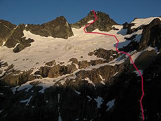
 Bonanza, Mary Green Glacier Face, viewed from Holden Pass camp, July 2008 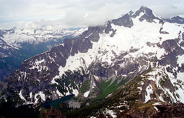 Bonanza & Holden Lake, viewed from Martin, 2000 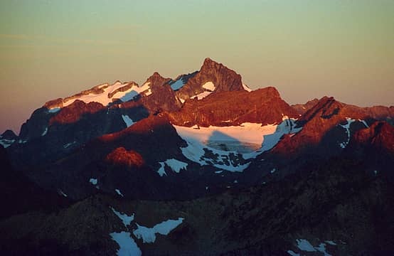 Bonanza & Martin, viewed from Flora, August 2000 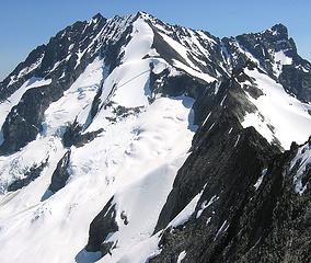 Bonanza, Company Glacier face, viewed from Dark Peak, June 2006 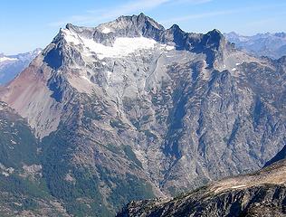 Bonanza, Isella Glacier face, viewed from Greenwood, August 2006 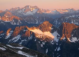 Bonanza, viewed from Booker, July 2006 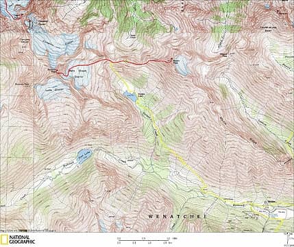 Bonanza Trip Map 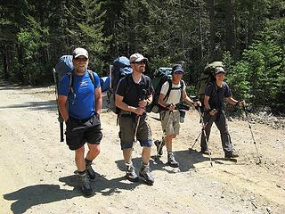 Hiking out of Holden (note three sets of matching boots) 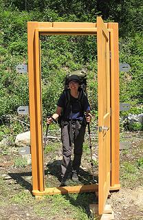 Door to Bonanza 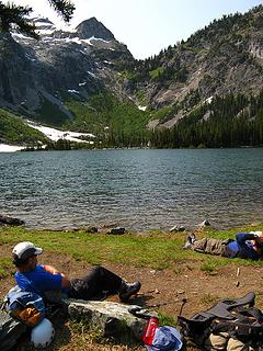 Break at Holden Lake 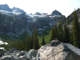 Marmot, waterfall cliffs, Mary Green glacier, & summit (point with broken snowfield at left) 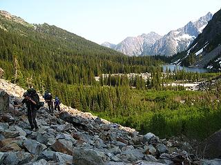 Escaping the brush above Holden Lake 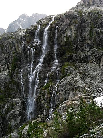 Waterfalls 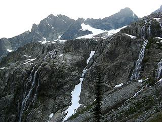 More waterfalls 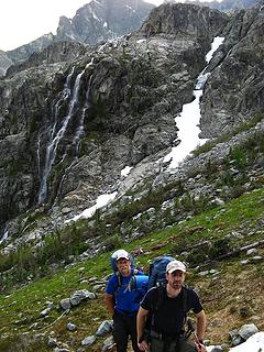 Don & Randy approaching Holden Pass 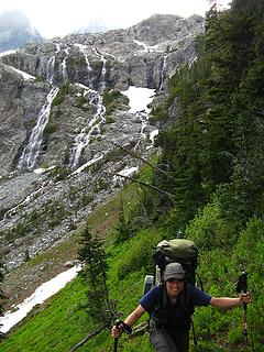 Yana approaching Holden Pass  Campsite 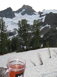 Tea & Bonanza from camp 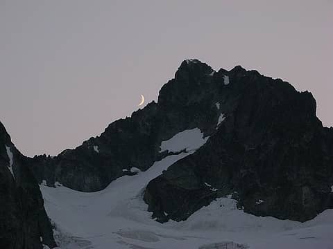 Bonanza summit moon 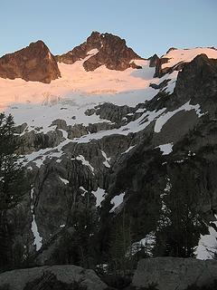 Bonanza sunrise 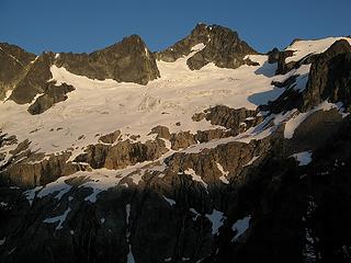 Bonanza in morning light 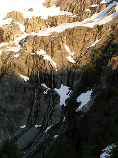 Light descending to waterfalls - Traverse from Holden Pass up to the glacier. The crux is crossing the edge of the wet waterfall slabs and getting onto the snow.
- Hike up the glacier and then up the snow thumb above the glacier. Curve around icefalls on the glacier. Finish at the huge schrund that bisects the thumb.
- Scramble up another 900 feet of sloping unprotected steep rock, with occasional weak patches of snow for obstacles. Mostly 3rd class, with occasional 4th class. This part was just damned scary, with no margin for error.
 Bonanza Route 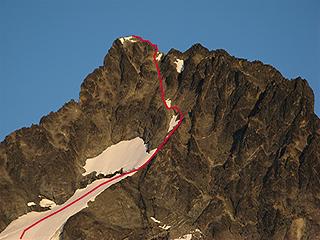 Upper part of the route 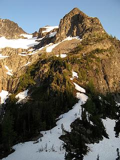 the route up from Holden Pass to the slabs 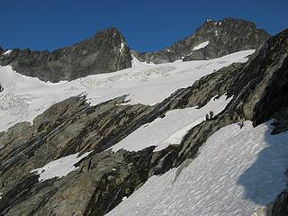 Traversing snow to the slabs 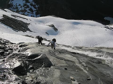 Cramponing up a waterfall slab 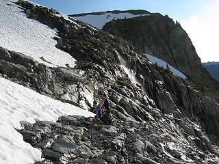 Ready to rope up for the glacier 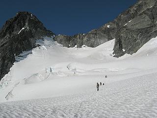 Hiking up the Mary Green Glacier 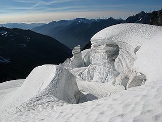 Seracs 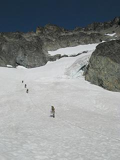 Turning the corner to the snow thumb 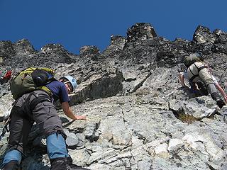 Yana & Dicey on the rock 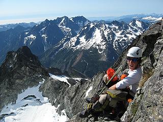 Dicey at one of the widest rest spots along the way 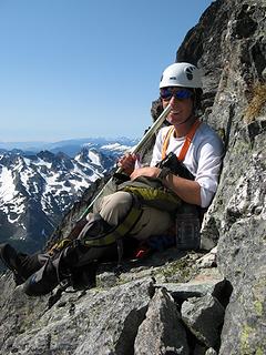 Nose picker 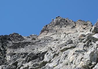 Don near the summit 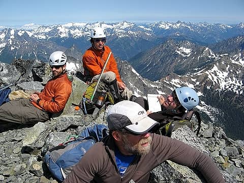 Summit group 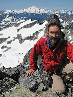 Matt & Glacier  Matt & Copper/Fernow/7FingerJack/Maude 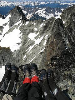 Triplet boots shot 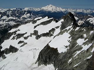 Bonanza sub-summits & Glacier Peak 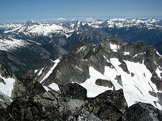 Dark Peak, Dome, Baker, etc 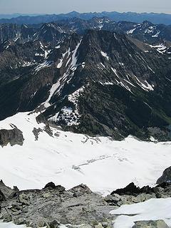 Looking down to Mary Green Glacier, Holden Pass, & Martin 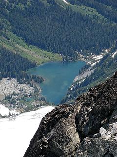 Holden Lake 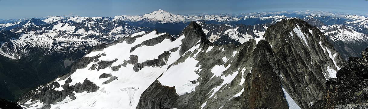 Glacier Peak Area 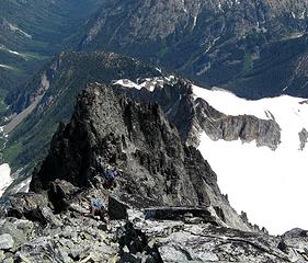 Randy & Don departing the summit. 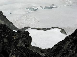 Randy & Don on the glacier 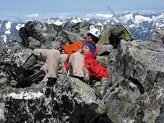 Matt & Dicey napping 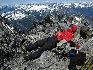 Changed clothes to nap some more 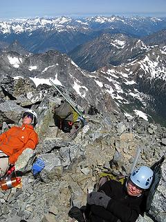 Dicey & Yana napping 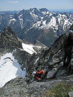 Climbing down 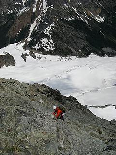 Dicey downclimbing 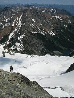 Yana on the way down 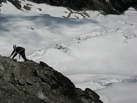 Yana and glacier patterns 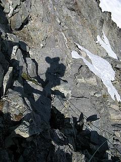 My shadow rappelling 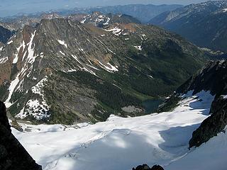 Holden Pass, Martin, Holden Lake, & Holden Tailings (plus Castle, Flora, & Riddle behind Martin) 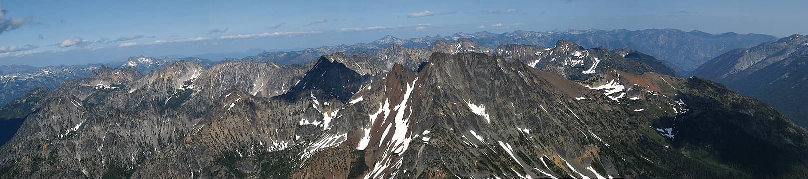 Pan of Martin & all its neighbors 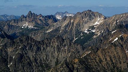 Tupshin, Reynolds, & Devore 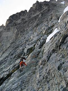 Treading carefully 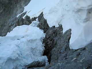 Never been so glad to arrive at a schrund 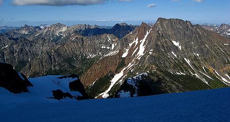 Tupshin, Devore, WyNorth, WyEast, & Martin 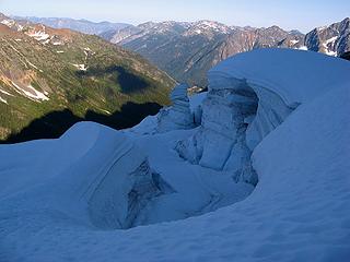 Shadowed seracs on the glacier 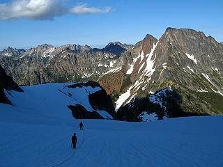 Descending the glacier 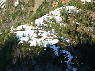 Camp (look for yellow tent in center of photo) 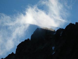 Summit shadows 1 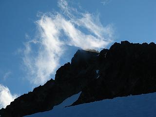 Summit shadows 2 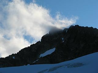 Summit shadows 3 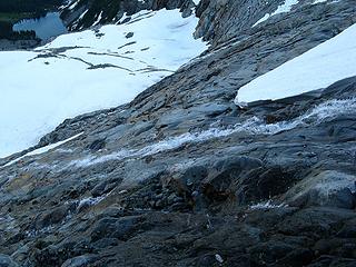 Wet slabs 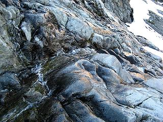 More wet slabs 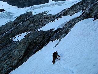 Traversing some steep snow after the slabs. 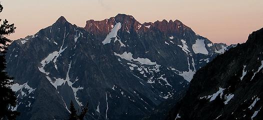 Last light on Copper, Fernow, 7FingerJack & Maude 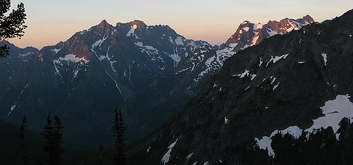 First light on the Fernow group and Dumbell group 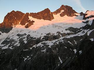 Sunrise on Bonanza 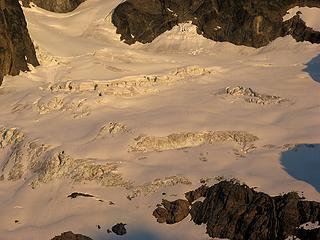 Sunrise light on the icefalls 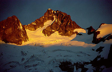 Mary Green Glacier in 2000 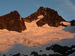 Mary Green Glacier in 2008 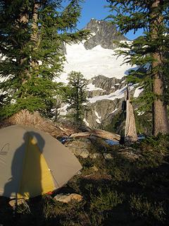 Camp & Bonanza 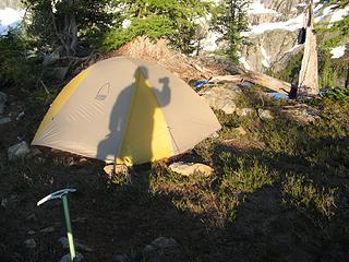 Photo tent shadow Bonanza in later morning light. 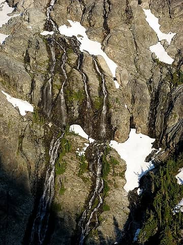 Waterfalls in morning light 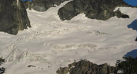 Our tracks on the glacier 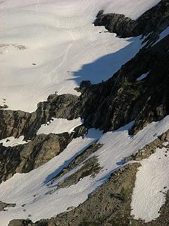 Our tracks across the waterfall slabs 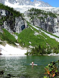 Matt swimming in Holden Lake 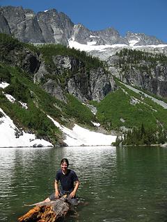 Yana on a log in Holden Lake 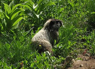 Marmot browsing 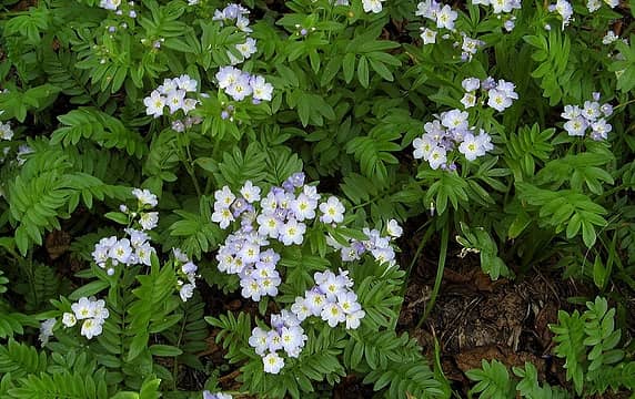 Phlox? 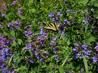 Torn-winged Tiger Swallowtail 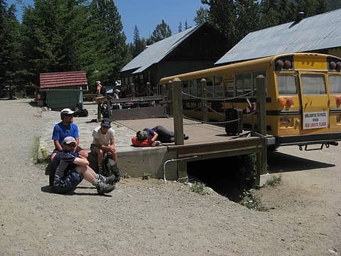 Waiting for the bus out of Holden
As beacons mountains burned at evening. J.R.R. Tolkien
As beacons mountains burned at evening. J.R.R. Tolkien
|
| Back to top |
  
|
|
Scrooge
Famous Grouse

Joined: 16 Dec 2001
Posts: 6966 | TRs | Pics
Location: wishful thinking |
|
Scrooge
Famous Grouse
|
Sat Jul 12, 2008 3:02 am |
|
|
Something lost behind the ranges. Lost and waiting for you....... Go and find it. Go!
|
| Back to top |
|
|
picowave
Member

Joined: 02 Jun 2008
Posts: 17 | TRs | Pics
|
|
picowave
Member
|
Sat Jul 12, 2008 3:38 am |
|
|
Great report and beautiful pictures!
Thanks for sharing!
|
| Back to top |
|
|
Hiker Mama
Member

Joined: 25 Jun 2006
Posts: 3451 | TRs | Pics
Location: Lynnwood |
WOW! Great effort and wonderful pictures!
|
| Back to top |
|
|
Bert
Member
Joined: 12 Jul 2008
Posts: 12 | TRs | Pics
|
|
Bert
Member
|
Sat Jul 12, 2008 11:06 am |
|
|
Nice trip report...sounds like a good time had by all. Quick question...what are the boots the three of you are wearing? Thanks.
|
| Back to top |
|
|
yukon222
Member

Joined: 12 Mar 2007
Posts: 1893 | TRs | Pics
|
|
yukon222
Member
|
Sat Jul 12, 2008 11:24 am |
|
|
Stunning report and trip. Very glad you posted it here.  I know I wouldn't enjoy 900' of exposed Class 3/4 rock climbing (and the downclimbing) so I most likely won't be around this peak in the near future. But at least I am able to sort of experience the peak thru your excellent pictures and descriptions. Thanks!!
|
| Back to top |
|
|
puzzlr
Mid Fork Rocks

Joined: 13 Feb 2007
Posts: 7220 | TRs | Pics
Location: Stuck in the middle |
|
puzzlr
Mid Fork Rocks
|
Sat Jul 12, 2008 4:01 pm |
|
|
Congratulations to all in the party. Was this the first successful Bonanza summit for everyone?
|
| Back to top |
|
|
Bryan K
Shameless Peakbagger

Joined: 29 Sep 2005
Posts: 5129 | TRs | Pics
Location: Alaska |
|
Bryan K
Shameless Peakbagger
|
Sat Jul 12, 2008 5:22 pm |
|
|
Bustin' Bonanza!!!!!!! What a great looking trip. Looks like an epic adventure. Glad you all made it to the summit and back
|
| Back to top |
|
|
Schmidt Alti-Dude
4th class poster
Joined: 06 Jul 2007
Posts: 1361 | TRs | Pics
Location: Looking for Adventure 201! |
Yea, yea, yea, epic trip, great photos, blah, blah, blah!
Were there any fish in Holden Lake?
Anything stated by me in no way reflects the attitudes or opinions of my wife
Anything stated by me in no way reflects the attitudes or opinions of my wife
|
| Back to top |
|
|
Tom_Sjolseth
Born Yesterday

Joined: 30 May 2007
Posts: 2652 | TRs | Pics
Location: Right here. |
Nice work, Matt and company!!
Keep those TRs coming.
|
| Back to top |
|
|
Matt
Tea, Earl Grey, Hot
Joined: 30 Jan 2007
Posts: 4307 | TRs | Pics
Location: Shoreline |
|
Matt
Tea, Earl Grey, Hot
|
Sun Jul 13, 2008 12:54 am |
|
|
| Scrooge wrote: | Hiking ? ....... Hmmmm.  Over at CC they use a different term when they describe that kind of trip. Bonanza Peak and Tiger Mountain just don't have all that much in common. I think it's great that you all prefer our company to the company of your peers. I also think Karen had a point when she suggested dividing the Trip Reports forum into two separate sections, one for trail hikes and one for expeditions.
 |
Aye, tis a good question you raise. I notice there are more climbing reports lately. But I think thats a byproduct of a larger issue. As the site grows, there are many more reports of every kind. I find that I have to be more selective of what I read. As far as my reports, theyre usually clearly identified as including a climb in the first couple lines, so you can skip them if wanted.
There are three reasons I post here rather than CC.
First, the report includes a lot of hiking discussion. Well over half the text and photos are taken along the trail and at camp. Its actually an appealing place for regular hiking and camping.
Second, for me, the difference between nwhikers and CC is not simply the type of travel, but a different focus for the experience. CC tends to be focused on routes and technical accomplishments. Thats not why I go into the mountains. My focus is on enjoyment of the mountain environment, regardless of whether thats experienced on a hike, climb, road walk, road trip, or whatever. How I got there is much less important to me than appreciating whatever I find along the way. I try to describe my whole experience of each trip in the mountains. I enjoy reading others experiences, even when its very different from the kind of trip I might do. I post here because I hope others here would enjoy what I describe and photograph, even if its not someplace they might go, and even sometimes exactly because its someplace they might not get to themselves.
Third, I post here because it is a mountaineering community, not just a set of reports. I really like the people here, I enjoy their stories and comments, and I like sharing the discussion with these people.
However, though I believe all kinds of trip reports have a place here, I have come to agree with Karens original suggestion to split the Trip Report forum, so Ive bumped her thread.
As beacons mountains burned at evening. J.R.R. Tolkien
As beacons mountains burned at evening. J.R.R. Tolkien
|
| Back to top |
|
|
Matt
Tea, Earl Grey, Hot
Joined: 30 Jan 2007
Posts: 4307 | TRs | Pics
Location: Shoreline |
|
Matt
Tea, Earl Grey, Hot
|
Sun Jul 13, 2008 12:55 am |
|
|
| Islandman wrote: | | Nice trip report...sounds like a good time had by all. Quick question...what are the boots the three of you are wearing? Thanks. |
Some kind of Scarpas. Don, Randy, or Dicey would know. Too narrow for my feet.
| Schmidt Alti-Dude wrote: | | Yea, yea, yea, epic trip, great photos, blah, blah, blah!
Were there any fish in Holden Lake? |
Dayhikers from Holden reported catching some small fish. Dont know if they were in the best place, however. Midway up the lake, theres an arm of rocks and trees that might interest fish.
Or, to put it in your terms: Fish, fish, fish, blah, blah, blah.
BTW, the summit panorama now has labels:
As beacons mountains burned at evening. J.R.R. Tolkien
As beacons mountains burned at evening. J.R.R. Tolkien
|
| Back to top |
|
|
Scrooge
Famous Grouse

Joined: 16 Dec 2001
Posts: 6966 | TRs | Pics
Location: wishful thinking |
|
Scrooge
Famous Grouse
|
Sun Jul 13, 2008 7:33 am |
|
|
Matt said | Quote: | | However, though I believe all kinds of trip reports have a place here, I have come to agree with Karens original suggestion to split the Trip Report forum, so Ive bumped her thread. |
I agreed with Karen, originally, but the overwhelming number of counterarguments convinced me I was wrong. Aside from so many people disliking the idea, the problem of where to draw the line came to seem insurmountable.
Your Bonanza climb and Dayhike Mike's Alta-Chickamin traverse are clearly expeditions. Tiger Mountain rambles and TNAB's Thursday night hikes are clearly trail hikes (even though many of us can't hope to emulate the TNAB'rs).
But, where do I post my trips? Today we're trying again for Rachor Falls. None of it is on trail and about a mile of it is bushwhacking over unknown territory ........ but the whole thing will only take about six hours.
Or Big Four: starting with rafting the Stilly is different, but no big deal; spending an hour or two clambering over blowdown isn't exactly hiking; and exploring the ice caves (when they're there) is pretty adventurous ....... but the whole roundtrip is only about three miles! And half of it is still on accessible trail. ........ Is that an expedition?
I was worried, at first, that the peakbagging and the expedition reports would intimidate "100 Hikes" hikers, and discourage them from reporting. That doesn't appear to be the case. The majority of Snow Lake daytrippers seem to enjoy reading about your assault on the "Top 100", just like most of the Cascade peakbaggers enjoy reading about Everest expeditions, without having any particular thought of joining one.
All that aside, the group has grown, from about 40 refugees from WTA when we started, to its present level, when it's not uncommon to have 100 people viewing the site at once. If the interests of the group have changed some, I think we just have to accept it.
Something lost behind the ranges. Lost and waiting for you....... Go and find it. Go!
Something lost behind the ranges. Lost and waiting for you....... Go and find it. Go!
|
| Back to top |
|
|
Magellan
Brutally Handsome

Joined: 26 Jul 2006
Posts: 13116 | TRs | Pics
Location: Inexorable descent |
|
Magellan
Brutally Handsome
|
Sun Jul 13, 2008 7:57 am |
|
|
Well Matt, you have outdone yourself. Somehow this trip report stands out amongst your many fine efforts. I personally won't be cramponing up waterfall slabs or scrambling 900' of unprotectable classs 3/4, but it's great to read about it.
I for one am glad for the variety of reports on this site. I read most everything from kid hikes to Cascadian hardmen(women) epics. Keep them coming peoples!
|
| Back to top |
|
|
Guiran
Member
Joined: 03 Mar 2004
Posts: 621 | TRs | Pics
Location: University of Washington |
|
Guiran
Member
|
Sun Jul 13, 2008 8:21 am |
|
|
Feel gripped just reading about the trip. Fantastic pictures and report as always!
|
| Back to top |
|
|
|
|
You cannot post new topics in this forum
You cannot reply to topics in this forum
You cannot edit your posts in this forum
You cannot delete your posts in this forum
You cannot vote in polls in this forum
|
Disclosure: As an Amazon Associate NWHikers.net earns from qualifying purchases when you use our link(s). |


