| Previous :: Next Topic |
| Author |
Message |
wildernessed
viewbagger


Joined: 31 Oct 2004
Posts: 9275 | TRs | Pics
Location: Wenatchee |
I was able to get out with Steve late Sun., we started around 1315 hrs., from the Tyee Ridge TH. The road though rough is snow free, as are the trails, with a bounty of wilflowers. I had done Signal this Spring - Summer with MLHSN from the Billy Creek trail off FR 5700, but Steve wanted to get up here and it seemed the perfect time to do so.
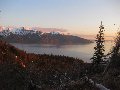
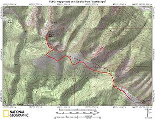 Signal Peak - Point 6998' via Tyee Ridge Trail 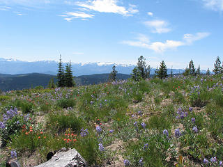 Plenty of wildflowers along the SW open slopes. 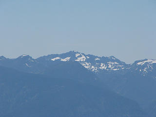 Grindstone 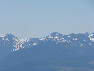 Cape Horn - Ladies Pass - Snowgrass 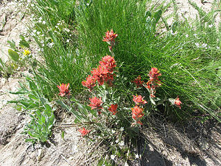 Indian Paintbrush 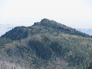 Looking back at Tyee Peak / Lookout 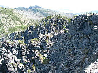 NE face of Point 6998' 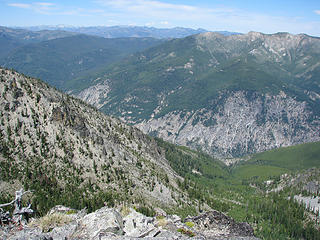 Lake Creek Basin left and the beginning of Four Mile Ridge. 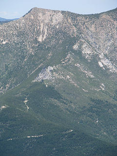 Spring route up to Four Mile Ridge and 7k' highpoint. 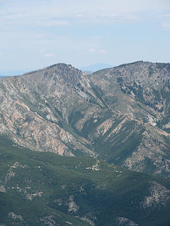 Spring route up to Angle Peak. 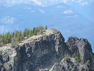 Signal Peak 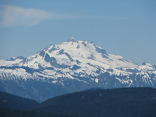 Glacier Peak 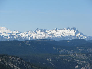 Buck Mtn. 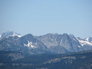 Garland and Devils Smokestack. I think the peak behind is Fortress. 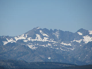 Mt. Maude, 7FJ, Fernow 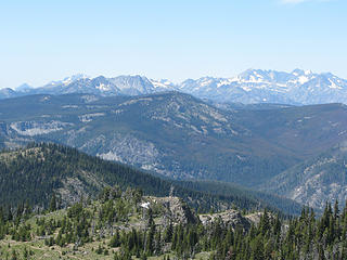 Kelly Peak (foreground) 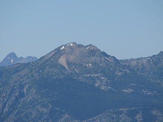 Duncan Hill 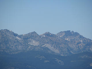 Highpoints along Entiat Ridge, NF Entiat Valley, Fern Lake Basin, Gopher Peak, and Pinnacle Peak (background) 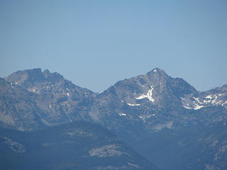 Pinnacle Peak, saska Pass, and Saska Peak. 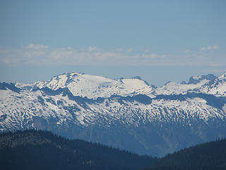 Name that peak (center - background) 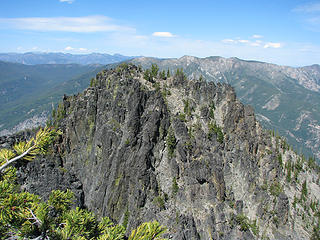 Signal Peaks N sub-peak. 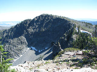 Point 6998' from Signal Peak. 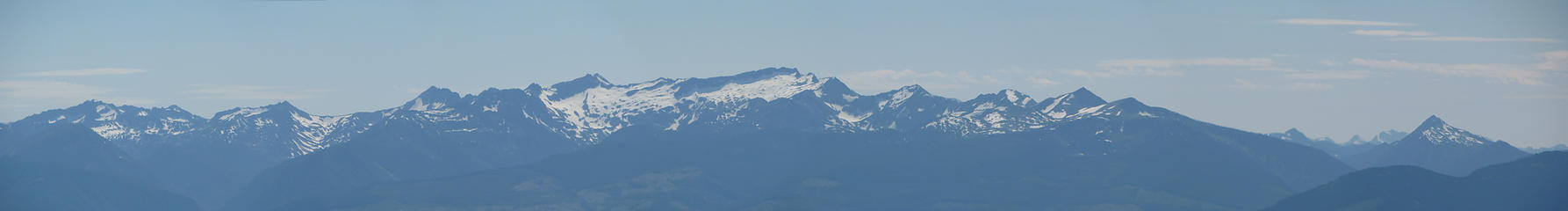 Grindstone to Jim Hill 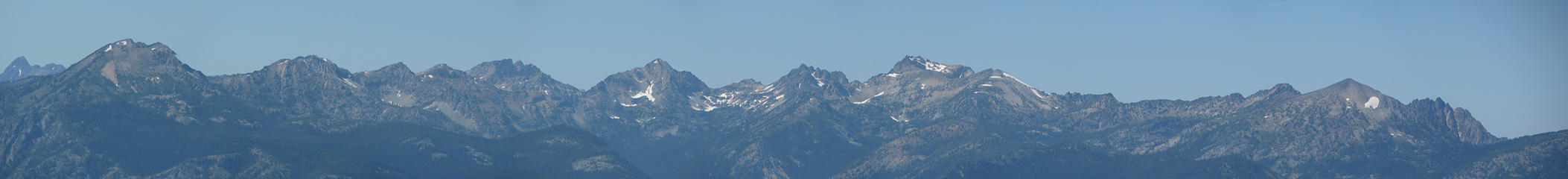 Duncan Hill to Pyramid Peak, with Pinnacle Peak in the background 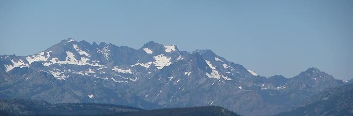 Mt. Maude - Seven Fingered Jack - Fernow - Copper 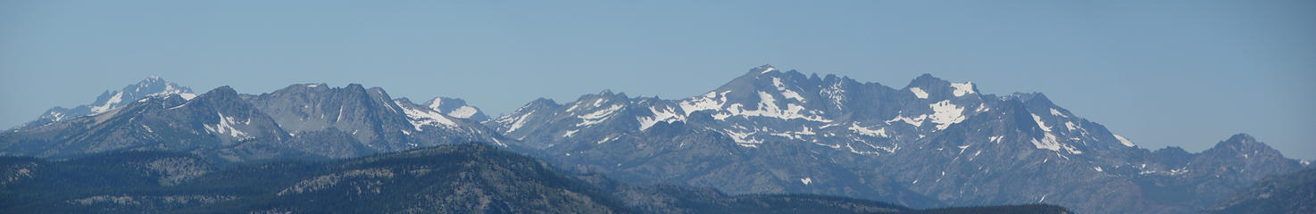 Entiat Ridge with Fortress in the background 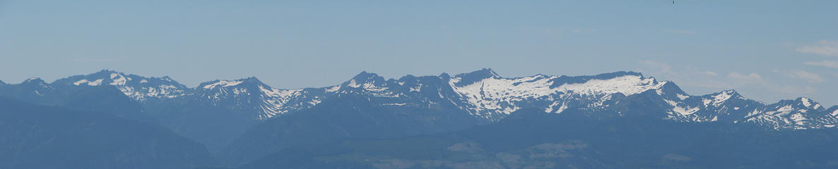 Grindstone - Cape Horn - Ladies Pass - Snowgrass - Chiwaukum Ridge 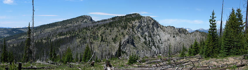 Tyee Ridge from Tyee Ridge TH
Living in the Anthropocene
Living in the Anthropocene
|
| Back to top |
  
|
|
Movenhike
\m/..mmmmetal\m/
Joined: 16 Apr 2007
Posts: 642 | TRs | Pics
Location: Leavenworth, WA |
|
Movenhike
\m/..mmmmetal\m/
|
 Mon Jul 14, 2008 6:47 pm |
|
|
Wow right on. I've been curious about Signal Peak myself. It looks like a neat mini-fortress from Cougar Mtn near Maverick Saddle. Was the trailhead easy to locate or confusing? Nice photos, and great scale examples of Signals summits.
"Make it your Friend" -John Bull
"Make it your Friend" -John Bull
|
| Back to top |
|
|
wildernessed
viewbagger
Joined: 31 Oct 2004
Posts: 9275 | TRs | Pics
Location: Wenatchee |
| movenhike wrote: | | Wow right on. I've been curious about Signal Peak myself. It looks like a neat mini-fortress from Cougar Mtn near Maverick Saddle. Was the trailhead easy to locate or confusing? Nice photos, and great scale examples of Signals summits. |
You can drive to the end of the forest road below Tyee Lookout and the TH starts where the road switchbacks up to the lookout itself. Nice to be able to get so close this time.
Living in the Anthropocene
Living in the Anthropocene
|
| Back to top |
|
|
MLHSN
What goes here?????

Joined: 09 Sep 2007
Posts: 1068 | TRs | Pics
Location: Wenatchee |
|
MLHSN
What goes here?????
|
Mon Jul 14, 2008 10:25 pm |
|
|
Did they open up the rest of the road yet from where we had to stop at that gate before?
|
| Back to top |
|
|
wildernessed
viewbagger
Joined: 31 Oct 2004
Posts: 9275 | TRs | Pics
Location: Wenatchee |
| MLHSN wrote: | | Did they open up the rest of the road yet from where we had to stop at that gate before? |
That was our first choice of an entry point, and the sign that was posted that said the road which is in excellent condition would open July 1st, was replaced by a sign that said it was closed indefinitely as part of a revegetation project.  So we started back at Tyee Ridges TH, saving maybe 10 miles and a 1000'. So we started back at Tyee Ridges TH, saving maybe 10 miles and a 1000'.
Living in the Anthropocene
Living in the Anthropocene
|
| Back to top |
|
|
|
|
You cannot post new topics in this forum
You cannot reply to topics in this forum
You cannot edit your posts in this forum
You cannot delete your posts in this forum
You cannot vote in polls in this forum
|
Disclosure: As an Amazon Associate NWHikers.net earns from qualifying purchases when you use our link(s). |


