| Previous :: Next Topic |
| Author |
Message |
Schmidt Altitude
Whippet Entourage


Joined: 28 Mar 2007
Posts: 803 | TRs | Pics
Location: The Quah |
Dates: Sunday July 6, 2008 through Wednesday July, 9, 2008
Participants: MLHSN (Mark), Mrs.MLHSN (Annie), RockBob* (Ryan), DayHike Mike (Mike), yukon222 (Steve), Schmidt Alti-Babe (Tisha), and Schmidt Alti-Dude (Jeremy) *May not be his actual nickname - it's a work in progress
Names: We prefer to use the mythological names the Starks gave the various features of the Enchantment Basin and that is what we will use in the trip report. The names that appear on maps are in parentheses after (if it is named on a traditional map).
*Many of the panoramic photos are labeled. Double click on the photo to enlarge and move your mouse over the picture to see the labels. Alti-babe wanted everyone to know that Alti-Dude did all the labeling so any errors are 100% his  .*
Day 1: Pack Mules Meet Mountain Goats
The West Side crew (Mike, Steve, and the Altitude Team) met the Wenatchee crew (Mark, Annie, and Ryan) on Stuart Lake trail near where the side trail branches off towards Colchuck Lake and re-crosses Mountaineer Creek. After some brief introductions, it was time to haul our way too heavy packs up to Colchuck Lake.
Mark and Jeremy led the way to the head of the lake because they wanted to fish the lake where the inlet steam came in; a spot where Dude remembered catching a few trout the last time he fished it. Jeremy, in particular, was eager since he hadn't even made a single cast yet this year because of all the peak bagging his wife was making him do. Alas, the lake was so high because of all the melt water running in to it that they boys couldn't find room to make a decent cast .*
Day 1: Pack Mules Meet Mountain Goats
The West Side crew (Mike, Steve, and the Altitude Team) met the Wenatchee crew (Mark, Annie, and Ryan) on Stuart Lake trail near where the side trail branches off towards Colchuck Lake and re-crosses Mountaineer Creek. After some brief introductions, it was time to haul our way too heavy packs up to Colchuck Lake.
Mark and Jeremy led the way to the head of the lake because they wanted to fish the lake where the inlet steam came in; a spot where Dude remembered catching a few trout the last time he fished it. Jeremy, in particular, was eager since he hadn't even made a single cast yet this year because of all the peak bagging his wife was making him do. Alas, the lake was so high because of all the melt water running in to it that they boys couldn't find room to make a decent cast  . After steeling our resolve, we set up to climb the 2200' in less than a mile to Aasgard Pass. . After steeling our resolve, we set up to climb the 2200' in less than a mile to Aasgard Pass.
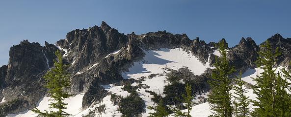
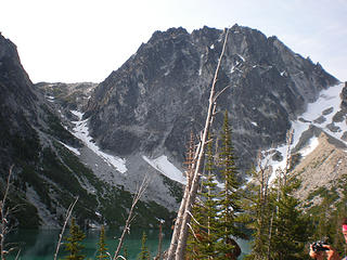
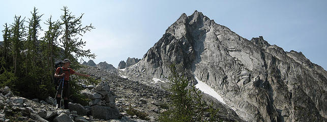 RockBob makes sure we don't miss the cairn  Taking a rest by the creek going up to Aasgard Pass 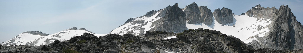 5 labels Little Annapurna, Witches Tower, & Dragon Tail from Freya Lake 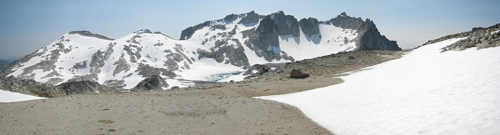 5 labels Little Annapurna and Dragontail from Enchantment Plateau 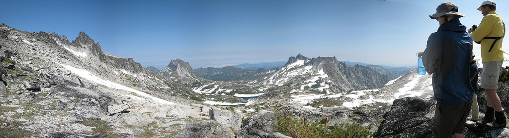 12 labels Looking down on the Enchantments from a ridge above Enchantment Plateau 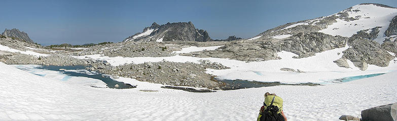 7 labels Lake Sigrun and Olrun (behind L-R; The Temple, McClellan, Little Annapurna 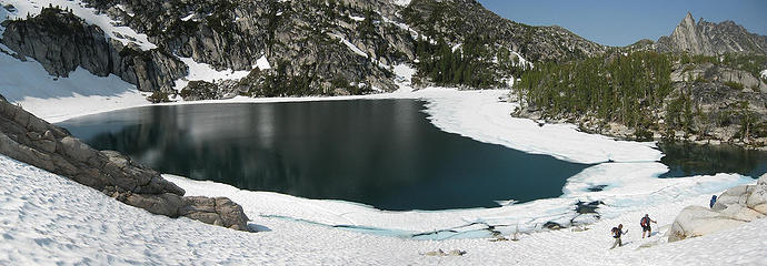 Traversing around Talisman Lake 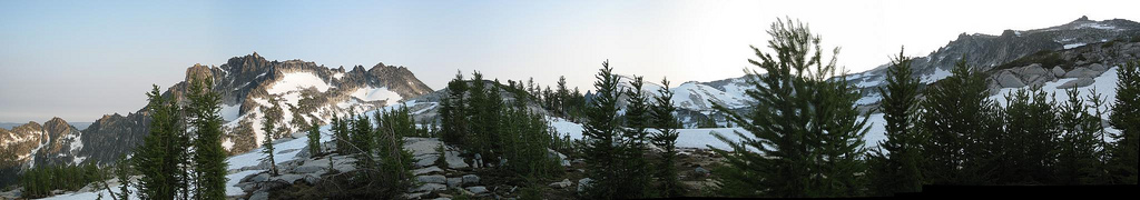 6 labels McClellan, Little Annanpurna, & Enchantment from camp  Camp at Gnome Tarn  3 labels Druid Plateau in front of the Cannon summit  . After our summits, we found a nice flat and less exposed part of the mountain to have lunch (summer sausage, parmesan, and naan sandwiches = delicious).
After lunch, we climbed out to north end of the mountain to look at the extremely steep route down to Coney Lake 1000 plus feet below us. We figured we'd probably done worse and headed down. The first third of the way was on bare gravel, scree, and rock but soon we had to face in and downclimb the snow. This was a new experience for RockBob and he admitted to feeling a little out of his element. Dude stated that he was going to glissade until he watched an accidentally dislodged rock go screaming down the face at Mach 1 and careen into a finger of rock sticking out into the snow chute. After we made our way past the rocks and the way was fully clear, we conducted a very bumpy 400 elevation drop glissade (also a first for Ryan).
Once at the shore of the lake the plan was for us to take a short break and pump more water until Dude saw a huge trout swim by and he freaked out. Of course, he was off fishing while the others took care of the water filtering. After refilling the water, Jeremy led the way around the north end of the lake and across the outlet stream, casting the whole way. Once again, he was disappointed as the trout were just following his lures but never biting. Finally, near the bend in the lake where he could cast into the deeper water, he hooked and landed his first fish of the year, a healthy, fat cutthroat. . After our summits, we found a nice flat and less exposed part of the mountain to have lunch (summer sausage, parmesan, and naan sandwiches = delicious).
After lunch, we climbed out to north end of the mountain to look at the extremely steep route down to Coney Lake 1000 plus feet below us. We figured we'd probably done worse and headed down. The first third of the way was on bare gravel, scree, and rock but soon we had to face in and downclimb the snow. This was a new experience for RockBob and he admitted to feeling a little out of his element. Dude stated that he was going to glissade until he watched an accidentally dislodged rock go screaming down the face at Mach 1 and careen into a finger of rock sticking out into the snow chute. After we made our way past the rocks and the way was fully clear, we conducted a very bumpy 400 elevation drop glissade (also a first for Ryan).
Once at the shore of the lake the plan was for us to take a short break and pump more water until Dude saw a huge trout swim by and he freaked out. Of course, he was off fishing while the others took care of the water filtering. After refilling the water, Jeremy led the way around the north end of the lake and across the outlet stream, casting the whole way. Once again, he was disappointed as the trout were just following his lures but never biting. Finally, near the bend in the lake where he could cast into the deeper water, he hooked and landed his first fish of the year, a healthy, fat cutthroat.
 Coney Lake flanked by Elf Ridge 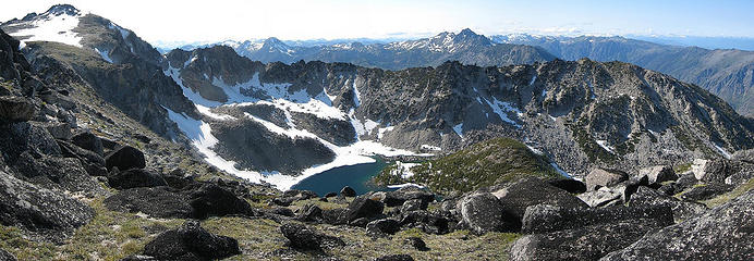 6 labels Coney Lake from Elf Ridge (Cannon left, Eightmile middle left, Cashmere middle right) 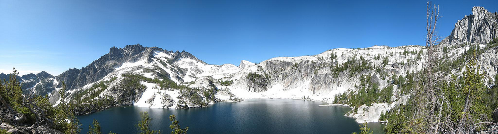 5 labels McClellan and Prusik above Lake Vivianne 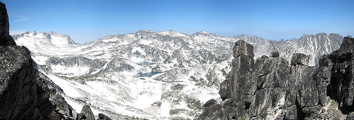 14 labels The Prong watches over the Enchantments  21 labels Traversing under McClellan over to Crystal 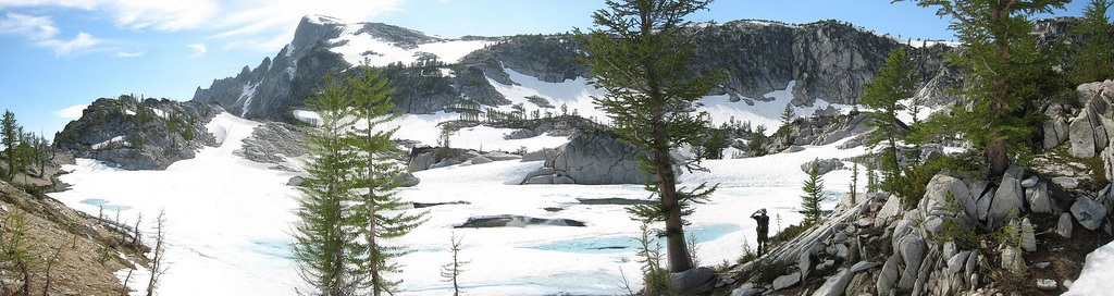 2 labels Crystal Lake under Little Annapurna  Crystal Lake  9 labels Looking back from the route up to Little Annapurna 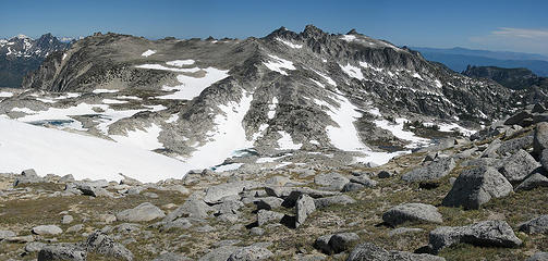 11 labels The Upper Enchantments from Annapurna Ridge  . Besides, if we do everything in one trip there will be no reason to ever go back, right?
We made our way back to the little saddle between East Dragontail and Little Annapurna and down to the shore of Brynhild Lake (Isolation). We crossed around the lake and over the land bridge between it and Reginlief Lake and over to Aasgard Pass. Going down the trail in 80 degree heat was absolute misery and it took us an hour and a half.
Then it was back around Colchuck Lake and down to Mountaineer Creek where we stopped for our last water pumping session. Jeremy was so tired at this point that he didn't even fish even though he could see three trout swimming in the pool we pumped from. We pounded out the last 2.5+ miles in 39 minutes and stumbled to Steve's vehicle. We made it to Visconti's at 8:30 to find the rest of gang had been there since 6:30 and were just finishing their food (they waited as long as they could to order). We celebrated with good food, beer, wine, and of course the Nightmare dessert! Then we went our separate ways to hot showers and soft beds (after a long drive back across the Blewitt and Snoqualmie Passes).
Day 4 Trail Stats: Time 11:33. 3278' gain, 7037' loss
Total Elevation Gain for all four days: 18,211'
A huge thanks to Mark for obtaining the permits and inviting us along on his hike. What a great idea and you planned the weather perfect.
Thanks to Annie putting up with all our mapsterbating and hiker talk.
We also wanted to say thanks to Ryan for sticking with the crazy S Team this whole trip. You totally kick @ss. Anyone lucky enough to have an opportunity to hike with this guy shouldn't hestitate to include him at all.
Favorite Lake: Coney
Favorite Peak: McClellan (Witches Tower a close second)
Favorite Day: Day 2 (Cannon and Coney day)
Favorite Goat(s): The twin kids
Favorite Meal: Backcountry Pizza/Calzones . Besides, if we do everything in one trip there will be no reason to ever go back, right?
We made our way back to the little saddle between East Dragontail and Little Annapurna and down to the shore of Brynhild Lake (Isolation). We crossed around the lake and over the land bridge between it and Reginlief Lake and over to Aasgard Pass. Going down the trail in 80 degree heat was absolute misery and it took us an hour and a half.
Then it was back around Colchuck Lake and down to Mountaineer Creek where we stopped for our last water pumping session. Jeremy was so tired at this point that he didn't even fish even though he could see three trout swimming in the pool we pumped from. We pounded out the last 2.5+ miles in 39 minutes and stumbled to Steve's vehicle. We made it to Visconti's at 8:30 to find the rest of gang had been there since 6:30 and were just finishing their food (they waited as long as they could to order). We celebrated with good food, beer, wine, and of course the Nightmare dessert! Then we went our separate ways to hot showers and soft beds (after a long drive back across the Blewitt and Snoqualmie Passes).
Day 4 Trail Stats: Time 11:33. 3278' gain, 7037' loss
Total Elevation Gain for all four days: 18,211'
A huge thanks to Mark for obtaining the permits and inviting us along on his hike. What a great idea and you planned the weather perfect.
Thanks to Annie putting up with all our mapsterbating and hiker talk.
We also wanted to say thanks to Ryan for sticking with the crazy S Team this whole trip. You totally kick @ss. Anyone lucky enough to have an opportunity to hike with this guy shouldn't hestitate to include him at all.
Favorite Lake: Coney
Favorite Peak: McClellan (Witches Tower a close second)
Favorite Day: Day 2 (Cannon and Coney day)
Favorite Goat(s): The twin kids
Favorite Meal: Backcountry Pizza/Calzones
"Forest 101: These big wood stick things are called trees. The big rocks are called mountains, and the little rocks are their babies." Elliott from Open Season
"Forest 101: These big wood stick things are called trees. The big rocks are called mountains, and the little rocks are their babies." Elliott from Open Season
|
| Back to top |
  
|
|
yukon222
Member

Joined: 12 Mar 2007
Posts: 1894 | TRs | Pics
|
|
yukon222
Member
|
 Mon Jul 14, 2008 8:27 pm |
|
|
A land of lakes, mountains and ridges. Flowing water, grasses starting to green up and roaming mountain goats. What a place. Special thanks to Mark (MLHSN) for securing the permits. Definitely an area that can best be appreciated by camping there for several nights.
Goats
Ridges
 pano11 - mc clellan peak 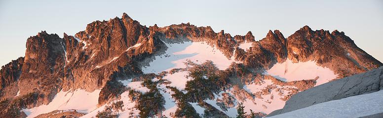 pano32 - morning glow on mc clellan peak 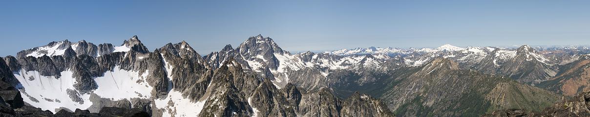 pano12 - mt stuart, dragontail 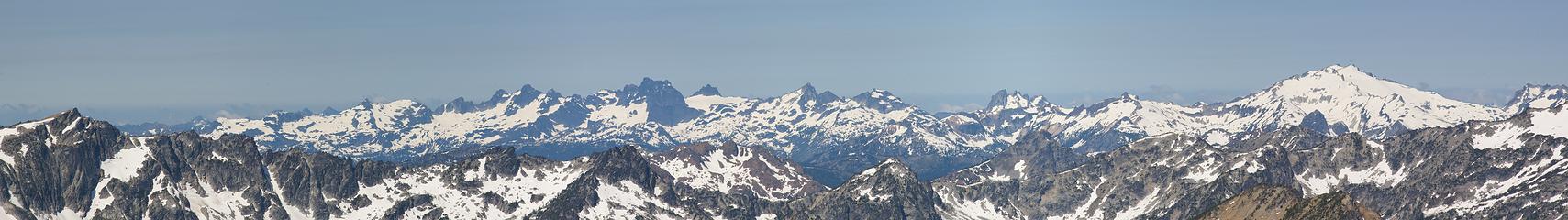 pano13 - mt daniel and south 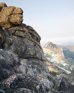 pano10a - enchantment peak summit 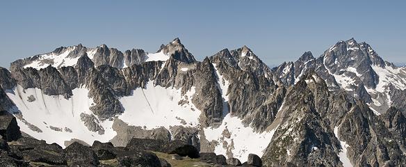 pano14 - looking west from Druid's Plateau 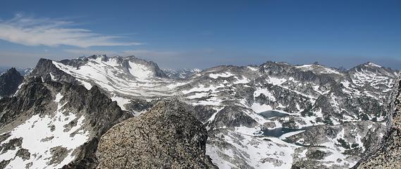 pano28 - Upper Enchantments from McClellan summit 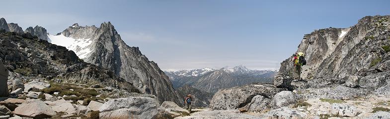 pano3 - annie, tisha near asgaard pass 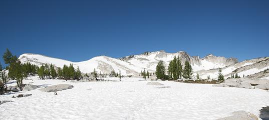 pano34 - little annapurna, upper enchantments  pano7 - little annapurna 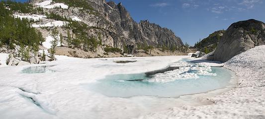 pano29 - crystal lake 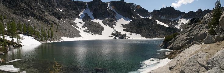 pano20 - coney lake, looking west 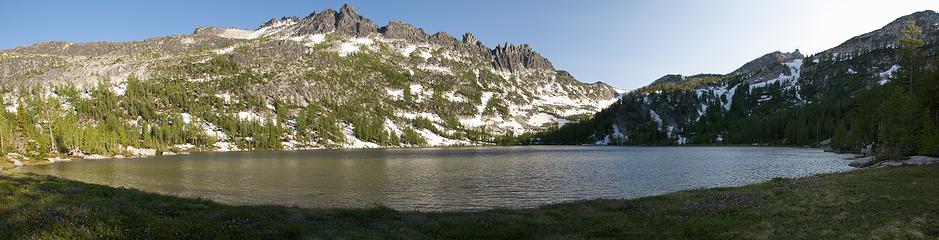 pano23 - shield lake and prusik pass 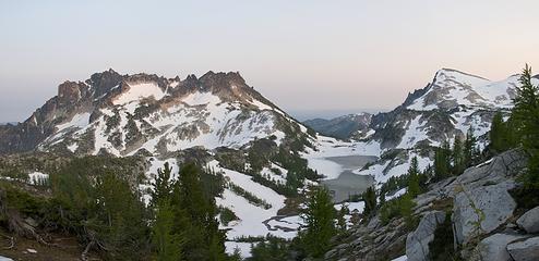 pano10b - mc clellan peak, rune lake & annapurna 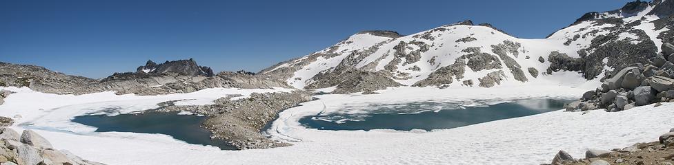 pano37 - brynhild lake & little annapurna 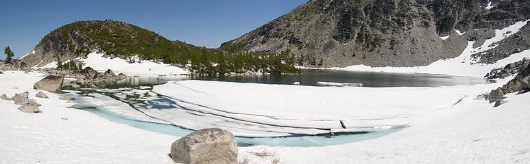 pano18 - coney lake 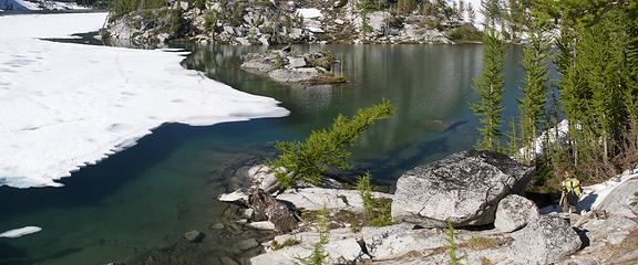 pano30 - rune lake melting out 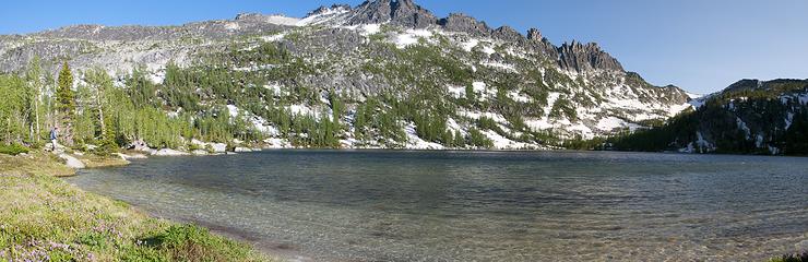 pano22 - Shield Lake 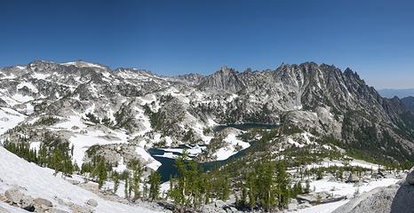 pano27 - Prusik Peak, Leprechaun Lake
|
| Back to top |
|
|
Backpacker Joe
Blind Hiker

Joined: 16 Dec 2001
Posts: 23956 | TRs | Pics
Location: Cle Elum |
Good Lord look at all those PANO'S. You guys are amazing. Thank you so much. I only wish there had been a little less snow. 
"If destruction be our lot we must ourselves be its author and finisher. As a nation of freemen we must live through all time or die by suicide."
Abraham Lincoln
"If destruction be our lot we must ourselves be its author and finisher. As a nation of freemen we must live through all time or die by suicide."
Abraham Lincoln
|
| Back to top |
|
|
Tom_Sjolseth
Born Yesterday

Joined: 30 May 2007
Posts: 2651 | TRs | Pics
Location: Right here. |
|
| Back to top |
|
|
mtnwkr
Member

Joined: 27 Jul 2004
Posts: 1332 | TRs | Pics
Location: Bremerton. I'm the Lorax, I speak for the trees |
|
mtnwkr
Member
|
Mon Jul 14, 2008 8:43 pm |
|
|
Outstanding!
There's a mostly unspoken acknowledgment among the voluntarily impoverished that it's better to be fiscally poor yet rich in experience-living the dream-than to be traditionally wealthy but live separate from one's passions.
There's a mostly unspoken acknowledgment among the voluntarily impoverished that it's better to be fiscally poor yet rich in experience-living the dream-than to be traditionally wealthy but live separate from one's passions.
|
| Back to top |
|
|
Movenhike
\m/..mmmmetal\m/
Joined: 16 Apr 2007
Posts: 642 | TRs | Pics
Location: Leavenworth, WA |
|
Movenhike
\m/..mmmmetal\m/
|
Mon Jul 14, 2008 8:48 pm |
|
|
my golly!!!
"Make it your Friend" -John Bull
"Make it your Friend" -John Bull
|
| Back to top |
|
|
wildernessed
viewbagger

Joined: 31 Oct 2004
Posts: 9275 | TRs | Pics
Location: Wenatchee |
Sweet !
Living in the Anthropocene
Living in the Anthropocene
|
| Back to top |
|
|
Dayhike Mike
Bad MFKer
Joined: 02 Mar 2003
Posts: 10955 | TRs | Pics
Location: Going to Tukwila |
"There is only one basic human right, the right to do as you damn well please. And with it comes the only basic human duty, the duty to take the consequences." -P.J. O'Rourke
"Ignorance is natural. Stupidity takes commitment." -Solomon Short
|
| Back to top |
|
|
raz2sea
Daddy RAZ
Joined: 04 Dec 2007
Posts: 1060 | TRs | Pics
Location: Seattle |
|
raz2sea
Daddy RAZ
|
Mon Jul 14, 2008 9:07 pm |
|
|
|
| Back to top |
|
|
Tim and Angel
Angel now an Angel

Joined: 20 Jul 2006
Posts: 376 | TRs | Pics
Location: Pugetopolis |
|
| Back to top |
|
|
SlowWalker
Perma-grinner
Joined: 23 Aug 2005
Posts: 888 | TRs | Pics
Location: Seattle |
|
SlowWalker
Perma-grinner
|
Mon Jul 14, 2008 10:13 pm |
|
|
Congrats all around! Those are some of the best mountain goat pictures I've ever seen!
|
| Back to top |
|
|
MLHSN
What goes here?????

Joined: 09 Sep 2007
Posts: 1069 | TRs | Pics
Location: Wenatchee |
|
MLHSN
What goes here?????
|
Mon Jul 14, 2008 10:18 pm |
|
|
Lot's of fun on this trip. Thanks a bunch for the great company guys
As _Dude said. We split up during the day to attain whatever leisurely goes we esteemed too. We spent most of Sunday hiking in and setting up camp while Trish and Steve tagged Enchantment peak before dark.
On Monday Mike, Annie, and I went over Prusik pass to the lost world lakes. After a leisurly mourning, we hit up the saddle between Mesa Lake the Toketie drainage. There's a nice little tarn there where we all ate lunch. Afterwards, Mike went up to Edwards Mesa while Annie and I descended to Toketie Lake.
 Colchuck and Aasgard pass almost completely melted out 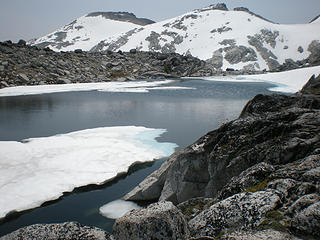 Freya/Tranquil 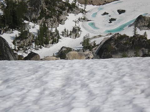 Goats above Crystal 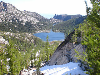 Shield 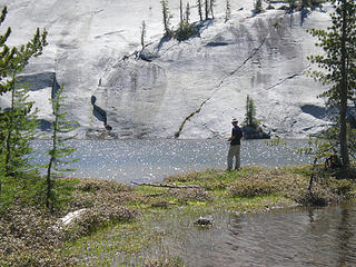 Fishing at Mesa 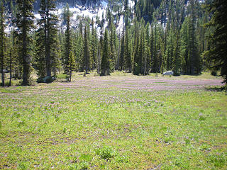 Meadow above upper toketie 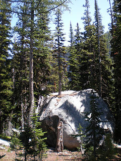 Tree growing out of boulder 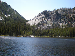 Toketie 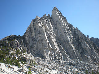 Prusik 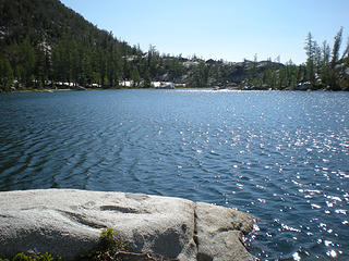 Temple 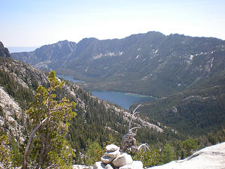 Snow Lakes 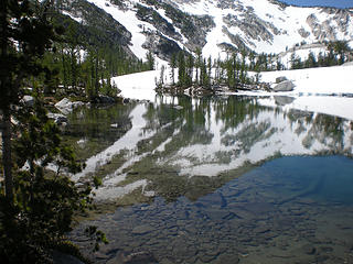 Leprechaun 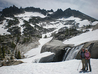 Waterfall with McClellan in background 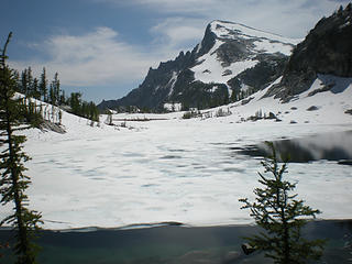 Little Ann from Perfection 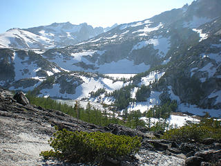 Inspiration and Perfection 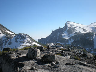 Little Ann from Ridgline heading towards McClellan from Gnome Tarn 
|
| Back to top |
|
|
Yet
Member

Joined: 23 Apr 2005
Posts: 2634 | TRs | Pics
Location: Happily Ever After |
|
Yet
Member
|
Mon Jul 14, 2008 11:16 pm |
|
|
| yukon222 wrote: | 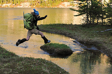 DSC_4133 - tisha jumping to the island (does she make it?) |
Well, does she??
Sweet action shot!
My favoritest one of hers that you took thus far, yukon, and there are many!
|
| Back to top |
|
|
More Cowbell
Warrior Princess

Joined: 01 Jul 2006
Posts: 5657 | TRs | Pics
Location: Alive on Earth |
That was certainly a grand tour. Well done everyone. Yukon, those goat shots are fantastic but I was hoping for some sexy nekkid pics of Dayhike Mike jumping in the water. Anyone got any?
If you want to forget all your other troubles, wear too tight shoes. - Unknown
If you want to forget all your other troubles, wear too tight shoes. - Unknown
|
| Back to top |
|
|
rdyhiker
Member

Joined: 07 Dec 2007
Posts: 567 | TRs | Pics
|
|
rdyhiker
Member
|
Mon Jul 14, 2008 11:31 pm |
|
|
|
| Back to top |
|
|
|
|
You cannot post new topics in this forum
You cannot reply to topics in this forum
You cannot edit your posts in this forum
You cannot delete your posts in this forum
You cannot vote in polls in this forum
|
Disclosure: As an Amazon Associate NWHikers.net earns from qualifying purchases when you use our link(s). |


