| Previous :: Next Topic |
| Author |
Message |
jeremybe
Ol' One-shirt


Joined: 17 Jul 2008
Posts: 275 | TRs | Pics
Location: Seattle |
|
jeremybe
Ol' One-shirt
|
 Tue Aug 05, 2008 11:28 am |
|
|
Note: long-winded, as always.
After a one-weekend hiking hiatus (which actually amounts to about fourteen days, and felt like every minute of it) we were determined to make the most of our common day off, and get out and hike. Since were still left with just Sundaysa temporary situation, we hopewe werent looking for an overnighter, and it had to be something marginally nearby. Id seen a trip report or two for Lake Ingalls lately, so I kept that in my mind as Nicole and I set about our routine of searching websites and guidebooks for other possibilities. I wouldnt call it wasted time, but in the end, we decided on Lake Ingalls anyway. I think I can speak for the both of us when I say that were glad we did.
 Embiggen. 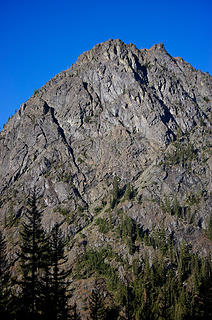 Esmerelda Peak from the trail 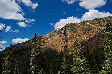 Red rocks of ridge toward Ingalls 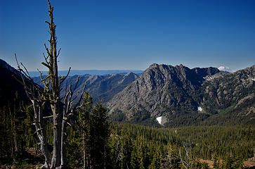 Mt Adams, Esmerelda, and Mt Rainier 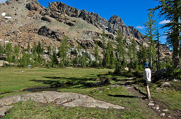 Nicole and Headlight Basin 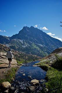 From Headlight to Mt Stuart 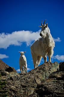 But I found the kid 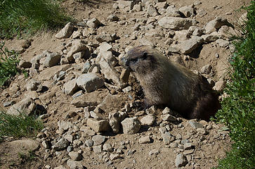 Right on the trail 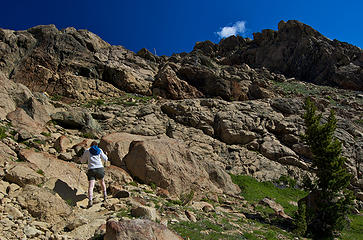 Almost across Headlight Basin 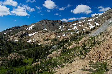 Looking back at the Basin 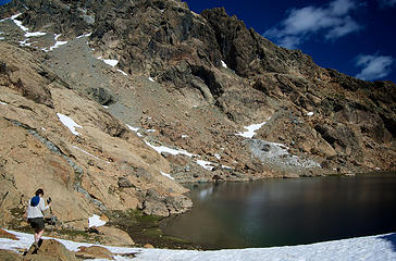 Down to Lake Ingalls 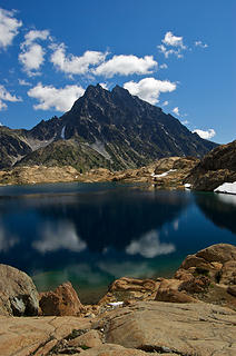 Mt Stuart in Lake Ingalls 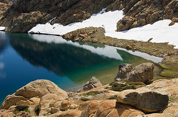 The water 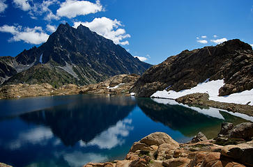 Mt Stuart in Lake Ingalls 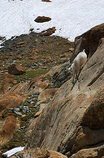 A kid with balance 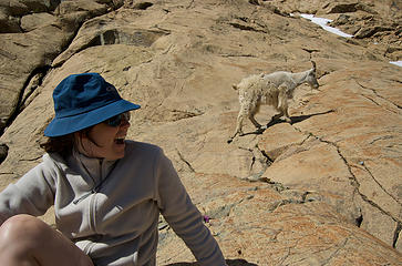 Nicole and goat 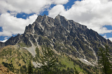 Mt Stuart from Lower Headlight Basin 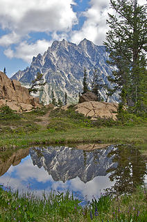 Saw it done, had to try it. Made sure to find it. 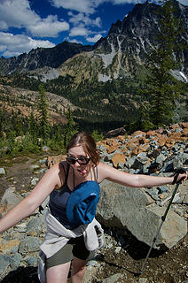 Out of the Lower Basin 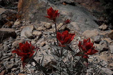 Paintbrushes
|
| Back to top |
  
|
|
Canuck
Member

Joined: 05 Jun 2006
Posts: 2137 | TRs | Pics
Location: Lacey WA |
|
Canuck
Member
|
Tue Aug 05, 2008 12:47 pm |
|
|
Excellent TR!  This is one of my favorite hikes as well. If you want to return when it's even more beautiful, go in early October, first or second weekend, when the larch are golden. It's simply gorgeous. I spent the night there, in one of the sites in the lower basin with a great view of Stuart. It was amazing.
And yeah, the view from the toilet is spectacular too. This is one of my favorite hikes as well. If you want to return when it's even more beautiful, go in early October, first or second weekend, when the larch are golden. It's simply gorgeous. I spent the night there, in one of the sites in the lower basin with a great view of Stuart. It was amazing.
And yeah, the view from the toilet is spectacular too. 
|
| Back to top |
|
|
Hiker Mama
Member

Joined: 25 Jun 2006
Posts: 3451 | TRs | Pics
Location: Lynnwood |
I enjoyed your TR. Nice pics, too!
|
| Back to top |
|
|
silly_traveler
~ roaming ~

Joined: 04 Jun 2006
Posts: 1525 | TRs | Pics
Location: Bellevue |
Dang, that is a nice pano
♫ You have brains in your head. You have feet in your shoes. You can steer yourself any direction you choose. And you're the one who will decide where you'll go. Oh the places you'll go. - Dr. Seuss
♫ You have brains in your head. You have feet in your shoes. You can steer yourself any direction you choose. And you're the one who will decide where you'll go. Oh the places you'll go. - Dr. Seuss
|
| Back to top |
|
|
jeremybe
Ol' One-shirt
Joined: 17 Jul 2008
Posts: 275 | TRs | Pics
Location: Seattle |
|
jeremybe
Ol' One-shirt
|
Tue Aug 05, 2008 6:08 pm |
|
|
|
| Back to top |
|
|
touron
Member

Joined: 15 Sep 2003
Posts: 10293 | TRs | Pics
Location: Plymouth Rock |
|
touron
Member
|
Tue Aug 05, 2008 6:58 pm |
|
|
Touron is a nougat of Arabic origin made with almonds and honey or sugar, without which it would just not be Christmas in Spain.
|
| Back to top |
|
|
Tazz
Member
Joined: 27 Apr 2005
Posts: 7902 | TRs | Pics
|
|
Tazz
Member
|
Tue Aug 05, 2008 8:12 pm |
|
|
very good tr and pics!!!! thanks for sharing. I love that area!
|
| Back to top |
|
|
|
|
You cannot post new topics in this forum
You cannot reply to topics in this forum
You cannot edit your posts in this forum
You cannot delete your posts in this forum
You cannot vote in polls in this forum
|
Disclosure: As an Amazon Associate NWHikers.net earns from qualifying purchases when you use our link(s). |


 And thanks for the tip, Canuck; I know we'll be going back here again in the future, so I'll try to plan it for that time of the year. I'm hoping that by this September/October, we'll have a proper weekend again and we'll be able to spend a few nights somewhere in the North Cascades or around Glacier Peak. So maybe I'll get to see some Larch color yet; just not sure where!