| Previous :: Next Topic |
| Author |
Message |
trail head
makin' tracks


Joined: 03 Aug 2008
Posts: 21 | TRs | Pics
Location: far out |
A planned weekend climbing trip in the N Cascades E of Mt Baker was killed by rain in the area Saturday morning. I had my sights set on getting out this weekend, and the forecast for Sunday was perfect, so I headed out to Alta, above Rachel Lake on Sunday morning.
Got to the Rachel Lake TH and hit the trail about 8:45 am. The blue skies were a contrast to the clouds that still shrouded Seattle earlier in the morning.
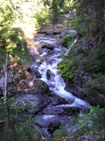 box canyon creek 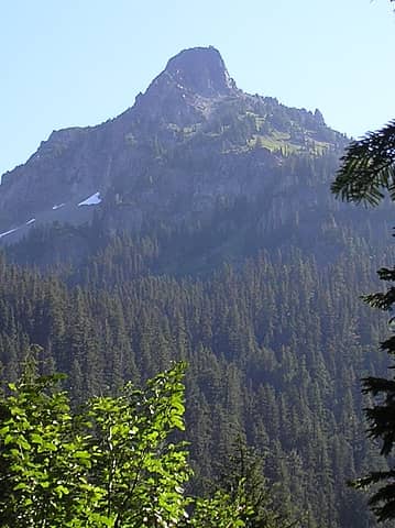 Hibox mountain from Rachel Lake trail 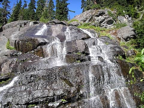 Can't hike the Rachel Lake trail without a picture of the waterfall... 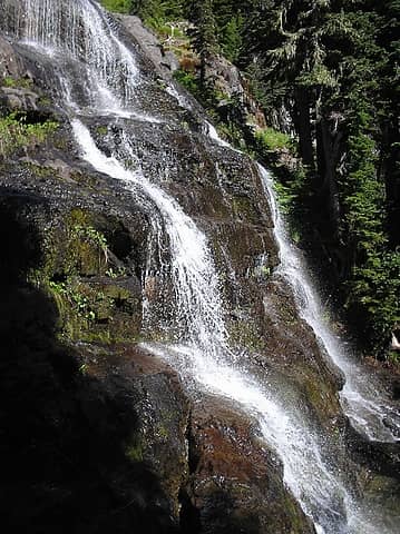 ...or two! 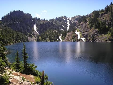 Ray-Chill Lake 
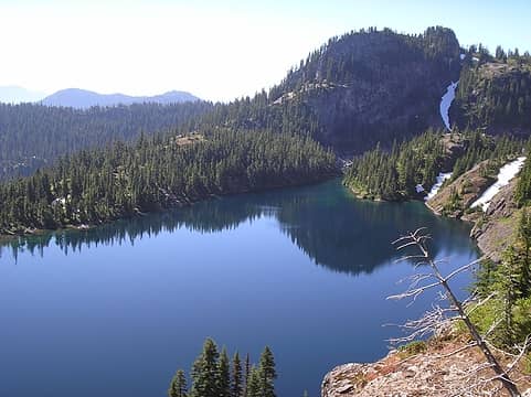 looking down on Rachel from trail to Rampart Ridge 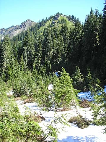 alta in the distance on the left  Mt. Thompson 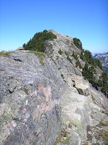 trail to Alta summit. 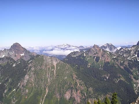 summit view 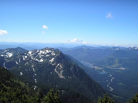 anyone know the name of that summit in the distance? 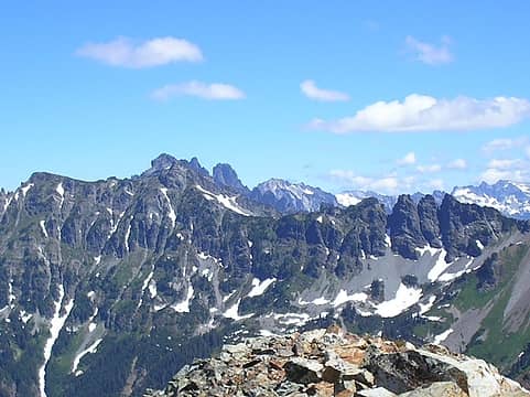 more views 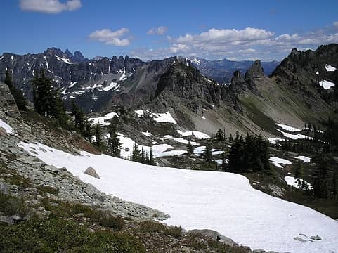 frozen tarns below 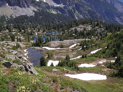 Lila Lakes 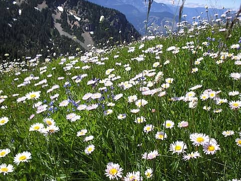 Flowers... 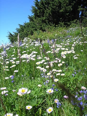 ...flowers... 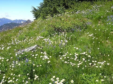 ...flowers, and... 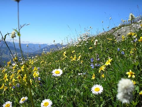 ...flowers!!
|
| Back to top |
  
|
|
Matt
Tea, Earl Grey, Hot

Joined: 30 Jan 2007
Posts: 4307 | TRs | Pics
Location: Shoreline |
|
Matt
Tea, Earl Grey, Hot
|
 Sun Aug 03, 2008 8:34 pm |
|
|
It's great hiking through the flowers on the way up to that ridge.
As beacons mountains burned at evening. J.R.R. Tolkien
As beacons mountains burned at evening. J.R.R. Tolkien
|
| Back to top |
|
|
bobbi
stillaGUAMish

Joined: 13 Jul 2006
Posts: 8012 | TRs | Pics
Location: olympics! |
|
bobbi
stillaGUAMish
|
Sun Aug 03, 2008 10:03 pm |
|
|
great TR and photos!
those elevation gain stats include all the ups along the way, that's why the math is off.
bobbi ૐ
"Today is your day! Your mountain is waiting. So
get on your way!" - Oh, the Places Youll Go! By Dr. Seuss
bobbi ૐ
"Today is your day! Your mountain is waiting. So
get on your way!" - Oh, the Places Youll Go! By Dr. Seuss
|
| Back to top |
|
|
Foist
Sultan of Sweat

Joined: 08 May 2006
Posts: 3974 | TRs | Pics
Location: Back! |
|
Foist
Sultan of Sweat
|
Mon Aug 04, 2008 9:04 am |
|
|
It's not an up-and-down route -- I've hiked the top of Alta 3 times I think -- so there shouldn't be extra gain. Certainly not THAT much.
|
| Back to top |
|
|
The Angry Hiker
SAR Blacklistee

Joined: 13 Jun 2008
Posts: 2890 | TRs | Pics
Location: Kentwila |
| Quote: | | anyone know the name of that summit in the distance? |
That would be Mt. Pilchuck.
|
| Back to top |
|
|
Hulksmash
Cleaning up.

Joined: 20 Apr 2008
Posts: 7113 | TRs | Pics
Location: Arlington |
|
Hulksmash
Cleaning up.
|
Thu Aug 07, 2008 9:48 am |
|
|
The Angry Hiker
| Quote: | | Quote:
anyone know the name of that summit in the distance?
That would be Mt. Pilchuck. |

"Bears couldn't care less about us....we smell bad and don't taste too good. Bugs on the other hand see us as vending machines." - WetDog
Albuterol! it's the 11th essential
"Bears couldn't care less about us....we smell bad and don't taste too good. Bugs on the other hand see us as vending machines." - WetDog
Albuterol! it's the 11th essential
|
| Back to top |
|
|
paultkuhn
Member

Joined: 11 Jun 2007
Posts: 103 | TRs | Pics
|
| Hulksmash wrote: | The Angry Hiker
| Quote: | | Quote:
anyone know the name of that summit in the distance?
That would be Mt. Pilchuck. |
|
No wonder he is so angry. He's lost! 
|
| Back to top |
|
|
Dancing Hiker
Member

Joined: 10 May 2008
Posts: 78 | TRs | Pics
Location: seattle |
| bcfc53 wrote: | | great TR and photos!
those elevation gain stats include all the ups along the way, that's why the math is off. |
Don't you just hate that "fuzzy math"?
Dancing hiker...formerly known as slowhiker, but was afraid I'd be confused with Slow Hiker, and slowwalker.
Dancing hiker...formerly known as slowhiker, but was afraid I'd be confused with Slow Hiker, and slowwalker.
|
| Back to top |
|
|
trail head
makin' tracks
Joined: 03 Aug 2008
Posts: 21 | TRs | Pics
Location: far out |
| The Angry Hiker wrote: | | Quote: | | anyone know the name of that summit in the distance? |
That would be Mt. Pilchuck. |
I thought Si or maybe Tiger. Thanks for setting me straight.
|
| Back to top |
|
|
DIYSteve
seeking hygge

Joined: 06 Mar 2007
Posts: 12655 | TRs | Pics
Location: here now |
|
DIYSteve
seeking hygge
|
Thu Aug 07, 2008 8:57 pm |
|
|
Big Snow
Edited to add: in the pic entitled "summit view," from L to R it's Thompson, Alaska, Big Snow, Huckleberry, Pt. 6480
|
| Back to top |
|
|
bestes
Member
Joined: 05 Jun 2007
Posts: 35 | TRs | Pics
Location: Renton, WA |
|
bestes
Member
|
Thu Aug 14, 2008 3:59 pm thanks!
|
|
|
thanks for the tip on the white flagging on the tree!
|
| Back to top |
|
|
|
|


